
The Rugged North Dakota Badlands Await You in 2026
But here is what I think is the real kicker: National Geographic just slapped the Badlands on their "Best of the World 2026" list.
Why 2026 Is the Perfect Year: The New Theodore Roosevelt Presidential Library and National Geographic’s Top Honor
Look, if you've been waiting for a reason to actually put North Dakota on your radar, this is it. I've been tracking the 2026 travel trends, and it's rare to see a "perfect storm" like this where a major cultural anchor and global prestige hit the same spot at the same time. We're talking about the opening of the Theodore Roosevelt Presidential Library in Medora, which is a huge deal because we haven't seen a new presidential library join the system since the George W. Bush one back in 2013. It's not just another building with some old papers; they're positioning it as a hub for intellectual programming, blending history with real-world conservation talk.
But here is what I think is the real kicker: National Geographic just slapped the Badlands on their "Best of the World 2026" list. Think about that for a second. We're not talking about a trendy spot in California or New York, but a rugged, under-visited region of the Midwest getting a global spotlight. It's a massive validation for a place that's usually overlooked, and honestly, it's about time. When you pair a world-class museum opening with that kind of "gold seal" approval, you get a destination that's suddenly a priority rather than an afterthought.
I suspect we'll see a real shift in how people visit the region, moving from casual road-trippers to serious history buffs and nature researchers. You've got the library's sustainable architecture on one side and the raw, unfiltered beauty of the Little Missouri River's carvings on the other. It's the kind of place where you can go from analyzing Roosevelt's original environmental documents to staring at some of the most extensive ancient mammal fossils in North America—we're talking 300 species from 35 million years ago.
And look, maybe it's just me, but there's something about the timing that feels right. The Badlands have stayed untouched because they're remote, which means you still get those ink-black skies for stargazing that you just can't find anymore. By visiting in 2026, you're catching the region at the exact moment it transitions from a hidden gem to a global destination. My advice? Get your plans sorted now, because once the National Geographic crowd arrives, those quiet spots in Medora aren't going to stay quiet for long.
A Geologist’s Playground: Exploring the Colorful Buttes, Canyons, and Prairie of Theodore Roosevelt National Park
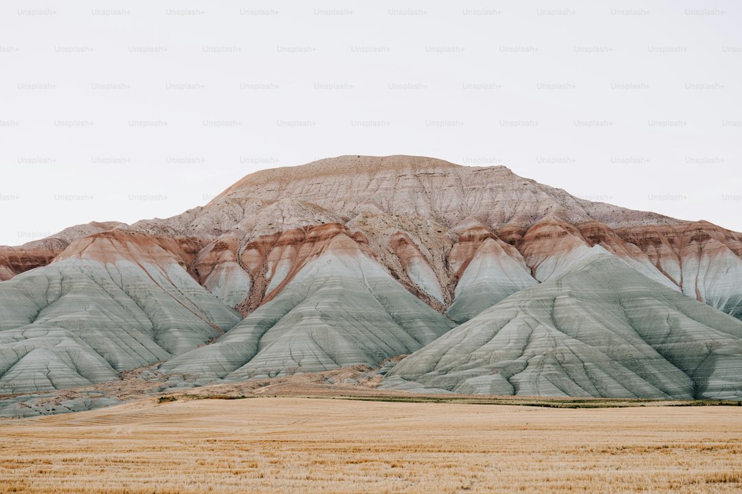
Let’s be honest—most people visit Theodore Roosevelt National Park for the bison herds and the wide-open prairie skies, but the real story here is written in the rock itself. I’ve spent a fair amount of time staring at those colorful buttes, and what gets me every time is that the park’s exposed bedrock dates exclusively to the Paleocene Epoch, a roughly 10-million-year window right after the dinosaurs vanished. That means every layer you see—the rust-reds, the ochres, the slate grays—was laid down in a warm, humid subtropical floodplain, not the semi-arid badlands you’re walking through today. The two primary rock units, the Bullion Creek Formation and the Sentinel Butte Formation, preserve fossilized leaf imprints and petrified wood from ancient cypress, palm, and sycamore trees. That’s right: this place was a swampy forest, not a desert. And the colors? They’re not random. The vibrant bands come from varying concentrations of iron oxides, manganese, and traces of volcanic ash—ash that blew in from erupting volcanoes during the Laramide orogeny over 60 million years ago, settling into ancient lakes and wetlands before turning into the soft, swelling bentonite clay you see in the slopes today.
Here’s where it gets really interesting from a geologist’s perspective. The park sits right on the boundary between the glaciated and unglaciated portions of the Missouri Plateau, which means the northern and southern units have fundamentally different soil compositions and erosion patterns. The unglaciated central and southern sections have almost no glacial till, so the Paleocene bedrock is exposed at the surface without the thick, ice-deposited sediment cover that hides ancient rock layers across most of the northern Great Plains. Meanwhile, the bentonite clay layers—which expand by up to 30% of their volume when saturated—create unstable ground that prevents most deep-rooted vegetation from taking hold. That instability accelerates erosion of the surrounding sedimentary rock, and the numbers back it up: ongoing badland erosion removes an average of 0.8 to 1.2 inches of sediment from exposed slopes each year. That might not sound like much, but it’s fast enough that hikers can spot subtle changes in narrow canyon walls and small butte crests between repeat visits spaced just a few years apart.
The Little Missouri River is the main engine here, carving the badland topography and carrying an average of 1.2 million tons of eroded sediment downstream annually. During a single high-water spring runoff, the river’s course can shift by up to 30 feet in some sections. That’s a living, breathing landscape, not a static postcard. And the flat, erosion-resistant caprock that tops many of the iconic buttes? It’s dense, silica-rich sandstone that weathers at a rate nearly 10 times slower than the underlying bentonite and mudstone layers. That’s why those table-like shapes persist for thousands of years. The fossil mammal remains found in the Sentinel Butte Formation—early ancestors of modern horses, camels, and tapirs—tell us that this region was a cradle of mammalian evolution in North America, long before those animals spread to other continents. So when you’re standing on the prairie, staring at those banded cliffs, you’re not just looking at a pretty view. You’re reading a 60-million-year diary, written in ash, mud, and iron, and it’s still being rewritten every single year.
Wildlife Encounters: Bison, Wild Horses, and the Return of the Northern Lights Over the Badlands
Let's be real for a second—when most people picture the Badlands, they think of the layered rock formations and that iconic Teddy Roosevelt silhouette. But honestly, the real reason you're here is the wildlife, and the numbers tell a story that most casual visitors completely miss. That bison herd you're watching from the overlook? It's a genetically distinct subspecies, Bison bison bison, and the entire Theodore Roosevelt National Park population—now hovering between 200 and 400 animals—traces back to just 29 individuals brought over from Fort Niobrara in 1956. That's a bottleneck that could have been a disaster, but instead, the herd has thrived, and here's the kicker: those massive animals can hit 35 miles per hour in a sprint and clear a six-foot fence like it's nothing. So when the park rangers tell you to stay at least 100 yards back, they're not being dramatic—they're citing performance data. And that iconic hump? It's not fat or muscle in the way you'd expect; it's actually a structural adaptation of massive vertebrae that lets them use their heads as literal snowplows, clearing forage when temperatures plunge to minus 40 degrees. They don't seek shelter. They just stand there, in that dense winter coat with a wool underlayer, and wait out the storm like it's nothing.
Now, the wild horses are a different story entirely, and this is where it gets fascinating from a conservation genetics standpoint. They're not native—these are descendants of domestic livestock that were either released or escaped in the early 1900s—but a 1970 law specifically carved out protection for them as a "living legacy" of the open-range era. And here's what I find remarkable: the park manages them with zero supplemental feeding and zero veterinary intervention. That's not neglect; it's a deliberate culling mechanism. The weak genetic traits have been systematically eliminated over generations through pure natural selection, leaving behind a population that's exceptionally hardy. You'll notice primitive markings on many of them—dorsal stripes and zebra-like leg bars—which are traits you'd normally associate with ancient Spanish mustang lineages, not modern ranch stock. These horses form stable social bands with leadership hierarchies that researchers have documented persisting for over a decade, and they're not just wandering around randomly. Each band has a lead mare that knows the water sources, the best grazing areas, and the escape routes. It's a sophisticated social structure that's evolved entirely on its own terms, and watching it play out against that stark badland backdrop is something you simply cannot replicate in a managed zoo environment.
But the truly wild card here—pun intended—is what's happening in the sky. We're smack in the middle of Solar Cycle 25's peak, which hit maximum intensity in 2025 and is still pumping out significant geomagnetic storms through 2026. The Badlands sit at a magnetic latitude of about 49 degrees north, which means you don't need a Kp-index of 7 or 8 to see auroral activity. A moderate storm with a Kp of 4 or 5 is enough to push the lights into view, and during solar maximum, you're looking at 20 to 30 visible nights per year. That's far more than most people realize, especially given how absurdly dark the skies are out here. On a clear night during a decent event, you can catch the faint green glow of oxygen atoms fluorescing at 60 miles altitude with your naked eye—no camera tricks, no long exposures. And if you're really lucky, you'll see red auroras from higher oxygen at 200 miles, which is a rare sight even for seasoned aurora chasers. So here's my honest take: if you time your visit right in 2026, you can spend the day watching bison use their heads as snowplows and wild horses with Spanish mustang genetics, then stand on a butte that's eroding at nearly an inch per year and watch a geomagnetic storm paint the sky green. That's not just a wildlife encounter. That's the full ecosystem—ground, animal, and atmosphere—operating in real time, and it's why the Badlands deserve every bit of the attention National Geographic just gave them.
Hiking, Road Trips, and Stargazing: Top Activities for Adventuring in the Rugged Terrain
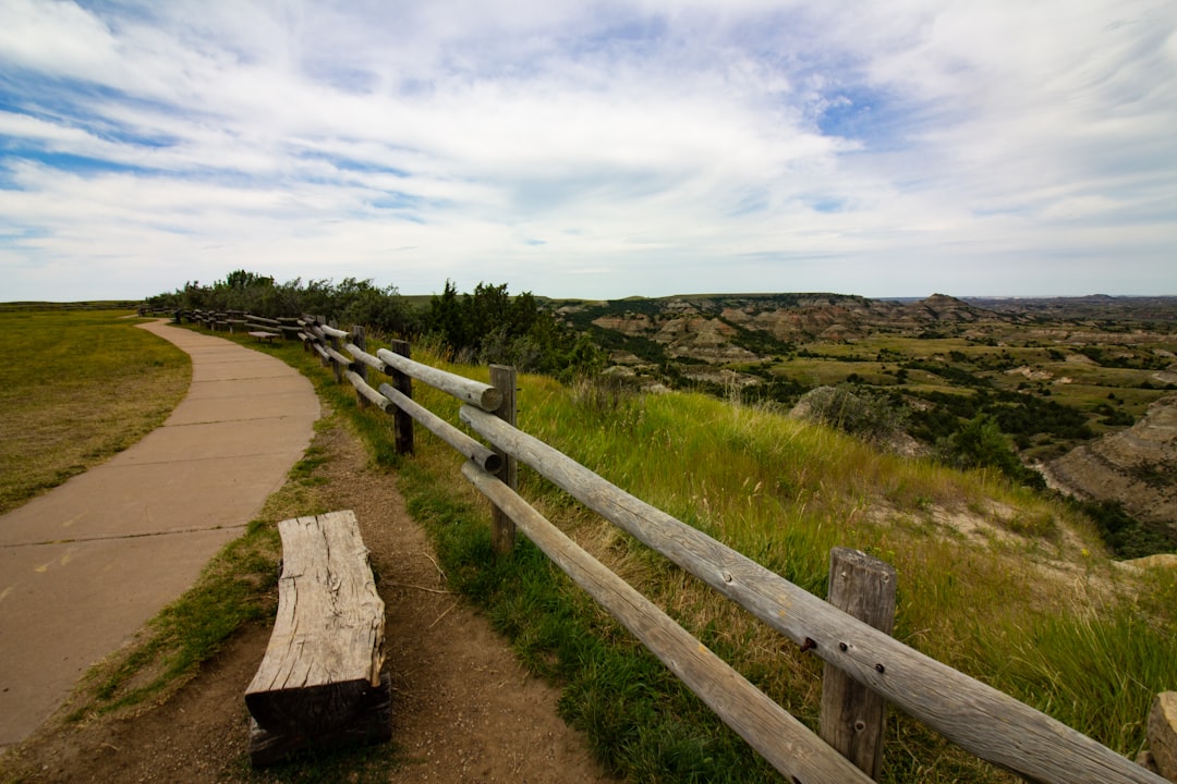
Look, if you're planning to actually get your boots dirty in the Badlands, you've got to decide if you're in the mood for a marathon or a curated highlight reel. I've been looking at the logistics, and the Maah Daah Hey Trail is honestly a marvel—144 continuous miles of single-track built entirely by volunteers back in the 90s. It's one of the longest volunteer-led projects in the country, and it's where you go to really feel the scale of the Little Missouri National Grassland. But if you're short on time, the Badlands Loop Road is your best bet. It's only 36 miles, but it's got 16 scenic pullouts that let you soak in the views without the blisters. Interestingly, that road started as a coal haul road, which just goes to show how this region's industrial bones are woven into the tourism experience.
If you want something a bit more "off the beaten path," you should check out the Ekblaw Trail in the north unit. It's a 10-mile loop that gets fewer than 500 visitors a year, which is wild considering the 360-degree views of the river valley are some of the best in the park. Or, for something truly strange, try the Coal Vein Trail. There's a coal seam under the path that's been smoldering since 1951, and it actually heats the soil enough to melt snow on contact during the winter. It's one of those weird, tactile experiences that makes you realize the ground here is literally alive. And if you're into the deep history, the Petrified Forest Loop lets you see 60-million-year-old sycamore and cypress logs still in the ground, with bark textures so clear it feels like they were just knocked over yesterday.
Now, let's talk about the night sky, because this is where the Badlands really outclasses almost everywhere else in the lower 48. The south unit sits under Bortle class 2 skies—for those who don't know the scale, that means it's so dark the Milky Way actually casts visible shadows on moonless nights. That happens in fewer than five percent of locations in the contiguous U.S. I'm not kidding. Because the buttes block the light domes from Bismarck and Dickinson, you get pockets of absolute darkness that registered zero artificial light on the 2021 World Atlas of Night Sky Brightness. If you time it for the Perseid meteor shower in mid-August, you can hit 60 meteors an hour with just your naked eyes because the dry prairie air is so crisp.
Just a heads-up on the driving: be careful between Medora and the north unit. There are two unbridged dips across the Little Missouri River that can turn into impassable streams after just one inch of rain, which could force you into a 30-mile detour if you're not paying attention. While you're out there, stop by the Long X Trading Post. It's been around since 1884 and still functions as a working cattle ranch, so it gives you a real sense of the frontier grit that defines this place. If you can swing a winter visit, you'll get nearly 15 hours of darkness a night, and since the ground is frozen, there's no dust to scatter the light. Honestly, it's the cleanest view of the cosmos you're likely to find without flying to the Southern Hemisphere.
Where to Stay and When to Go: Best Seasons, Lodging in Medora, and Insider Tips for a Crowd-Free Escape
Let’s talk timing, because if you show up in Medora during the third week of July, you’re going to be standing in line with 3,000 other people who all had the same idea. The town’s year-round population is about 150, but during the Medora Musical peak, the lodging inventory gets absolutely crushed—the Rough Riders Hotel has only twelve rooms, each named after a specific cavalry member, and they’re gone months ahead. The Elk Horn Quarters, those four historic cabins from the 1880s Custer Trail Ranch, are typically booked six months out for summer. So here’s the real insider move: target the two weeks after Labor Day. The Musical has wrapped, daytime highs still hit the mid-70s, and hotel occupancy drops by roughly 40 percent. You’ll have the place to yourself, and the Pitchfork Steak Fondue—that communal dinner that serves nearly 400 people a night in July—operates only on weekends in May and September, which means a far more intimate experience.
Now, let’s get specific about lodging strategy, because not all Medora accommodations are created equal, and the tax math matters more than you think. The AmericInn is the only property with an indoor pool, which means it fills first with families, but its adjacent conference center often has empty meeting rooms you can use as quiet indoor space when the weather turns. The Medora Campground’s primitive walk-in tent sites along the Little Missouri River remain half-empty even in July, giving you the closest access to the park’s scenic loop trailhead without the RV generator noise. But here’s the kicker on costs: Medora’s combined lodging and sales tax is 11 percent, a full two points higher than the state average, so that $200 room actually costs $222. Booking a Monday-through-Thursday stay in June can save you up to 30 percent on room rates compared to weekends, and trail use on the Maah Daah Hey drops by half on weekdays. If you’re willing to rough it, the north unit of Theodore Roosevelt National Park receives only about 20 percent of the south unit’s annual visitation, yet its 24-mile scenic drive rivals the south unit’s geology. October brings the elk rut, and the north unit’s gravel roads stay open until the first heavy snow, letting you watch bull elk sparring with virtually no other vehicles on the road.
But you’ve got to plan your logistics like a researcher, not a tourist. Medora’s only full-service grocery store, the Medora Mercantile, closes at 5 p.m. daily and is shut entirely on Sundays, so if you’re self-catering and show up after 5 on a Saturday, you’re driving 30 miles to Dickinson for a loaf of bread. That’s a mistake I’ve seen people make repeatedly, and it ruins the whole relaxed vibe. My honest take: aim for a late September visit, book the Elk Horn Quarters at least six months out, and use the north unit as your primary hiking zone. You’ll get the elk rut, the 70-degree days, the empty trails, and the cleanest Bortle class 2 night skies of the year. That’s the crowd-free escape you’re actually looking for, and it’s hiding in plain sight if you just shift your calendar by a few weeks.
Beyond the Park: The Rich Cultural History and Small-Town Charm of North Dakota’s Badlands Region
Here's the thing about Medora that most people miss: it's not just a gateway town for the national park, it's a case study in boom-and-bust frontier economics that played out on a microscopic scale. The town was founded in 1883 by a French aristocrat named Marquis de Mores, who showed up with ambitious plans to build a meatpacking empire in the middle of nowhere—a state-of-the-art facility that was one of the first industrial-scale operations in the entire region. He named the place after his wife, Medora von Hoffman, and built a 26-room hunting lodge that still stands today with its original furnishings, including a cast-iron bathtub that had to be hauled 30 miles by wagon from the nearest railhead. But here's where the story gets interesting: the Marquis abandoned his entire operation by 1886, and the town nearly became a ghost town. It's a classic story of overreach, of someone trying to force industrial-scale efficiency onto a landscape that simply wasn't ready for it. And honestly, that pattern—grand ambition meeting harsh reality—is kind of the defining theme of this whole region.
What I find remarkable is that the Lakota people had a far more accurate read on this place centuries before any European showed up. They called it "mako sica," which literally means "bad land," and they used it primarily as a hunting ground for bison and a source of flint for toolmaking. French fur traders later mapped the Little Missouri River and called it "Rivière des Mauvaises Terres" for the treacherous terrain along its banks. So you've got two completely different worldviews colliding here: one that saw the Badlands as a resource to be exploited and another that understood its limitations and worked with them. The Marquis de Mores tried to build an empire and failed. The Lakota built a sustainable hunting system that lasted for generations. I think there's a lesson in that contrast that a lot of modern visitors completely overlook.
The small-town charm you hear about isn't just quaint nostalgia—it's the result of a very specific historical trajectory. Medora wasn't revitalized as a tourist destination until the 1960s, which means the town essentially skipped a century of development. The Medora Mercantile still has the same creaky wooden floors from when Teddy Roosevelt walked through its doors, and it's still the only full-service grocery store in town. The North Dakota Cowboy Hall of Fame has inducted over 200 individuals who represent the ranching heritage that kept this region alive after the Marquis failed. And then you've got towns like Amidon, 30 miles south, which is the smallest county seat in the United States with a population that's fluctuated between 20 and 30 people for decades. That's not a statistic you can manufacture. That's a community that's stubbornly persisted on its own terms. The Maah Daah Hey Trail gets its name from the Mandan language word for "enduring" or "long-lasting," which is exactly the right descriptor for a region that's been scraped by glaciers, burned by coal seams, settled by aristocrats, and abandoned by industry, yet still draws people who want something real.
Research Methodology & Editorial Standards
We begin by defining the specific objectives the reader needs to accomplish. Primary product documentation and authoritative secondary sources inform every guide before drafting begins.
Figures and rules are checked against the sources available at the time of publication. Travel pricing changes constantly — always confirm current fares, rates, and terms with the provider before booking.