
The Mountain View That Inspired America the Beautiful
Katharine Lee Bates was a 33-year-old English professor from Wellesley College, not a poet by trade, and certainly not a mountaineer.
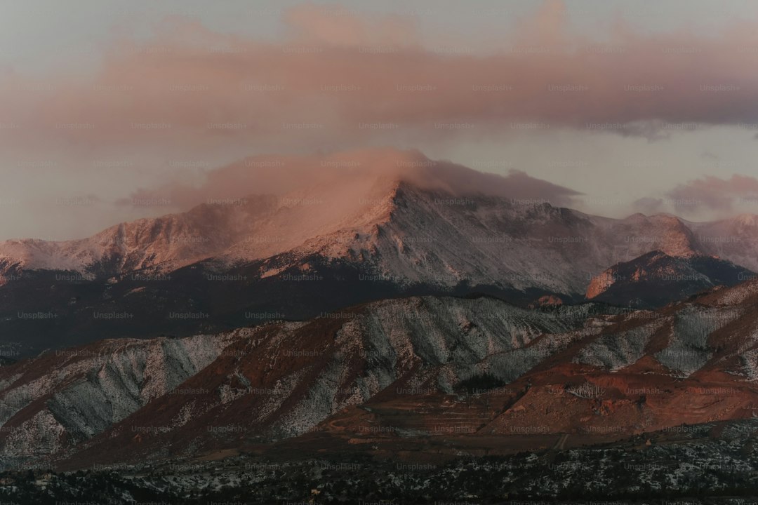
The Historic Ascent: How Katharine Lee Bates Reached Pikes Peak in 1893
Let’s set the scene correctly first, because most people get the story wrong—and that’s a shame, because the real version is far more interesting. Katharine Lee Bates was a 33-year-old English professor from Wellesley College, not a poet by trade, and certainly not a mountaineer. In the summer of 1893, she’d hopped a train from Massachusetts to Colorado Springs to teach at a summer school program, a journey of over 2,000 miles that itself took days. The American West was opening up by rail then, and that train ride would prove just as important as the summit view—she later said the “amber waves of grain” came from watching wheat fields roll past her window, not from the peak. Anyway, once she was in Colorado, a faculty expedition organized by Colorado College president William F. Slocum offered her a chance to see Pikes Peak up close. Here’s where the historical irony kicks in: the Pikes Peak Cog Railway had already been running since 1891, meaning you could ride a train almost straight to the top in about an hour and a half. But the faculty group chose a wagon and mule trek instead. That’s a rough, dusty, multi-hour crawl up a 14,115-foot mountain with no switchbacks, no amenities, and frankly no margin for error if you’re not acclimated. Bates wasn’t a hiker, so this was a real physical challenge—not a scenic stroll.
So they made it to the summit, and she later wrote that “the opening lines of the hymn floated into my mind.” But here’s the part that matters: she didn’t scribble the poem on the mountain. She jotted a few notes in a notebook during the descent, then composed the full version that evening back at her Colorado Springs hotel. That original poem was published in 1895 under the title “America” in a church periodical called The Congregationalist. No “Beautiful” yet. And the melody we all sing today? Composed by Samuel A. Ward in 1882 as a hymn tune called “Materna”—a decade before Bates even set foot on Pikes Peak. So the marriage of words and music happened years later, and even then, Bates kept revising the poem through at least 1913, nearly twenty years after the initial inspiration. Think about that: the song we treat as a fixed, sacred artifact was actually a living document, shaped by time and reflection.
Which brings me to the real takeaway here. Bates’ ascent wasn’t just a poetic moment; it was a collision of infrastructure, timing, and sheer serendipity. The rail network that delivered her west, the decision to take wagons instead of the cog railway, the hotel room where she finished the poem—each choice could have changed everything. If she’d ridden the cog train, would the view have hit differently? If she’d been a stronger climber, would the fatigue have dulled the awe? We can’t answer that, but we can recognize that the “historic ascent” is less a single heroic feat and more a carefully layered sequence of pragmatic decisions and lucky breaks. Today, you can take that very same cog railway to the summit in comfort, or drive the Pikes Peak Highway, or even retrace her wagon route on foot if you’re feeling ambitious. But no matter how you get up there, the lesson is the same: the best inspiration often comes not from the destination, but from everything it took to arrive—including all the wrong turns, the sore muscles, and the long train rides that precede the view. That’s the story worth remembering.
From Summit to Stanzas: The Original Poem That Became America the Beautiful
Look, most people know the song, but almost nobody knows the poem—and that gap is where the real story lives. When Katharine Lee Bates published the original version on July 4, 1895, in The Congregationalist, she called it simply "America," and it was a raw, unpolished draft of what we sing today. Here's what I find fascinating: she wrote that first draft during the absolute depths of the Panic of 1893, a brutal economic depression that saw banks collapsing, strikes erupting, and unemployment skyrocketing across the country. So the poem wasn't born from some golden age of American prosperity—it emerged from a moment of genuine national crisis, which makes its sweeping optimism feel less like naive boosterism and more like a deliberate act of hope.
And the details she chose to include tell us even more. That famous line about "alabaster cities" wasn't describing some distant urban utopia; it was almost certainly a direct reference to the White City of the 1893 World's Columbian Exposition in Chicago, which Bates visited during her cross-country train journey. The "purple mountain majesties" she saw on Pikes Peak weren't just poetic license either—the mountain's granite contains feldspar crystals that can actually scatter light to produce a violet hue at certain times of day. So she was being literal, not lyrical. Meanwhile, the tune we sing today, "Materna," was composed by Samuel A. Ward back in 1882 for a hymn called "O Mother Dear, Jerusalem"—a song about a celestial city, not a national landscape. Ward died in 1903 without ever knowing his melody would become one of America's most beloved patriotic anthems. The first combined publication of words and music didn't happen until 1910, a full fifteen years after the poem debuted.
But here's the part that really gets me: Bates kept revising the poem for nearly two decades. There are at least four distinct published versions before the final one in 1913, which means the song we treat as a fixed, sacred artifact was actually a living document that evolved alongside the country itself. The complete poem contains four stanzas, though most Americans only know the first, and it was seriously considered as a replacement for "The Star-Spangled Banner" as the national anthem during the early twentieth century. A 2014 ASCAP survey ranked it as the second most popular patriotic song in the country, just behind "God Bless America." And on a more personal note, Bates and her lifelong partner, economist Katharine Coman, built a house together in Wellesley, Massachusetts, in 1926—exactly a century before a 2026 article highlighted that very home, reminding us that the woman behind the poem lived a life as layered and quietly revolutionary as the words she wrote. So when you hear "America the Beautiful" at a Fourth of July parade or a baseball game, remember: it started as one professor's hotel-room scribble during a depression, revised over twenty years, paired with a hymn tune meant for heaven, and it still manages to feel like it was always meant to be exactly this.
The 360-Degree Vista: What Bates Saw That Morning Above the Enameled Plain
Let’s pause for a moment and actually put ourselves on that summit with her, because the physical reality of what Katharine Lee Bates saw that July morning is way more striking—and more scientifically interesting—than most of us realize. The “enameled plain” she described isn’t just a pretty phrase; it’s a precise observation of how the Great Plains look from 14,115 feet up. At that altitude, the atmosphere scatters light in a way that flattens the terrain into what looks like a glazed ceramic surface, and because the horizon is nearly 145 miles away on a clear day, you can actually perceive the curvature of the Earth as a faint arc separating land from sky. That’s not something you get from a postcard—that’s a genuine optical phenomenon that most people never witness in their lives. And the “purple mountain majesties”? That’s not poetic license either; the Sangre de Cristo range to the southwest is loaded with manganese-rich rocks that naturally scatter short-wavelength light, producing a violet tint that’s strongest in the morning sun. So Bates was being literal, not lyrical, and that matters because it means she was paying attention to the actual landscape, not just romanticizing it.
But here’s what really gets me: the conditions up there were brutal and beautiful at the same time. The temperature would have hovered around 50°F—a solid 30-degree drop from the Colorado Springs streets below—and the air was so bone-dry that distant peaks looked unnaturally sharp, almost etched against the sky. The silence was so profound that Bates later wrote she could hear her own heartbeat, which isn’t just a poetic flourish; at that elevation with zero ambient noise, your own cardiovascular system becomes the loudest thing in the room. And the summit itself is a surprisingly flat, grassy plateau of about 60 acres, which meant she could walk a full circle and take in an unbroken 360-degree panorama stretching from Longs Peak to the north down to the Spanish Peaks in the south. Because the tree line ends at roughly 11,500 feet, every direction is exposed rock and tundra, giving you that vertiginous sensation of standing on the rim of the world. I’ve stood on peaks like that, and I can tell you—your brain struggles to process the scale. It’s not just a view; it’s a re-calibration of your sense of place.
Now think about what else she saw below. To the east, the young city of Colorado Springs spread out in a tidy grid of fewer than 12,000 residents, its whitewashed buildings catching the sun and prefiguring the “alabaster cities” she would later write about. The Arkansas River valley cut a green ribbon through the brown prairie, patchworked with wheat and corn fields in high summer—those very “amber waves of grain” she’d watched from the train window days earlier, now visible from above in their full context. So the vista wasn’t just a scenic postcard; it was a layered composition of geology, light, elevation, and human settlement that she had to process all at once. And because she wasn’t a mountaineer, because she was a 33-year-old professor who’d just endured a grueling mule ride up a 14,115-foot mountain, the sensory overload was probably even more intense. You don’t need to be a poet to appreciate what she saw—you just need to understand that sometimes the most powerful inspiration comes from standing somewhere that forces you to rethink everything you thought you knew about scale and silence and light.
Retracing Her Steps: Hiking the Barr Trail and Other Routes to the Summit
If you’re serious about retracing Katharine Lee Bates’ path to the summit, you’ve got to understand what you’re signing up for—because the wagon route she took in 1893 is long gone, and the modern equivalent is a beast of an entirely different magnitude. The Barr Trail, built by Fred Barr between 1918 and 1921, is the de facto standard: a 24-mile round trip with 7,600 feet of elevation gain that makes it the longest and tallest standard route ascent of any 14er in Colorado. Roughly 95% of all foot ascents use it, which tells you something about its status, but that doesn’t mean it’s forgiving. Starting in Manitou Springs at 6,720 feet, you’re already 2,000 feet above sea level before you even take a step, and the trail climbs relentlessly through a landscape that shifts from ponderosa pine to alpine tundra in a single day. The first half is shaded and relatively gentle—if you can call gaining 4,000 feet over six miles gentle—and brings you to Barr Camp, a rustic shelter at about 10,200 feet where you can crash overnight to acclimate. That’s the smart play, honestly, because the second half above treeline is where the trail earns its reputation: the final four miles pack in over 3,000 feet of vertical gain, the wind routinely hits 50 mph, and the only thing between you and the sky is a thin layer of billion-year-old Pikes Peak granite. I’ve seen strong hikers turn around up there not because they’re out of shape, but because the altitude hits like a wall—about 25% of direct summit attempts from the trailhead end in altitude sickness, and that’s the single biggest reason people bail.
Now, if the Barr Trail sounds like too much—and honestly, for most people it is—there are alternatives worth weighing. The Crags Trail, starting from the Crags Campground on the mountain’s west side, is only 5.5 miles one way with just 2,000 feet of gain, making it the more accessible route for anyone who wants a taste of the summit without the full 14-hour death march. But here’s the trade-off: it’s shorter, yes, but you still need proper acclimatization because the trailhead sits at 10,000 feet, meaning you’re starting high and going higher. And then there’s the Manitou Incline, which isn’t a summit route at all—it’s a 2,768-step monster that climbs nearly 2,000 feet in less than a mile right next to the lower Barr Trail. Locals use it as a training tool, not a scenic hike, and it’ll wreck your quads faster than you can say “amber waves of grain.” For the full historical experience, though, the Barr Trail is the only footpath that follows a continuous line from base to summit, and it was built specifically to improve on the old wagon road Bates used. That red granite you’ll crunch underfoot on the lower sections? It’s stained with iron oxide, giving the rocks that rusted hue, while higher up you’re walking on gray granite that dates back over a billion years—some of the oldest surface rock in North America. The trail sees over 50,000 hikers each year, and the Friends of the Barr Trail volunteer group has added stone steps and drainage structures to keep erosion from washing it away, because this many boots take a toll.
But here’s what really sticks with me: the best conditions run from June to September, when the daily thunderstorms usually hold off until after noon, but even then you’re playing a game of odds with the weather. I’ve seen clear skies turn to hail and lightning in 20 minutes above treeline, and there’s no cover—just you, the wind, and the exposed ridge. If you want to do it in a single day, plan for 10 to 14 hours of continuous effort, and bring way more water and electrolytes than you think you need, because the dry air at 14,000 feet saps you faster than any hike I’ve done elsewhere. The Barr Trail was never meant to be easy; it was built as a direct line, and Fred Barr didn’t bother with switchbacks on the steepest sections, so you’re just grinding straight up. But that’s also what makes it the closest you can get to Bates’ experience—not because the route is the same, but because the effort and the exposure force you to earn the view in a way that a cog railway or a car ride simply can’t replicate. So if you’re going to retrace her steps, take Barr Trail, consider an overnight at Barr Camp, and remember that the song didn’t come from a comfortable summit—it came from a long, dusty, awe-struck slog.
Riding the Rails: Experiencing the View Aboard the Pikes Peak Cog Railway
Let’s be honest—when you hear “scenic train ride,” you probably picture something slow, maybe a little touristy, and definitely not the kind of thing that changes how you see the world. The Pikes Peak Cog Railway is none of that. It’s a 9-mile climb on a 25-percent grade, using an Abt rack system that literally locks steel teeth into a toothed rail to keep the train from sliding backward or running away on the descent. That’s not just engineering trivia; it’s the reason you can safely ride from 6,720 feet in Manitou Springs to 14,115 feet in about an hour and twenty minutes, gaining 7,400 vertical feet without breaking a sweat. The original construction in 1891 cost a million dollars—about $30 million today—and it was bankrolled by Zalmon Simmons, the mattress guy, because he got fed up with the same brutal wagon ride that Katharine Lee Bates took two years later. If she’d waited, she could have skipped the mules entirely. But that’s a what-if for another day.
What you actually experience on that ride is a compressed journey through three distinct ecological zones in under 90 minutes. You start in montane forest, climb through subalpine spruce-fir, and then break treeline into alpine tundra where the only things growing are low grasses and lichens that shrug off 50-mph winds. The train itself, rebuilt after a $100 million overhaul in 2021, is a Swiss-built Stadler machine that runs on biodiesel made from waste vegetable oil—cutting particulate emissions by 85 percent compared to the old diesel-electric engines they replaced in 1968. And here’s the part that blows my mind: the regenerative braking system captures energy on the way down, cutting fuel consumption by up to 30 percent. So you’re essentially getting a free recharge from gravity. The air pressure at the summit is only about 60 percent of sea level, which means your body starts feeling the altitude before you even step off the train—that’s a 10,000-foot-equivalent ascent in terms of physiological stress, all compressed into a 70-minute ride. Most people don’t feel it until they stand up and suddenly realize the stairs to the glass-walled observation deck are harder than they looked.
The track itself is laid on crushed granite quarried from the mountain, and the entire system was rebuilt with new ties and a signal system sensitive enough to detect frost heave misalignments. That matters because this line operates year-round, and the mountain doesn’t care about your vacation plans. The cog system uses two parallel toothed rails offset by half a tooth pitch, so the pinion gears are always engaged—even if the locomotive loses power, the pins lock into the rack automatically, providing a failsafe brake. That’s not just safety theater; it’s the same mechanical principle that lets you stand on the observation deck at 14,115 feet—the highest building in the United States—and, on a clear day, actually perceive the curvature of the Earth. I’ve done it, and I can tell you it’s disorienting in the best way. Your brain knows intellectually that the horizon should be flat, but at that elevation, with nearly 145 miles of visibility, the arc becomes unmistakable. The summit visitor center is modern, heated, and glass-walled, but don’t mistake comfort for authenticity—the view itself is the same one that hit Bates like a freight train in 1893, only now you get there without the dust, the saddle sores, or the 14-hour round trip. So if you want the closest thing to her experience without the risk of altitude sickness, the cog railway is your move. It’s not cheating; it’s just using 130 years of engineering to let you focus on what actually matters: standing at the top of the world and letting the silence do its work.
Beyond the Lyrics: Pikes Peak’s Enduring Legacy as America’s Mountain
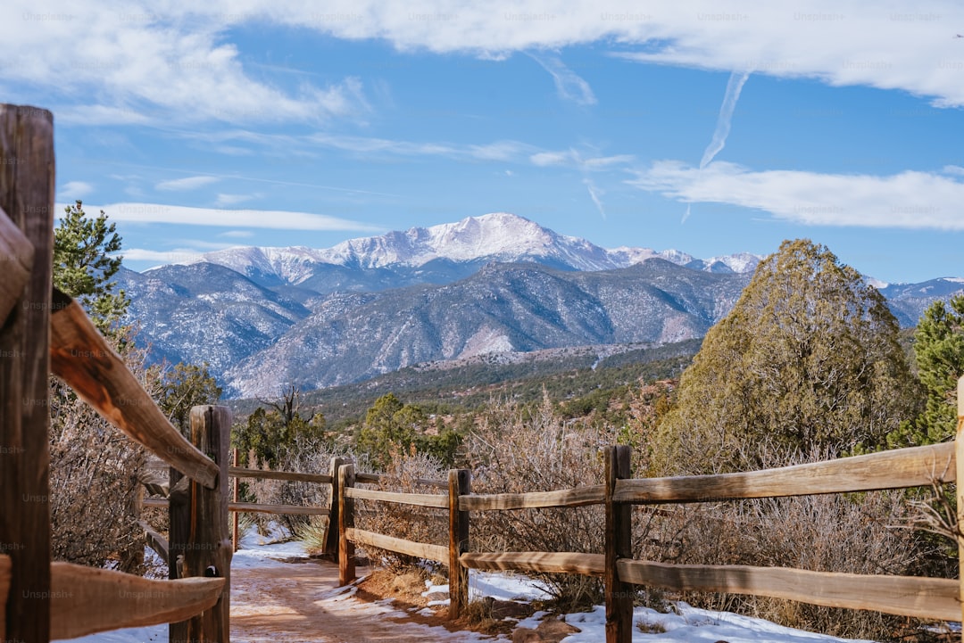
Look, we all know the song, but calling Pikes Peak "America's Mountain" isn't just about the view that inspired Katharine Lee Bates—it's about how this single 14,115-foot peak has become a living laboratory, a mechanical proving ground, and a political experiment in land management all at once. The mountain's granite is over a billion years old, some of the oldest exposed rock on the continent, and you can actually see the iron oxide staining on the lower sections of the Barr Trail, giving the rocks that rusted hue that feels ancient in a way most peaks just don't. That geological age is paired with a weird quirk: the feldspar crystals in the rock scatter short-wavelength light, producing that literal "purple mountain majesty" Bates wrote about, meaning the most famous line of American poetry is actually a mineralogical fact. But here's what really makes this place different—it's one of the few 14ers in Colorado that you can access without being an elite mountaineer. The Cog Railway opened in 1891, bankrolled by Zalmon Simmons (yes, the mattress guy), and the current Swiss-built Stadler trains, overhauled for $100 million in 2021, run on biodiesel from waste vegetable oil and use regenerative braking to cut fuel consumption by 30 percent on the descent. That's not just engineering nerdery; it's a genuine demonstration that a 130-year-old tourist attraction can adopt modern tech without losing its soul.
Now, compare that to the Barr Trail, which is the longest and tallest standard route ascent of any 14er in Colorado—24 miles round trip with 7,600 feet of vertical gain. Roughly 25 percent of direct summit attempts end in altitude sickness, which is the single biggest reason people bail, and that statistic tells you something honest about the mountain: it doesn't care about your fitness level or your Instagram feed. The summit visitor center is the highest building in the United States, and on a clear day, with nearly 145 miles of visibility, you can actually perceive the curvature of the Earth. That's not a metaphor; it's a genuine optical phenomenon where your brain struggles to reconcile the arc of the horizon with your expectation of a flat line. And then there's the Pikes Peak International Hill Climb, the second-oldest continuously held auto race in the country, which has been running since 1916—a tradition that turns the mountain into a racetrack for a single day each year, with cars and motorcycles blasting up the same gravel-and-pavement highway that Bates would have seen as a dusty wagon route.
But the part that I think gets overlooked is how the mountain is actually managed. It's a unique partnership between the U.S. Forest Service, the City of Colorado Springs, tribal leaders, nonprofit groups, and community volunteers—a collaboration that's essential because Pikes Peak sits on public land but attracts over half a million visitors annually. That kind of multi-stakeholder governance is rare in the national forest system, and it's forced everyone to think about sustainable tourism, trail maintenance, and wildfire risk in ways that other iconic peaks don't have to. The Friends of the Barr Trail group has added stone steps and drainage structures to prevent erosion from 50,000 hikers a year, and the cog railway's emission reductions aren't just PR—they're a response to the reality that you can't keep running diesel engines through a fragile alpine tundra ecosystem forever. So when I think about "enduring legacy," it's not just the song or the view or the race. It's the fact that this mountain has forced engineers, poets, racers, and federal bureaucrats to work together across generations, each group leaving a layer on top of the billion-year-old granite. That's what makes it America's Mountain—not the inspiration, but the ongoing negotiation between human ambition and a landscape that still manages to humble everyone who makes it to the top.
Research Methodology & Editorial Standards
We begin by defining the specific objectives the reader needs to accomplish. Primary product documentation and authoritative secondary sources inform every guide before drafting begins.
Figures and rules are checked against the sources available at the time of publication. Travel pricing changes constantly — always confirm current fares, rates, and terms with the provider before booking.