
Why Cappadocia is the ultimate destination for hiking through otherworldly landscapes
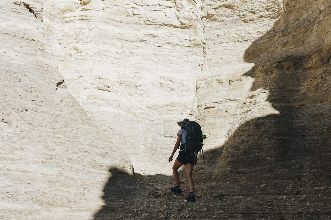
You can actually see the history of these volcanic outbursts in the horizontal bands running through the rock, which change color based on the mineral content of the ash from different eruptions.
Geological Wonders: Understanding the Formation of Iconic Fairy Chimneys
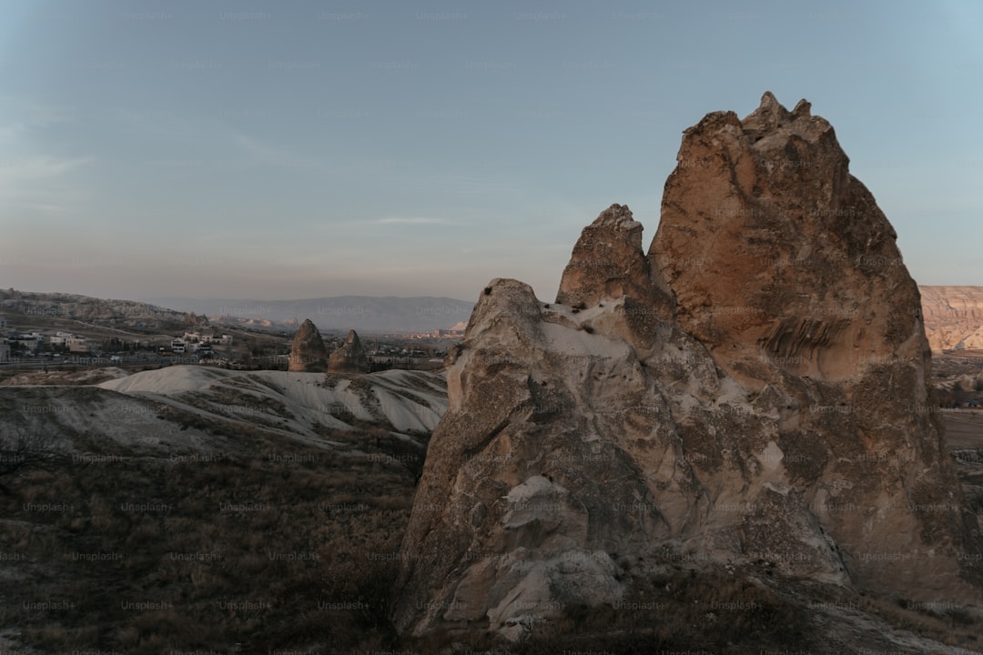
When you stand in front of these towering stone spires, it is easy to assume they are some kind of ancient architectural project, but the reality is much more raw and mechanical. The foundation here is thick tuff, essentially compacted volcanic ash that settled some nine to thirteen million years ago. Think of it as a soft, porous canvas waiting to be worked on by the elements. What keeps these chimneys standing is a literal hat made of harder rock like basalt or andesite, which sits on top and acts as a shield against the rain and wind. Without that heavy cap, the softer tuff underneath would have vanished long ago, leaving just a flat, uninteresting plain.
This whole process boils down to what geologists call differential erosion. Basically, the harder top layer prevents the material directly beneath it from wearing away at the same speed as the surrounding ground. As wind and water carve out canyons, they isolate these columns, leaving them standing tall while the rest of the plateau recedes. You can actually see the history of these volcanic outbursts in the horizontal bands running through the rock, which change color based on the mineral content of the ash from different eruptions. Some of these spires hit forty meters in height, which is pretty wild when you realize they are essentially just the leftovers of a landscape being slowly leveled over millions of years.
The durability of these formations is honestly a bit of a paradox. You might look at them and think they look fragile, but that tuff is incredibly stable when it stays dry. That specific quality is exactly why people could carve entire homes and churches right into the shafts without the whole thing collapsing. Still, the clock is always ticking. Once that basalt cap slides off or breaks, the tuff column loses its protection and turns into a cone before disappearing entirely. It is a slow, constant transformation that even seismic activity in Central Anatolia helps nudge along, reminding us that even the most solid-looking mountains are just temporary features of a changing earth.
Best Valley Trails for Every Skill Level: From Love Valley to Pigeon Valley
If you’re heading to Cappadocia, you’re likely looking for more than just a postcard view; you’re looking to get your boots dusty and actually move through that surreal landscape. I’ve spent enough time navigating these volcanic corridors to know that not every trail is created equal, and honestly, the sheer variety can be a bit overwhelming if you don’t know what you’re stepping into. Let’s look at the Pigeon Valley trek, which is arguably the most approachable starting point for anyone just getting their bearings. It’s a gentle, four-kilometer descent from Uçhisar to Göreme, where you’re walking past cliff faces literally honeycombed with man-made pigeon houses that once fueled the local agriculture. It’s a perfect introduction to the region’s history without requiring you to be a seasoned mountaineer.
But if you’re craving something that feels a bit more, well, otherworldly, you have to head over to Love Valley. Just be warned that while those thirty-meter tall fairy chimneys are visually stunning, the ground under your feet is almost entirely loose volcanic silt. It sounds fine until you’ve had a light rain, and suddenly that trail turns into a slick, unpredictable mess that demands real care with your footing. On the flip side, you’ll notice the temperature often drops a few degrees in those narrow sections, which is a massive relief when the Anatolian sun is really beating down. It’s a trade-off, but in my experience, the microclimate and the scenery make the effort absolutely worth it.
For those who want to escape the crowds, Zemi Valley is your best bet, though it’s definitely not for the navigationally challenged. The path here is often buried under dense fruit trees and wild vegetation, which makes finding the hidden Byzantine-era frescoes at the Cistern Church feel like a legitimate discovery. If you’re looking for a serious test of your legs, the Ihlara Valley is where you go to earn your dinner. You’re starting with a descent of over three hundred steps down to the Melendiz River, but the reward is a lush, shaded riparian oasis that stays cool even in the heat of a July afternoon. It’s a completely different rhythm compared to the exposed, sun-baked trails, and it’s a great reminder of how diverse this terrain actually is once you get off the main tourist map.
Beyond the Hike: Exploring Ancient Cave Dwellings and Underground Cities
If you’ve ever found yourself staring at a jagged cliffside in Cappadocia, you might have wondered what was happening behind those weathered rock faces. We often focus on the hiking, but the real story here is what’s buried beneath our feet. Think about it: entire cities were carved into the soft volcanic tuff, reaching depths of over eighty meters. It’s not just a series of caves; it’s a masterclass in ancient engineering. Places like Derinkuyu were designed to house up to 20,000 people, along with their livestock and food, during times of conflict. Honestly, the scale of it is hard to wrap your head around until you’re actually navigating those narrow, winding tunnels yourself.
What really gets me is the sheer sophistication of these subterranean networks. The inhabitants didn’t just dig; they built massive circular stone doors weighing up to 500 kilograms that could only be locked from the inside. To keep things breathable, they engineered complex ventilation shafts that doubled as wells for a steady supply of groundwater. And they weren’t just surviving; they were living. We’re talking about dedicated spaces for schools, chapels, and even wine production, complete with stone vats and presses that show how important viticulture was to them. It’s fascinating how they used clever acoustics in those deeper churches to amplify chanting, creating a space that felt truly transcendent despite being deep underground.
If you’re comparing this to other historical sites, the contrast is stark. While some regions have basic shelters, these cities were built for long-term endurance, maintaining a constant 13 degrees Celsius throughout the year. They even had vertical apertures between floors for communication, which is essentially an analog version of a modern intercom system. It’s pretty wild to think that these early communities had secret exit tunnels stretching for kilometers, essentially a subterranean escape hatch for when things got truly desperate. If you decide to go, try to look past the tourist crowds and really study the wall textures. The clay and plaster coatings are still there, doing the same job of humidity control they did centuries ago. It’s a powerful reminder that while we often look for the next big peak to climb, the most incredible history is often hiding right underneath us.
The Perfect Base: Why Staying in a Cave Hotel Enhances Your Hiking Experience
When you’re planning a trek through a landscape as rugged and exposed as Cappadocia, where you rest your head at night isn't just about convenience—it’s actually a vital piece of your recovery strategy. I’ve found that staying in a cave hotel completely changes the rhythm of your trip because these structures act as a natural thermal buffer against the region’s intense daily temperature swings. While a standard hotel room might fluctuate wildly in heat or humidity, the thick, volcanic tuff walls maintain a steady, cool environment that helps your body regulate more easily after a grueling day on the trail. Honestly, there is something incredibly restorative about waking up in a space that feels like a natural extension of the valleys you’ve been hiking all day.
Beyond the comfort, the physics of these rooms really work in your favor when it comes to quality of rest. Because the porous rock is a natural acoustic insulator, it absorbs almost all that ambient noise you’d get in a typical hotel, creating a near-silent environment that helps you hit that deep REM sleep faster. You’ll also notice the air quality feels different; the rock’s hygroscopic properties naturally balance humidity, which is a massive relief if you’re prone to the respiratory dryness that usually comes with high-altitude, dusty hiking. Plus, those original stone-hewn air channels that have been around for centuries are still doing their job, providing a constant flow of fresh air without the dry, artificial buzz of a modern air conditioning unit.
Think about the psychological shift that happens when your living space mirrors the geology you’re exploring. It creates this profound sense of immersion, and when you combine that with the natural electromagnetic shielding these dense walls provide, you’re essentially getting a forced digital detox that honestly drops your stress levels in a way a glass-and-steel building never could. Many of these hotels even use clever geothermal heat exchange systems to tap into the very same volcanic energy that formed the landscape, making your base of operations feel perfectly in sync with the terrain. It’s not just a place to sleep; it’s a way to let your body recover in the same geological sanctuary you’ve been traversing, and trust me, your legs will thank you for the extra level of stillness when you’re prepping for your next canyon ascent.
Timing Your Trek: Seasonal Advice for Navigating Cappadocia’s Rugged Terrain
When you’re planning your time in the valleys, you have to realize that Cappadocia’s semi-arid climate is less about the general weather and more about managing extreme shifts. We’re talking about diurnal temperature swings that can easily cross 20 degrees Celsius between high noon and midnight, even in the heart of summer. If you’re aiming for the most stable conditions, late spring, specifically April and May, is your best window because the seasonal rain helps keep the pervasive volcanic dust down. Just keep in mind that those spring months bring sudden meteorological shifts; the plateau heats up so quickly that it can trigger intense afternoon thunderstorms, turning those porous, clay-rich trails into slick, unstable hazards that can stay saturated for up to 48 hours.
If you’re looking for the absolute best time to hit the trails, I’d argue that late September through October is the sweet spot. You get the harvest season, sure, but more importantly, the sun angle drops, which cuts down on that blinding glare reflecting off the light-colored tuff surfaces. On the flip side, if you’re a photographer or just trying to beat the heat, June offers a massive 15-hour daylight window, letting you start your trek as early as 5:15 AM to avoid the peak UV index. You’ll want to pay attention to the wind, too; it typically shifts from the north in the afternoon, so if you plan your route to move in a southerly direction, you can actually use those gusts to stay cool while the sun is at its most relentless.
Honestly, I’d be careful about pushing your luck in the shoulder months or winter. If you’re visiting between January and March, you’re looking at serious ice formation in the shadowed, north-facing corridors, which makes standard hiking gear pretty much useless without extra caution. November is a bit of a secret, though, because the ground holds onto that residual summer heat, keeping the valley floors noticeably warmer than the exposed ridges. Just remember that once you hit December, your daylight drops to about nine hours, which really shrinks your safety margin if you’re planning anything but the shortest, most direct routes through the terrain.
Aerial Perspectives: Combining Morning Hot Air Balloon Rides with Afternoon Exploration
If you’ve ever watched the sunrise from a wicker basket hovering over the Göreme basin, you know there’s no better way to get your bearings before hitting the trails. Balloon flights here happen in that tiny two-hour window just after dawn, specifically to beat the chaotic thermal currents that kick in once the sun starts heating the ground. It’s actually a brilliant bit of physics; pilots use the morning temperature inversion, where cold air traps the balloon in a stable, hovering layer, to weave through those narrow volcanic canyons with surprising precision. They’re basically reading the vertical wind shear, climbing or descending into different air streams to steer, which is a far cry from the predictable, gusty wind patterns you’ll encounter when you’re down hiking in the afternoon.
Think about it this way: that morning view isn't just for the photos. Seeing the landscape from above gives you a masterclass in the region’s drainage systems, revealing how those dendritic erosion patterns actually carve out the valleys you’ll be walking through later. When you’re up there, you can actually spot which fairy chimneys look most vulnerable to collapse based on the cap rock density, something that’s nearly impossible to gauge once you’re standing at the base looking up. It’s a total game changer for your afternoon planning because you’re effectively mapping your hike from a bird’s-eye view while the air is still dead calm.
But you have to remember that the math behind these flights changes fast once the sun gets high. By the afternoon, the intense solar radiation hitting that light-colored tuff creates localized, predictable convection that pulls wind straight through the canyon corridors. That’s why your ground experience is so different; you’re trading the stillness of the dawn for the natural airflow that follows the valley’s topography. I always tell people to lean into that dual perspective—use the morning to scout the terrain and the afternoon to get into the details, like the cave dwellings or those hidden frescoes you spotted from the basket. It’s the ultimate way to sync your internal rhythm with the geology, turning a standard trip into something that feels like you’re actually reading the landscape itself.
Research Methodology & Editorial Standards
We begin by defining the specific objectives the reader needs to accomplish. Primary product documentation and authoritative secondary sources inform every guide before drafting begins.
Figures and rules are checked against the sources available at the time of publication. Travel pricing changes constantly — always confirm current fares, rates, and terms with the provider before booking.