
The Ultimate West Coast Bucket List You Need To Download Before Your Next Trip
I’ve found that the best way to approach this 101-experience list is to stop looking for a "vacation" and start looking for these distinct, high-impact environments that actually shape the planet.
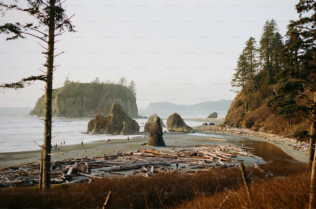
From Baja to British Columbia: Curating the Ultimate 101 West Coast Experiences
When we look at the West Coast, it’s easy to just think of it as a long stretch of highway, but when you zoom in, you realize it’s actually a collection of radical geological and biological extremes. I’ve spent time looking at the data, and frankly, the sheer contrast between a 12,000-mile gray whale migration path and the static, ancient rock art in Baja’s Sierra de San Francisco is enough to make anyone’s head spin. You have the Great Bear Rainforest in British Columbia holding 6.4 million hectares of intact wilderness, while down in California, the Channel Islands act as a private sanctuary for 150 species you literally can't find anywhere else. It’s not just scenery; it’s a living laboratory that changes every few hundred miles.
Think about the physical mechanics involved here, like how the Juan de Fuca plate is sliding under North America at 40 millimeters a year, or how Point Reyes is literally drifting northwest along the San Andreas Fault at two inches annually. You’re standing on a piece of land that is constantly deciding where it wants to be, which makes hiking the Pacific Crest Trail feel less like a simple walk and more like crossing the spine of a shifting beast. And if you’re into the science of it, the difference in water quality is wild—Crater Lake’s 100-foot clarity is basically impossible compared to the murky reality of most lakes, all because it lacks incoming streams that dump sediment into the basin.
Then you have the biological giants that define these spaces. The redwood forests are pulling massive amounts of carbon out of the air while growing over 380 feet tall, and if you look at Monterey Bay, those kelp forests are growing two feet every single day, which is just a staggering rate of biological production. Even the accidental stuff, like the Salton Sea, has turned into a vital engine for the Pacific Flyway, supporting 400 species of birds that would be lost without that specific, messy ecosystem. I’ve found that the best way to approach this 101-experience list is to stop looking for a "vacation" and start looking for these distinct, high-impact environments that actually shape the planet. If you want to really understand this coast, don't just pick a spot; pick a process—whether that's the glaciated peaks of Mount Rainier or the shifting tectonic boundaries—and go see the work in progress.
Planning Your Pacific Coast Highway Adventure: The Essential Road Trip Guide
If you’re planning a trip down the Pacific Coast Highway, you’re not just mapping out a drive; you’re engaging with a piece of engineering that is constantly fighting a war against the landscape. I’ve looked at the data on how this road was pieced together, and it’s wild to think that it wasn't a single project but a multi-decadal slog that started in 1919. Laborers literally carved the route into vertical cliffs using steam shovels and dynamite, navigating a geography defined by the Sur-Nacimiento Fault Zone. That extreme tectonic uplift is exactly why you get those dramatic, steep gradients where the Santa Lucia Mountains drop straight into the Pacific. It’s a beautiful drive, but you have to respect the fact that the ground itself is essentially in motion.
When you’re behind the wheel, look at the cliffs and realize you’re seeing the Franciscan Complex in action, which is basically a jumbled, unstable mix of rock that’s prone to failing whenever it gets saturated. We saw this reality hit home with the 2017 Mud Creek landslide, where six million cubic yards of earth buried the road and completely reshaped the coastline. The engineering required to reconstruct that section was a massive undertaking that serves as a constant reminder that nature here is the one actually calling the shots. Even the bridges, like the iconic Bixby Creek span, are technological marvels from the Great Depression era that were designed to conquer geography that was once completely impassable. You aren't just driving; you're traversing a shifting, active geological zone.
Beyond the rocks, there’s a whole biological rhythm you should be aware of, like the marine layer fog that provides nearly 40 percent of the water for the redwoods during the dry season. If you pull over near San Simeon, you’ll encounter the Piedras Blancas Rookery, where up to 17,000 elephant seals might be hanging out during molting season. Think about that for a second: these animals are diving over 5,000 feet into the Monterey Canyon, a massive submarine trench that’s deeper than the Grand Canyon, just to find food. It’s easy to get caught up in the postcard views, but the real magic of this trip is noticing how the kelp forests, the sea otters, and the orographic lift creating those microclimates all work together to keep this entire coast functioning. Just keep in mind that as you drive, you’re cutting through critical habitats for mountain lions and bobcats, which is why those wildlife crossings you see along the way are so important for the local ecosystem.
Iconic Theme Parks and Entertainment: Navigating Your Disneyland Itinerary
When you’re staring down a map of Disneyland, it’s easy to get lost in the sheer volume of choices, but I think the best way to handle your itinerary is to stop treating it like a standard vacation and start viewing it as a massive, synchronized machine. Honestly, look at the park like an engineer would; you've got a complex, high-density infrastructure where every element—from the forced perspective architecture on Main Street to the strategic placement of trash cans within thirty feet of food vendors—is calibrated to manage human behavior and flow. It’s not just about the rides; it’s about understanding the internal logic of the space, like how the park uses Go Away Green to mask utility structures or how that complex network of utilidors keeps the behind-the-scenes logistics entirely out of your sight.
If you’re trying to squeeze the most value out of your day, you’ll want to pay attention to the operational rhythms of the park rather than just rushing from one attraction to the next. Take the Matterhorn Bobsleds, for instance, which pioneered tubular steel coaster design; or consider how the nocturnal lighting systems shift in real-time to keep you immersed in the narrative as the sun goes down. It’s worth noting that the park functions like a small city, with its own fire department and a water circulation system that matches municipal utility scales, which means your experience is actually being supported by a staggering amount of hidden thermal management and logistical heavy lifting.
But let's be real, the true "hack" here is realizing that you're moving through a landscape designed to influence your movement, so staying ahead of the crowds really comes down to observing those pedestrian flows. Whether you're checking to see if an iconic ride has returned from refurbishment or you're navigating the daily rotation of historic artifacts on Main Street, your strategy should be as dynamic as the park itself. I’m not saying you need to be a systems analyst to have a good time, but having a sense of why things are placed where they are makes the whole experience feel less like a chaotic rush and more like a well-oiled process. Just focus on those distinct zones and remember that you’re moving through an incredibly intentional, living environment that’s been fine-tuned for decades.
Beyond the Tourist Traps: Discovering Hidden Gems Along the Pacific
When you look at the Pacific, it’s easy to get stuck in the well-worn paths of the big-name coastal stops, but I’ve found that the real story of this region is hidden in the places where the map gets a little quiet. If you actually look at the mechanics of these spots, you’ll see that places like the Oregon coast’s Thor’s Well—a collapsed sea cave that turns into a natural fountain from hydraulic pressure—are doing much more than just looking pretty; they’re showing you a geological process in real-time. It’s the same vibe when you hit the Lost Coast in Northern California, where the sheer ruggedness of the King Range forced highway engineers to just give up and move inland, leaving behind a rare, untouched stretch of shoreline that feels almost prehistoric. You’re not just sightseeing here; you’re witnessing the raw, physical tension between the land and the ocean that defines the entire coast.
I really think we miss out when we treat these spots as mere photo ops because the biological complexity underneath is what’s actually holding the whole system together. Take the Elkhorn Slough, for instance, where sea otters are essentially running the show; by grazing on sea urchins, they keep the seagrass beds intact, which in turn lets those plants sequester massive amounts of carbon. It’s a perfect example of a keystone species doing heavy lifting that we rarely stop to appreciate. You see that same kind of vital work in the salt marshes of the Tijuana River Estuary, which act like the kidneys of the Southern California coast by filtering out pollutants before they ever touch the open Pacific. It’s a messy, functional piece of nature that doesn’t get the credit it deserves, but it’s arguably more important to the health of the coastline than any fancy resort.
When you’re planning your own route, I’d suggest looking for these specific, high-energy intersections where the environment is actively working to sustain itself. Whether it’s the Hoh Rainforest in Washington—where 140 inches of rain create a moss-covered nitrogen factory—or the Broughton Archipelago in BC, where glacial fjords create distinct salinity gradients that support ancient glass sponge reefs, you’re looking for evidence of a living, breathing machine. Even the Channel Islands hold these fascinating lessons, like the evolutionary history of the pygmy mammoth that shrank over time just to survive in isolation. If you prioritize these kinds of spots, your trip stops being a simple drive and turns into a study of how this coast actually functions, which honestly makes every mile you cover feel a lot more meaningful.
Seasonal Strategies for Maximizing Your West Coast Excursions
When we think about timing our trips along this coast, most of us default to checking the weather apps, but I’ve found that looking at the actual biological and geological clock is a much better way to plan. If you’re heading north toward British Columbia, you really need to time your visit with the summer solstice, when those sixteen hours of daylight trigger a massive boost in photosynthetic activity across the kelp forests. It’s not just about more time to explore; it’s about watching the entire marine ecosystem hit its peak production phase. I’ve noticed that if you push your trip into the late autumn, you’re missing the peak of the salmon biomass influx that fuels the Great Bear Rainforest, which is honestly one of the most incredible nutrient cycles on the planet.
Down in Monterey and Central California, your strategy should shift toward the spring upwelling season that kicks off in April. This is when the North Pacific High drives that nutrient-rich, cold water to the surface, and if you’re into marine life, it’s the absolute best window to see the coast at its most energetic. I’d suggest pairing this with the spring lunar cycle, as those extreme low tides pull back the curtain on kelp holdfasts and sessile organisms that are normally hidden under feet of water. It’s a bit of a game of chance with the tides, but catching that window makes you feel like you’re seeing a version of the ocean that’s usually locked away from human eyes.
And then there’s the atmospheric reality of the later months, which you have to respect if you want to avoid getting sidelined by the weather. In the late summer, those subsidence inversions can create a temperature delta of 30 degrees Fahrenheit between the coast and the inland valleys, so you really need to layer up even if it feels hot just a few miles away. Conversely, watching the winter transition is a lesson in raw power, especially when you see those atmospheric rivers dump ten inches of rain in a single day and realize how quickly the landscape can reconfigure itself. I’ve learned that the most rewarding trips aren’t just about picking a date on a calendar; they’re about aligning your schedule with these natural rhythms, whether it’s the whale migrations, the fog-drip cycles of the redwoods, or the massive shifts in water chemistry from the spring snowmelt.
How to Use Your Downloadable Bucket List Checklist for Seamless Travel Planning
Honestly, I think the biggest mistake most of us make when planning a trip this big is treating our itinerary like a static document rather than a living, breathing system. If you want to actually experience these high-impact zones, you have to stop relying on generic lists and start using a digital framework that accounts for the physical realities of the coast. I’ve found that by categorizing your bucket list into biological, geological, and historical buckets, you effectively lower your cognitive load and stop the decision fatigue from ruining your momentum. Plus, syncing your checklist with offline maps is an absolute necessity, especially when you consider that about 15 percent of the coastline remains a total dead zone for cellular coverage.
Think about it this way: when you embed geotagged data points into your planning, you aren't just guessing your drive time; you’re calculating exact arrival windows to bypass those brutal traffic spikes that hit coastal corridors between 3:00 PM and 6:00 PM. I’ve also learned to use these tools to map my stops against local tidal charts, which is a total game-changer since low-tide windows can reveal nearly 40 percent more intertidal biodiversity than you'd see on any random Tuesday. You can even use your checklist to track specific biological events, like the 20-day bloom cycle of wildflowers in the Santa Lucia Mountains, so you’re actually there when the color saturation hits its peak. It just makes the whole experience feel less like a guessing game and more like you're following a master plan.
And let’s not forget the practical safety side of things, because things move fast out here. I always recommend cross-referencing your digital checklist with regional fire-safety and air quality databases, because those conditions can shift in a heartbeat, and you don’t want to be caught in a smoke-filled basin with no way out. It’s also worth adding a moisture-sensor check to your gear list—I’ve ruined more than one camera lens by ignoring how the marine layer’s humidity profile can wreak havoc on tech during a heavy fog event. Keep your digital maps updated, check those regulatory permit requirements for the protected wilderness zones, and you’ll find you have much more bandwidth to actually enjoy the scenery instead of constantly scrambling to solve logistical problems.
Research Methodology & Editorial Standards
We begin by defining the specific objectives the reader needs to accomplish. Primary product documentation and authoritative secondary sources inform every guide before drafting begins.
Figures and rules are checked against the sources available at the time of publication. Travel pricing changes constantly — always confirm current fares, rates, and terms with the provider before booking.