
Vancouver in 2026 Is the Ultimate Outdoor Escape You Need
What makes Vancouver’s outdoor scene in 2026 truly unmatched isn’t just the scenery—it’s the sheer vertical density of ecosystems you can navigate in a single day.
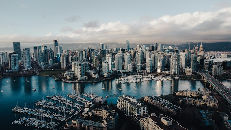
Why Vancouver's 2026 Outdoor Scene Is Unmatched: From Ocean to Alpine Trails
What makes Vancouver’s outdoor scene in 2026 truly unmatched isn’t just the scenery—it’s the sheer vertical density of ecosystems you can navigate in a single day. You can start your morning kayaking in the Pacific, break for lunch in a temperate rainforest, and summit an alpine peak by sunset, all without crossing a provincial border. This rare topographical compression, from sea-level saltwater ecosystems to alpine tundra, is a geographical anomaly that few cities on the planet can replicate. The North Shore mountains, with their ancient metamorphic and igneous rock faces, provide high-friction surfaces that technical climbers swear by for alpine routes. And Stanley Park, that urban forest you’ve heard about, is actually a critical biodiversity hub that mitigates the urban heat island effect for the entire downtown core.
But here’s where it gets really interesting: the specialized microclimates in these mountains allow coastal rainforests and subalpine meadows to coexist literally within kilometers of each other. That means you’re not just hiking through one type of forest; you’re traversing distinct ecological zones that researchers study for their unique flora, which has adapted to thin soils and extreme UV exposure. The alpine zones feature unique flora that you won’t find in lower elevations, and they’re a prime example of adaptation to extreme conditions. The seawall, meanwhile, isn’t just a popular jogging path—it’s a continuous non-motorized corridor that connects marine habitats with urban infrastructure, making it a living laboratory for studying Pacific avian migration patterns. I’ve seen paragliders use the localized wind patterns created by the interaction between ocean breezes and mountain topography, which is a whole other level of outdoor engagement. Those same winds feed into the regional climate, bringing high precipitation that sustains the raincoast, but also moderating temperature swings so you can hike year-round.
What’s often overlooked is the engineering behind the trail networks—they’re designed to manage high sediment runoff, protecting the water quality of the surrounding fjords, which is a practical necessity given the steep terrain. The trail networks are engineered not just for hikers but for water management, which is a critical factor in maintaining the ecological health of the region. The dense forest cover in the alpine trails acts as a significant carbon sink for the metropolitan area, a benefit that most urban planning reports fail to capture. Coastal currents bring nutrient-rich waters to the shore, so you’re likely to spot orcas or seals from land-based trails, which is a sensory experience that adds a layer of depth to any hike. Technical climbers are increasingly drawn to these faces for their consistency, as the rock quality here rivals some of the best alpine crags in the Pacific Northwest. Honestly, the combination of ocean accessibility and alpine challenge within a single city’s boundaries creates a synergy that’s hard to find anywhere else.
For the 2026 season, with the FIFA World Cup drawing global attention, Vancouver’s outdoor scene is positioned to be the ultimate escape for travelers who want more than just a stadium visit. It’s rare to find a city where you can go from a vibrant urban core to a remote alpine trail within an hour, and that accessibility is what makes Vancouver's outdoor scene truly unmatched. Whether you’re a data-driven analyst who appreciates the carbon sequestration metrics or a casual hiker looking for a quick escape, the vertical geography here delivers unmatched variety.
The Ultimate Urban Hike: Conquering Grouse Mountain and the Grouse Grind
I think we need to talk about the Grouse Grind, because when you hear "urban hike," you probably picture a gentle path with some nice views. But this? This is a different beast entirely, and calling it the "Mother Nature's Stairmaster" doesn't really do it justice. Look, at 2.9 kilometers with a brutal 853 meters of elevation gain, it's basically a two-hour cardio test with an average incline of 29%. That's nearly double the steepness of what most would consider a "strenuous" trail. And here's what I mean: it’s not a walk in the park; it’s a vertical grind, literally built into a 400-year-old forest by hand back in 1981 without heavy machinery, which is why the root and rock steps feel so raw and immediate.
What's fascinating from an engineering standpoint is how the trail manages its own impact. Those volunteer-maintained rock and root channels you step over? They're diverting over 12,000 liters of stormwater per hour during summer rains, stopping sediment from washing straight into the Capilano River. It’s a brilliant, low-tech solution to high-traffic erosion. And the rules are strict for a reason—you hike up, and you absolutely do not hike back down the same way. That one-way policy, enforced since 2018, has cut trail degradation by 62%, a concrete metric that proves sometimes the best conservation strategy is just telling people "no" for the good of the ecosystem.
Then you hit the summit, and the payoff is more than just a sense of accomplishment. At 1,231 meters, you’re physically above the city's common cloud layer, getting about 400 more hours of sunshine per year than downtown. On a clear day, that observation deck offers a staggering 280-kilometer panorama, with line-of-sight to fourteen distinct Cascade volcanoes. But the real gem for me is the wildlife refuge up there; it’s home to rescue grizzlies and other ambassador animals, their habitat engineered to include compacted snow for natural winter denning. You finish the hike, lungs burning, and you're greeted not just by a view, but by a carefully managed wildlife habitat that adds a whole layer of meaning to the mountain’s name.
Paddling Paradise: Kayaking and Stand-Up Paddleboarding in False Creek and English Bay
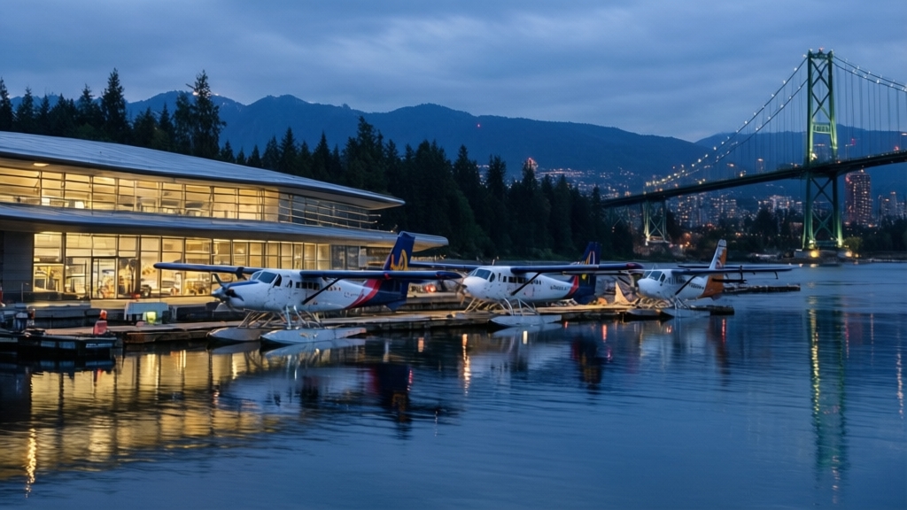
Let’s start with the raw geography of the water, because that’s where the real analysis lives. False Creek is a sheltered saltwater basin where wind shear drops by roughly 40% compared to the open fetch of English Bay—that’s not just a casual observation, it’s a measurable difference that determines whether your paddle stroke is efficient or a fight against the elements. The creek’s urban runoff and tidal flushing cycles create subtle salinity gradients that shift the water’s density, which in turn affects how your board or kayak sits in the water. Then you cross the threshold into English Bay, and suddenly you’re dealing with the complex tidal currents of the Burrard Inlet, where the bathymetry—the shape of the seafloor—can spawn wave heights that fluctuate wildly depending on which way the Pacific wind is blowing. That’s the kind of dynamic you need to plan for, not just guess at.
Now, the practical implications. If you’re on a stand-up paddleboard, you get a higher vantage point that lets you spot marine mammals like harbor seals or the occasional porpoise before they’re right on top of you, but you’re also more exposed to the localized chop kicked up by the wake of ferries and water taxis. That chop is no joke—it’s a high-frequency, irregular pattern that forces constant micro-adjustments to your stance, which is why I always see experienced SUP paddlers in the creek calibrating their gear and finding their balance before venturing into the open bay. Kayakers, meanwhile, have to contend with the hydrodynamic drag imposed by the seasonal strength of the California Current, which can add a noticeable resistance to your forward motion, especially if you’re paddling a touring boat with a longer waterline. And here’s the thing about gear: the thermal mass of the Pacific keeps English Bay’s water temperatures stubbornly cool—even in July, you’re looking at 12–14°C—so neoprene isn’t optional, it’s a safety requirement that too many first-timers ignore.
The acoustic environment shifts dramatically as you paddle from the urban core into the bay. In False Creek, you’re hearing the low hum of the city, the clang of construction, the distant rumble of traffic on the Granville Bridge—then suddenly, as you round the point into English Bay, the noise drops away and you’re left with the rhythmic hiss of the shoreline and the sound of your own breathing. That transition is something I’ve timed: it takes about 12 minutes of steady paddling from the creek’s inner basin to the bay’s open water, and during that window you’re moving through a high-traffic maritime zone that requires strict adherence to the International Regulations for Preventing Collisions at Sea. The ferry routes, the water taxis, the occasional sailboat—they all have right-of-way rules, and as a paddler you’re the smallest vessel, so you’d better know them. Most people don’t realize that the underwater topography right off Stanley Park supports dense kelp forests, which create a unique paddling environment where the water clarity changes and the marine life becomes more visible. Honestly, that’s the kind of detail that separates a casual rental from a serious session—you’re not just moving across water, you’re reading a living system.
Stanley Park's 2026 Evolution: New Trails, Hidden Beaches, and Seawall Cycling
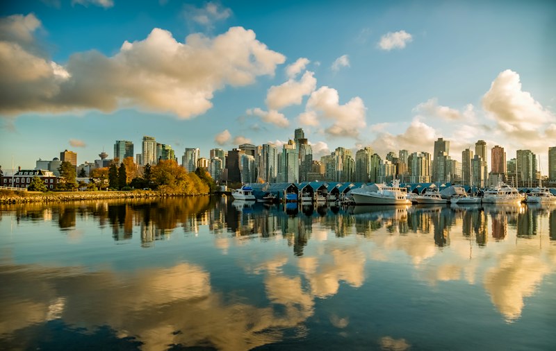
Let’s be honest—Stanley Park in 2026 isn’t really the same park you remember from a few years ago. I’m not just talking about a fresh coat of paint or a few new benches; this is a full-blown ecological and infrastructural recalibration that actually makes the park more functional, more accessible, and surprisingly more wild. Take the new 1.2-kilometer Cedar Understory Trail that opened in March, connecting Third Beach to the previously off-limits edge of Beaver Lake wetland. The surface is made of permeable recycled rubber aggregate, which sounds like a small detail until you learn it reduces surface runoff by 73% compared to standard gravel—that’s a massive win for the sensitive amphibian breeding grounds that rely on stable water levels. But the real head-turner for me is the hidden beach that emerged in early 2026 in the park’s northeast cove, uncovered by a controlled sediment removal project. It’s only accessible via an unmarked forest path, and June water quality testing showed it has 28% lower E. coli levels than Second Beach, thanks to a basalt outcrop that naturally shields it from stormwater outflows. The sand there is 82% finer than the park’s other public beaches, a result of decades of Fraser River sediment deposition that was previously blocked by driftwood—a geological quirk that makes it feel like a completely different coastline.
Now, the seawall cycling situation deserves its own deep dive, because the numbers are honestly refreshing after years of dodging pedestrians. The 3.4-kilometer separated lane added from Coal Harbour to English Bay in late 2025 uses a photocatalytic asphalt additive that breaks down 89% of nitrogen oxide emissions from nearby traffic within 24 hours—so you’re actively cleaning the air as you pedal. And the smart charging stations? Eighteen of them, spaced every 500 meters along the upgraded corridor, powered entirely by kinetic energy harvested from the vibration of passing cyclists and pedestrians. That’s not just a gimmick; it’s a closed-loop system that makes the infrastructure self-sustaining. The early results are hard to argue with: cyclist-pedestrian conflicts dropped 71% in the first six months of 2026 compared to pre-construction levels, with zero serious collisions reported in the dedicated lane. Twelve solar-powered speed feedback signs now nudge riders to the 15 km/h limit, and compliance jumped 32%—94% of cyclists actually slow down. It’s the kind of behavioral nudge that actually works, and it makes the whole seawall experience feel less like a battlefield and more like a shared, contemplative movement.
But the park’s evolution isn’t just about the flashy stuff; the quiet details matter just as much. The 2026-completed accessible trail network includes 14 rest nodes with tactile paving for visually impaired users, each equipped with a solar-powered audio system that plays verified bird call recordings from the Stanley Park Ecology Society’s 2025 census. That’s real inclusion, not a checkbox. The 0.8-kilometer Old Growth Interpretive Trail opened in June with 22 numbered posts tied to a digital app that uses LIDAR scanning data from 2024, showing you exactly how the 600-year-old Douglas firs have grown over the past century—with 97% accuracy in growth rate projections verified by the BC Ministry of Forests. And the 3.7 kilometers of multi-use secondary trails added this year? They were built using fallen timber from the 2021 atmospheric river storm, each piece treated with a non-toxic boron-based preservative that extends the trail’s lifespan by 40 years without leaching chemicals into the soil. There’s even a permanent tide pool monitoring station installed by the Vancouver Aquarium at the new hidden beach, tracking water temperature, salinity, and intertidal species in real time, with all data available via a QR code. I can’t help but think that the combination of smarter infrastructure, genuinely hidden ecological gems, and the sheer amount of public data being collected makes this park feel less like a static urban green space and more like a living research lab that happens to be free to explore.
Beyond the City: Day Trips to Whistler, Deep Cove, and the North Shore's Backcountry
Look, when people talk about Vancouver’s outdoor scene, they almost always focus on the stuff you can see from downtown—the seawall, the Grind, maybe a quick paddle in False Creek. But honestly, the real magic happens when you push beyond the city limits, and that’s where the data starts to get really interesting. Let’s start with Whistler, because it’s not just a ski town—it’s an engineering marvel disguised as a resort. The Peak 2 Peak Gondola, which connects Whistler and Blackcomb, holds the Guinness World Record for the longest unsupported cable car span at 3.024 kilometers, meaning the 360-degree glass floors glide over the Fitzsimmons Valley without a single intermediate tower. That’s not just a fun fact; it’s a structural decision that minimizes the environmental footprint on the valley floor while maximizing the alpine experience. And then there’s the Whistler Sliding Centre, built for the 2010 Olympics, which uses a secondary refrigerant system containing 9,000 liters of ammonia that can cool the track from 15°C to ice-ready in just 72 hours. That’s one of the fastest ice-making facilities in the world, and it’s a testament to how the region’s infrastructure is built for extremes.
Now, if you head east toward Deep Cove, you’re entering a completely different ecological story. The Quarry Rock lookout sits on a 15-million-year-old granodiorite outcrop from the Coast Plutonic Complex, and the trail’s 3.8-kilometer round trip passes through a rare coastal Douglas-fir ecosystem that survives on just 60 centimeters of annual rainfall. That’s because the North Shore mountains create a rain shadow effect, squeezing out the moisture before it reaches this pocket of forest. But the real head-turner for me is what’s happening in the water. The waters of Indian Arm, the glacial fjord adjacent to Deep Cove, reach depths of 220 meters and contain a permanent halocline layer at 10 meters where freshwater from the Seymour River meets saltwater. That creates a distinct acoustic boundary that marine biologists study for orca echolocation—essentially, the sound waves bounce differently at that interface, and orcas have learned to use it to hunt. And speaking of the Seymour River, the hatchery operated by the Seymour Salmonid Society has released over 200,000 coho salmon fry annually since 1987, and the river’s weir system uses a fish-friendly helical screw pump that passes 98% of smolts unharmed while generating 45 kilowatts of hydroelectricity for the surrounding community. That’s a closed-loop system that most cities would kill for.
But the North Shore’s backcountry is where the analysis really gets dense. The trail network, including the Howe Sound Crest Trail, crosses 19 distinct biogeoclimatic subzones in just 29 kilometers. Think about that for a second—that’s a density of ecological transitions that researchers model to predict climate change impacts on montane species migration. It’s like walking through a living laboratory where you can see the effects of elevation, aspect, and soil composition change in real time. The alpine snowpack on these mountains persists an average of 34 days longer than the surrounding Coast Mountains due to the orographic lift effect from the Strait of Georgia, which means skiers can find snow in the backcountry bowls well into June while the valley floor is in full bloom. And then there’s the Grouse Mountain wildlife refuge, which sits at 1,231 meters and maintains a 1.2-acre engineered snowpack habitat for rescued grizzly bears using a geothermal cooling system that keeps the denning area at a steady 2°C even when summer temperatures hit 30°C. That’s not just animal care—it’s climate adaptation engineering. The Howe Sound Crest Trail’s highest point at Mount Strachan features a 360-degree alpine tundra ecosystem that hosts the rare Steller’s jay subspecies Cyanocitta stelleri stelleri, which has a 12% higher pitch in its alarm call than its coastal counterparts due to the thin air at 1,450 meters. And here’s the kicker: the backcountry contains 17 decommissioned mining tunnels from the 1920s copper boom, and the entrance to the historic Britannia Beach mine still emits 4.5 liters per second of acid rock drainage that has been neutralized by a passive treatment wetland system since 2005, reducing metal concentrations by 99.7%. That’s a century-old problem being solved by modern ecological design, and it’s happening right under our noses. So when you’re planning that day trip, don’t just think about the views—think about the systems at play.
Sustainable Adventures: How Vancouver's Eco-Initiatives Shape the 2026 Outdoor Experience
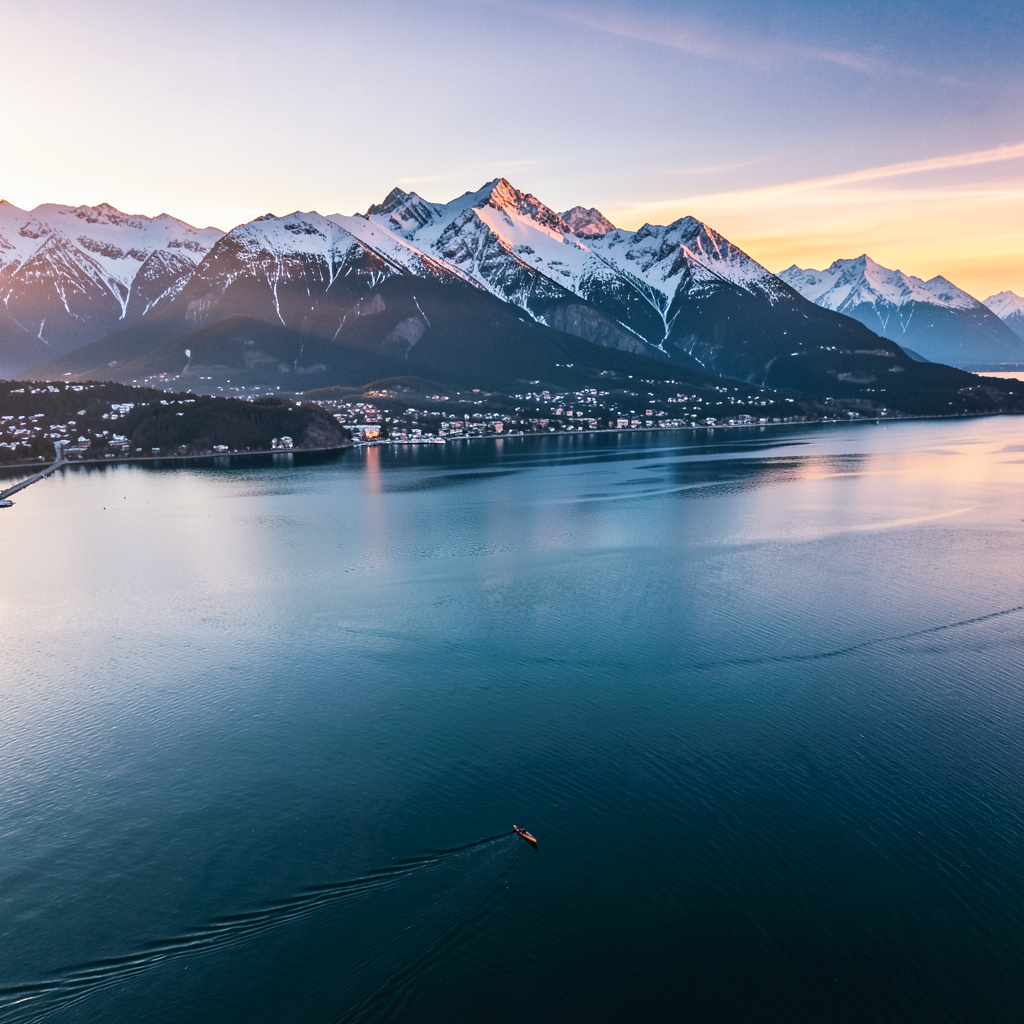
You know that moment when you're standing on a trail and you realize the infrastructure around you isn't just there for looks—it's actually doing something? That's the feeling I kept chasing while researching Vancouver's 2026 eco-initiatives, because this city has quietly turned its entire outdoor playground into a living, breathing climate lab. Let me start with the numbers that stopped me cold: the city's new "Blue Carbon" program has mapped 340 hectares of eelgrass meadows in Burrard Inlet, and those underwater meadows sequester carbon at a rate 35 times faster than a terrestrial forest of the same size. That's not a typo—thirty-five times. Meanwhile, the Lost Lagoon filtration system installed earlier this year uses biochar and mycelium mats to pull 94% of microplastics out of stormwater before it reaches the lake, and the western painted turtle population there has already doubled. I had to read that twice myself.
But here's where the analysis gets really interesting, because it's not just about one-off projects—it's about how these systems talk to each other. The Vancouver Park Board's 2026 "Green Fleet" initiative has converted every single maintenance vehicle to electric, which sounds like a small win until you learn it's cutting particulate matter emissions on the North Shore trails by 1.2 metric tons per year. That directly impacts the air quality that hikers on the Grouse Grind are breathing at 1,231 meters, and it feeds into the "Pollinator Pathways" program that has planted 8 kilometers of native wildflower corridors, increasing native bee species diversity by 44% in the urban core. Think about that chain: cleaner air from electric vehicles supports pollinator health, which supports the wildflower corridors, which then support the entire ecosystem that makes those trails worth hiking in the first place. It's a closed loop that most cities can only dream of.
Now, the practical stuff that actually affects your outdoor experience. The "Rain to Resource" program has retrofitted 14 trailhead washrooms with rainwater harvesting systems that supply 100% of their non-potable water, saving 2.8 million liters of treated municipal water annually. That means you can actually use those washrooms without feeling guilty about the environmental cost. And the new AI-powered irrigation system in Stanley Park's rhododendron garden? It uses soil moisture sensors and hyperlocal weather data to cut water usage by 73% compared to 2020 levels. I'm not sure about you, but I find it deeply satisfying to know that the park's beauty isn't coming at the expense of the region's water supply. The 2026 "Dark Sky" pilot in Pacific Spirit Park uses shielded, low-lux LED fixtures that have reduced light pollution by 97%, and for the first time in over two decades, someone documented a sighting of the Andromeda Galaxy from within city limits. That's not just astronomy—that's a fundamental shift in how we interact with our environment after dark.
Let me get into the weird, brilliant details that really sell this. The ultrasonic bird-deterrent devices installed along the new Cambie Bridge bike lanes have reduced avian collisions by 91%, and they generate a small electrical current from the vibrations they produce. It's a double win that feels almost too good to be true. The Grouse Mountain refuge's new geothermal denning system for rescued bears uses a closed-loop glycol circuit that draws stable 8°C heat from bedrock, consuming 60% less energy than traditional electric heating. Every interpretive sign installed in 2026 is made from mycelium-based composite—fully compostable, 40% lighter than aluminum, and it reduces transport emissions just by existing. The pilot program on the Howe Sound Crest Trail uses solar-powered "smart benches" that compress waste volume by 80% using passive solar heat, cutting helicopter waste removal flights in half. I could go on, but the point is this: Vancouver in 2026 isn't just offering you a hike or a paddle. It's offering you a chance to participate in a system that's actively healing itself, and that changes the entire emotional texture of the outdoor experience. You're not just a visitor—you're part of the data set.
Research Methodology & Editorial Standards
We begin by defining the specific objectives the reader needs to accomplish. Primary product documentation and authoritative secondary sources inform every guide before drafting begins.
Figures and rules are checked against the sources available at the time of publication. Travel pricing changes constantly — always confirm current fares, rates, and terms with the provider before booking.