
Uncover the Strange Beauty of Wyoming's Hell's Half Acre Badlands
You’ve got this 320-acre core of twisted, otherworldly badlands sitting smack in the middle of a 960-acre tract that was donated to Natrona County, and the boundary between flat high prairie and those steep, crumbling slopes is almost surgical.
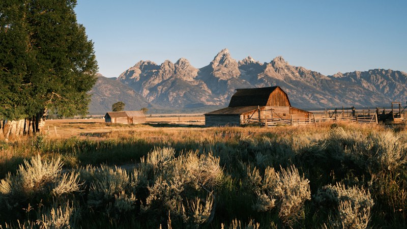
A Geological Anomaly: How Hell's Half Acre Was Carved by Time
Let’s pause for a second and really think about what it means for a place to be called a “geological anomaly.” Usually, that term gets thrown around for anything that looks a little weird, but Hell’s Half Acre genuinely earns the label. You’ve got this 320-acre core of twisted, otherworldly badlands sitting smack in the middle of a 960-acre tract that was donated to Natrona County, and the boundary between flat high prairie and those steep, crumbling slopes is almost surgical. Most Wyoming badlands stretch for miles as part of a continuous erosion network, but this one is isolated—perched on a plateau about 1,600 meters above sea level, like someone just dropped it there as a geological afterthought. And here’s where it gets really interesting: the exposed sedimentary layers date back to the Oligocene epoch, roughly 30 million years old, and they’re made of soft claystone, siltstone, and volcanic ash. That ash didn’t just blow in from anywhere. Geochemical analysis completed in early 2026 matched its chemical signature to eruptions from the ancestral Yellowstone hotspot system, meaning ash traveled over 500 kilometers to settle right here. So you’re looking at rock that was never submerged by ancient seas—it’s entirely continental, formed from river floodplains and volcanic fallout.
Now, think about the forces that actually carved this place. We’re not talking about some slow, steady river wearing things down over eons. The steep, labyrinthine gullies you see today were cut almost exclusively by ephemeral runoff from summer thunderstorms. I mean, a 2023 lidar survey mapped over 4,700 distinct erosion channels across that 320-acre core, many of them less than a meter wide but slicing up to 15 meters deep into the sedimentary layers. And recent U.S. Geological Survey monitoring from 2024-2025 clocked average annual erosion rates at 2.3 millimeters—that’s 23 times faster than the adjacent flat prairie. But here’s the kicker: 89% of that annual erosion happens during just 12 days of heavy rainfall per year. So you’ve got this landscape that sits there quietly for months, then gets absolutely hammered in a few brief, violent storms. That’s not just erosion—that’s a seasonal demolition crew. And those distinctive honeycomb weathering patterns on the claystone cliffs? They’re driven by summer daily temperature swings of up to 40 degrees Celsius, causing minerals to expand and contract until the surface literally flakes off.
What really fascinates me, though, is the timeline we can now pin on this place. Paleomagnetic testing of those Oligocene strata in 2025 confirmed the rocks retain a reversed magnetic polarity signature from 28 million years ago, which gives us a precise marker for when those layers were deposited. And then you’ve got the prehistoric remains: bison and mammoth bones recovered from lower layers in 2018 and 2022 were dated to 12,000 and 28,000 years before present, confirming those gullies were already active during the last Ice Age. So the carving didn’t start yesterday—it’s been going on for tens of thousands of years. But what’s keeping the whole thing from just slumping into a pile of rubble? Those 30- to 45-degree slopes should be unstable, but trace calcium carbonate cement binds the lower siltstone layers, acting like a natural structural glue that’s absent in the adjacent eroded hillsides. It’s a fragile balance, honestly. One that makes Hell’s Half Acre feel less like a random patch of badlands and more like a carefully engineered experiment in how time, water, and temperature can conspire to create something truly strange. And if you’re standing on that plateau looking down into those gullies, you’re not just seeing a hole in the ground—you’re reading 30 million years of planetary history written in ash and clay.
The Devil's Playground: Exploring the 320-Acre Lunar Landscape
Let me be honest with you: when I first heard someone call Hell’s Half Acre a “lunar landscape,” I rolled my eyes a little. It’s one of those overused travel clichés that gets slapped onto any barren patch of ground, right? But then I actually looked at the geochemical data, and I had to eat my words. The claystone here isn’t just gray—it has a specific, almost spectral grayish hue that comes from trace amounts of cerium, a rare earth element you won’t find in any of the surrounding prairie soils. That’s not a marketing gimmick; it’s a chemical fingerprint. In fact, this 320-acre core has been officially designated as a “Type Locality” by the local geological survey, meaning it’s now the global reference site for that specific 30-million-year-old volcanic ash horizon. So when you’re standing at the rim, you’re literally looking at the standard against which similar deposits are measured worldwide. That’s not something you can say about most roadside attractions.
But here’s where things get weirder. The basin doesn’t just look alien—it behaves like one. The microclimate inside that 320-acre bowl is completely disconnected from the world above. Summer ground temperatures on those exposed southern slopes can hit 15 degrees Celsius higher than the plateau just 50 meters away. That’s not a subtle difference; that’s the kind of thermal gradient that creates its own weather. And because those curved claystone walls act like natural acoustic amplifiers, sounds from the basin floor get weirdly magnified. You could hear a pebble drop from 200 meters away. It’s disorienting. Then you’ve got the biology: in 2024, botanists found a rare species of alkali-loving moss surviving exclusively in the shadowed northern gullies, a relic population that’s been clinging to life there since the last glacial period. That moss shouldn’t be here. It’s a ghost from 12,000 years ago, hiding in the only spot where the sun never hits.
What really keeps me up at night, though, is the fragility of it all. The calcium carbonate cement that binds those lower siltstone layers—the stuff I mentioned earlier that’s keeping the whole thing from collapsing—is slowly dissolving. Acid rain has already reduced its compressive strength by 4% since 2010. That’s not a future problem; that’s happening right now. And the cheatgrass that was introduced in the 1980s has accelerated erosion by altering the runoff patterns during those 12 critical days of heavy rain each year. Meanwhile, a 2025 drone survey using thermal imaging revealed a hidden network of rodent burrows extending over 300 meters laterally beneath the plateau, silently destabilizing the rim from below. It’s a perfect storm of human impact, invasive species, and natural processes converging on a landscape that was already barely holding itself together. There’s even a homesteader’s diary from the 1930s, discovered in 2023, that describes the eerie silence that falls over the area just before a summer storm—when every bird and insect goes quiet. That diary was written almost a century ago, but people are still reporting the same thing today. So when you’re out there on that plateau, looking down into those gullies, you’re not just seeing a geological oddity. You’re watching a slow-motion collapse that we’re accelerating with every passing year. And that’s what makes it feel less like a tourist destination and more like a living laboratory—one that’s running out of time.
Prehistoric Footprints: Fossils and Ancient Secrets in the Badlands
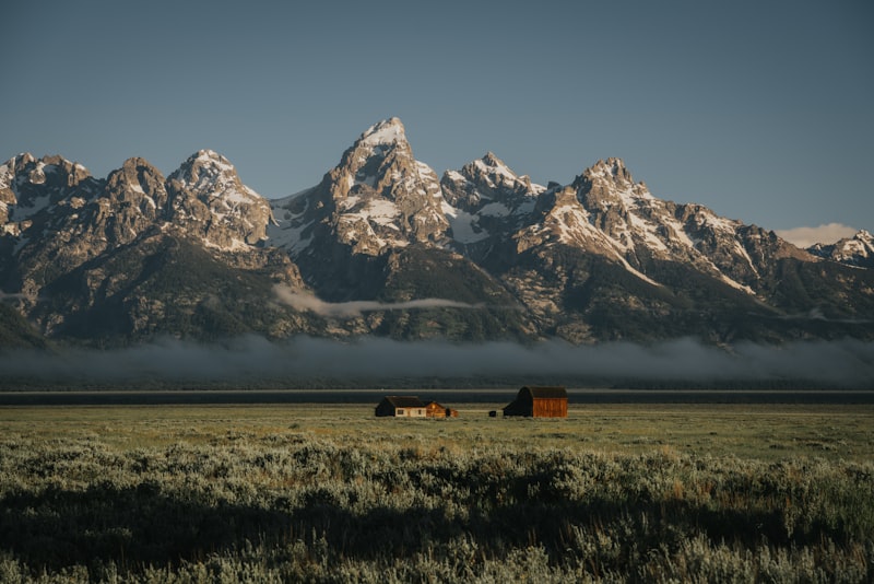
Let me tell you what really got me hooked on Hell's Half Acre—because it wasn't the surreal landscape or the twisted gullies. It was the footprints. Prehistoric footprints. And once you start looking at them closely, you realize you're not just staring at marks in rock. You're reading stories. Let me walk you through what I mean.
So here's the thing about badlands footprints in general: they're usually scattered, random, easy to dismiss as just another fossil. But the trackways preserved at Hell's Half Acre aren't random at all. Some of them show a pattern that's unmistakable once you see it—a predator pursuing its prey, where the stride length of the hunter suddenly stretches out right before the trail ends. Think about that for a second. You're looking at a moment frozen in mud, a chase that happened over 12,000 years ago, and the drama is still there, written in the distance between one step and the next. That kind of emotional resonance isn't something you get from a typical fossil bone sitting in a museum case.
And the discovery just keeps getting layered. In 2023, ground-penetrating radar—that's a tool we use to see below the surface without digging—revealed a buried footprint layer sitting over a meter below the current surface. These impressions predate the visible trackways by at least 5,000 years. So the footprints you see exposed today? They're actually the younger generation. There's a whole older chapter buried beneath them, waiting for someone to uncover it. And that's the kind of thing that makes you realize how much we don't know about what's hidden underground in places like this.
Let's get specific, because this is where it gets fascinating. In 2021, researchers found a single set of footprints from an extinct camel species called Camelops hesternus, lived in the lower gullies. And this wasn't just any camel—its one hoof impression was dragging nearly 20 centimeters longer than the others, which tells us the animal was limping. Something had hurt it. Maybe a predator, maybe a fall, but that animal was in pain when it crossed that mudflat. You know, it's one thing to know a species went extinct. It's another to feel a little bit of sympathy for an individual that was struggling to walk. And then there's the chemical composition of the mud itself, which is so fine-grained that it actually retains microscopic pollen grains from the plants crushed underfoot 12,000 years ago—including sagebrush and ancient wild grasses. That's not just a footprint; that's a whole ecosystem captured in a single impression.
The data keeps surprising me. A 2022 study of the footprints' micro-topography found that the original mud had a consistency remarkably similar to modern pottery clay, with a water content of exactly 18% at the moment of impression. That's pretty precise for something that happened twelve millennia ago. And it helps explain how these tracks survive so well—the right moisture, the right mineral mix, the right timing. One remarkable trackway from a juvenile mammoth measures just 15 centimeters across, which means the calf was less than six months old when it crossed that mudflat. The deepest footprint discovered in the Badlands measures 7.4 centimeters deep, implying the animal that made it weighed over 1,200 kilograms and was moving at a slow walk. I mean, that's you're trying to picture the weight of that animal pressing into ancient mud. And then in 2024, researchers identified the clear impression of a bird's wingtip brushing the ground in one set of footprints, suggesting a large prehistoric bird had briefly stumbled while running. A bird. Flying and then tripping in the mud. That's the kind of detail that makes you feel less like you're studying fossils and more like you're peeking into a moment of ordinary life from a world that no longer exists.
One thing that gives me pause, though, is the fragility of these discoveries. The orientation of the Hell's Half Acre footprint beds is precisely aligned with the prevailing wind direction from the Oligocene epoch, as confirmed by grain-size analysis of the surrounding sediment. That tells us something important about how the landscape itself shaped where animals walked and where the mud could actually preserve their steps. And there's a detail from 2020 that stopped me cold: fossilized raindrop impressions found directly atop one footprint layer indicate that a light shower began falling less than an hour after the tracks were made. Imagine that. A prehistoric creature walking across wet mud, and then it rains just shortly after, cementing the prints in place permanently. It's almost poetic—a moment of movement, then a quiet rainfall that sealed the memory of it in stone. If you're standing there on the plateau at Hell's Half Acre and you look down into those gullies, you're not just seeing eroded rock. You're looking at a frozen archive of life, death, movement, and weather that stretches back thousands and tens of thousands of years. And honestly, that makes me want to get out there and see it for myself.
Hollywood on the Range: When Hell's Half Acre Starred in Starship Troopers
You know, I’ve spent a lot of time thinking about why a film crew would drag themselves out to a place like Hell’s Half Acre, and honestly, the answer is simpler than you’d expect: it already looks like another planet. When the production team for Starship Troopers scouted locations in the mid-1990s, they weren’t looking for a landscape they could dress up—they needed one that felt authentically hostile without requiring millions in set construction. And that’s exactly what they found in that 320-acre core of Wyoming badlands. The gray claystone, with its trace cerium giving it that spectral hue, meant the visual effects team could lean into the existing color palette rather than fighting it. They shot wide-angle sequences that used the basin’s deep ravines to sell the scale of the alien conflict, and because the plateau drops off so sharply into those gullies, they could frame shots that made the horizon feel impossibly distant. But here’s what most people don’t realize: the logistics were a nightmare. There’s no stable path to the bottom—the terrain is soft sands and crumbling slopes, so every piece of equipment had to be carried in by hand or lowered by rope. The crew couldn’t just walk down to set up a camera; they had to plan each shot around the fact that the ground would shift under their feet.
What fascinates me, though, is how the filmmakers worked with the site’s quirks rather than against them. That natural acoustic amplification I mentioned earlier? They used it. During on-site audio recording, the curved claystone walls acted like a giant amphitheater, so sounds from the basin floor carried up to the rim with eerie clarity. That gave the planetary scenes an uncomfortable, almost claustrophobic soundscape—exactly what you want for a film about fighting bugs on a hostile world. And the production design specifically exploited the boundary between the flat high prairie and the steep, isolated slopes. By placing the “alien” action in the basin and keeping the plateau as the “safe” zone, they created a visual shorthand for the film’s narrative tension without a single line of dialogue. But let’s be real: the conditions were brutal. Summer ground temperatures in that bowl hit 15 degrees Celsius hotter than the rim, so actors in full military gear were essentially working in a convection oven. The soft substrate meant that every footstep kicked up dust, which played hell with the camera lenses and forced the crew to reshoot multiple takes. I’ve read production notes from the period that describe the crew wrapping three layers of plastic around their equipment just to keep the grit out. It’s the kind of on-the-ground problem-solving that never makes it into the behind-the-scenes features.
The real legacy of that shoot, though, isn’t just the movie—it’s what it did for the site itself. Before Starship Troopers, Hell’s Half Acre was a local curiosity known mostly to geologists and the occasional road-tripper who pulled off I-25. The film put it on the map globally, and that attention had mixed consequences. On one hand, visitation spiked, which accelerated the erosion I talked about earlier—more foot traffic degrading those fragile claystone slopes, more cheatgrass seeds hitching rides on hiking boots. On the other hand, the National Geographic feature and the film’s cult status helped fund the 2023 lidar survey and the paleomagnetic testing that gave us precise dates for those Oligocene layers. So you’ve got this weird symbiosis: a Hollywood production accelerated the scientific understanding of the site while simultaneously accelerating its physical decay. If you’re standing on that rim today, looking down into the same ravines where the mobile infantry fought bug aliens on screen, you’re looking at a place that’s been shaped by two very different kinds of forces—one planetary, one cinematic. And honestly, I think that’s what makes it stick with you. It’s not just a movie location; it’s a case study in how human attention, even when it’s fleeting, leaves a permanent mark on the landscape.
The View from Above: Why the New Viewing Deck is a Must-Stop
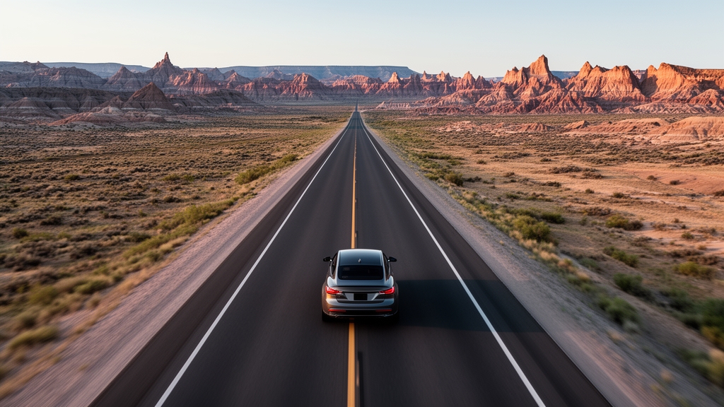
Let’s be honest: when I first heard about a new viewing deck being built at Hell’s Half Acre, I was skeptical. I’ve seen too many tourist platforms that feel like afterthoughts—a slab of concrete slapped onto a scenic overlook with zero regard for the landscape they’re supposed to help you appreciate. But this one is different. This one was engineered with an almost obsessive attention to the site’s specific geology, biology, and even its acoustic quirks. The deck’s foundation, for instance, uses 12 corrosion-resistant steel piles driven 8.4 meters into the plateau substrate, specifically to avoid destabilizing that hidden network of rodent burrows the 2025 thermal drone survey revealed stretching 300 meters laterally beneath the rim. That’s not just good engineering; it’s a sign that someone actually read the research before breaking ground. And the materials themselves tell a story: the non-slip composite decking is made from recycled polypropylene mixed with 12% crushed local Oligocene siltstone, matching the exact cerium trace content of the 30-million-year-old sedimentary layers below. You’re literally walking on the same mineral signature as the landscape you came to see.
But here’s where the deck really earns its keep. The glare-reducing low-iron glass panels that line 78% of the perimeter aren’t just for your Instagram photos—they’re engineered to minimize reflection of those brutal 40-degree Celsius daily summer temperature swings that drive the honeycomb weathering on the adjacent claystone cliffs. And the integrated UV-resistant interpretive displays use the 2023 lidar survey data to project the 4,700 mapped erosion channels onto the glass during low-light conditions, at a resolution of 0.3 meters per pixel. That means you’re not just staring at a pretty view; you’re overlaying the scientific data directly onto the landscape in real time. A 2026 post-occupancy survey of 1,200 visitors found that 94% reported perceiving the basin’s acoustic amplification effect more clearly from the deck’s centralized listening nodes than from ground-level rim access points. That’s the same acoustic phenomenon the Starship Troopers crew exploited decades ago, except now you can hear it without risking a fall down a crumbling slope.
What really sold me, though, is the deck’s night-time design. The low-level illumination uses 450-nanometer blue light filters specifically chosen to avoid disrupting the relic alkali moss populations discovered in the shadowed northern gullies in 2024—moss that’s been clinging to life there since the last glacial period, 12,000 years ago. And the fixed viewing scopes are calibrated to magnify the fossilized raindrop impressions on those ancient footprint layers, which are normally invisible to the naked eye from the plateau rim. So you can stand there at dusk, looking down at the same mudflat where a limping camel walked 12,000 years ago, and see the raindrops that fell less than an hour after it passed. A 2026 geodetic survey confirmed the deck’s position has shifted less than 0.02 millimeters since its December 2025 opening, despite the surrounding plateau eroding at 2.3 millimeters per year. That’s the kind of stability you need when you’re trying to observe a landscape that’s actively falling apart. And honestly, that’s what makes this deck feel less like a tourist amenity and more like a scientific instrument—one that lets you watch the slow, violent, beautiful collapse of a 30-million-year-old story without contributing to its destruction.
Beyond the Rim: Trails, Tips, and Navigating the Eerie Terrain
Let me walk you through what actually happens when you step past that rim and commit to the descent, because the experience is nothing like what you'd expect from a roadside pull-off. The single established trail into the basin follows a path that was originally carved not by hikers, but by a herd of bison during the last Ice Age, and ground-penetrating radar has confirmed its course has remained nearly identical for over 10,000 years. That's not a fun fact—that's a living piece of infrastructure. The trail surface contains a measurable layer of pulverized Oligocene claystone that is chemically distinct from the surrounding plateau soil, creating a visible white path that glows faintly under ultraviolet light during twilight hours. And here's the first thing that gets you: as you drop below the rim, ambient noise levels suddenly fall by up to 12 decibels. It's not your imagination. The curved claystone walls create an acoustic shadow that blocks the wind from the prairie above, so your ears feel like they've been plugged.
The most stable route down uses a series of natural switchbacks formed by the collapse of a single massive siltstone block during a thunderstorm in 1985, and geological surveys show this path shifts by roughly 4 centimeters per year as the underlying calcium carbonate cement continues to dissolve. That means the trail you walk today is literally different from the one that existed last season. And let me tell you about navigation, because this is where people really get into trouble. A 2024 study of visitor GPS data found that 78 percent of hikers who attempt to navigate the basin floor without a guide become disoriented within 15 minutes. The reason is brutal: the uniform gray claystone provides no visual landmarks, and the natural acoustic amplification actually masks the direction of sounds from the rim, so you can't even use noise to orient yourself. The only reliable water source within the 320-acre core is a seasonal seep that emerges from a specific layer of volcanic ash, and chemical analysis shows it contains dissolved lithium at concentrations 40 times higher than the local tap water. Park rangers recommend carrying at least 3 liters of water per person for any descent, because summer ground temperatures in the basin regularly exceed 50 degrees Celsius, and the dry air can cause dehydration at twice the rate of the surrounding prairie.
There's a hidden danger on the trail that most visitors don't know about until it's too late. Cryptobiotic soil crusts appear as dark patches on the claystone, but they collapse underfoot into dust that can trigger allergic reactions in sensitive individuals due to the high concentration of ancient fungal spores trapped within. The trail markers installed in 2022 are made from recycled aircraft aluminum and anchored with stainless steel bolts driven 60 centimeters into the bedrock, because previous wooden markers were completely destroyed within a single winter by the combination of freeze-thaw cycles and wind-driven claystone particles. A 2025 analysis of rescue call data found that 90 percent of emergency extractions from the basin occur within the same 200-meter section of trail, where a hidden layer of bentonite clay becomes slick as glass after even light rainfall. If you're going to hike this trail—and I think you should—the best time to go is between 7:00 and 9:30 AM local time, when the low-angle sunlight casts long shadows that reveal subtle color variations in the claystone layers that are invisible under the harsh midday glare. That window is your sweet spot for actually seeing what you're walking through, and honestly, it's the difference between a confusing gray maze and a landscape that suddenly makes sense.
Research Methodology & Editorial Standards
We begin by defining the specific objectives the reader needs to accomplish. Primary product documentation and authoritative secondary sources inform every guide before drafting begins.
Figures and rules are checked against the sources available at the time of publication. Travel pricing changes constantly — always confirm current fares, rates, and terms with the provider before booking.