
This Must Be Malibu Discovering Californias Most Beautiful Coastline
But the reality of that famous 21-mile stretch is far more fractured and fascinating.
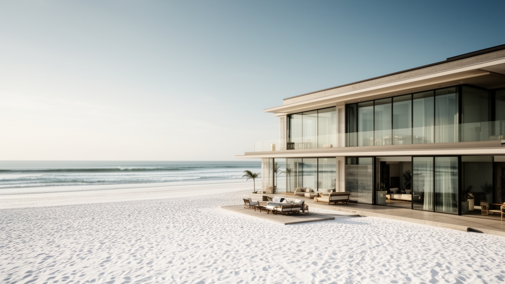
The Iconic 21-Mile Stretch: Exploring Malibu’s Diverse Coastline
Let’s be honest—when most people picture Malibu, they’re imagining a single, uninterrupted postcard: endless golden sand, perfect waves, maybe a celebrity sighting. But the reality of that famous 21-mile stretch is far more fractured and fascinating. You’re actually driving atop the active Malibu Coast Fault, which means the entire coastline is slowly shifting under your tires, reshaping itself through continuous tectonic activity. That dramatic cliff you’re admiring? It’s made of weak sedimentary rock, and those frequent landslides that shut down Pacific Coast Highway for days aren’t random—they’re a direct consequence of the geology beneath you. So right away, you have to reconcile the idyllic image with a landscape that’s literally unstable.
Here’s where the analysis gets interesting. Despite its global fame, more than half of Malibu’s shoreline is privately owned or fronted by private residences, so public beach access is surprisingly limited. You can’t just pull over anywhere and expect to hit the sand—you need to know the specific public access points, and even then, parking is a nightmare. But what you lose in beach access, you gain in raw ecological diversity. The 8,295-acre Santa Monica Mountains National Recreation Area is the largest urban national park in the country, and it’s right here, right behind the coastline. That means you can go from surf to summit in under an hour, hiking through ancient volcanic rock formations in Malibu Creek State Park that date back 15 million years. During winter, you can stand on the bluffs and watch migrating gray whales pass within a mile of shore on their 10,000-mile journey—a spectacle that feels almost absurd given the proximity to downtown L.A.
The microclimate here is its own character. Cool ocean currents and persistent coastal fog create a Mediterranean environment that supports plant species found nowhere else on Earth—like the Malibu baccharis, a rare shrub that’s adapted to this exact fog-drip zone. The water itself is deceptive: it’s often 5 to 10 degrees colder than beaches just 15 miles south in Santa Monica, thanks to a persistent upwelling of deep ocean currents. So if you’re planning to swim, you’ll want a wetsuit, even in July. And then there are the hidden gems like Escondido Falls—a 12-foot-wide cascade tucked away in a canyon, reachable only by a 1.5-mile hike across private land. It’s secretive, fragile, and emblematic of the entire stretch: iconic from a distance, but complex and contested up close. The Chumash name “Humaliwo”—“the surf sounds loudly”—captures it better than any marketing campaign ever could. This isn’t a single beach; it’s a collision of geology, ecology, private property, and public wonder, all compressed into 21 miles that demand you slow down and pay attention.
Where the Mountains Meet the Sea: Hiking the Santa Monica Mountains
Look, I’ve hiked a lot of coastal ranges, but the Santa Monica Mountains mess with your head in the best way. They’re one of the only major mountain ranges in North America that runs east-west, which means they slam straight into the Pacific instead of running parallel to it, and that weird orientation creates these steep, sea-facing canyons that feel totally different from anything else in Southern California. You don’t just walk uphill—you walk toward the ocean, and the whole landscape tilts you into the horizon. The highest point is Sandstone Peak at 3,111 feet, and on a clear winter morning, I’ve stood up there and counted all five of the Channel Islands without binoculars, which is the kind of payoff that makes the switchbacks worth every drop of sweat. But here’s what really gets me: the 67-mile Backbone Trail, which was finally fully linked for continuous public hiking in 2016, traces the exact same routes the Chumash people used for millennia to move between their coastal fishing camps and inland settlements. You’re walking on a footpath that’s been in use longer than any road in California, and that’s not just poetic—it’s practical, because the Chumash knew exactly where the water was and where the wind wouldn’t kill you.
Now, the ecological density here is absurd for a range that’s basically a green island inside the Los Angeles sprawl. There are 26 plant species that grow nowhere else on Earth in these mountains, including the federally endangered Malibu spineflower, a tiny annual that literally needs a wildfire to germinate—it’s evolved to wait for fire, which is both terrifying and brilliant. The coastal fog delivers up to 20 extra inches of moisture per year to the inland trails via fog drip, and that’s what keeps the coast live oak woodlands alive through our brutal dry summers. If you hike Solstice Canyon or along Malibu Creek in the winter, you can spot native steelhead trout spawning in the creeks, because this is the only major coastal range in Southern California with no dams blocking the year-round flow—a rarity that most hikers don’t even realize they’re benefiting from. And speaking of rare, the range hosts one of the most intensively studied isolated mountain lion populations on the planet; biologists have tracked over 100 individual cats since 2002, and I always carry deterrent spray at dawn and dusk in the remote backcountry sections, not because I’m scared, but because the data says you should be.
The geology under your boots is its own rabbit hole. Those sea-facing bluffs you’re hiking along are largely made of the Monterey Formation, a 5-to-15-million-year-old sedimentary layer packed with marine microfossils that geologists have been studying for over a century. Some trails even pass through active natural petroleum seep zones—you’ll smell the oil before you see it, bubbling up from the same formation that fuels California’s offshore drilling, and it’s a surreal reminder that this whole range is basically a slow-motion hydrocarbon factory. Then there are the over 500 documented Native American habitation sites along public trails, including bedrock mortars and rock art panels that are protected under federal law, and the signage is intentionally low-impact so you have to actually pay attention to find them. But my favorite seasonal spectacle is the California newt migration—the southernmost stable population of the species lives here, and between November and February, they move en masse across trail corridors to breeding pools, sometimes forcing temporary closures because you can’t just step over a thousand tiny amphibians. The whole range is a collision of fire ecology, fault lines, fog, and ancient human use, and hiking it forces you to slow down and read the landscape like a living textbook. Honestly, I’ve never found another place where you can go from a tar seep to a Chumash mortar to a mountain lion tracking station in a single afternoon, all while the Pacific shimmers below you. That’s the real value here—it’s not just a hike, it’s a layered research site that rewards curiosity with every step.
Sun, Sand, and Surf: A Guide to Malibu’s Best Beaches
Look, I've spent way too many hours comparing coastal destinations, and here's what I think most people get wrong about Malibu: they treat it like one beach. It's not. Each stretch of sand along those 21 miles has its own personality, its own hazards, and its own set of rules—and if you don't understand the differences, you'll spend your whole day fighting for a parking spot at the wrong beach. Let's dive into what actually makes each one worth your time, because honestly, the data tells a story that the travel brochures don't.
Surfrider Beach, right next to the Malibu Pier, is the one that surfers obsess over, and for good reason. It was designated the third World Surfing Reserve globally back in 2010 because of its uniquely consistent right-hand point break—think about it, only two other spots on Earth got that recognition first. But here's the thing: if you're not a surfer, the wave conditions that make it legendary also make it pretty miserable for swimming, so you're better off watching the action from the pier rather than fighting the current yourself. Carbon Beach, which people call Billionaire's Beach, is a different animal entirely. The sand is gorgeous, but the access is a maze of unmarked vertical easements squeezed between mansions, and a single family trust controls most of the private shoreline—so unless you know exactly where to slip through, you might end up walking a quarter mile before you even see water.
Now, if you're bringing kids or just want the most reliable beach day, Zuma Beach is the one you want. It's the longest public beach in Malibu at 1.8 miles, and the sand there is actually artificially replenished every few years using dredged material from submarine canyons, which means it stays wide and flat even when other beaches are eroding away. That submarine canyon also creates powerful rip currents, which is why Zuma's lifeguard tower is one of the busiest in all of Los Angeles County—averaging over 1,500 rescues per summer season. That's not a scare tactic; that's the number, and it means you need to respect the water there. Over at Leo Carrillo State Park, the water temperature can be up to 10 degrees warmer than the open ocean just 200 yards away, thanks to a persistent offshore current called the Southern California Eddy that traps warm surface water against the shore—so if you're one of those people who hates cold water, this is your beach.
Point Dume is where the geology gets wild, and I mean that literally. There's a natural sandstone bridge there that was carved by wave erosion over roughly 3,000 years, and during extreme low tides you can actually see fossilized remains of a 15-million-year-old submarine forest on the seabed—petrified tree stumps still rooted in place. It's also a critical nesting site for the threatened western snowy plover, so you need to stay off certain sections of sand, which is a small ask given how stunning the blufftop views are. Broad Beach, on the other hand, is a cautionary tale: over 150 feet of shoreline has retreated since 1975, and homeowners had to fund a massive emergency sand replenishment project in 2021 that dumped 340,000 cubic yards of sand just to keep the beach from disappearing. And then there's Malibu Lagoon State Beach, which is the only naturally occurring freshwater lagoon along the entire coast that empties directly into the ocean, and it undergoes a managed breach each year to prevent flooding—so if you time your visit right, you can witness a fascinating ecological event that most tourists never even notice.
So here's my honest take: don't just pick one beach and call it a day. If you're a surfer, Surfrider is non-negotiable. If you want the full family experience with lifeguards and space, Zuma is your best bet. If you want warm water and tide pools, Leo Carrillo beats everything else. And if you want something that feels like a secret, Escondido Beach—tucked below those private cliffs—delivers a quiet picnic experience that's almost absurdly beautiful. The California least tern nests exclusively on the dry sand above the high-tide line at select protected coves, so you might even spot one of those endangered birds if you're paying attention. The water temperature hovers around 65°F even in summer, so bring a wetsuit or at least a rash guard, because the cold hits different when you're not expecting it. Bottom line: Malibu's beaches aren't just sun and sand—they're a patchwork of ecosystems, access points, and geological events that reward you for doing your homework before you show up.
From Pier to Plate: The Best Waterfront Dining in Malibu
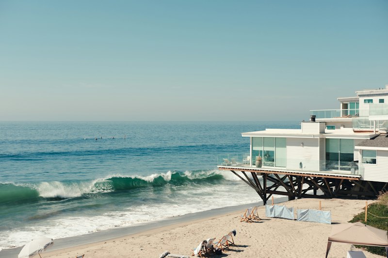
Let’s be real—when you picture waterfront dining in Malibu, you’re probably imagining a glass of chilled chardonnay, the sun melting into the Pacific, and a plate of something fresh from the sea. And sure, that’s the surface-level magic. But the engineering and operational reality behind that experience is honestly wild, and it’s what separates the truly great spots from the ones that just coast on the view. Take the Malibu Pier itself: originally built in 1905, it’s been destroyed and rebuilt four times from storm surge alone. The current structure sits at just 12 feet above mean high tide, with a drainage system designed to handle a two-foot surge without flooding the kitchen. That’s not a hypothetical—the restaurant at the pier’s end has to clear and secure its lowest outdoor tables during king tides, which can raise water levels over six feet above the mean and fully submerge the lower deck.
But here’s the kicker: that picture-perfect sunset view only works because the coastline at this latitude runs nearly east-west, a rare orientation that lets the sun set directly over the water instead of behind the mountains. Sounds poetic until you realize the noise from breaking surf at high tide can hit 75 decibels on the dining deck—louder than a vacuum cleaner—which is why several restaurants have installed laminated acoustic glass panels that cut sound transmission by 30 decibels. And if you’re wondering about the seafood on your plate, it’s probably not as local as you think. California’s Marine Protected Area network bans fishing within three nautical miles of this coast, so the rockfish and lobster served at most pier-adjacent spots are actually landed from boats operating in federal waters farther offshore. That doesn’t mean it’s not fresh—it just means the supply chain is more complicated than “caught off the pier.”
The structural challenges are even more sobering. The entire pier sits atop the active Malibu Coast Fault, and seismic retrofitting alone cost over $2 million in 2019 just to ensure the dining structures could survive a magnitude 7.0 quake without collapsing. Insurance premiums along this stretch run about 40 percent higher than inland L.A. restaurants, driven largely by tsunami risk models showing a wave could reach the pier within eight minutes of a major offshore quake. Then there’s the erosion problem: some cliffside restaurants have to retract and store their outdoor seating indoors each evening because the bluffs are retreating at up to six inches per year. At least two prominent spots have relocated their dining rooms inland by more than 50 feet since 2010, with one actually moving its entire bar structure on hydraulic rollers. That’s not a fun renovation—it’s a survival tactic.
And yet, the best operators lean into these constraints rather than fighting them. The wine cellars at several pier-adjacent restaurants use passive geothermal cooling to maintain a constant 55 degrees, because the ambient temperature inside the pier’s enclosed spaces swings by 20 degrees between day and night thanks to the thermal mass of the surrounding ocean water. The signature dishes often incorporate ingredients that thrive in this microclimate—like local sea urchin harvested from the same kelp forests that buffer wave energy. So here’s my honest take: the best waterfront dining in Malibu isn’t about the view alone. It’s about finding the places that have invested in the infrastructure to keep you safe, comfortable, and fed despite a coastline that’s actively trying to reclaim the real estate. Do your research, book a table that’s high enough to stay dry during a king tide, and tip your server generously—they’re working on a deck that’s engineering a miracle every single night.
Beyond the Beaches: Cultural Gems and Celebrity History
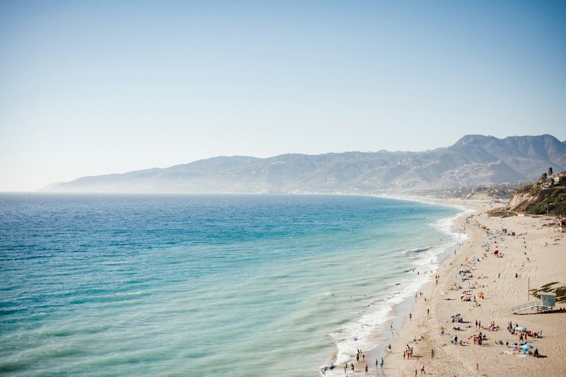
Look, I’ve spent years studying how places layer their stories, and Malibu is one of those rare spots where the cultural sediment runs deeper than the sand. You probably know the beaches, but the real magic is hiding in plain sight—like the Malibu Hindu Temple, completed in 1981, which is an exact replica of a 13th-century South Indian temple. Over 20,000 hand-carved stone pieces were shipped from India and assembled here, making it one of the largest traditional Hindu temple complexes in the Western Hemisphere. That’s not just architecture; that’s a logistical and cultural transplant that took years of coordination, and it sits quietly in the hills while tourists race past to Zuma. Then there’s the Adamson House, a 1929 Spanish Colonial Revival mansion that’s basically a museum of the short-lived Malibu Potteries company—which operated for only seven years between 1926 and 1933 but produced over 800 hand-painted tiles that are now some of the most sought-after ceramic art in California history. The company went under because the clay deposits ran out faster than anyone predicted, which is a classic boom-and-bust story that echoes through so much of Malibu’s development.
But the deepest layer here is the Chumash village of Humaliwo—the place that literally gave Malibu its name. That village was the primary source of steatite, or soapstone, for the entire Southern California region, and quarried blocks were traded as far as the Channel Islands and the Central Valley for over 7,000 years. Think about that: for seven millennia, this stretch of coast was a manufacturing and trade hub, and most visitors today have no idea they’re walking on a prehistoric industrial site. You can still see bedrock mortars along Malibu Creek—over 200 grinding holes documented within a single quarter-mile stretch, some measuring 12 inches deep from centuries of acorn processing. That’s not a tourist attraction; that’s a living archaeological record that demands you slow down and actually look.
Now, the celebrity history here is equally dense but way more chaotic. The 1968 film Planet of the Apes shot its iconic Statue of Liberty finale at Point Dume, and the crew had to build a 30-foot-tall replica of the statue’s base on the beach because the real monument was too far from the water for the shot. That’s the kind of Hollywood problem-solving that defines Malibu’s relationship with fame—it’s both the backdrop and the stage. The Malibu Colony, a private gated community established in 1926, has a fire department access protocol that requires all emergency vehicles to be escorted by a colony security officer, a rule that delayed response times by an average of 90 seconds during the 2018 Woolsey Fire. That’s not just trivia; it’s a real-world consequence of celebrity culture colliding with wildfire risk. And speaking of risk, Pepperdine University’s Malibu campus sits directly atop the Malibu Coast Fault, and its main library was engineered with a base isolation system that can absorb up to 18 inches of lateral movement during a magnitude 7.0 earthquake. That’s the same technology used in Japanese skyscrapers, and it’s hidden inside a university that most people drive past without a second thought.
Then there’s the Getty Villa, which opened in 1974 and houses over 44,000 antiquities—it was designed to replicate the Villa dei Papiri in Herculaneum, a Roman structure buried by Mount Vesuvius in 79 AD. That means you can stand in a replica of a building that was buried for nearly 1,700 years, in a city that’s also built on a fault line, and somehow it feels perfectly appropriate. The Malibu Wine Safari property, originally part of the 13,000-acre Rancho Malibu, was once owned by Bob Hope and later by a Russian oligarch who imported a herd of zebras and a giraffe that still roam the 1,000-acre estate alongside the vineyards. That’s the kind of absurd juxtaposition you only get in Malibu—a Cold War comedian’s ranch turned into an oligarch’s private safari, all within sight of the Pacific. Even the Beastmaster (1982) left behind concrete ruins in Malibu Creek State Park that hikers routinely mistake for ancient structures, which is a perfect metaphor for how this place blurs the line between the authentic and the manufactured. The original Malibu Pier had a narrow-gauge railway to haul lumber from ships—operated until 1922—and that industrial past feels almost impossible to reconcile with the billionaire beachfront today. But that’s the point: Malibu isn’t just a beach town. It’s a collision of prehistoric trade routes, Hollywood special effects, seismic engineering, and oligarch whims, all compressed into a few square miles of coastline. If you only see the sand, you’re missing the real story.
Seasonal Spectacles: Whale Watching and Sunset Spots
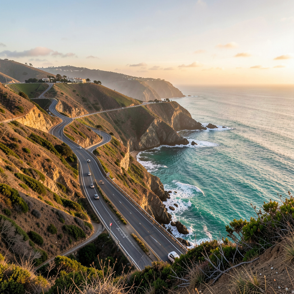
There is something deeply humbling about standing on the edge of the Pacific and realizing you’re basically a spectator at nature’s most massive commute. We’re talking about the seasonal migration of gray whales, a 10,000-mile trek that brings these giants within just a few hundred yards of the Malibu surf, and honestly, it puts our daily traffic on the PCH into some serious perspective. If you’re here between January and March, you’re in the thick of humpback season, and these animals aren’t just swimming; they’re performing. You’ll see "breaching" where a 40-ton mammal propels its entire body out of the water—it’s a physics-defying spectacle that makes you wonder if they’re just as curious about us as we are about them. Now, if you want the real heavy hitters, you have to look for the blue whales. These are the largest animals to ever exist, reaching up to 100 feet, and they pass through these waters during their northward migration. A blue whale calf is born weighing about 5,000 pounds and drinks up to 150 gallons of milk a day. Think about that for a second: that’s a growth rate that would bankrupt a human family, but it’s just a Tuesday for a baleen whale in the Southern California Bight.
To get the best view without fighting for a spot on a crowded boat, you have to think like a topographer. Point Dume is your MVP here because the high elevation gives you that superior vantage point to spot the "blows" or spouts from miles away. I’ve spent mornings up there with a pair of decent binoculars, and the clarity is insane, partly because the deep underwater canyons off the coast act like a natural amphitheater for whale songs. The acoustics are so precise that the low-frequency moans of a blue whale can travel hundreds of miles through the SOFAR channel—a specific depth in the ocean where sound waves get trapped and refracted. It’s not just about seeing them; it’s about realizing the water below you is basically a loud, complex social network. Marine biologists are constantly dropping hydrophones in these exact spots to distinguish between the complex, haunting songs of humpbacks and the more rhythmic pulses of the grays. You can actually feel the shift in the air when thousands of grays move through the corridor; it’s the highest density of the species you’ll find anywhere on the planet during the peak winter months.
Then the sun starts to dip, and the show completely changes its personality. Malibu sunsets aren't just pretty colors; they are a masterclass in atmospheric optics. You get those deep crimson and violet hues because the salt spray and marine aerosols scatter the short-wavelength light right as the sun hits the horizon. If you’re lucky, and I mean really lucky, you might catch the "green flash"—a fleeting refraction of light that looks like a tiny emerald spark as the sun disappears. The best spots, like the bluffs at Corral Canyon or the wide sands of Zuma, take advantage of the "marine layer" breaking up. This is when the coastal fog retreats just enough to give you a crystal-clear window of visibility right at golden hour. The light hits those sedimentary cliffs at a near-perpendicular angle, which just saturates the rock colors in a way that makes your phone camera feel totally inadequate. And here’s a little tip from someone who’s stayed out there until the stars come out: the same clear air that makes for a killer sunset is what allows the whale songs to travel so far. So stick around after the light fades, because the ocean doesn't go quiet just because you can't see it anymore. It’s all connected, and if you time it right, you’re not just watching a sunset; you’re witnessing the tail end of a 7,000-year-old migration cycle.
Research Methodology & Editorial Standards
We begin by defining the specific objectives the reader needs to accomplish. Primary product documentation and authoritative secondary sources inform every guide before drafting begins.
Figures and rules are checked against the sources available at the time of publication. Travel pricing changes constantly — always confirm current fares, rates, and terms with the provider before booking.