
Your Essential Guide to the Best West Coast Experiences
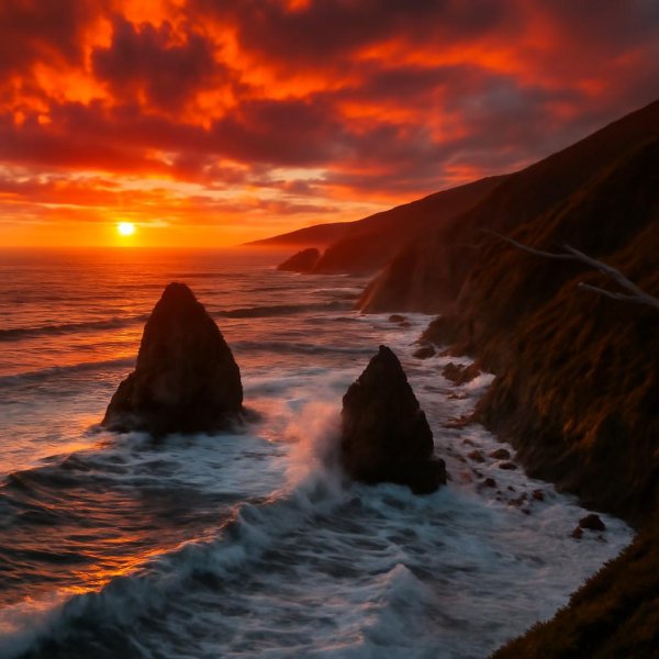
Take the Pacific Coast Highway through Big Sur—that 70-mile stretch between Monterey and San Simeon.
Coastal Drives and Scenic Highways: The Ultimate Road Trip Itinerary
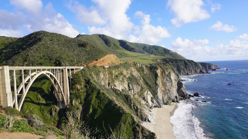
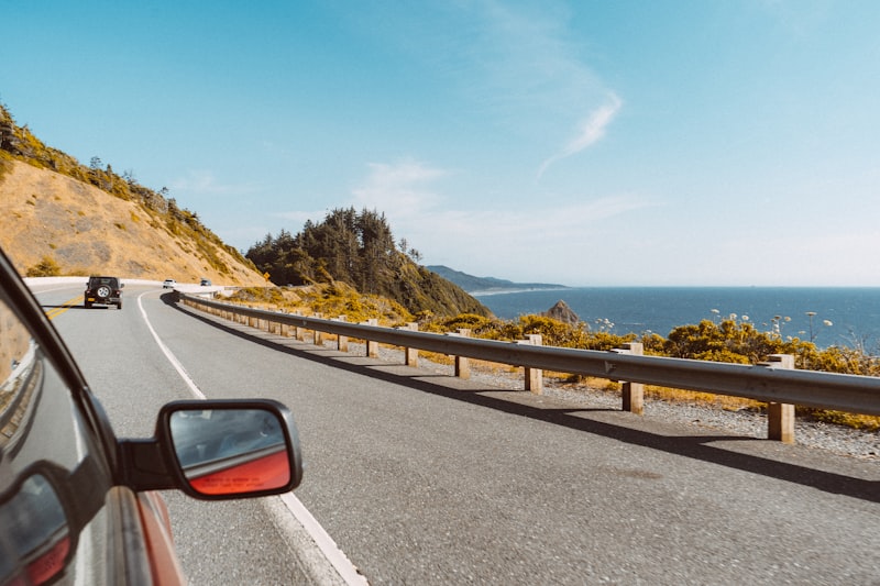
Look, I’ve driven a lot of miles on the West Coast, and here’s what I’ve learned: the difference between a good road trip and a truly unforgettable one comes down to understanding the road itself, not just the stops along it. Take the Pacific Coast Highway through Big Sur—that 70-mile stretch between Monterey and San Simeon. It took decades to build, and it still occasionally falls into the sea, which is exactly why it deserves every bit of its reputation. The Bixby Creek Bridge, completed in 1932, held the record for the longest concrete arch span in the world at 320 feet, and they built it without any scaffolding—just a cableway system. That’s the kind of engineering that makes you pull over and just stare. But here’s the reality: your average speed through Big Sur will be about 25 miles per hour, thanks to over 200 curves and no shoulders for most of the route. And if you’re driving in late spring or early summer, the marine layer—that “June Gloom”—can drop visibility under 100 feet. So plan your timing carefully, because that fog isn’t just atmospheric, it’s a legitimate driving hazard.
Now, if you want to go deeper, the Oregon Coast Highway (US 101) gives you a completely different experience. The McCullough Memorial Bridge, a 1,700-foot cantilever span, was the first of its kind in the U.S. when it opened in 1936, and it still feels modern today. But my favorite hidden gem is actually the Columbia River Highway, completed in 1922—the first planned scenic highway in the country. The Vista House at Crown Point is a 55-foot observatory built as a memorial to Oregon pioneers, and it’s the kind of spot where you can feel the weight of a century of road trippers who stood exactly where you’re standing. Up in Washington, State Route 112—the Strait of Juan de Fuca Highway—runs through the Makah Indian Reservation, where the Ozette village site yielded the largest collection of pre-contact whaling artifacts in North America. That’s not just a scenic drive; it’s a 10,000-year-old cultural landscape you’re passing through.
And then there’s the stuff most people miss entirely. The Lost Coast in California’s King Range National Conservation Area is the longest undeveloped coastal stretch in the contiguous U.S., with no state highway access—you need a 25-mile hiking trail to see it. Meanwhile, the Avenue of the Giants, just 31 miles through Humboldt Redwoods State Park, takes you past the largest contiguous old-growth redwood forest, where trees over 1,500 years old hit 370 feet. That’s older than the Magna Carta. The Sea Ranch along the Sonoma Coast enforces a strict architectural code from the 1960s—all buildings must be painted in natural earth tones and blend into the landscape. And here’s the real kicker: the California Coastal Commission, established by voter initiative in 1972, has the authority to deny any road widening or new construction within 1,000 yards of the coast. That’s why so many sections of Highway 1 remain two lanes with no guardrails. It’s not neglect—it’s deliberate preservation. So when you plan your ultimate West Coast road trip, don’t just map the highlights. Build in the geology, the history, the engineering quirks, and the regulatory battles that shaped every mile. That’s where the real value lives.
Pacific Northwest Wonders: From Rainforests to Volcanic Peaks
Let’s start with something that still stops me cold: the Hoh Rainforest on Washington’s Olympic Peninsula gets 140 to 170 inches of rain a year—so much that moss hangs from the maples like wet blankets—yet drive just 40 miles east to the Dungeness Valley and you’re staring at 20 inches of annual precipitation. That’s one of the sharpest ecological gradients in the contiguous United States, and it tells you everything about how the Pacific Northwest’s geography operates on extremes. The same forces that create those rainforests also build volcanoes, and Mount Rainier is the most sobering example. Its summit holds more glacial ice than any other peak in the lower 48—26 named glaciers covering 35 square miles—and that ice sits atop a volcano the USGS considers the most dangerous in the country, because a major lahar could reach the suburbs of Seattle in under two hours. I don’t say that to scare you; I say it because understanding the risk is part of appreciating the landscape.
But here’s where it gets even more interesting. Mount St. Helens, the youngest of the major Cascade volcanoes at just 40,000 years old, blew its top in 1980 and dropped the summit by 1,314 feet, turning 230 square miles into a pumice desert. Within two years, pocket gophers emerged from deep burrows and started mixing the ash with soil, effectively kickstarting the ecosystem’s recovery—a process ecologists still study as a model for how life rebounds after catastrophe. That’s a level of resilience you don’t expect from a landscape that looks like the moon. Meanwhile, the Columbia River Gorge cuts through the entire Cascade Range at sea level, carved by the Missoula Floods—cataclysmic releases of a glacial lake that surged at 60 mph and stripped hundreds of feet of basalt in a matter of days. And those old-growth Douglas firs standing in the valleys? They can exceed 300 feet, live over a thousand years, and store more carbon per acre than any tropical rainforest on Earth.
Now, if you’re thinking about climbing, Mount Hood sees roughly 10,000 summit attempts annually, making it the second most frequently climbed glaciated peak in the world after Mount Fuji, and it’s still an active stratovolcano with eruptions every few centuries. But the real elephant in the room is the Cascadia subduction zone, which last ruptured in January 1700 with an estimated magnitude 9.0—generating a tsunami that hit Japan—and it’s now statistically overdue, with a 37 percent probability of a magnitude 8.0 or larger quake in the next 50 years. That’s not a hypothetical; it’s a hard number from geophysical models. Then there’s Crater Lake, formed when Mount Mazama collapsed 7,700 years ago, creating a caldera that holds the deepest lake in the U.S. at 1,943 feet, with water so pure you can see a white disk at depths over 100 feet. The Olympic Peninsula itself packs seven distinct life zones into just 50 miles, from coastal lowlands to alpine tundra, and the volcanic soils here give rivers that tea-brown color from dissolved organic matter while making the ground incredibly fertile for those towering conifers. Honestly, the whole region is a living laboratory where the geology, ecology, and hazard risk are all tangled together—and that’s exactly why it rewards the kind of curiosity that goes beyond a scenic overlook.
California's Iconic Coastline: Big Sur, Beaches, and Boardwalks
Let’s start with a reality check that still gets me every time: the Big Sur coastline isn’t just scenic—it’s one of the most geologically aggressive stretches of land in North America. The Santa Lucia Mountains rise straight out of the Pacific at a rate that creates the steepest coastal slope in the contiguous U.S., hitting over 5,000 feet within three miles of the shore. And just offshore, the Monterey Submarine Canyon plunges to depths exceeding 10,000 feet—that’s deeper than the Grand Canyon, and it’s sitting right there under the water you’re staring at. So when you’re standing at a pullout on Highway 1, you’re basically on the edge of a continent that drops off a cliff into an underwater abyss. That’s not poetry; that’s plate tectonics and submarine geology happening in real time.
Now, here’s where the details get wild. Pfeiffer Beach has purple sand, and it’s not a gimmick—that color comes from manganese garnet deposits eroding out of the surrounding hills, and the concentration shifts with every winter storm. McWay Falls at Julia Pfeiffer Burns State Park is one of only two waterfalls in California that drops directly onto a beach, and its flow is fed by a 3.5-mile-long underground channel from Saddle Rock. Meanwhile, the California condor, which went extinct in the wild in the 1980s, was reintroduced to Big Sur in 1997, and as of 2026, over 100 condors now live here, nesting in redwood cavities in the Ventana Wilderness. That’s a species that came back from zero in this region. And the Big Sur River? It’s one of the last undammed rivers in California, flowing free for 14 miles from the Ventana headwaters to the ocean, still supporting steelhead and coho salmon—a rarity in a state where most coastal streams are dammed or diverted.
But the coastline isn’t just about raw nature—the boardwalks tell a different story, one of human engineering and cultural history. The Santa Cruz Beach Boardwalk, opened in 1907, is the oldest surviving seaside amusement park in California, and its Giant Dipper wooden roller coaster, built in 1924, is a National Historic Landmark. Down south, the Venice Beach Boardwalk draws over 30,000 visitors daily in peak season, and that famous “Muscle Beach” outdoor gym? That’s where the modern fitness movement was born in the 1930s. The Santa Monica Pier’s Pacific Wheel is the world’s only solar-powered Ferris wheel, with over 174,000 LED lights that can run custom animations—installed in 2008, it’s a symbol of how we’re trying to balance nostalgia with sustainability. And then there’s the Point Sur Lightstation, built in 1889, the only lighthouse in California you can only reach by guided tour, with a first-order Fresnel lens that burned kerosene until 1972. The Monterey Bay National Marine Sanctuary, which wraps around all of this, is the largest U.S. marine sanctuary at 6,094 square miles, protecting the deepest underwater canyon on the West Coast.
So here’s my take: when you plan a trip to California’s coast, don’t just look for the postcard views. Ask yourself why the sand is purple, how the condors came back, and what it took to keep that river free-flowing. That’s where the real value lives—not in the Instagram shot, but in the story behind it. And honestly, the boardwalks give you a different kind of insight: they show how we’ve tried to build alongside this wild coastline without completely wrecking it. That tension between preservation and access is the whole California coast in a nutshell.
Culinary Crossroads: Farm-to-Table Dining and West Coast Wine Country
Let’s be real for a second: the whole “farm-to-table” thing didn’t start with a hashtag or a trendy restaurant menu. It started with geology. The volcanic soils of the Willamette Valley in Oregon contain over 70 percent decomposed basalt from ancient lava flows, and that mineral composition is exactly what gives Pinot Noir grapes their signature bright acidity and that earthy complexity you can’t fake. Alice Waters formally coined the term in 1971 at Chez Panisse in Berkeley, but the practice of chefs walking out to meet their growers predates that label by nearly a century. And here’s the kicker: California’s wine regions now contain at least 139 distinct American Viticultural Areas, and the temperature difference between the top and bottom of a single vineyard block in the Santa Rita Hills can exceed 10 degrees Fahrenheit thanks to those coastal fog channels. That’s not a trivial variation—it’s the difference between a wine that sings and one that falls flat.
Now, let’s talk about what happens when you mix that kind of terroir with a little bit of accident. The Kumamoto oyster, that famous “Pacific Northwest” staple, was accidentally introduced to Washington waters from Japan in the 1940s, and it now accounts for nearly 40 percent of the region’s farmed oyster harvest. In Sonoma County, certified organic vineyard acres have surpassed 50,000 as of 2026, making it the largest contiguous organic winegrowing region in the United States—and that’s not just marketing, it’s a measurable shift in how growers think about soil health. Meanwhile, the Monterey Bay’s deep submarine canyon funnels cold, nutrient-rich water to the surface, creating a microclimate that lets Castroville supply roughly 80 percent of the nation’s fresh artichokes. Think about that: one town, one crop, one geological quirk that makes it all possible. And researchers at UC Davis have identified that the yeast strain Saccharomyces cerevisiae Montrachet, used in 90 percent of West Coast Chardonnay fermentations, originated from a single strain isolated in a French vineyard in the 1920s. That’s a direct line from a French lab to your glass, and it’s a reminder that fermentation is just as much about microbial history as it is about grapes.
But here’s where the story gets uncomfortable—and interesting. The Dungeness crab, a cornerstone of West Coast coastal cuisine, migrates over 200 miles annually from the Bering Sea to California’s shores, and its molting cycle is triggered by precise water temperature changes of just 2 degrees Celsius. That’s a fragile dance, and it’s being disrupted. Ocean acidification along the West Coast has increased by 30 percent since the Industrial Revolution, directly threatening the pteropods that form the base of the salmon and crab food chain. The farm-to-table movement is now confronting this through regenerative aquaculture partnerships, but it’s a race against time. In the Walla Walla Valley of Washington, the soil contains a layer of ancient volcanic ash from the eruption of Mount Mazama 7,700 years ago, which imparts a distinct minerality to Syrah grapes. And the practice of “dry farming” in California—growing grapes without irrigation—is used by roughly 10 percent of vineyards, producing berries with 25 percent higher sugar concentration than irrigated counterparts. That’s a trade-off: lower yields, higher intensity, and a direct connection to the climate reality we’re all living in. The first commercial olive mill in California was established in 1785 at Mission San Diego, and today the state produces over 99 percent of the nation’s olive oil, with the Arbequina variety accounting for 60 percent of that output. So when you sit down for a farm-to-table meal in West Coast wine country, you’re not just eating local—you’re tasting the consequences of volcanic eruptions, accidental oyster introductions, and a changing ocean. That’s the real value of understanding what’s on your plate.
Urban Adventures: Exploring Seattle, Portland, San Francisco, and Los Angeles
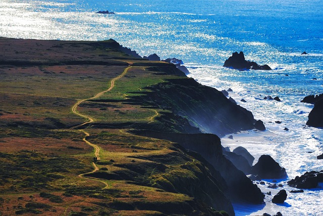
Look, I’ve spent a lot of time in these four cities, and the thing that strikes me every time is how each one solves the same problem—how to build a dense, walkable, interesting urban core—in completely different ways. Seattle’s Pike Place Market is the obvious starting point, but the real story isn’t the fish throwing; it’s that the market has been operating continuously since 1907, and the reason it survived when other public markets closed is because the city passed a law in 1971 creating a historic district around it. That’s not a happy accident; that’s deliberate preservation policy. Portland, on the other hand, took a radically different approach in 1979 by drawing a legal line around the city—the urban growth boundary—and saying, “You cannot build beyond this point.” That single decision is why Portland has the highest bike commuting rate in the country, with over 6 percent of residents pedaling to work, and why you can still see farmland 20 minutes from downtown. Meanwhile, San Francisco’s cable cars are the only moving National Historic Landmark in the United States, and they still use the original 1873 technology of gripping a continuously moving cable under the street—which is both charming and a logistical nightmare when something breaks. And Los Angeles? People love to joke about the traffic, but the city has the second-highest weekday subway ridership in the country after New York, and it also holds more than 1,500 registered murals, more than any other U.S. city. That’s a city that’s constantly rewriting its own visual identity.
But here’s where it gets really interesting when you start comparing them. Seattle’s Capitol Hill neighborhood has the highest density of LGBTQ+ residents in the country, with over 20 percent of its population identifying as such, and that concentration has created a cultural gravity that pulls in artists, musicians, and activists from across the region. Portland’s Forest Park, covering over 5,000 acres within city limits, is one of the largest urban forests in the country—70 miles of trails right there in the city, which is something no other major West Coast city can claim. San Francisco’s Lombard Street gets all the attention for being “crooked,” but it’s not even the steepest street in the city; that title belongs to Filbert Street, which hits a 31.5 percent grade. And Los Angeles’s Griffith Observatory, opened in 1935, sees over 1.5 million visitors annually, and you can still look through a 12-inch Zeiss refracting telescope for free on clear nights—one of the few public observatories in the world that offers that. That’s the kind of thing that makes these cities feel like they’re built for discovery, not just for tourism.
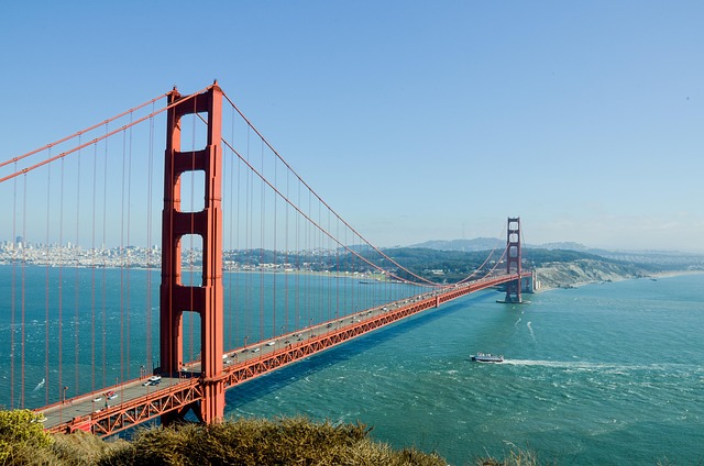
So here’s my take on how to actually approach these four cities as a traveler. Don’t just hit the obvious spots; dig into the infrastructure decisions that shaped each place. Seattle’s underground city tours take you through storefronts and sidewalks that were buried after the Great Fire of 1889, when the city literally raised its streets by one to two stories—you’re walking on the old street level, which is now a basement. Portland’s St. Johns Bridge, completed in 1931, is the only suspension bridge in the city, and its Gothic-style towers are among the tallest of any suspension bridge west of the Mississippi—it’s a piece of engineering that feels like it belongs in a cathedral. San Francisco’s Golden Gate Bridge was painted “International Orange” because the color was originally a rust-inhibiting primer, and they just decided to keep it because it looked good against the hills and the ocean. And Los Angeles’s mural scene is a direct reflection of the city’s cultural politics—many of those 1,500 works were painted during the Chicano mural movement of the 1970s, and they’ve been fought over, preserved, and sometimes whitewashed in a cycle that tells you everything about how the city negotiates its identity. Honestly, the best way to experience these four cities is to stop looking for the postcard views and start asking why things are where they are. That’s where the real value lives.
Outdoor Escapes: Hiking, Surfing, and Wildlife Encounters
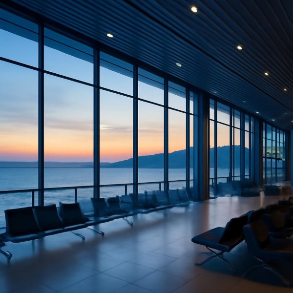
Let’s be honest—when most people think about outdoor escapes on the West Coast, they picture the postcard: a lone hiker on a cliff, a surfer dropping into a perfect wave, a whale breaming in the distance. But the real story is way more interesting, and it lives in the details that don’t make it onto Instagram. Take the kelp forests, for example. Bull kelp along the Pacific Coast can grow up to two feet per day under ideal conditions, making it one of the fastest-growing ecosystems on Earth, and that growth directly supports everything from juvenile salmon to the sea otters that crack open abalone with rocks—one of the few examples of routine tool use among marine mammals. Meanwhile, a single gray whale migrating along this coast can consume over 1,000 pounds of amphipods daily during feeding season, literally reshaping the seafloor community wherever it passes. That’s not just a wildlife encounter; it’s a geological force with a heartbeat.
Now, let’s talk about surfing, because the conditions here aren’t just challenging—they’re engineered by specific underwater geography. Mavericks near Half Moon Bay generates waves that can hit 60 feet, and that’s not random; it’s the result of a particular submarine canyon that focuses ocean swell into a single violent peak. Up in Oregon, surf breaks like Nelscott Reef are so cold that surfers wear hooded 5/4-millimeter wetsuits, and hypothermia sets in within minutes if that suit fails. That’s a completely different risk profile than what you’d face in Southern California, and it demands a different kind of preparation. And here’s what I love: the coastal fog that rolls over the redwoods doesn’t just look moody—it provides up to 40 percent of the trees’ annual water intake, with some researchers measuring over 100 gallons of fog drip per tree per season. That fog is literally a water delivery system, and it’s why those forests can thrive in a Mediterranean climate.
But hiking brings its own set of hidden complexities. The Lost Coast Trail, for instance, is a 25-mile route that requires you to time your passage with low tide, because several sections become completely impassable when water covers the beach. That’s not a suggestion; it’s a hard constraint from tidal physics. And along the way, you might step right past a western snowy plover nest without ever seeing it—these threatened shorebirds lay their eggs directly in the sand above the high tide line, and the camouflage is so good that beachgoers walk by all the time. Then there’s the red tree vole, a tiny rodent found only in old-growth forests of the Pacific Northwest that spends its entire life in the canopy and may never touch the ground. That’s a creature that evolved for a world most of us never see. And don’t forget the banana slug—UC Santa Cruz’s official mascot—which can stretch over 10 inches and uses its rasping tongue to consume everything from mushrooms to animal scat, playing a critical role in nutrient cycling. The tide pools at Fitzgerald Marine Reserve near Half Moon Bay contain over 200 species of marine invertebrates, including the giant green anemone that can live for over a century. And poison oak? Its urushiol oil is so potent that a single nanogram—one billionth of a gram—can trigger a reaction in sensitive individuals. So when you plan your outdoor escape, don’t just look for the scenic overlook. Ask yourself how the waves form, what the fog is feeding, and which creatures are hiding right under your nose. That’s where the real value lives.
Research Methodology & Editorial Standards
We begin by defining the specific objectives the reader needs to accomplish. Primary product documentation and authoritative secondary sources inform every guide before drafting begins.
Figures and rules are checked against the sources available at the time of publication. Travel pricing changes constantly — always confirm current fares, rates, and terms with the provider before booking.