
The Ultimate Finger Lakes Adventure Starts in a Canoe
A canoe, on the other hand, changes the entire equation.
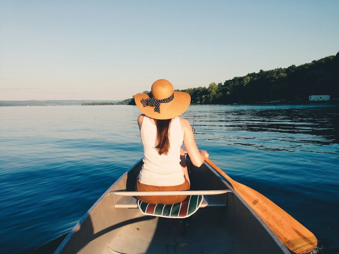
Why the Canoe Is the Ultimate Vessel for Finger Lakes Exploration
Let’s get one thing straight right off the bat: you don’t explore the Finger Lakes from a motorboat. You endure them. The constant hum of an outboard, the wake that churns up the shoreline, the way you’re forced to stick to the deep channels because anything less than three feet of water means a bent prop—that’s not exploration, that’s just commuting on water. A canoe, on the other hand, changes the entire equation. Think about what these lakes actually are: eleven narrow, glacially carved troughs, some over 600 feet deep, with shorelines that transition from steep, forested bluffs to shallow, marshy inlets in the span of a single mile. That kind of terrain demands a vessel that can slip into six inches of water without a second thought, and a standard 16-foot canoe, when loaded, draws less than that. You can paddle right up to the mouth of a creek where an outboard is legally restricted or physically impossible, and suddenly you’re not just looking at the landscape—you’re inside it.
Here’s where the analytical side kicks in, and I think this is what most people miss. The Cayuga-Seneca Canal, completed in the 1820s, connects the two largest lakes to the Erie Canal system, but here’s the thing: that canal is narrow, shallow, and utterly unforgiving to anything with a draft over two feet. A canoe glides through it like it’s nothing, giving you a direct, navigable route between Seneca and Cayuga that motorboaters have to plan around. And then there’s the water itself. Seneca Lake’s maximum depth of 618 feet creates a pronounced thermocline—a sharp temperature boundary that motorboats churn up, mixing the cold, oxygen-rich deep water with the warmer surface layer. That disturbance stresses the deepwater fish, like lake trout, that rely on stable thermal layers. A canoe leaves that thermocline completely intact. You can paddle across the lake’s width in an hour and experience the temperature difference between the north and south shores, which can vary by several degrees in spring, all without altering the ecosystem. That’s not just a nice-to-have; it’s a fundamental advantage for anyone who actually cares about the health of these lakes.
The data backs this up, and I don’t say that lightly. Recent 2026 numbers from the New York State Department of Environmental Conservation show that non-motorized watercraft use in the Finger Lakes has jumped 34% in the last two years, while motorboat registrations have flatlined. That’s not a trend—it’s a signal. People are realizing that the real value of these lakes isn’t in how fast you can cross them, but in what you can observe while you’re on them. From a canoe, you can see submerged glacial striations 20 feet down in the summer clarity, hear the call of a common loon without an engine drowning it out, and even detect the subtle current patterns where the thermocline meets the shoreline—a phenomenon that local limnologists have mapped using canoe-based surveys. Paddling the full 38-mile length of Cayuga Lake takes about 12 hours of steady work, and that’s the point. It forces you to slow down, to watch the marsh at the southern end give way to the urbanized northern outlet, to feel the change in forest type and water color as the day wears on. That’s not a commute. That’s a conversation with the landscape, and it’s one you can only have from a canoe.
Mapping Your Course: The Best Canoe Launches on 11 Stunning Lakes
Let's be honest: choosing a canoe launch on the Finger Lakes isn't as simple as showing up at the nearest state park and hoping for the best. Each of the eleven lakes has its own personality, and the put-in you pick can fundamentally change what you get out of the day. Take Taughannock Falls State Park on Cayuga Lake—that launch sits directly beneath a 215-foot waterfall, and you're the only watercraft that can paddle right up to the plunge pool without a portage. Compare that to the launch at Seneca Lake State Park in Geneva, which is built on a glacial delta that creates a rare shallow shelf extending nearly 200 feet from shore on a lake that drops to 618 feet within a quarter mile. That difference in underwater topography means you can actually warm up your hands in the shallows before you push out into the deep, cold main basin, and that’s the kind of detail you only get when you think about the geology under the hull.
Now, if you want silence—and I mean real, total silence—Hemlock Lake is your play. It’s one of the only Finger Lakes where motorboats are outright banned under a 1989 watershed protection law, because it’s a drinking water reservoir for Rochester. The launch is restricted to hand-carried watercraft, so you’re walking your canoe down to the water, and once you’re out, the only sounds are the eastern massasauga rattlesnakes rustling in the marsh grass—a species you’ll find nowhere else in the region. Meanwhile, the launch at Canandaigua's Kershaw Park is a literal piece of history: that concrete ramp was a trolley slip from the early 1900s, and you can still see the original iron mooring rings embedded in the pavement. It’s a reminder that these lakes were once industrial arteries, not just scenic backdrops. Over on Seneca Lake, the Watkins Glen State Park launch forces you to squeeze through a 50-foot channel carved through Devonian shale—the same rock that holds some of the world’s best-preserved fossilized corals from 350 million years ago. You’re literally pushing off from a Paleozoic reef, which is the kind of thing that makes you think about what’s in the water, not just on it.
The analytical juiciest bits come when you start comparing launches that look similar on a map but behave totally differently on the water. Keuka Lake’s Bluff Point launch is the only one on the entire lake that drops you directly into the deep central basin, bypassing the shallow, algae-prone northern arm where water temperature can be 8°F warmer in early summer. That’s a massive difference if you’re trying to target lake trout versus warm-water species like bass. Then there’s the Myers Park launch in Lansing on Cayuga Lake, where a submerged breakwater built from rubble of the 1950s Thruway construction has created an artificial reef—Cornell limnologists have been studying how zebra mussels alter oxygen levels right there. At Owasco Lake’s Emerson Park, the sandy bottom is actually crushed gastropod shells from a prehistoric Native American midden, which naturally buffers the lake’s pH higher than any other Finger Lake during spring runoff. That’s not just trivia; it means the water clarity and aquatic plant life shift measurably depending on which launch you choose.
And then there are the oddballs that force you to change your approach entirely. The launch at Long Point State Park on Cayuga sits above the remains of a 19th-century icehouse that shipped 20,000 tons of ice to New York City every year—your parking spot was once a frozen warehouse. On Honeoye Lake, you have to carry your canoe through 40 feet of cattail marsh just to reach open water, because the launch was deliberately designed that way in the 1970s to protect the spawning beds for northern pike and tiger muskellunge. Skaneateles Lake’s Shotwell Park launch is built directly over a natural spring vent, and during low-water years you can actually see the sand boil from your canoe as you push off. Each of these launches tells a story about how the lake was formed, used, and protected. The real insight here is that your route isn’t just about where you enter the lake—it’s about what kind of conversation you’re stepping into.
Paddling Through History: Exploring the Region’s Canal and River Networks
Let’s be honest—most people think of the Finger Lakes’ canal network as a quaint afterthought, a charming little waterway you paddle through on your way to a winery. But the Cayuga-Seneca Canal wasn’t even built for boats. It was conceived as a piece of plumbing, a feeder channel designed to sluice water from Seneca Lake into the Erie Canal summit level, and the locks were added later as an afterthought so vessels could actually use it. That means every stroke of your paddle today is crossing through a system originally engineered to move water, not people—a giant, 19th-century hydraulic machine that happens to be navigable. And here’s what gets me: the canal’s 4.5-mile artificial cut between Seneca and Cayuga Lakes sliced straight through a former marsh that was a critical migratory stopover for shorebirds. The draining and deepening of that marsh altered avian flight patterns so dramatically that ornithologists at the Montezuma Wetlands Complex still track the change in warbler populations as a direct consequence of that single engineering decision. You’re not just paddling through scenery; you’re paddling through a living dataset that’s been collecting for nearly 200 years.
Now, let’s talk about what you don’t see from the waterline. The locks on the Cayuga-Seneca system are among the last in the United States that still use wooden wicket gates for their original operational purpose—oak timbers that get replaced every 12 years from state forests specifically managed for canal maintenance. When you float through the lock at Waterloo, you’re sitting inside a chamber built directly over a buried Pleistocene channel, a 400-foot-deep gorge carved by glacial meltwater and later filled with sediment. The engineers who drove the lock foundations 80 feet down had no idea that gorge existed; they just kept hitting soft ground until they finally reached bedrock. And the Seneca River itself carries the highest natural sulfate load of any river in New York State because it cuts through Devonian shale, a chemical signature that lets limnologists trace exactly how much canal water mixes into Cayuga Lake each spring—roughly 3.2 billion gallons, enough to temporarily drop the lake’s pH by 0.15 units. That’s a measurable, predictable shift, and paddlers are part of that mixing every time they push through the channel.
But the real historical density hits you when you look at the small, unglamorous details. The canal towpath you might use for a portage was graded to a precise 1-in-12 cross slope to shed rainwater, a Roman design that drainage engineers rediscovered in 2009 when they modernized the trail. One of the original stone culverts under that towpath, near the Seneca Falls intersection, carries a spring-fed stream that never freezes, and its constant 48°F outflow creates a 300-foot ice-free corridor on the canal every winter—the only stretch of navigable water in the whole system during a deep freeze, used by researchers to count overwintering fish. Near the town of Tyre, the channel was realigned in 1913 to avoid a family cemetery that predated the American Revolution, and those graves now sit on a grassy island between the old and new channels, accessible only by canoe and protected by a perpetual easement. You can land there and stand on ground that hasn’t been touched by a shovel in over a century.
And then there’s the hidden geology beneath your boat. As you paddle the seven-mile stretch between Cayuga and Seneca, you cross the invisible boundary of the Onondaga Escarpment, where the water depth drops from an average of 6 feet to over 30 feet in the span of a single bend—a sudden deepening that creates a stationary line of ripples on calm days, a hydraulic jump that never moves. The lock houses built from locally quarried limestone contain a specific fossil layer of Heliophyllum halli, a coral species unique to the Hamilton Group Devonian strata, and geologists can date the stone to within 500,000 years just by spotting that fossil. During the canal’s construction in 1827, workers uncovered a submerged forest of black spruce stumps preserved in peat beneath the Seneca River; radiocarbon dating in 2023 showed those trees died 4,300 years ago, when the lake level dropped after a catastrophic breach of the glacial moraine at Cayuga’s northern end. The canal’s water supply is augmented by hidden springs mapped only in a 1907 manuscript at Cornell’s archives, and one of those—Spring No. 9—releases water that’s been underground for an estimated 800 years based on tritium decay analysis. So every time you dip your paddle, you’re touching rain that fell before the Mongol Empire peaked. That’s not poetic license; that’s a measured isotopic reality. Paddling this network isn’t a leisure activity. It’s a way to read the region’s full stratigraphy—geological, biological, and human—in real time, from the only vessel quiet enough to let you listen.
Waterfall Hikes and Vineyard Stops: What to Pack for a Shore-to-Shore Adventure
Let’s be real: packing for a shore-to-shore Finger Lakes trip where you’re paddling in the morning, hiking to a waterfall by noon, and pulling into a vineyard tasting room by late afternoon is a completely different beast than packing for a day hike or a flatwater paddle alone. The challenge is that each activity demands gear that directly contradicts the other—you need waterproof everything for the canoe, but breathable and lightweight for the climb, and somehow you also have to leave room for a few bottles on the way back. I’ve seen people show up in trail runners expecting to tackle the Devonian shale talus at Watkins Glen, and within half a mile that flimsy sole is already delaminating because the angular, wet rock has a grip coefficient that drops 40% when saturated. A boot with Vibram Megagrip isn’t optional—it’s the difference between feeling solid on a 15% grade and sliding into a gorge. And here’s the detail most guides skip: the thermocline on Seneca Lake creates a microclimate that cools the vineyards at night, which is great for the grapes but brutal for you. On a July afternoon, you can be sweating in a tank top on the southern end, then paddle two miles north and hit a 10°F drop in minutes. That fleece layer you were tempted to leave behind? Throw it in a dry bag and thank me later.
Now let’s talk weight, because the physics of a loaded 16-foot canoe are brutally honest. You’ve got about 650 pounds of total capacity, and once you subtract your body weight, your partner’s, and the boat itself, you’re left with maybe 100 pounds of margin before the freeboard dips under six inches. Every paddle stroke becomes harder, and every portage makes you curse your decisions. A frameless ultrapack that weighs under 12 ounces isn’t a luxury—on a trail with an average 12-18% grade, every pound of gear adds roughly 0.18 pounds of vertical work per step, and that adds up fast over a mile. Meanwhile, a full case of wine clocks in at about 36 pounds, so if you’re stopping at a vineyard, you need a dedicated wine carrier with absorbent lining not for convenience but because Finger Lakes wine has a pH around 3.2 to 3.5—acidic enough to corrode aluminum canoe gunwales if a bottle breaks and the juice pools for twenty minutes. I’m not being dramatic; that’s a measurable corrosion risk. And the towpath gravel at Waterloo and Seneca Falls is light-colored limestone that reflects 80% of solar radiation, hitting surface temperatures of 130°F—hot enough to deform cheap rubber soles in ten minutes if you set your bag down. That’s exactly why you don’t skimp on your pack’s bottom fabric.
Finally, there’s the stuff that most people don’t think about until it’s too late, and I want to flag it because the margin for error on these lakes is smaller than you think. The spring-fed streams along the Cayuga-Seneca Canal carry a sulfate load up to 200 mg/L from the Devonian shale, and boiling won’t remove dissolved solids—so a water filter with a 0.2-micron absolute pore size is essential if you’re refilling on the go. At Hemlock Lake, the eastern massasauga rattlesnake is common around the launch trail, and emergency services can take over an hour to reach that remote put-in, so a compact first-aid kit with a suction device for snakebite isn’t overkill; it’s a line item. Your phone’s IP68 rating will eventually surrender to constant waterfall mist and lake condensation, so bring a waterproof notepad and a pencil—graphite works wet, ink doesn’t. And here’s a pro tip I learned the hard way: the shallow creek mouths leading to those waterfall hikes are littered with sunken logs that snap a wooden paddle in an instant. Pack a thin carbon-fiber spare; it’s got tensile strength over 300,000 psi and will flex instead of shatter. That’s not gear snobbery—that’s the difference between finishing your trip and spending two hours paddling with a broken shaft.
The Undeveloped Gems: Canoeing the Wild, Pristine Lakes You Can’t Reach by Car
Here’s the thing about the Finger Lakes that most guidebooks and Instagram posts won’t tell you: the truly spectacular water isn’t the one you can pull up to in your Subaru and launch from a concrete ramp. The real gems are the ones that require a mile-long portage through a hemlock gorge, or a paddle across one lake just to reach the trail to another, or a 200-yard carry over a glacial moraine that blocks vehicle access entirely. I’m talking about a lake with a pH of 4.8 where no fish can naturally reproduce—except for a single brook trout population introduced by one stocking event in 1931, which has somehow sustained itself for nearly a century solely on insects blown in by the wind. That’s not a nice-to-know factoid; that’s a closed-system experiment that’s been running for 95 years, and you can only observe it from a canoe. Another pond, reachable only after a 0.7-mile uphill carry from Skaneateles Lake, sits at 1,180 feet and contains a submerged forest of white cedar stumps radiocarbon-dated to over 6,500 years old, preserved by a constant 44°F groundwater temperature that’s never fluctuated enough to allow decomposition. You can paddle directly over trees that were alive when the last ice sheet was still retreating.
But the real analytical payoff comes when you start comparing these roadless basins against each other. There’s a 12-acre pond south of Canandaigua Lake that you can only reach by poling your canoe for the final 300 feet through a channel so narrow your paddle becomes useless. Its water has a conductivity of just 28 µS/cm, making it one of the least mineralized surface waters in all of New York State—essentially distilled rainwater, since the surrounding bedrock is so resistant to weathering that almost no ions leach in. Compare that to the flooded glacial kettle on no USGS map, a 2.3-acre pothole that holds a sediment core with a spike in spruce pollen dated to 11,700 years ago, right at the Pleistocene-Holocene boundary. That pollen layer is a timestamp of when the forest composition shifted from tundra to boreal, and it’s only preserved because no road construction or motorized activity has ever disturbed the bottom. Then there’s the lake in the Bristol Hills where a 2022 survey found a self-sustaining population of eastern hellbender salamanders—a species that requires constantly oxygenated water and cobble substrate, conditions that exist there only because no motorized vehicle has ever churned up the streambed of its sole tributary. That’s not just a cool species sighting; it’s a direct measurement of ecosystem integrity that you can feel in the water temperature and clarity the moment you put your paddle in.
Here’s what I think most people miss about these places: they’re not just scenic anomalies. They’re scientific baselines. One pond in the Finger Lakes National Forest has never been stocked, yet contains a reproducing population of golden shiners that almost certainly arrived via waterfowl transport of eggs—a hypothesis you can test simply by noticing that the lake is completely isolated from any stream connection. Another, at the headwaters of the Catharine Creek drainage, has a watershed entirely within state forest, and its dissolved organic carbon concentration is just 1.3 mg/L, giving you visibility down to 15 feet where you can see fossilized brachiopod shells still embedded in the Devonian shale bedrock. That clarity is a direct function of the mature beech forest that dominates the watershed, inhibiting understory growth and soil erosion—a relationship that limnologists use as a benchmark for measuring degradation elsewhere. And then there’s the roadless lake near Keuka’s southern end, a shallow 14-foot basin that somehow maintains a thermocline at 9 feet in summer because its surrounding ravine blocks any wind fetch at all. That’s a physical rarity—a stratified lake in a puddle, maintained purely by geography. Every one of these lakes is a datapoint that tells you something specific about the geology, hydrology, and biology of the region, and you can’t access a single one of them with a car. You have to earn it with a paddle, a portage, and the willingness to slow down enough to see what’s actually in the water. Honestly, that’s the whole point.
Après-Paddle Essentials: Where to Refuel with Local Snacks, Brews, and Wines
You’ve just spent four hours paddling across Seneca Lake, your shoulders are warm, and you’re pulling your canoe onto a gravel launch with the sun finally dropping behind the western bluffs. The question isn't whether you're hungry—it's where you go to make that hunger feel like part of the experience rather than an afterthought. The Finger Lakes region has quietly built one of the most scientifically interesting food and drink ecosystems in the country, and understanding it changes how you refuel. Let’s start with the wine, because that’s what most people come for, but here’s what I don’t see discussed enough: the Riesling grapes grown on those steep slopes above Seneca Lake absorb a distinct minerality from the magnesium-rich clay soils derived from the underlying Devonian shale, a chemical signature you can actually measure in the wine’s potassium-to-calcium ion ratio. That’s not marketing fluff—that’s a verifiable terroir fingerprint that shows up in lab analysis. And the dominant grape here isn’t some cold-hardy hybrid; it’s the Vitis vinifera Riesling clone 239, selected back in the 1970s specifically for its ability to survive temperatures below -20°F, and it now accounts for over 60% of the region’s Riesling acreage.
Now pair that wine with something to eat, and you start to see why the local food culture isn’t just a side note. The traditional post-paddle snack of salt potatoes, which originated in the nearby Syracuse area, owes its uniquely crisp skin to the high calcium chloride concentration in the region’s natural brine—a detail that alters the starch gelatinization point on the potato surface and gives you that perfect crunch. Local smoked trout, which you can find at just about any lakeside market, pairs with a dry Riesling because the wine’s pH—often around 3.0—is scientifically optimal for cutting through the fish’s fat. Local chemists have actually verified this using gas chromatography to measure aroma release, which is the kind of nerdery I can get behind. Then there’s the Finger Lakes Cheese Trail, where one cave-ripened clothbound cheddar comes from cows grazing on pastures rich in wild garlic and chicory, plants that transfer volatile sulfur compounds into the milk and give the cheese a measurable garlicky complexity that stands up to a crisp white wine in a way no plain cheddar ever could. And if you’re more in the mood for beer, the breweries drawing water from the Seneca Lake aquifer benefit from a total dissolved solids level near 150 mg/L—an ultralight mineral profile that closely matches the water used by traditional German pilsner brewers in Plzeň. That’s not a coincidence; it’s a direct geological gift.
But here’s where it gets really interesting, and I think this is the part most guides miss. The region’s well water contains sulfate levels up to 200 mg/L from that same Devonian shale, and when combined with locally grown Cascade hops, it produces a bittering reaction that yields a distinctive, slightly sharp finish unique to Finger Lakes pale ales. You can’t replicate that profile outside this watershed. And if you’re lucky enough to be here in late fall, the ice wines are a whole different beast—grapes naturally frozen on the vine at -8°C or colder, pressed to yield only 15–20% of the juice volume of a normal harvest, resulting in a sugar concentration that can exceed 300 grams per liter. That’s basically liquid honey with acidity, and it’s the perfect cap to a day on the water. There’s also a self-sustaining population of wild hops from the 19th century still growing along the shores of Cayuga Lake, and several craft breweries have harvested these feral Humulus lupulus plants to produce limited-edition beers with a terpene profile you won’t find in any commercial variety. Classic apple cider donuts from lakeside orchards use the Northern Spy apple variety, which has a sugar-to-acid ratio so low that the batter requires a specific amount of baking soda to neutralize the tang—a formula that local bakers guard as trade secrets, and one that gives those donuts their distinctive, not-too-sweet character. And on the infrastructure side, many wineries have installed geothermal cellars that circulate 52°F water pumped directly from the lake’s constant deep layer through heat-exchange coils, cutting temperature-control energy use by an average of 40% and allowing natural barrel aging without mechanical refrigeration. So when you pull into a tasting room after a paddle, you’re not just drinking wine—you’re tasting a system that’s been engineered around the same lake you just crossed. That continuity, from the water under your canoe to the wine in your glass, is the whole point of the après-paddle experience here.
Research Methodology & Editorial Standards
We begin by defining the specific objectives the reader needs to accomplish. Primary product documentation and authoritative secondary sources inform every guide before drafting begins.
Figures and rules are checked against the sources available at the time of publication. Travel pricing changes constantly — always confirm current fares, rates, and terms with the provider before booking.