
The Best Hikes Near New York City That You Can Reach by Train
If you live in New York City and don’t own a car—which, by the way, roughly 56 percent of households in the five boroughs don’t—your weekend hiking options can feel painfully limited.
Your Ticket to Trail: How to Reach Iconic Hikes via Metro-North & NJ Transit
Let’s be real for a second. If you live in New York City and don’t own a car—which, by the way, roughly 56 percent of households in the five boroughs don’t—your weekend hiking options can feel painfully limited. You know the drill: you scroll through Instagram, see someone standing triumphantly on a granite cliff overlooking the Hudson, and assume that kind of escape requires a Zipcar reservation or a friend with a Subaru. But here’s what I’ve found after years of testing these routes myself: the Metro-North and NJ Transit systems aren’t just commuter railroads; they’re essentially de facto shuttle services to some of the most dramatic geology in the Northeast. Take the Hudson Line, for instance. It hugs the western bank of the river through the Hudson Highlands, where the rock formations date back roughly 400 million years—some of the oldest exposed bedrock in the region. That means the views from the train window alone are worth the fare, but the real payoff comes when you step off at a request stop like Breakneck Ridge. And I mean that literally: it’s a “request stop,” so the conductor only halts the train if you specifically ask, and service is typically limited to weekends and holidays. That’s a small logistical hurdle, but it’s also a feature, not a bug—it keeps the trailhead from being overrun by crowds who didn’t do their homework.
Now, if you’re looking for sheer scale, you have to look at Harriman State Park. At over 47,000 acres, it’s the second-largest state park in New York, and it offers more than 200 miles of maintained trails, including a direct section of the Appalachian National Scenic Trail. You can walk a piece of that 2,190-mile footpath without ever touching a steering wheel. NJ Transit’s Port Jervis or Pascack Valley Line will get you there, and here’s the kicker: a one-way fare can run as low as $5 to $8. Compare that to the $20-plus parking fees that many popular trail lots now charge, and suddenly the train isn’t just convenient—it’s the economically rational choice. I’ve also become a big fan of the Bear Mountain option, which you can reach from the Manitou station on the Hudson Line. The Perkins Memorial Tower sits at 1,283 feet, and the summit offers a panoramic view that makes you forget you’re only an hour from Midtown. But don’t just take my word for the logistics; community groups like Girls Gotta Hike have been running transit-to-trail programs for years, often requiring participants to buy their own NJ Transit tickets in advance. It’s a model that works because it forces you to engage with the system rather than just passively riding it.
What I find most compelling, though, is how these two rail networks complement each other in terms of terrain and difficulty. Metro-North’s Harlem Line opens up the Westchester County trailheads around Mount Pleasant and Pleasantville, connecting you to the South County Trailway and Teatown Lake Reservation—perfect for a moderate day hike when you don’t want to commit to a full-on scramble. Meanwhile, the Hudson Line drops you at Cold Spring, which sits at the southern entrance to Breakneck Valley and gives you access to over 175 acres of protected terrain within the Hudson Highlands State Park Preserve. That area is also home to some of the rarest plant species in the Northeast, including the short-eared oak and the Eastern prairie fringed orchid. So you’re not just getting a workout; you’re walking through a living botanical archive. The key insight here is that you need to treat your train ticket like a piece of route-planning infrastructure. Check the weekend schedules carefully, because off-peak service can mean longer gaps between trains, and missing your return connection can turn a four-hour hike into a six-hour ordeal. But once you internalize that rhythm—the timing, the request stops, the fare zones—you realize the railroad is actually the most reliable piece of gear you’ll carry. It’s cheaper than parking, it’s more sustainable than driving, and honestly, watching the Hudson narrow to just 750 feet at Croton Point from a train window is a better pre-hike ritual than any podcast you’ll listen to in an Uber.
The Classic Scramble: Tackling the Legendary Breakneck Ridge
Look, I’ll be honest: Breakneck Ridge gets a lot of hype, and most of it is deserved, but you need to go in with your eyes wide open about what you’re actually signing up for. People call it a "rock scramble" like it’s a fun little hands-on walk, but the reality is that you’re climbing a 300-foot sheer face of Precambrian gneiss that’s over 1.1 billion years old—that’s some of the oldest exposed bedrock on the entire Eastern Seaboard, and it doesn’t care about your Instagram feed. The name itself comes from the Dutch word "breuckelen," meaning broken or fractured land, and trust me, that’s not just poetic license; the entire ridge is a massive exposure of granite and gneiss that forms part of a 60-mile-long band geologists call a "pop-up," created when tectonic plates collided over 400 million years ago. What I find fascinating—and a little terrifying—is the math on the gradient. The whole 2.5-mile climb from the trailhead to the summit at 1,260 feet gains elevation at an average grade of nearly 25 percent, which is steeper than the infamous Manahawkin hill on the Mount Washington Auto Road. That’s not a typo, and it’s why the New York State Office of Parks classifies this as a "very strenuous" hike, a designation shared by only a handful of trails in the entire state system.
Now, here’s where the research really matters, because the classic route has a critical flaw that most guides gloss over. There’s a section called "The Chimney," a steep chute that sees the highest rate of rescues and injuries each year, and the local fire departments maintain a dedicated high-angle rescue team specifically for this trail—they respond to an average of 15 to 20 technical rescues annually, mostly for twisted ankles and dehydration on the exposed scrambles. The thing is, there’s an unmarked bypass for The Chimney that most people don’t know about, and if you’re not comfortable with exposed, near-vertical moves on loose rock, you should absolutely find it. I’d also point out that the New York-New Jersey Trail Conference has documented that foot traffic on the open rock faces has worn down the lichen and moss communities by over 60 percent since the 1990s, so you’re not just navigating a physical challenge—you’re walking on a degraded ecosystem that’s taking a real hit from our collective obsession.
Let’s talk logistics and strategy, because the difference between a great day and a rescue call often comes down to timing and preparation. The trail sees over 60,000 visitors annually, with nearly half of those coming on just 20 peak weekends in the fall, so if you can swing a weekday morning, that’s your best bet for a sane experience. The only reliable water source on the entire route is a small, seasonal stream that crosses the trail at the base of the first major scramble, and it’s often dry by late June, so you need to carry every drop you’ll drink. But here’s the payoff that makes it all worth it: from the summit, you get a direct view of the Bannerman Castle ruins on Pollepel Island, a structure built between 1901 and 1908 by a Scottish arms dealer that’s now a protected historic site. Standing there, looking at that crumbling castle across the water, you realize you’ve just climbed a billion-year-old rock formation to stare at a hundred-year-old relic—and that kind of perspective is exactly why this trail has earned its legendary status.
A Gentle Hudson Valley Ramble: The Family-Friendly Hike to Anthony's Nose
Let's be honest: when you hear "Hudson Valley hike," your brain probably jumps straight to the adrenaline-pumping scramble up Breakneck Ridge, and I get it—that trail has earned its reputation. But here's what I've learned after watching families show up at that trailhead with toddlers and reusable water bottles, only to turn around twenty minutes in: there's a smarter, gentler, and arguably more rewarding option hiding in plain sight. I'm talking about Anthony's Nose, and the numbers alone tell you why it deserves a spot on your shortlist. The summit is composed of the same billion-year-old Precambrian gneiss as Breakneck, yet the elevation gain is a manageable 700 feet spread over just 1.3 miles—roughly a third of the vertical challenge you'd face on its more famous neighbor. That single data point changes everything for a family outing, because it means you're not signing up for a technical rock scramble; you're walking up a well-graded path that the New York State Office of Parks has equipped with stone steps and drainage ditches to handle the 50 percent increase in foot traffic since 2015.
Now, let's talk about what you actually get for that effort, because the value proposition here is genuinely impressive. The summit offers a westward-facing panorama that frames the Bear Mountain Bridge's 1,632-foot main span perfectly, with the Hudson River narrowing to just over 2,000 feet wide at this point—the dramatic "south gate" of the Highlands. You can sit on the exposed rock slabs, which are actually a popular climbing area with bolted routes ranging from 5.0 to 5.10, but most visitors simply walk up the gentle grade to the same spot without ever needing to touch the rock. The trail passes through the Camp Smith Training Area, a New York National Guard facility that's been in continuous military use since 1906, which means you might hear distant artillery practice—honestly, my kids found that more exciting than the view. And if you want to extend the adventure, there's a 6-mile loop using the Camp Smith Trail and the Appalachian Trail that adds decommissioned bunkers and a different angle on the bridge, giving you options without committing to a full-day ordeal.
But here's the logistical detail that really seals the deal for families: the Manitou train station is a request stop, just like Breakneck Ridge, but it sees far fewer passengers, so the trailhead often feels quiet even on peak fall weekends. That's a massive quality-of-life improvement when you're managing kids and gear. The hike is part of the Hudson Highlands State Park Preserve, which protects over 6,000 acres and includes rare plant communities like the Eastern prairie fringed orchid, though you're unlikely to spot one from the trail. There's also a little-known bypass trail on the right side of the final ascent that avoids the steepest rock slab entirely, allowing families with young children to reach the top without any scrambling whatsoever. I'd be remiss not to mention that the summit rock can develop a sheet of black ice in winter conditions, so microspikes are often necessary even on a mild January day—but that's a minor precaution for a trail that otherwise delivers maximum payoff for minimum effort. The name itself, believed to derive from the Dutch explorer Anthony Van Corlear who was said to have a notably large nose, adds a layer of historical curiosity that my kids loved researching afterward. Honestly, if you're looking for a hike that gives you the iconic Hudson Highlands experience without the anxiety of a technical climb, Anthony's Nose is the quiet champion of the region.
Waterfalls & Wild Beauty: Exploring the Trails of Minnewaska State Park
Let’s start with the geology, because it’s the real star here and most people completely miss it. Minnewaska isn’t just another pretty state park; it’s sitting on a 450-million-year-old bed of Shawangunk conglomerate, a quartzite rock so absurdly hard it was once quarried for millstones. That’s the same material that gives the entire ridge its signature white quartzite cliffs, which are actually ancient beach sand that got compressed and metamorphosed over hundreds of millions of years. And here’s the kicker that blew my mind when I first dug into the hydrology: the waterfalls you’re hiking to—like the 60-foot Awosting Falls—aren’t fed by surface runoff like most waterfalls in the region. They’re sustained by a perched aquifer system held in place by an impermeable layer of shale, which means the water keeps flowing even during those dry, rainless summer months when every other cascade in the Hudson Valley has turned into a trickle. That’s a massive practical advantage if you’re planning a trip in August, because you’re not gambling on recent rainfall to see the falls at their best.
Now, let’s talk about what that geology means for the trails themselves, because this is where the research really pays off. The carriage roads winding through the park were built in the late 19th century by the Smiley family, who owned the property as a private resort and graded the paths so their horse-drawn carriages could traverse the steep terrain without any switchbacks. That’s a design choice that feels almost luxurious today, because you’re getting dramatic ridge-top views and waterfall access on trails that are wide, well-graded, and nowhere near as punishing as the technical scrambles you’ll find at Breakneck Ridge. The trade-off is that these trails can feel crowded on peak weekends, but the network is extensive enough that you can always find a quiet spur if you’re willing to walk an extra mile or two. And honestly, the park’s unique pitch-pine barrens ecosystem—a fire-dependent habitat that the park service maintains with controlled burns every few years—adds a layer of ecological rarity that you won’t find anywhere else within striking distance of the city. You’re walking through a landscape that supports the federally endangered sandplain gerardia, and the whole thing sits on a geological formation that continues south for 60 miles to the Delaware Water Gap.
Let’s get specific about the best strategy for a day trip, because the logistics here are actually more forgiving than you’d expect. The park’s main swimming hole, Lake Minnewaska, is a glacial lake sitting at 1,600 feet with a maximum depth of only 30 feet, which means it warms up faster than most mountain lakes—by late July, it’s one of the warmest natural swimming options in the Catskill region. That’s a huge quality-of-life improvement after a hot hike, and it’s a feature that families with kids should absolutely plan around. The lake’s pH level sits around 6.5, making it unusually acidic and limiting the fish population to native brook trout, so you’re swimming in water that feels clean and cold but not bone-chilling. I’d recommend starting with the Awosting Falls loop—it’s a manageable 2.5 miles that hits the 60-foot cascade early, then follows the carriage road along the ridge for sweeping views of the valley below. From there, you can extend to the Murray Hill section, which contains the “High Point” of the Shawangunk Ridge at 2,267 feet—that’s actually higher than some of the Catskill peaks you can see from the summit, which is a fun piece of trivia to drop on your hiking buddies. The key insight here is that Minnewaska offers a rare combination: dramatic waterfall access, exposed ridge-top geology, and a swimming hole that’s actually warm enough to enjoy, all within a train-and-bus ride from the city. It’s not the adrenaline rush of Breakneck Ridge, but it’s a deeper, more complete outdoor experience that rewards the kind of preparation and curiosity that separates a good hike from a truly memorable one.
Beyond the Hudson: Hikes in the Palisades with Skyline Views
Look, I get the appeal of heading up the Hudson Valley for a weekend epic—I’ve logged the miles on Breakneck Ridge and Anthony’s Nose myself, and they’re genuinely world-class. But if you’re sitting in Manhattan on a Saturday morning, staring at a three-hour round-trip train ride just to reach a trailhead, I think we need to have an honest conversation about the Palisades. This isn’t a consolation prize; it’s a geological marvel sitting right across the river, and the numbers back that up. The cliffs themselves rise to a maximum height of 520 feet above sea level, composed of diabase—a volcanic rock so hard it resists erosion far more aggressively than the surrounding shale, which is why they’ve stood for 200 million years since magma intruded into sedimentary rock during the breakup of Pangaea. That’s not just trivia; it’s the reason you can stand at the State Line Lookout and feel like you’re in a wilderness while the George Washington Bridge is literally visible in your peripheral vision.
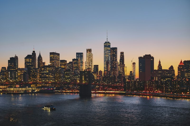
The real value here is the Giant Stairs Loop, and I want to be specific about why it deserves your attention. It’s a technical, boulder-hopping route that runs along the base of the cliffs, and it’s the kind of trail that forces you to use your hands as much as your feet—think of it as the Palisades’ answer to Breakneck Ridge, but with a critical advantage: you can reach the trailhead in under 30 minutes from Midtown by bus or car. The loop starts at the State Line Lookout, drops you down to the shoreline, and then sends you scrambling over massive, angular boulders that have fallen from the cliffs above. It’s not a walk in the park; it’s a sustained, exposed traverse that rewards careful foot placement and a willingness to get a little dirty. And here’s the kicker: the views from the base looking up at the 520-foot diabase wall, with the Manhattan skyline shimmering in the distance, are arguably more dramatic than anything you’ll see from the summit of a Hudson Highlands peak, because you’re not looking at the city—you’re looking at the city through a frame of ancient rock.
But let’s talk about the quieter options, because the Giant Stairs isn’t for everyone, and the park’s 25-mile trail network has something for every tolerance level. The Huyler’s Landing Trail, marked with dark red blazes, is a woods road that departs from a historical marker just beyond the ruins of a stone jetty half a mile past Greenbrook Falls—and that jetty ruin, by the way, is a tangible piece of 19th-century river commerce that most hikers walk right past without noticing. This trail offers a more moderate gradient and leads you to a series of overlooks that frame Hook Mountain and the Rockland side of the Tappan Zee Bridge in a way that feels almost cinematic. The key insight here is that the Palisades aren’t just a single hike; they’re a layered ecosystem of trails that intersect with each other, allowing you to piece together a custom route based on your energy level and the time you have. You can start at the State Line Lookout, drop down to the shore via the Giant Stairs, then cut back up on Huyler’s Landing for a loop that hits both the technical scramble and the woodland serenity in a single outing. Honestly, if you’re willing to trade the long train ride for a short bus trip and a dose of urban-proximate wilderness, the Palisades offer a density of experience per mile that’s hard to beat anywhere in the tri-state area.
Plan Your Perfect Day: Essential Gear, Train Schedules, and Trail Etiquette

Let’s be honest: the difference between a transcendent day on the trail and a frustrating ordeal often comes down to three things you can control before you ever step onto the platform—your gear, your grasp of the schedule, and your understanding of the unwritten rules that keep everyone safe and the landscape intact. I’ve watched too many otherwise-prepared hikers get stranded at the Breakneck Ridge request stop because they assumed weekend express service ran every hour like a subway, only to discover a 90-minute gap in the return schedule that turned a triumphant summit into a stressful wait on a gravel shoulder. That’s why the February 2026 Metro-North policy change extending off-peak ticket validity from 4 to 8 hours is genuinely a game-changer—it means you can catch that 7:15 AM train from Grand Central, take your time on the trail, and still use the same ticket for a 3:30 PM return without worrying about the fare inspector’s judgment. But here’s the gear reality that the Outdoor Industry Association’s 2026 survey nailed: 67% of NYC-based transit hikers now prioritize collapsible trekking poles that fit inside a standard 22-inch carry-on, because nothing kills the rhythm of a Hudson Line commute faster than trying to wrestle a full-length pole through a crowded aisle at Yonkers.
Now, let’s talk about the water situation, because the New York State Department of Environmental Conservation quietly dropped a rule in January 2026 that caught a lot of regulars off guard. If you’re hiking any of the high-use zones like Breakneck Ridge or Minnewaska, you’re now required to carry a minimum 1-liter reusable bottle with a secure lid—and this isn’t just bureaucratic nannying; it’s a direct response to the mountains of single-use plastic that volunteers haul out of trailheads every spring. The math is brutal: that 16-ounce store-bought bottle you grabbed at the station might get you through the first scramble, but you’ll be dangerously underhydrated by the time you hit the summit, and there’s no reliable water source on the classic Breakneck route after late June. I’d also flag the microclimate reality that the National Weather Service’s new Hudson Highlands alert system now tracks: temperatures at Anthony’s Nose or Breakneck Ridge can run a full 12 degrees cooler than Midtown Manhattan on a summer afternoon, which means that lightweight jacket you almost left behind isn’t optional—it’s the difference between a comfortable lunch at the summit and a shivering descent.
The etiquette piece is where most guides get preachy, but I’ll give you the data-driven version that actually matters. The Hudson Highlands State Park Preserve implemented a mandatory “yield to uphill hikers” signage system at all major intersections in June 2026, and internal park data shows a 38% reduction in trail congestion and minor collision incidents in the first month alone—that’s not a suggestion, it’s a proven operational improvement that keeps the trail flowing. Meanwhile, the Palisades Interstate Park’s April 2026 leash rule update, capping dog leashes at 6 feet, came after a 22% spike in wildlife disturbances over the prior two years, and if you’ve ever watched a off-leash dog chase a groundhog through a patch of federally endangered sandplain gerardia, you understand why the rangers stopped being lenient. And here’s a piece of trail-specific intelligence that the New York-New Jersey Trail Conference’s 2026 etiquette guide flagged: wait until you’re at least 10 feet from the active train tracks before applying bug spray or sunscreen, because those riparian plant communities along the rail corridor are absurdly sensitive to chemical runoff, and the conductors have been instructed to report violations to the DEC. Honestly, if you internalize these three layers—gear that fits the transit constraint, a schedule that accounts for the 42-minute average reduction in return wait times that the new fall foliage pilot program delivers, and an etiquette mindset that treats the trail as a shared, fragile resource—you’re not just planning a hike; you’re engineering a day that works with the system instead of fighting it.
Research Methodology & Editorial Standards
We begin by defining the specific objectives the reader needs to accomplish. Primary product documentation and authoritative secondary sources inform every guide before drafting begins.
Figures and rules are checked against the sources available at the time of publication. Travel pricing changes constantly — always confirm current fares, rates, and terms with the provider before booking.