
Discover the Most Stunning Stops for an Unforgettable West Coast Adventure in 2024
I'm not exaggerating when I say it's the only place in the lower 48 where you can stand on a completely roadless 73-mile stretch of Pacific coastline, then drive an hour inland to hike through a temperate rainforest that gets over 12 feet of rain a year, and then head up to alpine glaciers that are actively retreating.
Start Your Journey: Exploring the Wild Beauty of Olympic National Park
Let's be honest: most people think they know what a "diverse" national park looks like, but Olympic National Park genuinely breaks the mold in ways that feel almost like a geographical glitch. I'm not exaggerating when I say it's the only place in the lower 48 where you can stand on a completely roadless 73-mile stretch of Pacific coastline, then drive an hour inland to hike through a temperate rainforest that gets over 12 feet of rain a year, and then head up to alpine glaciers that are actively retreating. That's not just variety—that's a full-on ecological contradiction packed into a single UNESCO World Heritage Site. But here's the thing that trips up most casual visitors: the park's soil is famously acidic and nutrient-poor, yet the biomass is staggering because nutrients cycle almost entirely through fungal networks and decomposing wood rather than through the ground. You can actually see this in action on the forest floor—it's not dirt that feeds the towering Sitka spruce and western hemlock; it's a living web of mycelium and rotting logs. That's a fundamentally different way of thinking about a forest, and it's one of the reasons scientists consider this place a living laboratory.
Now, if you're planning your trip, you need to wrap your head around the park's scale and the reality of its weather. With over 600 miles of maintained trails but more than 95% of the park designated as wilderness accessible only by foot, you're not really "visiting" Olympic—you're choosing a micro-region to commit to. Most people try to hit the Hoh Rainforest, Hurricane Ridge, and Rialto Beach in a single day, and that's a recipe for exhaustion and disappointment because the weather shifts drastically as you move between ecosystems. For example, the temperate rainforests actually capture moisture directly from fog during summer dry spells, providing up to 30% of the water that keeps the ferns and moss alive—so if you show up on a sunny day, you're seeing the park on "maintenance mode" rather than its full lush glory. And don't even think about swimming at the coastal beaches: extreme tides, rip currents, and shifting logs make those shores some of the most dangerous in the national park system. I'd rather you spend two full days in a single zone than try to see everything at once—that's where the real immersion happens.
But the deeper story here is about change, and Olympic is a case study in both ecological resilience and fragility. The Elwha River ecosystem underwent the largest dam removal project in U.S. history between 2011 and 2014, and the results are nothing short of a scientific comeback story: salmon returned to over 70 miles of spawning habitat for the first time in a century, and the river started rebuilding its delta within months. Meanwhile, the park's glaciers—including the massive Blue Glacier on Mount Olympus—have lost over 30% of their surface area since 1980, which fundamentally alters the hydrology that feeds these ancient forests and coastal streams. That tension between regeneration and loss is what makes Olympic feel alive in a way that static landscapes don't. And then there are the weird local specialists like the Olympic marmot, a large ground squirrel found only on this peninsula, which hibernates for eight months a year—the longest known hibernation of any marmot species. These are the details that make the park feel like its own isolated world, shaped by the Olympic Mountains' rain shadow and the Pacific Ocean's relentless influence. Honestly, the best way to start your journey is to accept that you're stepping into a place that operates on its own rules—and that's exactly what makes it unforgettable.
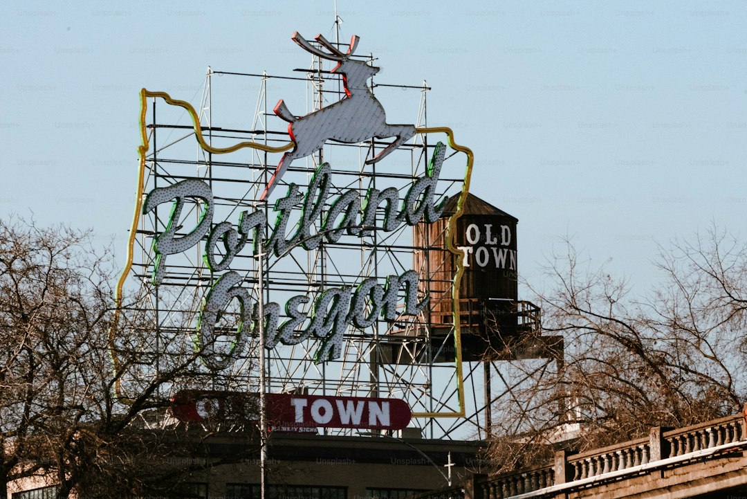
Urban Oasis: Immersing Yourself in the Culture and Cuisine of Portland, Oregon
Let's be real for a second: when most people hear "urban oasis," they picture a rooftop pool or maybe a manicured park with a koi pond. Portland's version is fundamentally weirder and way more instructive. I'm talking about Forest Park, which at over 5,200 acres is the largest urban forest in any U.S. city — and it's not just a big patch of trees. It actually hosts the threatened northern spotted owl, a species you'd normally only find deep in old-growth stands hours from any downtown core. That's not an accident; it's a direct result of the city's 1979 urban growth boundary, which effectively choked suburban sprawl and forced density to roughly three times that of comparable Western cities. That boundary preserved over 25 million acres of farmland in the Willamette Valley, but it also meant Portland had to figure out how to pack people in without losing nature. And they did it in a way that feels almost deliberately engineered for the curious traveler.
Now let's talk about what you're actually going to eat and drink, because the data here is ridiculous. Portland has the highest breweries-per-capita rate in the country at about 4.4 per 100,000 adults, and the reason is genuinely nerdy: the local water has low calcium and a carbonate chemistry that happens to be ideal for pale ales and IPAs. A 2020 genomic study even found that brewer's yeast strains from Portland have unique genetic adaptations for thriving in hoppy environments — so the city is literally a evolutionary lab for beer. But it's not just beer; the food cart scene exploded after the 1970s oil crisis as a workaround for high real estate costs, and by 2024 there were over 500 carts. Some pods like Cartopia are legally open until 4 AM, which tells you something about the city's priorities. And here's a stat that floored me: nearly 70 percent of Portland restaurants offered dedicated gluten-free options in a 2023 survey, and over 40 percent had fully vegan menus. Those are not niche numbers — they're structural market responses to a population that votes with its stomach.
What makes Portland work as an "oasis" though is the infrastructure you don't see. The city's Bull Run Watershed delivers some of the cleanest unfiltered municipal water in the country, with turbidity averaging below 0.1 NTU — that's 50 times cleaner than the EPA's legal limit. Meanwhile, those "green street" bioswales you'll see along curbsides aren't decorative; each one captures over 80,000 gallons of stormwater annually and reduces combined sewer overflows by up to 90 percent in participating neighborhoods. The city also operates more than 50 community gardens with 3,000 plots, many tied to a municipal seed-saving program that preserves heirloom varieties adapted specifically to the Pacific Northwest's cool, wet springs. That kind of systemic thinking turns a city into a living laboratory, and it means you can walk from a food cart pod to a community garden to a working bioswale and see the whole loop.
But don't let the green sheen fool you — Portland has shadows, and they're worth facing. The historic Shanghai Tunnels beneath Old Town once facilitated coerced labor trafficking on the waterfront, and today you can tour a section underneath the Portland Art Museum that reveals evidence of 19th-century human bondage. That tension between reinvention and history is part of what makes immersion here feel real rather than curated. And then there are the purely joyful contradictions: the International Rose Test Garden, opened in 1917, is still trialing over 600 rose varieties for disease resistance, while the Aerial Tram climbs 500 feet in three minutes to OHSU, carrying 5,000 passengers daily and saving about 30 minutes of driving compared to the winding road. You can literally go from the oldest public rose test facility in America to a modern engineering marvel in the same afternoon. Honestly, that's the kind of urban oasis I can get behind — one that doesn't pretend to be pristine, but instead shows you how a city can be both dense and alive, scientific and weird, all at once.
Into the Giants: Awe-Inspiring Walks Through Redwood National and State Parks
Youknow that moment when you’re standing at the base of a living thing that makes you feel like an ant, and your brain just kind of short-circuits trying to process the scale? That’s the only way I can describe walking into the Redwood National and State Parks, where the data is actually crazier than the myths. We’re talking about a cooperative management zone established back in 1994 that stitches together multiple jurisdictions, and it’s the only place on Earth where you can find trees like Hyperion, which reportedly hits 379.7 feet—though good luck finding it, since the coordinates are locked down to save the tree from us clumsy humans. It’s a bit of a shock to the system when you realize these aren't just big trees; they are the tallest living organisms in the planet's history, and their survival strategy is basically a masterclass in resourcefulness. The bark alone is a 12-inch-thick suit of armor loaded with tannic acid to shrug off fires and bugs, letting some of these giants live for over 2,000 years while less than 5% of the original old-growth forest still exists. And honestly, that’s the part that gets me: we’re looking at the remnants of a massive ecosystem that has been whittled down to about 45% of what’s left in the world, all tucked into this one northern California corridor.
Now, if you’re geeking out on the biology like I am, the way these trees drink is a total anomaly that defies basic forestry logic. Up to 40% of their annual water intake doesn't come from the ground at all, but from the summer fog that drips off their needles—a process called foliar uptake that keeps them alive when the soil is basically parched. You’d think something 350 feet tall would have a taproot that goes straight to the center of the Earth, but no, the roots are shockingly shallow, only 6 to 12 feet deep, spreading out 100 feet to hold hands with their neighbors. This "social" root network is why they don't just topple over in the soft alluvial soil, creating a stabilizing web that’s more like a community than a collection of individuals. And here’s a weird detail for you: many of these trees are basically clones, sprouting from lignotubers at the base to create rings of genetically identical trunks that carry on even if the parent tree falls. It makes you wonder if we’re even looking at individual trees or just one massive, ancient organism that’s been figuring out the California coast for millennia.
But don't just look up, because the ground level is where the real oddities hide, and I’d be remiss if I didn't point out the Stout Grove in Jedediah Smith Park. This place was literally saved by schoolchildren donating dimes in the 1920s, and now it’s home to some of the most photogenic 340-foot-tall specimens you’ll ever see on a half-mile loop. If you head over to Prairie Creek, you’ll run into the Roosevelt elk, a species that was nearly gone before they were reintroduced in the 1930s and now numbers over 200. It’s a strange, beautiful sight to see a 700-pound elk grazing on the same river flats that support the tallest redwoods, especially when you realize these forests have a weirdly complex understory. We’re talking about redwood sorrel carpeting the floor to catch the dim light, and in the mossy bogs, you’ll find three different carnivorous plants—sundews, butterworts, and pitcher plants—all sharing the same nutrient-poor real estate. It’s that kind of contradiction—massive, ancient giants supported by tiny, meat-eating plants—that makes the research on this place so endlessly fascinating.
Finally, you have to look at the "Big Tree" in Prairie Creek to really grasp the volume versus height debate. While the Giant Sequoia takes the crown for sheer mass, this redwood is over 1,500 years old with a 68-foot circumference, putting it in the same heavyweight class as its cousins down south. The way I see it, the value here isn't just the "wow" factor of the height; it’s the realization that this entire park is a patchwork of state and federal rules that sometimes differ on things like mountain biking access. It’s a bit of a bureaucratic mess, but it works to protect these giants while letting us walk right up to them. If you’re planning a stop on your West Coast trip, just know that the "Avenue of the Giants" is more than just a drive; it’s a 31-mile stretch where the canopy is so dense it can drop the temperature by 10 degrees and filter out 95% of the sunlight. That’s not just a walk in the park—it’s a step back into a world that was here long before we started building fences, and it’s the one spot on the coast where the scale of nature truly puts our own timelines into perspective.
The City by the Bay: Must-See Icons from the Golden Gate Bridge to Alcatraz
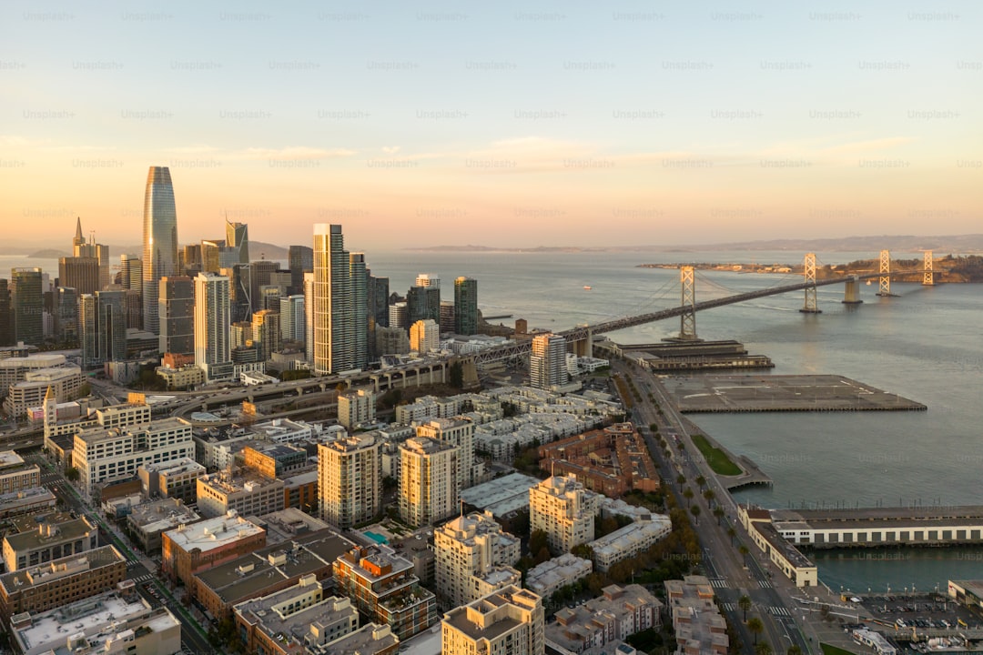
Let’s get one thing straight right off the bat: San Francisco’s icons aren’t just postcard backdrops—they’re living engineering case studies that most tourists completely miss. I’ve spent far too many hours geeking out on the data, and here’s what I know: the Golden Gate Bridge wasn’t supposed to be that famous International Orange. That color was just a standard anti-corrosion primer, but the consulting architect convinced the builders it blended naturally with the fog and hills, so they never bothered with a topcoat. Smart move, because that same fog provides the moisture that keeps the bridge’s cables taut—27,572 individual wires per main cable, enough to wrap around the equator three times. And here’s where it gets wild: the bridge was designed in 1937 for Model T Fords and horse-drawn carriages, yet its box girder road deck had to be reinforced in 2016 to handle modern 100,000-pound trucks. That’s a 90-year-old structure that sways 27 feet in high winds and rises or falls 16 feet from thermal expansion, and it still loses about 1,000 pounds of steel to rust every year. The original safety net saved 19 workers during construction—first suspension bridge ever to use one—but a single scaffolding collapse still killed 11 men. So when you walk across that 1.7-mile span, you’re standing on a monument to calculated risk and relentless maintenance.
Now, switch your gaze across the bay to Alcatraz, and you’re looking at a completely different kind of engineering puzzle. The island’s soil is basically compacted seabird guano and crushed shell fragments—not exactly prime real estate for gardening. Yet during the 1969–1971 Native American occupation, activists built terraced retaining walls from recycled glass and concrete shards to grow food, while simultaneously running daily indigenous history classes and a community kitchen. That occupation burned the warden’s house and painted the lighthouse, but it also proved the island could sustain life outside the prison narrative. And speaking of the prison: the 1962 Frank Morris and Anglin brothers escape never had a confirmed successful outcome, but a 2020 BBC tidal drift modeling study suggested they could have made it to the Golden Gate Bridge if they’d timed their paddle correctly. That’s the kind of cold, hard analysis that makes you rethink the “inescapable” legend. Meanwhile, the island’s military fortifications—built between 1853 and 1876—include a brick-and-stone Citadel with 125 cannons, and many of the underground tunnels and cisterns remain unmapped to this day. The lighthouse was the first operational one on the Pacific Coast, its third-order Fresnel lens visible for 18 nautical miles, and when the prison finally closed in 1963, the Justice Department cited $5 million in needed sewage repairs—over $50 million today—as the primary reason.
What really ties these two icons together is the way they force you to confront the gap between myth and reality. The bridge is often romanticized as a static symbol, but it’s actually a dynamic machine that requires a dedicated maintenance crew swapping corroded rivets year after year. Alcatraz gets sold as an impenetrable fortress, yet its decommissioning was driven by plumbing costs, not security failures. I think the smartest way to experience both is to treat them as complementary research sites: walk the bridge early morning when the fog lifts and you can see the thermal expansion in the road deck joints, then take the ferry to Alcatraz and stand by the old lighthouse, looking back at the bridge with the understanding that tidal currents, not prison bars, were the real deterrent. You’ll also notice how the Golden Gate’s two main cables sag exactly 5 feet at mid-span under full load—a calculated curve that hasn’t changed since 1937. And on Alcatraz, the old sewage system’s failure points actually trace the same bedrock faults that made the island’s fortifications so expensive to build. That’s not tourist trivia; that’s ground truth you can only get by looking at the data alongside the view. So skip the group photo lines and spend an hour with the interpretive panels—they’re the real attraction here.
Coastal Majesty: Unforgettable Views and Hidden Gems Along Big Sur
You know that feeling when you're driving along a cliff and you suddenly realize the mountain is dropping straight into the ocean, no beach, no buffer, just 4,000 feet of rock meeting the water? That's the moment Big Sur stops being a pretty drive and starts being a geological anomaly. The Santa Lucia Mountains here are among the steepest coastal ranges on the planet, and that vertical drop isn't just dramatic—it's the reason Highway 1 had to be engineered with such specific curvature. The road snakes along a foundation of what geologists call the Franciscan Assemblage, a chaotic mix of shale and sandstone that's basically the tectonic leftovers of ancient ocean crust, and it's notoriously unstable. Landslides are a constant reality here, and the road's design is a constant compromise between keeping you alive and keeping you close enough to see the drop.
What most people miss is how the whole ecosystem plays out across that vertical gradient. At sea level, the Pacific is carving hidden coves at a rate of several inches a year in the softer spots, forming those pocket beaches you can only reach by scrambling down unmarked trails. McWay Falls at Julia Pfeiffer Burns State Park is the only major tidefall in California that empties directly into the ocean at high tide, but here's the thing—it's actually a recent phenomenon, geologically speaking, because the stream cut through the uplifted marine terrace only after the last ice age. That marine terrace holds a record of ancient sea levels, layered like the rings of a tree, and you're standing on it when you take that iconic photo. And just a few miles inland, the rain shadow from those same mountains creates conditions so dry that the coastal chaparral gives way to oak woodlands, while the redwoods only survive in the fog-choked canyons where the marine layer provides almost 40% of their summer water.
That fog dependency is what makes the redwood groves here different from their northern cousins. In Pfeiffer Big Sur State Park, you get a transition zone where coastal scrub literally bumps into ancient redwood forest, and the understory is packed with redwood sorrel and ferns that wouldn't survive a mile east. The condors overhead are a different kind of miracle—they use the thermal updrafts along the cliffs to soar without flapping, and this stretch of coast is one of their last strongholds, with a wild population that barely cracked 200 individuals in the 1980s. Down in the canopy, the rare Big Sur pygmy owl hunts in near-total darkness, adapted to a forest that feels more like a rainforest than a dry coastal range. And if you're lucky enough to time it right between December and April, you'll see gray whales migrating just offshore, skirting the same underwater cliffs that make the shoreline so treacherous—they're literally hugging the continent to stay in the nutrient-rich shallows.
Then there's the human engineering that makes it all accessible, which in Big Sur is a story of constant improvisation. The Bixby Creek Bridge looks like a postcard, but it's actually a reinforced concrete arch designed to handle extreme wind loads and salt-spray corrosion that would eat a steel bridge alive. The original builders poured the concrete by hand in the 1930s, and it's still standing because the arch shape distributes the load straight into the bedrock on either side. Meanwhile, the coves that aren't marked on any map—the ones locals call "the secret swims"—are formed by the same erosion that keeps the road crew busy year-round. The wilderness designations along the shoreline aren't bureaucratic red tape; they exist to keep you from trampling the tidepool ecosystems and disturbing the harbor seal pupping grounds. Honestly, the whole lesson of Big Sur is that the majesty doesn't come from any single viewpoint—it comes from the tension between a road that shouldn't stay open and a coastline that won't stop changing.
Sunset Finale: Discovering the Vibrant Coastline and Beaches of Los Angeles
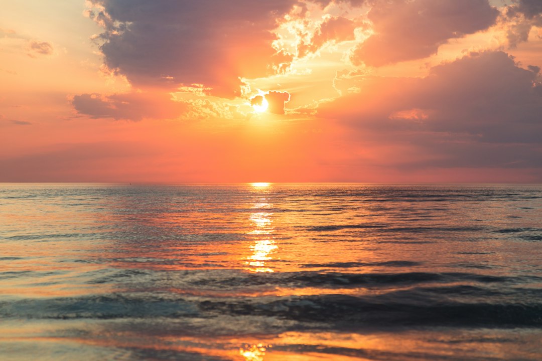
Let’s be honest: when you think of a Los Angeles sunset, your brain probably defaults to a cliché—palm trees silhouetted against a candy-colored sky, maybe some rollerblader gliding by at Venice. But if you’ve been following along this whole West Coast trip, you know I’m not here for the postcard. I’m here for the data that explains why the light actually behaves differently here, and honestly, it’s wilder than you’d expect. The Palos Verdes Peninsula alone holds 19 distinct uplifted marine terraces, each one a fossilized snapshot of a coastline that’s been rising for 125,000 years, and those terraces are the reason you can stand 1,500 feet up and look down on the fog bank during summer evenings. That’s not just a nice view—it’s a structural phenomenon: the “June Gloom” marine layer peaks at 300–500 feet, so on 47% of summer nights according to recent NWS data, lower-elevation beaches are shrouded in gray while the Palos Verdes overlooks get a perfectly clear horizon. And the color itself? The signature deep magenta and burnt orange you see from El Matador Beach isn’t just atmospheric romance—it’s because low-elevation marine stratocumulus clouds and fine particulate matter from regional wildfire activity scatter short-wavelength blue light up to 40% more efficiently than standard coastal haze. That’s a measurable, repeatable optical effect, and it means you can time your visit to catch those hues as late as 8:45 PM in July 2026.
Now, let’s talk about what’s happening in the water while you’re staring at that sky. The 175-mile kelp forest stretching from Point Conception to the border is the largest temperate kelp ecosystem in the Northern Hemisphere, supporting over 800 species, and it’s only visible from elevated overlooks like Point Dume Nature Preserve—you won’t see it from the sand. Meanwhile, the endangered California least tern has been staging a quiet comeback: nesting exclusively on flat open beaches from March to August, the population at Dockweiler State Beach jumped 22% since 2021, partly because protected zones close to public access during sunset hours to avoid disturbing fledglings. That’s a real trade-off—you might not be able to walk that stretch of sand at golden hour, but you’re helping a species recover. And if you’ve ever stood on a cobblestone beach like El Pescador in Malibu and heard that weird acoustic hum when waves crash over the smooth rhyolite and basalt cobbles, that sound is only audible during low-wind sunset hours, because the debris flows from the Santa Monica Mountains carried those stones down over millennia. It’s a subtle, fleeting auditory marker that most tourists miss entirely.
Here’s where the human engineering and the natural world collide in ways that should make you pause. The breakwaters protecting LA and Long Beach harbors, built between 1899 and 1932, have cut longshore sediment transport by 92% since the 1940s—that’s not a small number, and it’s why the first large-scale desalination brine diffusion system was approved in 2026 to mitigate the severe erosion now hitting San Pedro and Wilmington. On the other side of that coin, the Santa Monica Bay Beach Restoration Project dumped 1.8 million cubic yards of offshore sand onto 3.2 miles of coastline in 2022, slowing annual beach width loss from 2.3 feet to 0.1 feet—just enough to keep your sunset line of sight unobstructed from the boardwalks. And then there’s the Sunken City landslide site in San Pedro, where a whole 1929 neighborhood slid into the Pacific. The remaining concrete foundations are slowly being reclaimed by intertidal marine life, and it offers one of the only unobstructed southern-facing sunset views of the LA Harbor lighthouse. That’s not a curated Instagram spot—it’s a geological and cultural artifact that’s legally protected, and it forces you to reckon with the fact that this coastline is actively moving, both by natural forces and by our own desperate attempts to hold it in place.
If you want to get truly nerdy about it, the sand at Zuma Beach is 98% quartz and feldspar from eroded Santa Monica Mountains bedrock, with trace magnetite that makes it slightly magnetic—UCLA geophysicists have been studying that since 2018 to track sediment transport. And the summer thermocline off the LA shoreline drops 10 to 15 degrees Fahrenheit between the surface and 30 feet deep, trapping nutrient-rich cold water that fuels phytoplankton blooms, which in turn attract migrating blue whales from May to October. You can see them from sunset whale watching cruises departing Marina del Rey, which is a completely different way to experience the golden hour—floating on a water column that’s literally stratified by temperature, watching the largest animal on Earth surface just as the light turns. The whole point of this section, and really the whole trip, is that LA’s coastline isn’t just a backdrop. It’s a living laboratory of tectonic uplift, engineered sediment management, endangered species recovery, and optical physics, all happening in real time while you’re sipping something cold and watching the sky turn. Find a spot on the Palos Verdes bluffs at low tide, bring a pair of binoculars, and just sit with the data—you’ll never see a sunset the same way again.
Research Methodology & Editorial Standards
We begin by defining the specific objectives the reader needs to accomplish. Primary product documentation and authoritative secondary sources inform every guide before drafting begins.
Figures and rules are checked against the sources available at the time of publication. Travel pricing changes constantly — always confirm current fares, rates, and terms with the provider before booking.