
Bucket List West Coast Experiences from Baja to British Columbia
Biologists call it “friendly behavior,” and it’s almost exclusive to Baja’s lagoons like Magdalena Bay and Laguna San Ignacio.
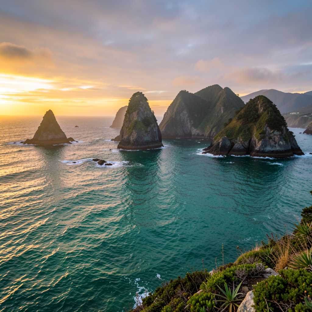
Discover Baja's Untamed Beauty: Gray Whales, Desert Beaches, and Tacos
Let’s be honest—when most people picture Baja, they default to Cabo’s rowdy beach clubs or the cruise-ship chaos of Ensenada. But the real magic lives about two hours north of those crowds, in the quiet lagoons where gray whales finish a 10,000-mile migration from Alaska every winter. I’m still not over the fact that these animals—each weighing as much as a school bus—will swim right up to your panga, roll onto their backs, and let you scratch their bellies. Biologists call it “friendly behavior,” and it’s almost exclusive to Baja’s lagoons like Magdalena Bay and Laguna San Ignacio. The leading theory is that the whales, protected here for decades inside the UNESCO-recognized El Vizcaíno Biosphere Reserve, have simply lost their fear of boats. That’s not speculation—it’s a documented shift in behavior observed since the 1970s, when local fishermen first started noticing mothers bringing their calves closer each season.
You’ll also see them “spy-hop,” lifting their heads vertically out of the water like periscopes, and while researchers still debate whether it’s for curiosity or communication, I’ll tell you this: standing eye-to-eye with a 40-ton mammal that chose to come say hello rearranges something in your brain. And it’s not just the whales. The Sea of Cortez on Baja’s other flank holds over 900 species of fish and 32 types of marine mammals, making it one of the most biodiverse bodies of water on Earth. From October through April, whale sharks up to 12 meters long filter-feed right off La Paz, and you can snorkel beside them without needing scuba gear. Over on Isla Espíritu Santo, the world’s largest California sea lion colony—over 10,000 animals—will swim circles around your kayak. Meanwhile, the desert itself is no afterthought: the endemic cardón cactus, which can tower 12 meters high and live past 200 years, puts on a silhouette show at sunset that rivals anything you’ll see in the water.
Then there’s the beach situation. Playa del Amor on the Islas Marietas is basically a hidden cove you can only reach by swimming through a volcanic tunnel—think of it as nature’s speakeasy. But honestly, you don’t need a secret beach to find solitude. Much of Baja’s coastline between Loreto and La Paz is still undeveloped, just raw desert running straight into turquoise water. And of course, you’re going to eat. The original Baja fish taco was born in Ensenada—a fisherman’s invention that married battered local catch with cabbage, crema, and a squeeze of lime, borrowing from both Mexican coastal cooking and American fish-and-chips. That style has been perfected over decades, and while everyone talks about the ones at La Guerrerense or the street carts near the port, my recommendation is to find a tiny palapa shack where the cook is also the fisherman who caught your shrimp that morning. It’s not complicated food—it doesn’t need to be. What makes it unforgettable is the context: you’re eating it on a beach where the only sound is waves and the occasional splash of a gray whale breeching a hundred yards out. That’s the Baja I’d come back for every single year.
California Dreaming: Iconic Coastal Drives, Redwood Giants, and Urban Gems
Look, we've all seen the postcards of the Golden Gate Bridge and the Hollywood sign, but California is really a study in extremes that you only get when you actually hit the road. I want to talk about the North Coast first, because that's where the real scale of this place hits you. Most people just breeze through on Highway 101, but you've got to take the Avenue of the Giants. It's a 31-mile stretch through Humboldt Redwoods State Park that protects over 10,000 acres of old-growth forest. It's wild to think that these trees basically manufacture their own weather; scientists have found that fog drip provides up to 40% of their annual water. But here's the catch: fog frequency has dropped by about 33% since the early 1900s, which makes these groves more fragile than they look.
If you're looking for those "bucket list" roadside stops, you might try the drive-through trees, but they're becoming rare. There are only three left on the coast. I'll give you a heads-up: if you're driving a modern SUV through the Chandelier Tree in Leggett, be careful. The tunnel is only six feet wide, and it's way too easy to scrape your mirrors on wood that's been there since 1937. And while everyone wants to find Hyperion—the 380.9-foot record holder—the park keeps its location a secret. They have to, because too many boots on the ground compact the shallow root systems, and a tree that transpires 500 gallons of water a day can't handle a crowd of tourists.
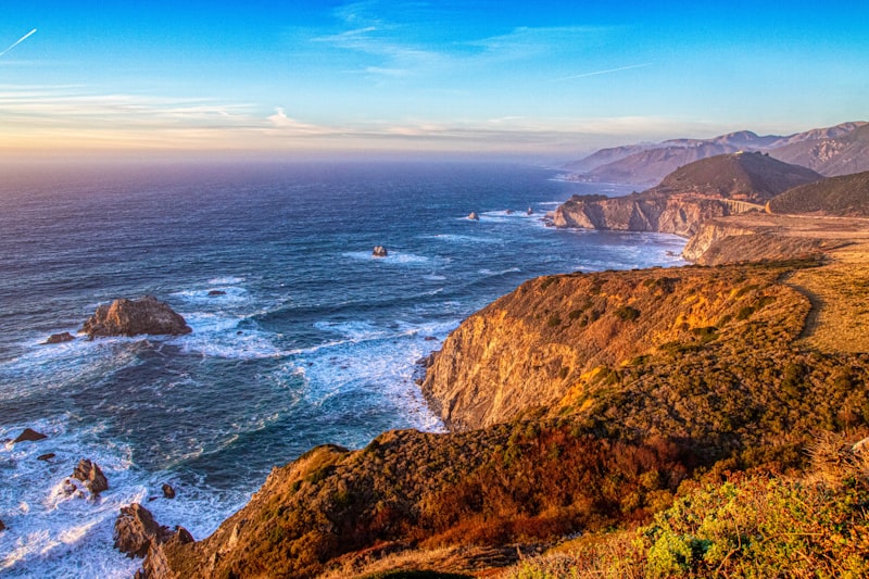
Moving south to the coast, you'll hit the Bixby Creek Bridge. It was a huge deal in 1932 as the longest reinforced-concrete arch span in the world, and it saved drivers from a brutal seven-mile dirt detour. But let's be real about Big Sur: the road is a gamble. Since 2010, landslides have shut down Highway 1 at least five times, usually after "rain-on-snow" events that dump 20 inches of water in a week. It's a constant battle between the engineering and the elements. It's a reminder that the "iconic" views come with a side of geological instability.
Once you hit the cities, the stories get even weirder. Take San Francisco—everyone raves about Lombard Street being the "most crooked," but honestly, Vermont Street is actually sharper. And that "International Orange" on the Golden Gate Bridge? It was literally just primer. The Navy wanted yellow-and-black stripes for visibility, but the architects won the fight for the orange. Then you've got LA, where the Hollywood Sign started as a real estate ad called "Hollywoodland" back in '23. If you want a break from the hype, head to the Griffith Observatory. You can see 9,000 stars in the Zeiss projector and find the James Dean bust, which feels like a much more authentic way to experience the city than fighting traffic on the 405.
Oregon Coast Adventures: Rugged Shorelines, Sea Stacks, and Crater Lake
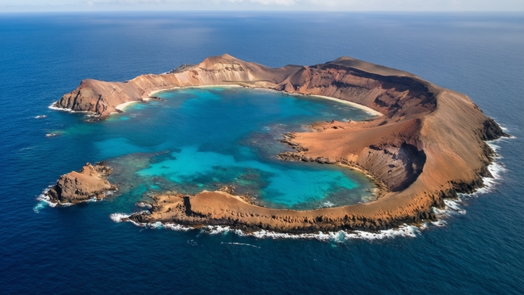
If you think you’ve seen everything the Pacific Northwest has to offer, you haven’t really looked at a map of the Oregon coast lately. We’re talking about a 363-mile stretch of Highway 101 that is way more than just a pretty drive; it’s a raw, unfiltered look at what happens when the Pacific Ocean slams into ancient basalt flows. Most people just stop at Cannon Beach to snap a photo of Haystack Rock, but that 235-foot monolith is actually the third-largest intertidal rock in the world, and it’s basically the tip of a massive volcanic iceberg. I’ve spent a lot of time comparing coastal geologies, and honestly, the way these sea stacks at Bandon host nearly 1,500 tufted puffins makes it a far more compelling wildlife stop than the more crowded spots up north. You really have to time your visit for low tide, though, because that’s the only way you’ll see the "Ghost Forest" at Neskowin. It’s a haunting collection of 2,000-year-old Sitka spruce stumps that only appear when the sand shifts, a direct result of that massive 1700 earthquake that literally reshaped the coastline.
And let’s talk about the power of the water here, because it’s not just about the views. At Thor’s Well, you’re looking at a collapsed sea cave that looks like it’s draining the ocean into the center of the earth, but it’s actually a masterclass in hydraulic pressure. The water there can be dangerous, and I’d argue the risk is part of what makes it feel so authentic compared to the manicured boardwalks you find in California. If you head south, the Oregon Dunes are a whole different beast—forty miles of shifting sand that actually migrate up to 30 feet a year. It’s the largest expanse of coastal dunes in North America, and it’s a stark reminder that this landscape isn’t static; it’s moving whether we’re watching or not. The fog here isn’t just a nuisance for drivers, either; it provides about 30 percent of the moisture for the local flora, creating these lush, almost Jurassic-looking ferns on cliffs that should technically be too dry to support them.
But the real analytical pivot in this road trip happens when you leave the salt air and head inland to Crater Lake. You’re moving from sea level to over 6,000 feet, and the data on this place is just wild. Because there are no inlets or outlets, the water is some of the purest on the planet, with a Secchi depth of 43.3 meters—meaning you can see down over 140 feet before the disc disappears. It’s the deepest lake in the US at 1,943 feet, and it stays a chilly 38 degrees year-round, which makes for a very brief swimming experience if you’re brave enough to take the plunge at Cleetwood Cove. I love the historical irony of the place, too; back in 1886, the USGS actually lowered a 12-year-old boy named Arthur Dutton on a rope to measure the depth, and his 1,996-foot finding is only off by about 50 feet from what modern sonar tells us. That’s some impressive old-school data collection. Whether you’re looking at the phantom sinkholes of the coast or the volcanic legacy of Wizard Island, this part of the West Coast doesn't just offer a view—it offers a deep, measurable connection to the planet’s bones.
Washington's Wild Edge: Olympic Rainforests, San Juan Islands, and Pike Place
Washington's state line isn't just a geographic boundary—it's a complete shift in tone. You're going from the sun-baked deserts and sea stacks of Oregon straight into a landscape that feels like it was designed by a different planet. And I mean that literally. The precipitation gradient alone is staggering: the Hoh Rain Forest, tucked deep inside Olympic National Park, receives up to 140 inches of rainfall per year, while just 40 miles away, the town of Sequim sits in a rain shadow and gets only 16 inches—that's a greater difference in moisture than almost anywhere in the lower 48. I've spent a lot of time comparing weather patterns across the Pacific Northwest, and honestly, that kind of dramatic shift explains why the Hoh's 300-foot Sitka spruce trees thrive in fog drip and moss while Sequim is practically a desert. Think about it this way: that rain isn't just falling on trees; it's feeding an ecosystem where the Quinault Rainforest holds the record for heaviest annual rainfall in the contiguous US, with some years exceeding 170 inches. And yet, just a few hours from those rain-logged valleys, you're staring at glacial peaks like Mount Olympus, where the Blue Glacier still moves—though it's losing ice volume at a rate that concerns the hydrologists I follow on X.
\Here we enter the San Juan Islands, which are basically the result of glacial ice carving out the land during the last Ice Age. You get over 170 islands and islets scattered across the water, and the largest—Orcas Island—feels like its own small country. This is where the southern resident killer whales patrol, and their social structure is fascinating: they're matrilineal, meaning offspring stay with their mothers for life, and each pod has a unique dialect of calls passed down through generations. I've read the research, and it's not just a cute fact—it's a neurobiological phenomenon that mirrors how human languages evolve. What makes it even more compelling is that the local whale-watching culture is deeply tied to conservation; these creatures are essentially ambassadors for an entire marine ecosystem. Now, you can kayak these waters, and the current can be tricky, but the payoff is this: you're watching a 40,000-pound animal interact with a habitat that's been shaped by glaciers, not highways. And there's the Pig War of 1859, which sounds absurd—a dispute over a pig that almost led to a military conflict between the US and Britain—but the islands remained American, and the story became a little piece of historical trivia that locals love to bring up over dinner. The island's current economy relies heavily on ferry tourism and sustainable farming, a sharp contrast to the industrial sprawl you'll find on the mainland.
\Let's circle back to Seattle for a moment, because Pike Place Market—opened in 1907—is one of the longest continuously operating farmers' markets in the country. The fish-throwing tradition didn't start as a gimmick; it began in the 1980s as a practical way to move heavy fish through crowded aisles without tripping over each other. It's now regulated by market rules, and while it might seem like a photo op, it's actually a highly efficient system. Then there's the Gum Wall, which started in the early 1990s when theatergoers waiting in line for the adjacent Market Theater started sticking gum on the wall. It's now a bizarre tourist attraction, despite periodic cleanings, and it's a stark reminder that some of the most iconic moments in travel are born from pure, unscripted human behavior. That's what I love about Washington: the natural world doesn't just sit in the background; it's intertwined with the culture in ways that feel tangible. You can stand in a rainforest where trees have been alive for 500 years, then drive a short distance to a market where a fish flies through the air every few minutes, and by the time you board a ferry to the San Jans, you're already recalibrating what you thought you knew about the West Coast.
British Columbia's Coastal Wonders: Vancouver Island, Whales, and Mountain Vistas
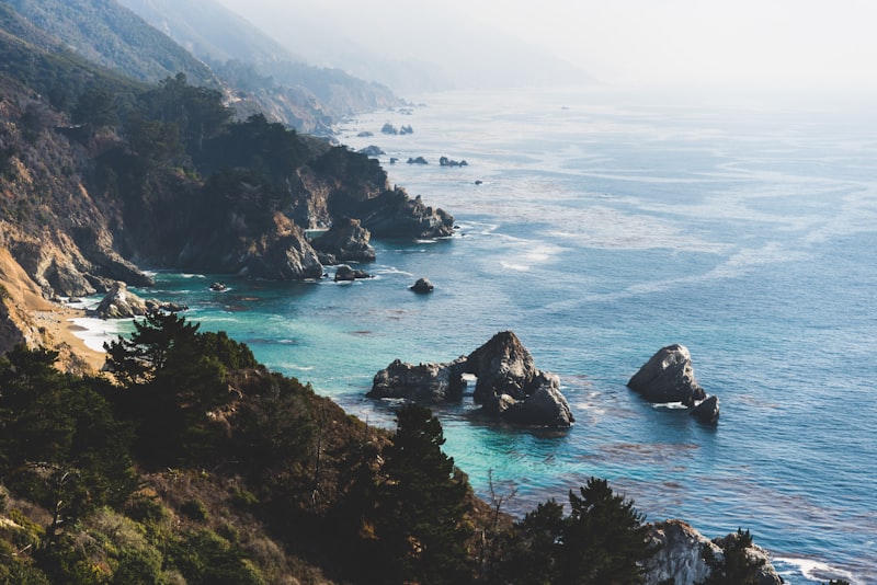
Look, we've hit the northern ceiling of our trip, and honestly, British Columbia is where the scale of the West Coast finally feels complete. If you think you've seen enough whales after Baja and Washington, you're missing the real data: the waters around Vancouver Island host 23 different species of cetaceans. I'm talking about everything from the common humpback to the North Pacific right whale, which is so rare now that fewer than 30 individuals remain in the eastern Pacific. It's a bit heartbreaking, really, and you see that tension in the southern resident killer whales too, where nutritional stress from disappearing Chinook salmon has led to a 69% pregnancy failure rate. It's not just "nature"; it's a fragile biological system fighting for air.
But let's pivot to the stuff that actually blows your mind, like the glass sponge reefs off the west coast. These things are over 9,000 years old, making them the oldest living animal structures on Earth, and we didn't even know they existed until 1987. Think about that—a massive, ancient biological city hiding in the deep until we finally looked. Then you've got the rainforests, where trees hit 1,500 years in age, though I've noticed a trend in the research showing carbon sequestration is dipping because warmer winters are cutting fog-drip moisture by about 30%. It's that same pattern we saw in the Redwoods, and it's a reminder that these "timeless" forests are actually quite vulnerable.
If you're into the peaks, you've got to look at Golden Hinde. At 2,195 meters, it's the island's highest point and the eroded core of a 50-million-year-old volcano. But here's the reality check: its summit glaciers have shrunk by 40% since 1980. It's a stark visual of what's happening globally. And for the tree hunters, the Red Creek Fir near Port Renfrew is a monster—74 meters tall with a 13.2-meter girth—but like the Hyperion in California, the authorities keep the exact spot secret to stop people from stomping the soil into concrete.
Before you head home, just spend a moment staring across the Strait of Georgia. If the temperature inversion is just right, you might catch a Fata Morgana mirage, where the Coast Mountains look like they're literally floating above the water. It's a wild optical illusion that's fooled plenty of sailors. Whether you're surfing 20-meter swells in Tofino or tracking dolphin signature whistles with machine learning, BC isn't just a destination; it's a high-resolution look at the planet's extremes. I'd suggest booking a zodiac tour on the west coast—it's the only way to really feel the power of the Pacific.
Planning the Ultimate West Coast Road Trip: Routes, Seasons, and Pro Tips
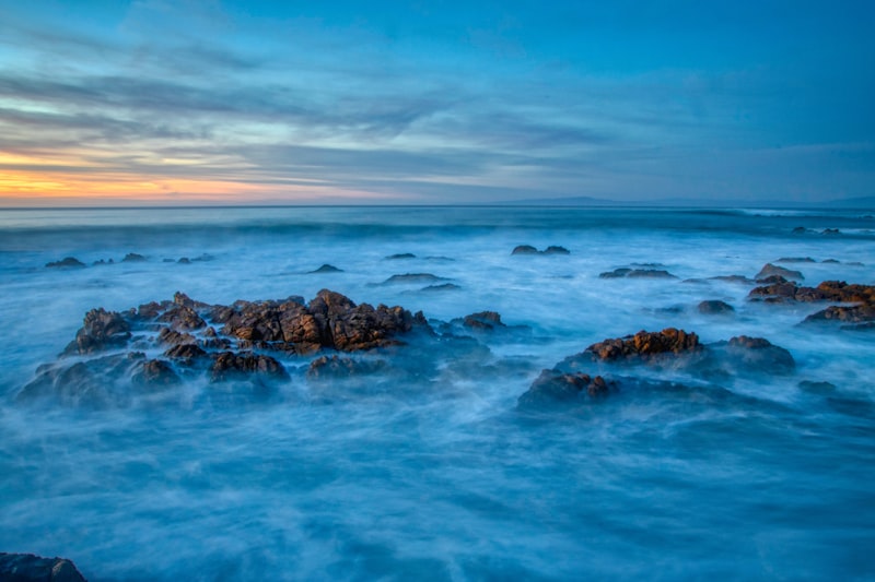
Let’s be real for a second: planning a West Coast road trip across 1,500 miles of coastline isn’t just about picking a playlist and pointing the car west—it’s a logistics puzzle that can make or break the whole experience. The biggest fork in the road is whether you take the coastal route (Highway 1/101) or the inland I-5 corridor, and here’s the hard data on that choice: the coastal route adds about four hours of driving time from San Francisco to Seattle, but it also packs 22 percent more curves and grades over 5 percent, which in a campervan can drop your average speed below 40 mph and spike fuel consumption by nearly 25 percent compared to the I-5 at 55 mph. That’s not just a trade-off—it’s a fundamental constraint on how far you can realistically push each day. And if you think you’ll just wing it on Highway 1, consider that the stretch between San Simeon and Ragged Point is closed an average of 60 days per year, triggered by atmospheric rivers that dump over 10 inches of rain in a single day. Your statistical window for a clean drive there is tightest from late August to early October, which aligns perfectly with the season when June Gloom finally lifts—that stable marine layer that can keep visibility under a mile until early afternoon, making sunrise photography a fool’s errand in June but a dream in September.
\When it comes to seasonality, late October is the underrated sweet spot that most guidebooks overlook. Crowds drop by 70 percent compared to August, the rain hasn’t fully arrived yet, and migrating gray whales are already passing the Oregon coast—so you get front-row wildlife viewing without the summer markup on lodging. But here’s the catch: if you’re aiming for Redwood National and State Parks between Memorial Day and Labor Day, you need to book your campground exactly six months in advance to the day, because sites like Jedediah Smith’s 44 spots sell out within minutes of their 8 a.m. release. And it’s not just campgrounds—California now requires day-use parking reservations at 28 popular coastal parks including Julia Pfeiffer Burns and McWay Falls, and skipping that step can result in a $65 citation for parking on the shoulder of Highway 1. So the planning window isn’t weeks out; it’s half a year ahead for the best stops.
\Let’s talk about the quiet killers of a West Coast road trip. The most common mechanical failure is a cracked windshield from flying gravel on Oregon’s Highway 101, where chip repairs spike 40 percent between March and May—so budget for that and carry a repair kit. If you’re driving an electric vehicle, the 600-mile stretch from Crescent City, California to Astoria, Oregon has only two public fast-charging stations as of July 2026, meaning you’ll need to plan charge stops with surgical precision or risk being stranded in a coastal fog patch. And here’s a packing reality check: the temperature differential between coast and inland valleys can exceed 30 degrees Fahrenheit in a single day, so you genuinely need both a down jacket and swim trunks in the same bag—that’s not a packing error, it’s a requirement. The most realistic timeline for the full Vancouver to San Diego scenic route is over 30 hours of driving even without stops, once you factor in construction, wildlife jams, and the dozens of mandatory turnouts. So my advice: don’t try to see it all. Pick a 300-mile segment, book everything six months out, and drive it in late October—you’ll get the clearest skies, the thinnest crowds, and the best chance of actually enjoying the road instead of fighting it.
Research Methodology & Editorial Standards
We begin by defining the specific objectives the reader needs to accomplish. Primary product documentation and authoritative secondary sources inform every guide before drafting begins.
Figures and rules are checked against the sources available at the time of publication. Travel pricing changes constantly — always confirm current fares, rates, and terms with the provider before booking.