Why Mexico is the ultimate destination for combining world class surfing and mountain escapes
You’ve also got the Sierra Madre Occidental, which isn't just a mountain range; it’s the largest continuous temperate forest on the planet.
From Pacific Swells to Sierra Peaks: Mexico’s Unique Topography
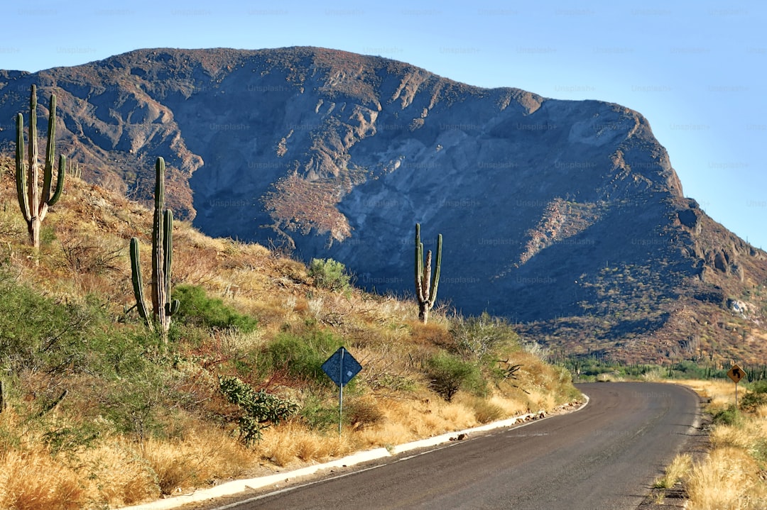
When you look at a map of Mexico, it’s easy to see it just as a long stretch of land, but the actual geology is doing something much more radical. Honestly, it’s all about the collision of the North American, Cocos, and Pacific tectonic plates, which forces the earth upward with a intensity you don't really find elsewhere. Think about it this way: you have the Altiplano Central plateau sitting at over 2,000 meters, yet you can drive from that thin, high-altitude air down to a Pacific surf break in just a few hours. That rapid change in elevation is exactly what makes the geography here so wild for anyone trying to chase both snow and swells in a single trip. And while the Baja Peninsula is literally drifting away from the mainland at about six centimeters every year, the mainland itself holds things like the Copper Canyon, which is honestly way more massive than the Grand Canyon if you actually look at the scale.
The Trans-Mexican Volcanic Belt acts as a massive bridge between the two oceans, and it’s home to Pico de Orizaba, where you’ll still find the Gran Glaciar Norte holding on in the tropics. It’s a strange, cool contrast when you consider that just a few hundred miles away, the Basin and Range province is creating these totally isolated desert basins that dictate everything about the local water supply and snowpack. You’ve also got the Sierra Madre Occidental, which isn't just a mountain range; it’s the largest continuous temperate forest on the planet. It functions like this huge biological highway that links alpine zones directly to the coastal plains, which explains why you run into such a crazy amount of biodiversity, especially if you’re looking at reptile species, where Mexico basically leads the world.
If you head further south, the vibe shifts again as the Chiapas Highlands pull in moisture from the Gulf to create these hyper-humid cloud forests that feel nothing like the arid volcanic peaks in the north. Then there is the subterranean side of things, like the Sistema Sac Actun in the Yucatán, which is currently the longest underwater cave system anyone has ever mapped. It’s a weirdly perfect setup because the deep oceanic trenches near the Revillagigedo Islands churn up that massive, consistent swell energy that hits the Pacific coast so reliably. Most people don't realize that the exact same tectonic forces pushing these mountains into the sky are also the reason the surf is so consistently world-class. It’s rare to find a place where the underwater bathymetry is as interesting as the high-altitude peaks, and that’s why I think this landscape is pretty much in a league of its own.
The Oaxaca Connection: Where Pristine Surf Breaks Meet the Sierra Sur
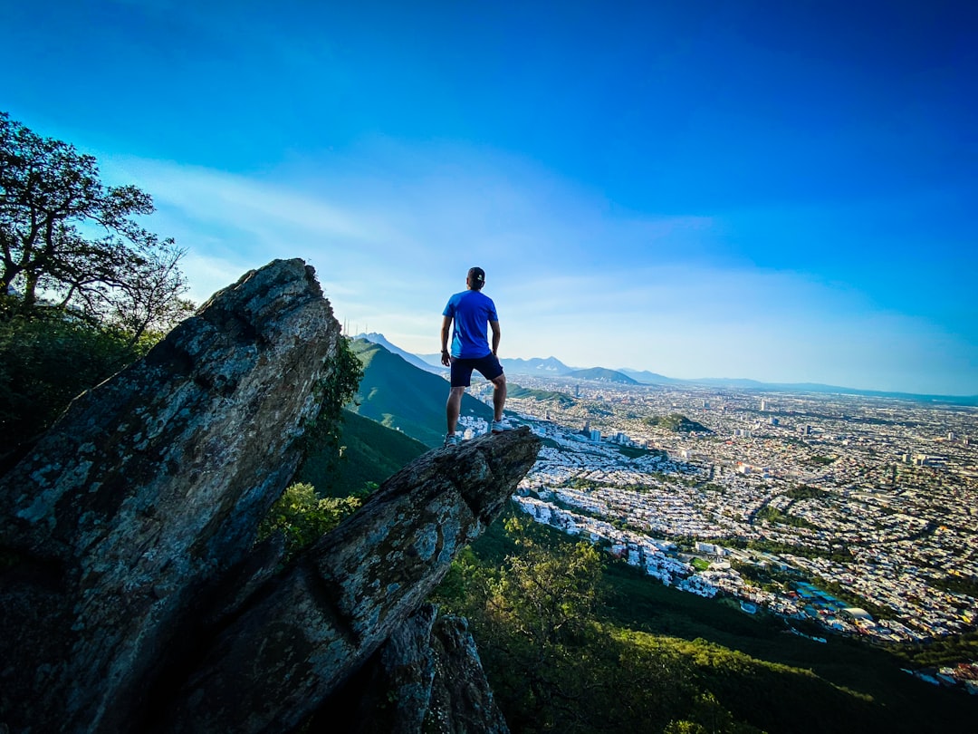
When we look at the Oaxacan coast, it’s easy to get distracted by the waves, but the real story is in the Sierra Sur mountains looming just behind the beach. You’ve got these peaks hitting over 3,000 meters just 50 kilometers from the ocean, creating one of the steepest elevational gradients you’ll find anywhere in North America. Think about the mechanics of that—it’s an orographic barrier that pulls moisture from the Pacific and forces it upward, creating a bizarrely specific mix of dry tropical forests and high-altitude cloud forests. Honestly, it’s this exact physical layout that makes the region a biodiversity hotspot, holding more endemic plant species than almost anywhere else in the country.
The connection to the surf is just as technical as the geology. Because the Middle America Trench drops to over 6,000 meters just offshore, deep-water swells hit the sand with almost zero energy loss, which explains why spots like Zicatela can produce such massive, hollow barrels. I’ve noticed that the submarine canyon offshore acts like a lens, focusing that raw power directly onto the sandbar. You also get a cool micro-climate effect where cold air drains down the river valleys at night, grooming the waves into clean offshore conditions right at sunrise before the heat turns the wind around.
It’s wild to think that the same tectonic activity pushing the land up by two or three millimeters every year is constantly shifting these breaks. Beyond the surf, those mountain peaks act as a massive corridor for migrating raptors using the thermals, and the runoff from the igneous rock in the mountains keeps the coastal lagoons nutrient-rich for local marine life. I’ve always felt that the Sierra Sur isn’t just a backdrop for a trip; it’s the engine that keeps the entire ecosystem—and the surf quality—running. When you’re standing on the beach, you’re basically watching a massive, ongoing geological experiment that happens to offer some of the best wave energy on the planet.
Baja California’s Dual Personality: Desert Waves and High-Altitude Mountain Retreats
Baja California feels like two entirely different planets stitched together by a single, jagged spine of granite. If you spend your morning watching the Pacific swell wrap around the Cedros Deep—which, by the way, acts as a massive bathymetric lens to sharpen wave energy—you’re basically witnessing raw, clear-water power that the mainland just can’t replicate because it lacks our sediment-free coastal shelves. Then, in the span of a few hours, you can drive up into the Sierra de San Pedro Mártir. Standing at the base of the 3,096-meter Picacho del Diablo, you’re suddenly surrounded by native Jeffrey pines rather than the cacti that define the desert floor just a few thousand meters below. It’s a total head-trip to be in an alpine sky island where it actually snows, especially when you know that just down the hill, the arid desert is doing its best to bake everything in sight.
The way the water moves here is just as technical as the mountain weather. While those high-altitude meadows in the Sierra de Juárez are busy acting as essential catchments for the peninsula’s rare mountain springs, the Gulf side is dealing with some of the most violent tidal shifts on the planet. I’ve seen the water drop or climb six meters in a single cycle, which is a massive contrast to the more predictable Pacific side. Geologically, you’re looking at a series of tilted fault blocks, which explains why the eastern side of the peninsula drops off like a cliff into the Gulf while the Pacific side slopes away with a much softer, more gradual touch. It’s honestly the reason the landscape feels so lopsided and dramatic when you’re driving through it.
That thermal regulation from the deep channel between the peninsula and the mainland is the only reason the coastal air stays as mild as it does; without it, the desert heat would be completely unmanageable. You’ve got these weird, alien-looking boojum trees holding down the central desert, while just off the coast, gray whales are finishing their massive migration from the Bering Sea to hide out in our lagoons. It’s a weirdly balanced ecosystem where the mountains keep the desert alive through hidden runoff, and the deep ocean keeps the surf world-class by protecting the water clarity. If you’re looking for a place where the geography is constantly testing your expectations, this is it. It’s not just a vacation spot; it’s a living, breathing experiment in how two extremes can coexist in one long, narrow strip of land.
Coastal Climates and Highland Cool: Mastering the Seasonal Shift
The beauty of planning a trip through Mexico in June really comes down to mastering the verticality of its climate, which feels like playing a game of atmospheric hopscotch. You’re essentially working with an adiabatic lapse rate that drops the temperature by roughly 6.5 degrees Celsius for every 1,000 meters you climb, meaning you can easily swap tropical coastal humidity for a crisp, temperate mountain breeze. I’ve found that the real secret here is the Sierra Madre Occidental, which functions as a massive thermal buffer; it stops that brutal Sonoran Desert heat from wrecking the high-elevation ecosystems just a short drive inland. While the coast is hitting its peak heat, those alpine plateaus stay remarkably comfortable because their dew point is significantly lower, effectively knocking the heat index down by more than 10 degrees.
This isn’t just about comfort, though; it’s about how these mountains physically dictate the quality of your surf. Because of the diurnal pressure differential between the cooling mountain air at night and the solar-heated plains, you get that classic, reliable offshore wind that grooms the waves into glass-like perfection every single morning. It’s a fascinating, repeatable phenomenon where the mountains essentially act as an engine for the surf conditions. Plus, the rain shadow effect created by these ranges keeps the coastal regions much drier during this transition, ensuring you get that consistent sunshine even when you know the cloud forests just 50 miles away are dealing with heavy, localized convective storms.
If you’re looking at the data, the seasonal shift in the Intertropical Convergence Zone is what triggers this humidity spike on the coast, but the higher alpine peaks remain blissfully unaffected by that thick, heavy air. You can actually traverse four distinct climate zones, moving from tropical savanna to alpine tundra in less than five hours, which is just wild when you think about it. I always try to time my sessions with the June transition because that’s when coastal wind speeds are at their lowest, lining up perfectly with those long-period southern hemisphere swells. It’s a rare, highly technical convergence of geography and meteorology that makes this specific window the gold standard for anyone trying to balance high-altitude trekking with world-class wave hunting.
Planning Your Surf-to-Summit Itinerary: Logistics for the Adventurous Traveler
Planning a trip that toggles between catching overhead barrels at sunrise and trekking through alpine pine forests by midday is as much about logistics as it is about the gear you pack. If you’re looking to actually pull this off, you need to understand that the vertical transition in places like Oaxaca isn’t just a scenic drive; it’s a controlled descent through the adiabatic lapse rate, where you lose about 6.5 degrees Celsius for every 1,000 meters you climb. I usually suggest timing your transit for the June shift of the Intertropical Convergence Zone, because that’s when coastal wind speeds hit their annual low, perfectly syncing up with those consistent, long-period southern hemisphere swells. Think about it: you’re essentially using the Sierra Madre Occidental as a massive thermal buffer that keeps the interior plateaus cool while the coast deals with the humidity.
The real trick is playing the diurnal pressure differential to your advantage, since the cooling mountain air drains down the river valleys at night to groom the Pacific surf into glass-like perfection before the afternoon heat kicks in. It sounds technical, but it’s really just about knowing that the mountains are functioning as an engine for your entire trip. You can move through four distinct climate zones in under five hours, and because the rain shadow effect keeps the coastal regions dry while trapping convective storms in the interior, you’re far more likely to get that steady sunshine you’re chasing. I’ve always found that the biggest mistake travelers make is underestimating how much that verticality changes the game for your daily schedule.
When you’re mapping out your route, keep in mind that the underwater topography is doing just as much heavy lifting as the mountain peaks. Submarine canyons, especially around the Cedros Deep, act like massive lenses that focus and amplify wave energy, which is why the surf here feels so much more powerful and clean than on a standard, flat shelf. You’re also looking at an environment where the lack of sediment-heavy continental shelves keeps the water clarity high, making it much easier to read the breaks from the shore. And if you’re heading over to the Gulf side of the peninsula, remember that the tidal shifts can hit six meters in a single cycle; if you don’t account for that massive water movement in your logistics, you’ll definitely find yourself scratching your head on the beach wondering where the water went.
I’ve learned the hard way that you have to view the Sierra Sur and the Sierra de San Pedro Mártir not just as backdrops, but as orographic barriers that create these hyper-specific micro-climates you just can’t find anywhere else. Because the geology here is defined by these dramatic, tilted fault blocks, you can be shivering in an alpine meadow one minute and baking in an arid desert the next. It’s wild, honestly. My best advice? Don’t try to fight the landscape. Use the deep-water thermal regulation from the channel between the peninsula and the mainland to keep your base camps comfortable, and always prioritize travel during those early morning windows when the pressure gradients are working in your favor. It’s a lot to manage, but when the swell is peaking and the air is crisp, it’s worth every minute of the planning.
Beyond the Beach: The Cultural Richness of Mexico’s Mountain Pueblos
When you finally pull yourself away from the coast, you’ll find that the real heart of Mexico isn't found in a resort, but hidden high up in the mountain pueblos where life moves to a much older rhythm. I’ve spent enough time hiking through these Sierra pockets to realize that these aren't just quaint villages; they’re functioning, high-altitude labs for ancient agricultural science. Think about the milpa system, where folks intercrop maize, beans, and squash to mimic forest biodiversity; it’s a brilliant way to maintain soil health that’s been working perfectly for centuries. And honestly, the governance here is just as fascinating. Many of these communities operate under Usos y Costumbres, an indigenous legal framework that lets them keep their own administrative rules, completely independent of the standard municipal laws you’d see down in the valley.
It’s easy to get lost in the details, but look at the architecture—it’s not just for show. Those thick adobe and volcanic stone walls are actually high-performance thermal mass buffers, designed specifically to handle the brutal temperature swings that happen when you’re living thousands of meters above sea level. You’ll notice the same level of engineering in their gravity-fed irrigation canals, which use a sophisticated understanding of hydraulics to prevent erosion on these impossibly steep slopes. Even the way they approach labor is different, with the tequio system requiring every resident to contribute to public works as a core duty of belonging. It’s a level of communal buy-in that we just don't see in modern cities, and it’s why these places feel so incredibly intact.
But what really gets me is the sheer linguistic and botanical diversity preserved in these ridges. Because some of these pueblos are still only reachable by mule or foot, they’ve stayed shielded from the homogenization that’s swallowed up so many coastal towns. You’ll find elders who carry encyclopedic knowledge of thousands of medicinal plants, and in some areas, linguistic variations so specific that neighboring villages can barely understand each other. Even their corn is a marvel; they’ve selectively bred heirloom varieties over millennia to survive everything from frost-heavy peaks to damp cloud forest clearings. If you’re ever up there, take a moment to look at the terracing on the hillsides—archaeologists have found that some of these systems once supported way more people than the current populations, which just goes to show how much we’ve forgotten about living sustainably in this rugged terrain.