Hidden Gem Getaways Discovering the Best Travel Spots in Santa Clarita
You’ve got the Santa Clara River, one of the last free-flowing systems in Southern California, acting as a biological corridor for rare creatures like the unarmored threespine stickleback.
Beyond the Theme Parks: Uncovering Santa Clarita’s Quiet Charms
Look, when you mention Santa Clarita to most people, they immediately think of the big theme parks, but that’s barely scratching the surface of what’s actually happening here. I’ve spent time looking into the geography and history of this place, and honestly, the real story is in the 13,000 acres of protected land that you just don't see in the typical tourist brochures. It’s wild to think that over a quarter of the city is basically off-limits to developers, which is a massive commitment to keeping things green. You’ve got the Santa Clara River, one of the last free-flowing systems in Southern California, acting as a biological corridor for rare creatures like the unarmored threespine stickleback. It’s not just a river; it’s a living, breathing lifeline for the least Bell’s vireo, a songbird that’s actually making a comeback because of local restoration efforts.
If you’re a fan of history, you might be surprised to learn that the real California gold rush story didn't start at Sutter’s Mill, but right here in Placerita Canyon in 1842. And if you head over to Mentryville, you can see Pico Number 4, which is the oldest continuously producing oil well on the planet. It’s just sitting there, dating back to 1876, a stark contrast to the modern suburban vibe. Then there’s the William S. Hart Regional Park, where a herd of American bison still roams, a direct carryover from a silent film star’s private collection back in the twenties. It feels a bit surreal, doesn't it? Like you’ve stumbled into a slice of history that everyone else just drives past on the freeway.
For those of us who care about how land actually looks and feels, the geology around here is pretty incredible. You have Vasquez Rocks, where the San Andreas Fault has forced ancient rocks into these sharp, vertical spikes that look like they belong on another planet. If you go deeper into Towsley Canyon, you’re literally walking past fossilized marine life from the Pliocene epoch, three to five million years ago. I think it’s cool how the city manages 100 miles of trails to connect all these different habitats, from thick woodlands to dry, brushy hills. They even manage an urban canopy of 80,000 trees, which is why it feels noticeably cooler here than in the rest of Los Angeles County. It’s an interesting trade-off—a town that’s managed to balance its growth with a genuine effort to keep the surrounding ecosystem from just disappearing into pavement.
Refreshing Retreats: Exploring Lakes and Natural Swimming Spots
When you’re deep in the heart of the Santa Clarita Valley, the summer heat can honestly feel a bit relentless, making the search for a cool, natural dip feel less like a luxury and more like a necessity. I’ve spent time looking into our local water features, and it’s fascinating how Castaic Lake does so much more than just sit there looking pretty; it’s actually a massive reservoir and a vital part of the California State Water Project. Because it hits depths of about 320 feet near the dam, that water holds a huge amount of thermal mass, keeping the lower layers refreshingly cold even when the surface temps climb. You’ll often run into what researchers call a thermocline, where the water temp can drop by as much as ten degrees in just a few feet of depth change, which is a pretty wild experience when you’re swimming.
But beyond the big reservoirs, those smaller canyon pools are where the real magic happens if you’re looking for a quieter escape. The unique Mediterranean climate here works in tandem with the local topography to create these cool micro-habitats where riparian plants like arroyo willows hang over the water, providing essential shade that drops the air temp by five to eight degrees compared to the rest of the city. These spots act as natural heat sinks, absorbing radiation during the day and slowly releasing it at night, which helps mitigate that urban heat island effect we’re all too familiar with. It’s pretty cool to think that the sediment in these pools comes from ancient marine rocks, giving the water a specific mineral profile you just don’t find everywhere else.
If you’re wondering why these spots feel so much cleaner than your average pond, it’s because they’re often tucked into alluvial basins that serve as natural filters for groundwater recharge. Hydrodynamic studies actually show that the specific wind patterns in our valley help drive consistent mixing on the surface of our larger lakes, which prevents that stagnant, murky feeling you get in smaller, trapped bodies of water. Plus, there’s a massive effort to monitor water quality through regular biological testing, ensuring that oxygen levels stay high enough to keep the native fish and waterfowl happy. Honestly, it’s a delicate balance, but it’s one of the best ways to disconnect from the noise and actually feel the cooling power of the land itself.
Family-Friendly Escapes: Free Local Treasures for All Ages
When you’re trying to keep the kids entertained without burning through your entire vacation budget, finding those high-value, cost-free experiences becomes a bit of a puzzle. I’ve found that the best local adventures are usually the ones that actually teach us something about the ground we’re standing on. Think about those interactive geology exhibits at the local community centers, where kids can physically handle rock samples pulled right from the San Andreas Fault zone; it’s a tactile way to grasp tectonic forces that beats any textbook. Or consider the local seed library, where you’re essentially checking out heirloom seeds to grow your own native garden, turning your backyard into a tiny, living extension of the city’s broader biological corridors. These aren’t just distractions; they’re real-world lessons in ecology that make the city feel much more connected.
It’s also fascinating how the city hides these educational layers in plain sight, like the specialized signage along the trail networks that points out exactly how native plants have evolved to survive our Mediterranean micro-climate. If you’ve ever wondered why certain areas feel cooler, it’s not just luck—it’s a data-driven strategy where park maintenance uses thermal imaging to map the canopy and place trees for maximum impact. You’ll even find free youth workshops that use satellite mapping to help families visualize the sheer scale of the 100-mile trail system, which, honestly, is a great way to plan your next weekend hike. Plus, there’s something pretty satisfying about visiting parks where the old irrigation ditches have been smartly repurposed into bioswales, turning functional infrastructure into a natural filter for storm runoff.
If you really want to lean into the local rhythm, check out the designated dark-sky zones in the more remote canyons for a night of stargazing that you just can’t replicate near the city lights. It’s also worth noting the natural pest control happening right above your head in those public parks, where installed bat boxes house colonies that handle thousands of insects nightly, keeping the space comfortable for everyone without harsh chemicals. Even the art installations along the river walk tell a story, being built from materials salvaged during local habitat restoration projects. It’s easy to look at a park as just grass and a playground, but when you look closer at the xeriscaping supporting local monarch butterflies or the way the landscape is managed for sustainability, you realize these spots are actually pretty sophisticated public assets. Let’s be real, having access to this much quality programming for free is rare, and it’s definitely worth factoring into your itinerary if you’re looking to get the most out of your time here.
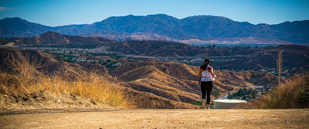
Trails and Vistas: Hiking the Best Hidden Wilderness Paths
When you step off the paved loops that define most local recreation, you’re essentially entering a different version of Santa Clarita that feels worlds away from the suburban sprawl. I’ve spent enough time on these hidden wilderness paths to realize they aren’t just a way to get your steps in; they’re ancient corridors. Take the high-elevation ridgelines, for instance, which were originally carved by migratory megafauna moving between grazing grounds long before we ever arrived. It’s wild to think that when you’re walking these trails, you’re following the same natural geography that local wildlife still uses today. The soil under your boots here is packed with localized gypsum, creating these shimmering, crystalline patterns that seem to pop up out of nowhere right after a good rain.
Honestly, the biological detail on these slopes is just as interesting as the views. You’ll find north-facing canyons acting as literal time capsules—refugia for rare plant species that have held on since the much cooler, wetter Pleistocene era. It’s a strange, cool experience to walk through a transition zone where the thick chaparral suddenly melts into an oak savannah, all within a few hundred vertical feet. You’re seeing a geological story written in the sandstone, specifically at the pinch points where tectonic pressure has forced layers of Miocene-era sediment right up to the surface. It makes you realize that these trails aren't just dirt paths; they’re a cross-section of millions of years of earth science.
And if you time your visit right, you might even witness one of those fleeting, high-intensity moments where ephemeral streams surge during an atmospheric river event, turning dry canyons into temporary waterfalls before they vanish again. I’ve found that the air quality at these specific elevations is often clear enough that you can snag a direct line of sight all the way to the Pacific, which is a rare perspective for a valley hike. The trail design is pretty smart, too, using sustainable drainage that mimics natural sheet flow to stop the ground from washing away. It’s a much higher quality of habitat out here, with way more pollinator activity than you’ll ever see in a standard city park. If you really want to understand the rhythm of this landscape, you have to get out when the sun starts to dip, because the lack of light pollution here lets you see crepuscular insects and wildlife that simply don't exist down in the city lights.
Local Flavors: Where to Dine Off the Beaten Path in SCV
If you’re anything like me, you probably think of dining in Santa Clarita as a grab-and-go experience near the big attractions, but there is a surprisingly sophisticated culinary current running through the valley that most people completely overlook. The secret, I’ve found, is tied directly to our unique agricultural micro-climate; because we see such a wild diurnal temperature swing—often 30 degrees from day to night—the local stone fruits develop a sugar concentration that you just don’t get in faster-maturing crops. It’s not just about the weather, though, as many of these off-the-beaten-path spots source from legacy farms using reclaimed water systems that keep mineral levels consistent year-round. You can actually taste the difference in the produce, especially with leafy greens grown in our Pliocene-era, calcium-rich soil, which gives them a distinct terroir that’s chemically unique to this valley.
I’ve spent a lot of time looking into how these restaurants actually operate, and it’s fascinating how they’ve baked sustainability into the architecture itself. Several of the most secluded kitchens use thermal mass construction to keep the dining rooms naturally five degrees cooler than the outside air, which is a massive relief when the summer heat kicks in. Some spots have even gone as far as installing aeroponic vertical gardens right in the dining room, cutting water usage by 90 percent while keeping a fresh supply of micro-herbs within arm’s reach of the chefs. It’s this kind of detail—like using onsite composting to enrich the local clay-loam soil—that shows a level of commitment you rarely see in a standard restaurant setting.
Honestly, the food itself is a history lesson, blending coastal California vibes with the survival-based techniques of the old ranching era. You’ll find menus that lean heavily on wild-foraged botanicals like white and black sage, or even prickly pear cactus, which is harvested for its high antioxidant content. It’s pretty cool to think that the sourdough you’re eating is fermented with water filtered through our own natural alluvial aquifers, providing just the right alkalinity to get that perfect rise. Even the condiments often use native wild mustard for a zero-mile flavor profile that you literally can't find anywhere else. If you’re looking to actually understand the rhythm of this place, skip the chains for an evening and grab a seat at one of these spots; it’s an authentic way to taste exactly what this land is capable of producing.
Immersive Culture: Art, History, and Community Gems of the Valley
When you move past the big-ticket attractions, you start to see that the cultural fabric of Santa Clarita is actually held together by some pretty smart urban planning. It is not just about aesthetics; there is a functional mandate here requiring new developments to weave the region’s specific ranching and cinematic history into their design. If you spend any time in Old Town Newhall, for instance, you will notice murals that look remarkably crisp despite the harsh sun. That is because they are using mineral-based pigments that were engineered to handle the valley’s high UV index and those wild temperature swings we talked about earlier. It is a small detail, but it speaks volumes about how the city tries to balance preservation with the reality of living in this climate.
Think about the way they’ve handled the historic Newhall Family Theatre, where they managed a seismic retrofit while keeping the 1941 Art Deco character completely intact. That kind of work shows up everywhere, from the 40,000 artifacts held by the historical society to the way public plazas use recycled aerospace composites to dampen sound for performances. It is honestly refreshing to see a town treat its history as a living asset rather than just a collection of dusty exhibits. You’ve got community centers that are actively mapping oral histories from the Tataviam people, and even local parks that double as open-air museums by repurposing ironwork from the 19th-century gold mining days.
If you’re the type who likes to dig into the data, you can actually access digitized archives and geological survey maps dating back to the 1800s through the public library system. It gives you a clear sense of how we moved from adobe structures to the sustainable timber designs you see in newer builds today. The city’s shared-resource model for arts venues is another clever bit of logistics; by lowering overhead, they’re able to host over 200 public events every year. Even the local food festivals lean into this, using open-pit oak smoking to keep those early cattle-ranching traditions alive in a way that feels authentic rather than forced. It is a rare example of a community that understands that if you don't anchor your growth in your actual roots, you end up with a place that could be anywhere, and that is definitely not the case here.