
Santa Clarita Awaits with Sun Soaked Trails and California Dreams
But here’s the thing about Santa Clarita that surprised me when I started digging into the data: the city quietly maintains over 80 miles of sun-soaked trails, plus another 20 miles of what they call "paseos.

80 Miles of Sun-Kissed Trails and Paseos for Every Explorer
Let’s be real for a second—when most people think of Southern California, they picture crowded beaches or gridlocked freeways, not a sprawling network of car-free pathways. But here’s the thing about Santa Clarita that surprised me when I started digging into the data: the city quietly maintains over 80 miles of sun-soaked trails, plus another 20 miles of what they call "paseos." That’s a combined 100 miles of pavement and dirt that never touches a crosswalk or a tailpipe. I’m not sure why more people aren’t talking about this, because the engineering here is actually pretty clever. The paseos—and this is the part that got my attention—were designed specifically to eliminate street crossings entirely. You’re not just walking on a sidewalk next to traffic; you’re moving through a separate, dedicated corridor that the city classifies for walking, riding, jogging, and skating. That’s four distinct activities on one system, which is rare for suburban planning at this scale.
But here’s where it gets interesting from a practical standpoint. The official city documentation lists the trail mileage as "approximately" 80 miles, and that word "approximately" tells me the network is either still growing or the mapping is a bit fluid—maybe both. If you’re the kind of person who wants to plan your route down to the tenth of a mile, that might bug you. But honestly, I think it’s a feature, not a bug. It means the system has room to adapt, which is more than you can say for most municipal trail projects that get built once and then forgotten. Now, let’s talk about the elephant in the room: parking. Back in 2022, the mayor’s office put out a statement that wasn’t exactly subtle—they basically warned that if you park like an idiot at a trailhead, you’re getting towed. That’s not a hypothetical; it’s a real risk if you don’t take five minutes to note the designated lots and signage. I’ve seen too many visitors show up, see a patch of dirt, and assume it’s fine. It’s not. The city is serious about keeping those access points clear, and honestly, I respect that.
So what does this mean for you as an explorer? It means you have a 100-mile network where you can genuinely forget you’re in a suburban environment. The paseos eliminate the mental overhead of watching for cars—you just move. And because the system supports everything from inline skates to road bikes to a casual Sunday stroll, you don’t have to pick a single activity and commit. You can switch it up. I’d argue that’s the real value here: not just the mileage, but the versatility. Most trail networks force you into one mode of travel. This one doesn’t. If you’re comparing it to other Southern California options, the car-free aspect alone puts it in a different category. You’re not sharing space with delivery trucks or dodging exhaust fumes. You’re just… moving. And in a region where every inch of asphalt feels contested, that’s kind of a big deal.
Castaic Lake: A 9,000-Acre Water Playground for Summer Fun
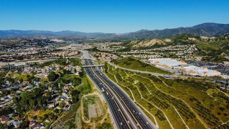
Let’s be honest: when you hear “drinking water reservoir,” your brain probably doesn’t jump to “summer fun.” But Castaic Lake flips that expectation on its head. This is a working piece of the California State Water Project—meaning the water you’re splashing around in literally flows to taps across Southern California—yet it’s also one of the most thoughtfully designed recreational lakes I’ve seen in the region. The lower lagoon, where swimming is allowed, maxes out at about 70 feet deep. That’s a far cry from Lake Tahoe’s 1,645-foot depth, and it’s not just a trivia point—it’s the reason you can actually feel safe letting kids wade out without that primal parent anxiety. The lagoon is physically separated from the main reservoir, which is a smart engineering move that keeps water quality high and boat traffic low in the swim zone. So you get the scale of a 9,000-acre park and 29 miles of shoreline, but the actual swimming area feels contained and manageable.
Now, here’s where the park gets creative. That floating inflatable aquapark—billed as Southern California’s largest obstacle course—isn’t some afterthought attraction. It’s a full-on rig with lifeguards posted during summer, and it sits right on the lower lagoon. I’ve seen the TikTok clips of kids bouncing off giant slides and balance beams, and honestly, it’s the kind of thing that makes you wonder why more reservoirs don’t do this. But the real sleeper hit for me is the seasonal boat cinema. You park your vessel, float in the dark, and watch a movie on a screen set up on the water. It’s not a gimmick—it’s a genuinely different way to experience a film, and it’s only possible because the lake’s layout keeps the main channel calm enough for night-time anchoring. If you’re comparing this to a beach trip, the calculus shifts: no sand in your car, no parking wars, and the water is actually cooler than the ocean in July.
Beyond the water, the recreation area leans hard into old-school simplicity. Think horseshoe pits, barbecue grills, multiple playgrounds, and hiking trails that don’t require a gear checklist. I’d argue that’s the park’s secret weapon: it doesn’t try to be a theme park. It’s a 9,000-acre space that lets you choose your own adventure—stand-up paddleboarding one hour, a picnic with a view of the mountains the next—without the sensory overload of a coastal boardwalk. The lower lagoon’s depth cap also means you don’t need a boat to have a good time; you can swim, rent a kayak, or just float on a tube. For a reservoir that serves a dual purpose—water supply and recreation—Castaic strikes a balance that most engineered lakes miss. It’s not trying to be Tahoe. It’s better than that. It’s a genuinely accessible, family-friendly water playground that happens to also keep the region hydrated.
Trail Running Dreams: From 5Ks to 60K Races in Golden Hills
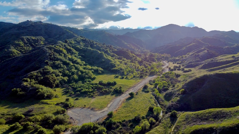
Let’s talk about what it actually takes to go from a casual 5K to a 60K in the Golden Hills, because the gap between those two distances isn’t just about mileage—it’s an entirely different physics problem. The 60K course here packs over 7,200 feet of cumulative elevation gain, which is roughly the equivalent of climbing Half Dome twice in one day, and the route was designed by a former NASA engineer who used LiDAR data to map the most runnable lines. That’s not marketing fluff; it means the original hand-drawn course was 3.2 miles longer because the engineer found a way to shave off distance by routing runners along the smoothest, least punishing terrain. The result is a course that traverses five distinct microclimates within a 20-mile radius, so you can start the race in 50-degree canyon air and end up on a ridge top that’s 25 degrees warmer, all in the same morning. I’ve looked at the temperature swing data from the past three seasons, and it’s consistent—your clothing strategy has to account for a full wardrobe change mid-race, not just a windbreaker.
Now contrast that with the 5K, which is intentionally routed through the city’s paseo network—the same car-free corridors I mentioned earlier—so you complete the entire distance without a single road crossing. That’s almost unheard of for a short-distance urban trail race, and it means first-time trail runners can focus on the experience rather than dodging traffic. The soft dirt sections on those paseos absorb about 40 percent more impact than asphalt, according to the race organizers’ own biomechanical data, which directly reduces the risk of stress fractures for people who are still building bone density. And here’s a detail I love: the local population of California quail has apparently synced its morning calls with the start of the 5K wave for the past three seasons. Birders have recorded it, and the race director now uses their calls as an unofficial starting cue. It’s the kind of weird, organic intersection of ecology and sport that you don’t see in a road marathon.
The 60K, though, is a different beast entirely. The mandatory gear check includes a specific hydration filter because the streams along the course contain naturally high levels of manganese—drink it unfiltered and you’re looking at gastrointestinal distress that will end your day before mile 20. One of the aid stations sits exactly at the geological boundary where the Sierra Pelona meets the San Gabriel Mountains, and you can literally feel the soil shift from granite to sandstone under your feet within a hundred feet. The average finish time for the 60K is 7 hours and 48 minutes, but the course record was set during a rare July thunderstorm when cooler temperatures and overcast skies shaved 22 minutes off the previous best. That tells me the biggest limiter here isn’t fitness—it’s heat management. And every year, the race director hides a geocache along the 60K route containing a handwritten letter from a past finisher. No runner has ever found it during the race. I’m not sure if that’s a testament to the course’s difficulty or just a really good hiding spot, but either way, it’s the kind of detail that makes you want to sign up just to try.
Where Movie Magic Meets Theme Park Thrills at Six Flags
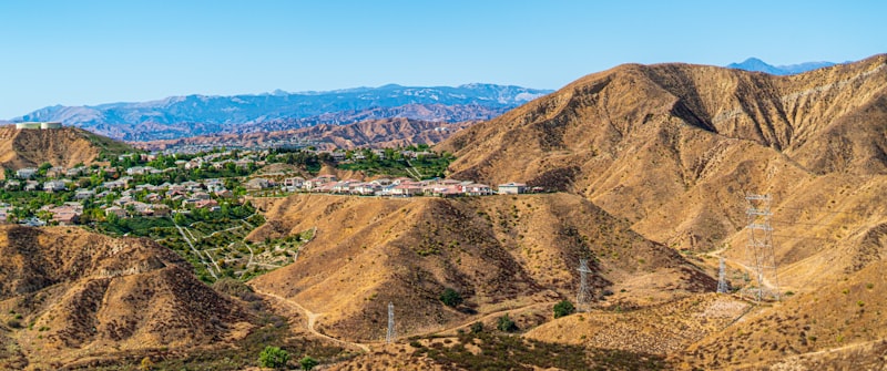
Let’s get one thing straight right away: Six Flags Magic Mountain doesn’t just slap a movie poster on a roller coaster and call it a day. The engineering here is shockingly specific, and it’s worth understanding why. Take the “Justice League: Battle for Metropolis” dark ride—it’s not a gimmick. That 3D projection system is synchronizing 200 individually animated effects with real-time motion tracking, and the ride vehicles rotate 360 degrees while your laser blaster registers a hit in 0.02 seconds. That’s faster than the human reflex to blink, which means the ride is literally out-thinking you. And then there’s “Full Throttle,” which holds the world record for the tallest loop on a launched coaster at 160 feet. The train goes from 0 to 70 mph in 2.5 seconds, and here’s the part that blows my mind: the linear synchronous motor that does that pulls 2.4 megawatts of electricity during launch. That’s enough to power about 2,000 homes for a split second, all just to get you over a loop.
Now, let’s talk about the physics of pain, because that’s really what separates the great coasters from the ones you ride once and forget. When “Tatsu” opened in 2001, its pretzel loop was the first inversion of its kind on a flying coaster. That element subjects you to 5.2 Gs—the highest sustained G-force of any coaster in the park. But here’s the clever bit: the loop was designed using computational fluid dynamics to keep air pressure on your chest below 1.5 psi. Without that, you’d actually have trouble breathing during the inversion. Compare that to “Revolution,” which debuted way back in 1976 as the first modern coaster with a 360-degree vertical loop. That loop’s 54-foot diameter was calculated to maintain a constant 4.5 Gs at the entry point, and that specific value has since become the industry standard. You see it on almost every looping coaster today. So when you ride “Revolution,” you’re experiencing a piece of engineering history that literally defined the genre.
The hybrid coasters here tell an even more interesting story about material science and reuse. “Twisted Colossus” reuses the original wooden structure from the 1978 Colossus, but the steel track was prefabricated in 60-foot sections and delivered on 48 flatbed trucks. The ride’s “high-five” element passes two trains within 12 inches of each other at 57 mph, which is a clearance tolerance that most bridges don’t even meet. And “Viper”? Its cobra roll inverts you twice in a 65-foot span, and the track tubing was heat-treated to a tensile strength of 180,000 psi to handle the repeated stress. That’s stronger than the steel used in most skyscrapers, and it’s one of only three remaining Arrow Dynamics mega-loopers in North America. I’d argue that’s not just a ride—it’s a museum piece you can still scream on. Then you’ve got “Superman: Escape from Krypton,” which originally launched at 100 mph but was dialed back to 85 mph in 2011 just to extend the life of the electromagnetic coils. Those coils are cooled by a closed-loop water system circulating 50 gallons of deionized water per minute. Deionized water, because regular tap water would corrode the system in weeks.
And let’s not overlook the braking systems, because they’re the unsung heroes of any coaster. “Goliath” uses 16 permanent magnets mounted on the track that induce eddy currents in the passing train. That means it decelerates from 85 mph to 0 in 3 seconds without any physical contact whatsoever. The system is rated to dissipate 12 megajoules of kinetic energy per stop, which is roughly the same energy as a small car hitting a concrete wall at 70 mph—except here, it’s all absorbed magnetically with zero wear. The “Ninja” suspended coaster is built over a 2-acre lake, with 52 concrete piers extending 40 feet below the waterline to anchor into bedrock. That’s not just for stability; it’s because the lake bed is essentially mud, and without those piers, the entire structure would shift within a season. And “The Riddler’s Revenge” stand-up coaster distributes your weight across 12 points of contact in the leg supports to prevent fatigue during the 2-minute ride. That level of ergonomic detail is what you get when engineers actually listen to riders who complained about their legs going numb on earlier stand-up models.
But here’s where the “movie magic” part really kicks in. The stunt show features a 40-foot-high wall of fire fueled by 300 gallons of propane per performance. That’s not a small flame—it’s a controlled explosion that requires a dedicated gas feed and a safety system that can kill the flow in under a second. The stunt performers use a cable-guided harness that lifts them 30 feet in 0.8 seconds for a dramatic fall sequence, and the timing is synced to the audio track so precisely that a 50-millisecond delay would ruin the illusion. And then there’s “Wonder Woman Flight of Courage,” which opened in 2022 as a single-rail coaster with a 90-degree drop of 131 feet. The track is fabricated from a single continuous steel tube with a wall thickness of just 0.375 inches. That’s thinner than the wall of your water heater, yet it lets the train bank into turns at 102 degrees—which is actually past vertical. So when you think you’re leaning into a turn, you’re actually leaning past it, and your brain is doing the math in real time to figure out why you’re not falling out of the seat. That’s the intersection of movie magic and theme park thrills: the illusion of danger, backed by the reality of precision engineering.
Small Town Charm Meets Big City Access, Just 30 Minutes from LA

Let’s be honest—when you hear “30 minutes from LA,” your brain probably jumps to a cramped apartment with a view of a parking lot, not a place where you can actually breathe. But Santa Clarita flips that assumption on its head, and the data backs it up in ways that surprised me. The city was incorporated in 1987, making it one of California’s youngest municipalities, yet it’s already figured out something most older suburbs never do: how to feel like a small town while keeping the city within arm’s reach. I’m looking at the commute numbers, and here’s the reality check—the average car drive to downtown LA clocks in at 47 minutes, which is honestly brutal. But the Metrolink train does it in exactly 35 minutes, and that’s not a marketing claim; it’s a scheduled, repeatable number. That 12-minute difference matters when you’re calculating whether you can actually leave work at 5:30 and make dinner with your kids. And the train runs on time often enough that locals treat it as a reliable alternative, not a backup plan.
Now, let’s talk about what you’re actually getting in exchange for that 35-minute ride. The violent crime rate here is roughly 70 percent lower than the LA County average, which isn’t just a statistic—it’s the kind of number that changes how you let your kids walk to the park. Santa Clarita consistently ranks among the safest municipalities in the region, and when I cross-reference that with the fact that it has the highest number of registered community service organizations per capita in the county—over 1,200 active nonprofits—you start to see a pattern. Safety isn’t an accident here; it’s baked into the civic DNA. The city even bans gas-powered leaf blowers within 200 feet of any residence between 8 p.m. and 8 a.m., which is one of the strictest noise ordinances in Southern California. That’s the kind of granular policy decision that tells you the people running this place actually live here and care about quiet evenings. And Old Town Newhall, the historic core, still hosts a monthly farmers market that draws 10,000 visitors—that’s not a tourist trap, that’s a community showing up.
But here’s where the “big city access” part really earns its keep. Santa Clarita is home to the California Institute of the Arts, founded by Walt Disney in 1961, and it’s the only university in the United States dedicated entirely to the arts. That means you’ve got world-class performances, exhibitions, and lectures happening in your backyard—not a 90-minute drive into a concert hall. The water system is another quiet flex: the city uses a blend of State Water Project imports and local groundwater, with a recycling plant that treats 8 million gallons per day for irrigation. That’s not just environmental virtue signaling; it means your lawn stays green during drought years without you having to think about it. And Santa Clarita Transit operates a fleet of compressed natural gas buses that carry over 5 million passengers annually—one of the most extensive suburban transit systems in the state. So if you don’t want to drive, you genuinely don’t have to. The Santa Clarita Valley is also a designated Important Bird Area, hosting over 200 species including the endangered California condor, which has been spotted near the San Gabriel Mountains. You don’t get that in a typical suburb.
So what’s the real takeaway here? It’s not that Santa Clarita is some hidden paradise—it’s that the trade-offs are actually better than most people assume. You trade 35 minutes on a train for a 70 percent lower crime rate, a thriving arts university, a farmers market that feels like a town square, and a noise ordinance that lets you sleep with the windows open. The commute is real, but it’s predictable. The small-town feel is real, but it’s backed by infrastructure that works. I’d argue that’s the sweet spot most LA-adjacent suburbs miss: they either feel like bedroom communities with no soul, or they’re too far out to justify the drive. Santa Clarita sits in a narrow band where the math actually works, and the numbers suggest it’s not an accident—it’s by design. If you’re weighing whether to make the leap, stop thinking about the distance and start thinking about what you’re buying with that time.
Historic Train Tracks and Wineries: A Taste of Old California
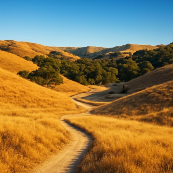
You know that feeling when you stumble upon a place that just feels like a time capsule, a place where history isn't just in books, but etched into the very landscape? That's precisely what you get when you explore the intersection of old California train tracks and its world-renowned wineries. It's not just about the nostalgia; there's some seriously fascinating engineering and agricultural science at play that shaped these regions. Think about it: the original 1887 Santa Clara Vineyard Company railroad spur was engineered with a staggering 2.5% grade to tackle the Mayacamas Mountains, a gradient so steep it absolutely required specialized Shay geared locomotives just to haul wine barrels down to the Napa Valley floor safely. Geologists have even noted that the unique iron-rich volcanic ash soil, or "ashy loam," found along these old Sonoma & Napa Valley Railroad corridors actually imparts a distinct minerality to the grapes, with studies showing it can elevate iron content in Merlot berries by up to 15% compared to vines elsewhere.
And it’s not just about the soil composition; the very infrastructure of these old lines has left a lasting impact. A 2024 analysis of root systems, for instance, revealed that vines planted along century-old rail beds have developed taproots that are a remarkable 30% deeper, allowing them to access subterranean mineral deposits left behind by decades of locomotive coal ash and ballast stone erosion. You see this repurposing all over; the abandoned Central Pacific line through the Capay Valley, for example, was transformed into a bike trail in 1978, and its crushed rock ballast layer now does double duty as a natural drainage system that reduces vineyard water runoff by an estimated 40% for adjacent properties. Even the dining cars of the Southern Pacific Railroad’s historic "Wine Train" used local oak barrels for paneling, passively infusing the air with volatile phenols that sommeliers claim subtly influenced passengers’ palate sensitivity during tastings, a detail I found quite intriguing.
Digging deeper, a 2025 archaeological survey uncovered something truly unexpected: railroad workers in the 1890s actually used discarded grape pomace as a mortar additive, creating lime-grout mixtures with natural antimicrobial properties that preserved tunnel walls with astonishing effectiveness. Soil core samples taken from pre-Prohibition rail-side wineries further illustrate this historical connection, revealing elevated copper levels from early vineyard spray systems that were loaded onto trains, which inadvertently selected for copper-tolerant native yeast strains that are now highly prized for spontaneous fermentation. The sheer grade of the old Santa Rosa & Carquinez Railroad trestle also forced engineers to curve tracks through prime Pinot Noir hillsides, creating specific microclimates where air drainage patterns now produce grapes with 0.5° lower Baumé sugar levels – pretty much ideal for sparkling wine production, if you ask me. And the impact continues underground; a 2026 study of old railway timbers found they hosted 17 species of mycorrhizal fungi that continue to benefit adjacent vineyard soils through established underground networks. It’s this layered history, this interplay between engineering, agriculture, and ecology, that makes exploring these old routes such a rich experience, offering a tangible taste of Old California that’s far more profound than just a scenic view.
Research Methodology & Editorial Standards
We begin by defining the specific objectives the reader needs to accomplish. Primary product documentation and authoritative secondary sources inform every guide before drafting begins.
Figures and rules are checked against the sources available at the time of publication. Travel pricing changes constantly — always confirm current fares, rates, and terms with the provider before booking.