
LA trail closures: verify agency status + water flow before you drive
This guide lays out a verification workflow for Los Angeles trailheads — including waterfall hikes — and explains how to confirm closure status and water flow before driving.
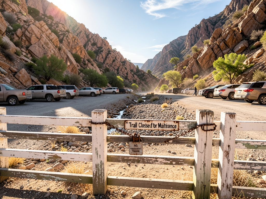
| Takeaway | Detail |
|---|---|
| Treat third-party trail status as stale within 24 hours of driving. | The thesis says AllTrails or park-map status can be hours-to-weeks stale for 2026 Los Angeles hikes. |
| Use two primary sources before committing to the drive. | The required workflow is managing-agency page plus a live camera, checked within 24 hours of driving. |
| Confirm closure with the managing agency, not a listing. | Use the NPS, US Forest Service, or city recreation department page for the trailhead. |
| Check live flow only where an indicator exists. | The reader rule says to check a live flow indicator if one exists; Paterson Great Falls lists “Waterfall Conditions” and asks about flow before visiting. |
This guide lays out a verification workflow for Los Angeles trailheads — including waterfall hikes — and explains how to confirm closure status and water flow before driving. It does not inventory specific closures; it shows you where to check them.
The practical answer is a two-source check: the managing agency's page for access, plus a live flow indicator where one exists, both confirmed within 24 hours of driving.
Why your trail app lags the ranger
The gap between what your phone says and what a ranger knows comes down to plumbing. AllTrails-style status labels are user- and editor-updated, not ranger-pushed. If a ranger logs a closure, that fact reaches the public in real time only when the managing agency publishes it on its own page. A third-party trail page changes only when a human edits the listing, so the app is a mirror of someone's later keystroke, not a live feed from the field — which is why the agency page, not the app, is the source to trust.
That distinction matters even when the label looks authoritative. AllTrails lists Bayhon Waterfall as "[CLOSED]" on a 5.8 km loop with 166 m of elevation gain and a 1.5–2 hr completion estimate. Treat that bracketed word as a title-level flag, not a live status reading. It tells you someone marked the page at some point; it does not tell you whether today's access matches that mark. Use it as your starting check, then leave the app before you commit to a drive.
The same caution applies to any crowd-maintained listing, including ones with fresh-looking review timestamps. A comment describing "great conditions" beside a "[CLOSED]" title, as seen on the Gorges of Poëta-Raisse / Môtiers Waterfalls page, is a snapshot from a visitor, not a clearance from the land manager. Reviews and flags can sit side by side and disagree because they arrive on different clocks and answer different questions.
The managing agency is the only authoritative source for access. For federal land, that means the National Park Service or US Forest Service page for the specific unit and trail — the USFS maintains trail records such as Tamanawas Falls Trail #650A on Mt. Hood National Forest, and NPS units post their own notices. For city trails, go to the relevant city recreation department. When NPS posts a park closure or street closure with alternative parking, as Paterson Great Falls National Historical Park does, that notice is the one a ranger's 9:03 AM entry feeds into.
Water is a separate question from access, and the agency may handle it separately too. Paterson Great Falls points visitors to a live Earthcam for current flow conditions alongside its closure notices. Where a live flow indicator exists, pair it with the agency access page: one tells you whether you can legally and safely get to the viewpoint, the other tells you whether there is anything worth seeing when you arrive. If either source is missing or stale, hold the trip rather than filling the gap with an app label.
The evidence: staleness is documented
The staleness problem isn't a hunch; it shows up when you put three independent sources side by side. AllTrails, the National Park Service, and waterfalls.us each treat water flow and trail access as separate variables running on different clocks. None of them folds one into the other. That convergence is the clearest evidence that a single status label can't carry both answers, and that your pre-drive check has to ask two distinct questions: is the route open, and is there water to see.
AllTrails makes the split visible on its own listing pages: as shown above, the [CLOSED] tags on Bayhon Waterfall and Gorges of Poëta-Raisse sit directly beside reviews reporting great conditions. The flag and the lived reality diverge on the same screen. Treat that as a prompt to open the managing agency's page, not as a verdict you can drive on.
The National Park Service models the better habit. Its Current Conditions page for Paterson Great Falls National Historical Park lists park and street closures alongside a separate "Waterfall Conditions" prompt, then directs visitors to a live Earthcam to see the falls' current flow before visiting. Notice the division of labor: the agency page carries the access facts, and the camera carries the water facts. The NPS itself points you to a live feed rather than asking a static status line to describe moving water.
waterfalls.us states the underlying rule plainly: water conditions and access conditions are not the same thing. A waterfall may be visually perfect but inaccessible because of rockfall, ice, flooding, or ranger closures. Its 2026 planning guide pushes the same timing discipline, describing flow as the asset and weather as the catalyst, with rainfall, runoff, snowmelt, wind, and cloud cover shifting the value of a visit window by the hour. A route can be signed open while the falls run thin; a falls can be roaring while the trailhead is shut.
Your working rule follows from that convergence. Read the listing for orientation only, then verify access on the NPS, US Forest Service, or city recreation department page that manages the trailhead, and verify flow on a live camera or flow indicator where one exists. Do both within the same short window before you leave. If the agency page is silent on water, don't let the app's cheerfulness fill the gap; if the camera shows a trickle, don't let an open gate sell you the trip.
Two checks beat one: compare your options
Once you accept that a trail app label and a ranger order are different kinds of information, the practical fix is to stop treating any single screen as final. Use three checks, but give them different weight. The managing agency tells you whether you are legally allowed in; a live camera tells you what the water and crowds look like right now; recent hiker reports tell you whether the ground matches both. The table below ranks those methods by speed and authority, and the winner is the agency page plus a live camera checked together inside your pre-drive window.
| Verification method | What it answers best | Speed | Authority | Main weakness |
|---|---|---|---|---|
| Managing agency page: NPS, US Forest Service, city parks | Closure status and official access | Fast to open; updates when the agency acts | Highest | May not show current water flow |
| Live camera | Near-real-time flow and crowd conditions | Highest for visual conditions | Observational, not an access order | Coverage is limited at LA trailheads |
| AllTrails and recent reviews | Ground-level hints from other hikers | High | Lowest for official status | Useful as a signal, not a clearance |
| Agency page plus live camera | Access plus flow in one decision | Best combined check | Strongest available pairing | Requires a camera or an honest non-answer |
Start with the agency page because it is the authoritative source for closures. For a national park site, use the National Park Service current conditions page; for national forest land, use the relevant US Forest Service trail page; for local open space, use the city or county recreation department. The National Park Service’s Paterson Great Falls page is a useful model because it separates park and street closures from waterfall conditions, then points visitors to a live Earthcam for the current look of the falls. That separation is exactly what you want when you verify an LA waterfall hike: one screen for permission, another for flow.
The camera check is the second half, but only when one actually exists. Search “[trail name] live camera,” “[waterfall name] webcam,” and the managing agency’s name together. If you find a live feed, use it for two things: whether water is moving enough to justify the drive and whether the parking area or viewpoint looks crowded. If you find no camera, record that as a non-answer. Do not convert “no camera found” into “conditions are fine.” Absence of coverage is not a pass; it simply means you have to rely on the agency page for access and treat flow as unverified.
AllTrails and recent reviews still have a place, but they belong at the bottom of the decision tree. Use them as a fast signal for ground truth: a recent comment mentioning a locked gate, washed-out approach, or dry cascade is worth reading before you leave. Then take that signal back to the agency page or camera. A review can tell you what someone observed; it cannot substitute for the agency’s closure order, and it cannot show you the stream at the moment you are leaving. The comparison is not about picking one perfect app. It is about ranking sources so the official access check and the live visual check outrank the crowd-sourced hint.
That is why the agency-page-plus-camera combo wins. It covers the two variables that travel on different clocks: access and water conditions. Water conditions and access conditions are not the same thing, as waterfalls.us notes; a waterfall may look good while rockfall, flooding, ice, or a ranger closure blocks the route. Before driving, open the agency page, search for a live camera, and make the call from those two checks. If either one is missing or ambiguous, downgrade your confidence instead of upgrading your plans.
The cost of driving on stale data
Here is the arithmetic that should govern your pre-drive routine: a wasted Los Angeles trailhead drive costs roughly 2–3 hours round-trip plus parking and fuel, versus about 10 minutes of verification. That 10-minute check is the highest-return step in the whole workflow. Do it before you put the car in gear, not after you have already circled the lot.
The downside of being wrong in that direction is concrete. You burn the 2–3 hours on the road, pay for parking, and arrive to a gate or closure notice. For waterfall hikes, the stakes scale up: ABC News reported that with Jim Jim Falls closed for the dry season in Kakadu, one tour operator described its worst season ever, with business down 45 percent. That is what a closure costs when people discover it on arrival instead of before committing.
The opposite error is cheaper, which is exactly why the rule is asymmetric. If you skip a trail that turns out to be open, you lose one hike but keep the day. You can pivot to a nearby trailhead, shorten the outing, or still make the drive for a different objective. That asymmetry is the reason the canonical rule is to confirm before driving: the penalty for a false "open" is measured in hours, while the penalty for a false "closed" is measured in a changed plan.
Treat the 10-minute verification as two separate checks, not one: the agency page for access, and a live flow indicator for water, as detailed in the workflow above. Keep the two answers distinct in your notes so a good camera image does not talk you into ignoring a closure line.
Keep the two variables distinct in your notes. Waterfalls.us states that water conditions and access conditions are not the same thing: a falls can look visually perfect yet be inaccessible because of rockfall, ice, flooding, or a ranger closure. When you do the 10-minute check, write down both answers separately — "access: open/closed" and "flow: running/low/unknown" — so a good camera image does not talk you into ignoring a closure line, and a closure line does not make you assume the water is absent.
Run the arithmetic on every candidate trailhead, not just the marquee waterfall. If the agency page and the live indicator both look current within your 24-hour window, the 2–3 hour drive is a reasonable bet. If either one is missing, stale, or ambiguous, spend the 10 minutes finding a second official signal or choose a different trail. The goal is not a perfect prediction of conditions; it is avoiding the one outcome where you have already paid the drive.
What this workflow cannot tell you
Even a disciplined two-source check has limits, and knowing where it breaks helps you decide whether to drive, wait, or adjust expectations. Use this section as a final risk check: identify which uncertainty applies to your hike, apply the matching mitigation, and decide if the remaining unknown is acceptable. The table below distinguishes when the two-check rule breaks—same-day flash closures, waterfalls without live cameras, and seasonal flow ambiguity—versus when it still wins.
| Scenario | When the two-check rule breaks | When it still wins |
|---|---|---|
| Same-day flash closure | A ranger action or storm damage changes access after your morning check. | It confirms baseline status before you leave; recheck the managing agency’s page from your phone in the trailhead parking lot before starting. |
| No live camera for the waterfall | It cannot verify current water flow. | It still verifies trail access; use recent review photos dated within a week as a flow proxy and accept the uncertainty. |
| Seasonal flow is the question, not closure | It cannot tell you whether conditions favor peak flow or peak clarity. | It still confirms you can reach the falls; weigh the timing trade-off described by waterfalls.us when planning your visit. |
A closure can occur after your morning check if a ranger acts or storm damage develops mid-day. Treat your pre-drive verification as a baseline, not a final answer: load the managing agency’s page on your phone before you leave cell coverage, then check it again in the trailhead parking lot before you start hiking. If the status has changed, turn back or choose an alternate destination instead of committing to a trail that is no longer open.
When no live camera exists for a waterfall, the workflow can confirm access but not current flow. In that case, search recent trip reports or review photos dated within a week and treat them as a flow proxy rather than proof. Compare multiple images if available, note whether the creek bed looks dry or active, and accept the uncertainty before you drive. If you cannot find dated images, plan for the possibility that conditions at the falls differ from what you expect.
When your main question is seasonal flow rather than closure, an open trail tells you only that you can reach the falls. As waterfalls.us explains, the best visit often involves a trade-off between peak flow and peak clarity, so timing depends on whether you prioritize dramatic water volume or clearer views and safer footing. Use the agency check to confirm access, then weigh recent rainfall, snowmelt, and seasonal patterns to set realistic expectations. If your goal requires a specific flow condition, treat the trip as tentative until conditions align.
A waterfall Saturday
Here is the exact three-checkpoint walkthrough I run before a waterfall Saturday, with the timestamps I use and a checklist you can copy into your notes app. The point isn't to become a detective; it's to make the last look at conditions happen close enough to departure that the information still means something.
Checkpoint 1 lands at 8 PM Friday. Open the managing agency's own page — National Park Service, US Forest Service, or your city recreation department — and read the current conditions or alerts block, not the trail description. Record the status word (OPEN, CLOSED, advisory) and, if the page displays a "last updated" stamp, write that down too. A page that says OPEN with no advisory but carries an older update stamp is still your highest-authority starting point; you're logging what the agency itself published, not what a third party inferred.
Checkpoint 2 is 8:10 PM Friday. Search for a live camera covering the trailhead or falls, then scroll the last 48 hours of recent reviews on your trail app. In this walkthrough, one Thursday review says "gate closed, rangers turning cars around." That conflicts with the agency page, and the tiebreaker is simple: agency page says open, recent review says closed, so call the ranger station or check the agency's official social/X account before you commit. Don't split the difference and drive anyway. The review is a signal worth chasing, not a verdict, and the phone call or official post is what resolves it.
Checkpoint 3 happens Saturday morning before you leave the driveway — the final pass on both the agency page and the live camera, in that order. Water flow and access are separate variables, as waterfalls.us puts it: a waterfall may be visually perfect but inaccessible because of rockfall, ice, flooding, or ranger closures. The camera tells you what the water is doing right now; the agency page tells you whether you're allowed in. Paterson Great Falls National Historical Park models the useful version of this on its own site, pairing a park-closure and street-closure notice with a live Earthcam for current flow, so you can see both answers in one place.
Copy-usable pre-drive checklist: (1) Friday 8 PM — agency page status + last-updated stamp; (2) Friday 8:10 PM — live camera found or marked unavailable + last 48 hours of reviews scanned; (3) conflict present — call ranger station or check agency social/X, note the answer; (4) Saturday departure — recheck agency page, then camera; (5) both answers green, or one answer unresolved — decide accordingly. Five lines, no guesswork, and every line has a source attached.
Decision rules for the drive
Once you accept that a listing page can lag a ranger, the drive itself needs a simple ruleset. Here is the one I use for Los Angeles hikes in 2026: check the managing agency's own page, check a live flow indicator when one exists, and apply three if/then rules before I turn the key. The rules are deliberately blunt, because the point is to remove judgment calls from the parking lot.
Rule one: any closure or advisory on the agency page means do not drive. If the National Park Service, US Forest Service, or city recreation department page for your trailhead shows a closure, a street closure, an alternative-parking notice, or any active advisory, switch to your backup trailhead. It does not matter what your app says, how many recent photos show a crowd, or how clear the sky looks from your window. The National Park Service's Paterson Great Falls current-conditions page is a clean example of the format: it separates "Park Closure" and "Street Closures and Alternative Parking Locations" from "Waterfall Conditions," and points visitors to a live Earthcam for current flow. When the agency posts an access restriction in that first category, the access question is settled.
Rule two: a verification older than 24 hours is not a verification. If your last agency-page-and-camera check is more than a day old, re-run both checks before driving. A Friday-night check does not cover a Sunday hike. Conditions and postings can change while you are making other plans, and the freshness rule is what keeps a reasonable Friday decision from becoming a stale Sunday assumption. I treat the timestamp on my own check as part of the decision, not as trivia: no timestamp, no green light.
Rule three: a conflict is a prompt to ask the agency, not a reason to pick the source you like. If the agency page and a recent first-person hiker review disagree, treat the review as a signal to contact the managing agency directly by phone or through its official social account. Do not let a listing page outrank a first-person report without a tie-breaker, and do not let a single report override an agency posting either. The tie goes to a direct answer from the manager, because that is the only step that resolves the disagreement instead of guessing around it.
These rules also keep the two variables separate. Waterfalls.us puts it plainly: water conditions and access conditions are not the same thing, and a waterfall may look perfect yet be inaccessible because of rockfall, ice, flooding, or a ranger closure. So a live camera can support the flow half of your decision while the agency page controls the access half. If the camera shows a trickle but the agency page is clear, you still have an access answer and a flow answer — just not the visit you hoped for. If the camera looks spectacular and the agency page carries any closure language, rule one still wins.
Run the rules in order: agency page first, live flow check second, timestamp third, conflict tie-breaker fourth. That order matters because it prevents the most common mistake — letting an appealing image or a friendly review talk you past an access warning. When all three checks are fresh and aligned, you drive. When any one of them fails, you keep the backup trailhead ready and make the switch without re-arguing the case.
Also worth reading Best Los Angeles waterfall hikes Discover the most beautiful Discover the most beautiful Los
What to do next
| Step | Action | Why it matters |
|---|---|---|
| 1 | Open the managing agency's own page for the specific Los Angeles trailhead—NPS, US Forest Service, or city recreation department—and read its closure notice instead of trusting AllTrails or park-map status. | Third-party status can be hours-to-weeks stale for 2026 hikes, so the agency page is the closure authority. |
| 2 | Check a live flow indicator or camera for that trailhead if one exists, such as a “Waterfall Conditions” notice that asks about flow before visiting. | Live conditions can differ from the posted closure notice. |
| 3 | Complete both checks within 24 hours of driving. | The required workflow is the managing-agency page plus a live camera checked within 24 hours of driving. |
| 4 | If either source shows closed, or you cannot verify status, choose a backup trailhead within 30 minutes' drive. | It avoids gambling the trip on unverified status. |
| 5 | Repeat the same two-source check for the backup trailhead before leaving. | A backup is only useful if its status is also verified. |
| 6 | Use the 9-closure guide as your planning list, but treat every status as needing re-verification. | The guide identifies closures; live agency and flow sources decide the final go/no-go. |
Frequently Asked Questions
How current does a trail app's closure label need to be before I trust it for a 2026 Los Angeles hike?
Treat third-party trail status as stale within 24 hours of driving because AllTrails or park-map status can be hours-to-weeks stale for 2026 Los Angeles hikes.
Which two sources does the guide require me to check before committing to the drive?
The required workflow is a managing-agency page plus a live camera, checked within 24 hours of driving.
If a listing says a trailhead is open, who should I confirm the closure with?
Confirm closure with the managing agency, not a listing, using the NPS, US Forest Service, or city recreation department page for the trailhead.
Do I need to check water flow on every hike, or only under certain conditions?
Check live flow only where an indicator exists.
What should I look for on a waterfall hike before visiting?
Paterson Great Falls lists “Waterfall Conditions” and asks about flow before visiting.
Does this guide tell me which Los Angeles trails are currently closed?
It does not inventory specific closures; it shows you where to check them.
Quick answers
| How should third-party trail status be treated before a drive? | Treat third-party trail status as stale within 24 hours of driving. |
| What can AllTrails or park-map status be for 2026 Los Angeles hikes? | AllTrails or park-map status can be hours-to-weeks stale for 2026 Los Angeles hikes. |
| What is the required workflow before committing to the drive? | The required workflow is managing-agency page plus a live camera, checked within 24 hours of driving. |
| Where should a closure be confirmed? | Confirm closure with the managing agency, not a listing. |
| When should a live flow indicator be checked? | Check a live flow indicator if one exists. |
Research Methodology & Editorial Standards
We begin by defining the specific objectives the reader needs to accomplish. Primary product documentation and authoritative secondary sources inform every guide before drafting begins.
Figures and rules are checked against the sources available at the time of publication. Travel pricing changes constantly — always confirm current fares, rates, and terms with the provider before booking.