
Hike Volcanoes and Explore Creole Culture on Réunion Island
The Enclos Fouqué caldera isn’t just a big hole—it’s a collapse structure that formed when the volcano’s flank gave way, creating a natural amphitheater that now funnels lava flows toward the island’s east coast.
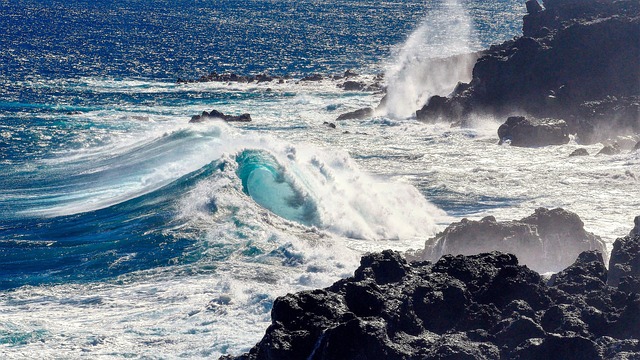
Conquering Piton de la Fournaise: A Guide to Hiking Réunion’s Active Volcano
Look, I’ll be honest—when I first read that Piton de la Fournaise translates to “Peak of the Furnace,” I thought it was just poetic license. Then I stood on the edge of the Enclos Fouqué caldera and felt the heat radiating off the basalt, and I realized the name is just a plain fact. This isn’t a dormant museum piece; it’s one of the most active volcanoes on the planet, erupting on average every nine months, yet somehow it’s also one of the most accessible summit hikes you’ll find anywhere. The standard guided route clocks in at about 9 kilometers with 500 meters of elevation gain—roughly six hours of steady walking—and you don’t need a single piece of technical climbing gear. You start from the Bellecombe parking area, drop into that massive U-shaped outer caldera, and then make your way up toward the rim of Dolomieu crater, which sits at 2,632 meters. What gets me is the contrast: you’re walking on terrain that was literally molten rock a few months ago, yet the trail is well-marked and manageable for anyone with decent fitness and a healthy respect for the ground beneath their feet.
Now, let’s talk about what you’re actually walking into, because the geology here is what separates this hike from a scenic stroll. The Enclos Fouqué caldera isn’t just a big hole—it’s a collapse structure that formed when the volcano’s flank gave way, creating a natural amphitheater that now funnels lava flows toward the island’s east coast. Inside that amphitheater, you’ve got two main craters: Bory and Dolomieu. Dolomieu is the primary active vent, the one that steals the show during eruptions, but don’t sleep on the Rivals crater—that’s an adventive cone that put on a serious display back in September-October 2022. If you’re doing a guided hike—and I’d strongly recommend it for your first time—the guides will walk you through the whole story of basaltic volcanism, turning the trek into a mobile classroom. You’ll learn why the lava here is runny rather than explosive, how the Krafft couple (the famous volcanologists who designed the Cité du Volcan museum back in 1992) essentially wrote the book on studying this mountain, and why the Plaine des Sables, that lunar-like plateau you cross to reach the caldera, feels like stepping onto another planet.
Here’s where the practical side kicks in, and it’s worth paying attention to because the infrastructure here has improved dramatically. The old volcano shelter was replaced in November 2024 with the brand-new Gîte du Volcan, built on the same site—so if you want to do an overnight or a pre-dawn start to catch the sunrise over the crater, you’ve got a solid base camp. Before you even set foot on the trail, swing by the Cité du Volcan museum; it’s not just a tourist trap, it’s a legit research-grade museum that gives you the context you need to appreciate what you’re about to see. And if you’re the type who obsesses over conditions (guilty), bookmark the live webcam on the official tourism site—it refreshes in real time and will tell you whether the volcano is currently smoking, steaming, or just basking in the sun. The bottom line? This is a hike that rewards preparation with perspective. You’re not just checking a box on a bucket list; you’re walking on active, breathing geology that changes every single day, and the only way to truly conquer it is to approach it with curiosity, not bravado.
Beyond the Crater: Exploring Réunion’s Network of Biodiverse Hiking Trails
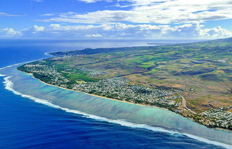
You’ve done the volcano hike, stood on the edge of Dolomieu, felt that raw geothermal pulse under your boots—and honestly, that’s a hard act to follow. But here’s what I’ve come to realize after digging into the data: the Piton de la Fournaise trek is just the headline act; the real story of Réunion’s hiking network lives in the quieter, less trampled corridors where the biodiversity gets genuinely weird. I’m talking about over 1,000 kilometers of marked trails across the Réunion National Park, and get this—fewer than 200 of those kilometers see heavy use. That leaves hundreds of kilometers of primary forest that are ecologically intact, basically untouched by the foot traffic that can silently degrade a fragile ecosystem. Take the Sentier du Grand Bénare, for example. It cuts through a zone where the critically endangered Réunion cuckooshrike has been recorded, and as of early 2026, fewer than 50 breeding pairs remain in the wild. Every sighting there isn’t just a cool birding moment; it’s a conservation data point that park ecologists track obsessively.
Now, the numbers really start to pop when you look at the endemic density. The forêt de Bébour—accessible via the Bébour–Bélouve trail—holds the highest concentration of endemic tree species in the entire Mascarene archipelago; 92% of its woody plant taxa are found nowhere else on Earth. That’s not a typo. And it’s not just trees. A 2024 park survey identified 17 species of native freshwater fish in streams that run parallel to trails like the Sentier de la Rivière des Marsouins, and six of those are strict endemics, including the recently described Réunion goby. Walk the alternative route across the Plaine des Osmondes and you’ll find yourself in a grove of giant tree ferns (Cyathea borbonica) that hit 12 meters tall—individual plants estimated at over 250 years old. I mean, these things were standing before the French Revolution. Then there’s the Chemin de la Découverte near Cilaos, where you’re stepping alongside restored 19th-century dry-stone walls built by enslaved and indentured laborers. Those walls now act as microhabitats for the endemic Réunion skink, a lizard that can regenerate its tail up to five times in its lifetime. That’s not just evolutionary resilience; it’s a living artifact.
What really impresses me, though, is how the park service is treating these trails as active research zones rather than just recreational corridors. Since 2023, they’ve enforced a “silent trails” program on three remote segments during the October-to-February nesting season, capping groups at six hikers to reduce acoustic disturbance for the endemic Réunion grey white-eye. That’s a direct response to bioacoustics data showing that human chatter masks their contact calls. Over at Cap Bénard, you overlook the Grand Brûlé lava field where soil temperatures at 15 centimeters depth stay above 25°C year-round, supporting thermophilic bacteria and the pioneer lichen Cladonia—which can appear on fresh lava within just three years. And up above 1,800 meters, you’ll run into the endemic “bois d’ortie” (Obetia ficifolia), whose stinging trichomes contain a venom that’s under active pharmaceutical research in 2026 for potential anti-inflammatory compounds. That’s right: a plant that hurts you might one day help you. Meanwhile, the 12-kilometer Sentier de la Roche Écrite traverses a montane cloud forest where humidity exceeds 90% year-round, enabling over 40 species of lichen and moss that are strict endemics to Réunion. Citizen-science projects since 2022 have enlisted hikers to photograph the critically endangered Bourbon aloe (Aloe bourneae) along Cirque de Salazie trails—only 150 wild individuals documented, but that’s actually a 12% increase from the 2020 census thanks to better habitat monitoring. Four mountain gîtes were retrofitted in 2025 with solar panels and rainwater harvesting, cutting organic waste discharge into sensitive alpine streams by an estimated 80%. So next time you’re planning a Réunion trip, don’t just book the volcano. The real research-grade biodiversity is waiting on those quiet, off-grid trails where every step has a conservation story behind it.
The Heart of the Island: Immersing Yourself in Créole Traditions and Cuisine
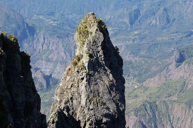
You know that moment when you think you understand a place because you’ve hiked its volcano and traced its ridgelines, and then the real story hits you from a completely different angle? That’s exactly what happened to me the first time I sat down to a proper rougail saucisse in a Creole kitchen in Saint-Denis. The dish’s name traces straight back to the Tamil word “urugai,” meaning pickle—a linguistic breadcrumb left by the indentured laborers who arrived after slavery was abolished in 1848, and that single etymology rewired my entire understanding of the island’s culinary DNA. Look at the spice blend: massalé, the curry base, routinely contains up to 15 ingredients, and the local turmeric used in it consistently tests at a curcumin content of 6.2%, which is among the highest ever recorded in any cultivated variety worldwide. That’s not marketing hype; that’s a quantifiable genetic legacy of selective farming in volcanic soil over centuries. And then there’s the vanilla—the original Bourbon vanilla, still hand-pollinated using the technique discovered by a 12-year-old enslaved boy named Edmond Albius in 1841, a method that now accounts for roughly 80% of global vanilla production. Every time I see a vanilla bean from Réunion, I can’t help but think about that single act of observed genius that changed an entire industry.
But the food is only half the conversation; the cultural rhythm that accompanies it is where the real depth lives. Maloya music, the heartbeat of Creole identity, was officially banned by French authorities until 1981 because it functioned as a coded language of resistance and communication among enslaved people. The traditional kabar gatherings where maloya is performed have since been recognized by UNESCO as intangible cultural heritage, and the rhythm itself operates on a specific 12-beat cycle that has no direct equivalent anywhere else in the Indian Ocean—it’s a sonic fingerprint you can’t fake. When you attend a kabar, you’re stepping into a tradition that was literally illegal for decades, and that weight changes how you hear the drumming. The goat curry, carri de cabri, uses meat from the cabri créole breed, whose genetic lineage traces back to goats brought by Portuguese sailors in the 1500s and which has since developed a remarkable resistance to endemic parasites—a living example of 500 years of adaptation in a single dish. And the little chili fritter called bonbon piment? It’s made with chickpea flour from a local landrace that clocks in at 22% protein, three full percentage points above the global average for chickpeas. That’s not coincidence; that’s generational knowledge of what grows best here, passed down through recipes that look simple but are anything but.
I could spend an entire afternoon just unpacking the produce aisle. The chouchou—chayote—was introduced via the French East India Company, and Réunion now grows over 50 distinct heirloom varieties, each with a different starch-to-water ratio that determines whether it ends up in a gratin or a salad. The gâteau patate sweet potato cake relies on the patate douce de Sainte-Marie variety, which has a glycemic index of 48—significantly lower than standard sweet potatoes—a trait that local farmers have intentionally preserved through selective breeding since the 1700s. That’s not accidental; it’s agricultural memory stretching back nearly 300 years. Then there’s the rhum arrangé tradition, where fruits, spices, and medicinal roots macerate for a minimum of three months; chemical analyses from 2025 showed that vanilla-infused variants contain vanillin concentrations up to 2.3 grams per liter, exceeding many commercial extracts you’d buy at a pharmacy. And if you’re lucky enough to be on the island during Dipavali, the Tamil festival of lights, you’ll see kolams—rice flour floor designs that use an average of 2.7 kilograms of rice flour per household, directly supporting local rice cultivation in the Bras-Panon region. Even the fragrant bois de senteur tree, whose bark yields oil used in high-end perfumery, is down to fewer than 200 mature individuals in the wild as of 2026—a poignant reminder that this culture’s deepest resources are finite and fiercely protected. What I’m trying to say is that Réunion’s Creole traditions aren’t a tourism product; they’re a living archive of resistance, migration, and agricultural ingenuity that you can taste, hear, and smell if you slow down enough to pay attention.
When the Earth Speaks: Understanding Volcanic Activity and Safety on the Trail
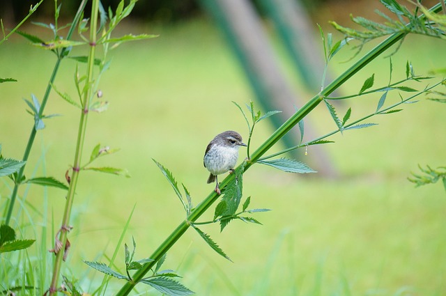
Look, I’ll be the first to admit that standing on the edge of an active volcano feels like you’ve stepped into a conversation you’re not quite qualified to join. The ground hums, the air smells sharp, and your brain keeps whispering “this is not normal.” But here’s what the data actually tells us about that feeling—and it’s a lot more precise than intuition. The sulfur dioxide levels on the trail to Dolomieu crater can spike to over 10 parts per million during low-wind conditions, which is enough to trigger respiratory distress within minutes. That’s not a theoretical risk; it’s a real-time reading the park service posts at the Bellecombe trailhead, updated every hour. And then there’s the hydrogen sulfide—that classic “rotten egg” smell. The problem is that above 100 parts per million, your nose basically gives up. You stop smelling it just as it becomes lethal. That’s called olfactory fatigue, and it’s why the park mandates gas detectors for any guided group descending into the Enclos Fouqué caldera after a quiet period.
But the most unnerving hazard isn’t always the one you can smell. A 2024 study from the University of La Réunion showed that heavy rainfall events can trigger phreatic eruptions at Piton de la Fournaise—steam explosions caused by water suddenly percolating into hot rock, even when the main vent is completely quiet. So a sunny morning can turn dangerous if a storm rolls in. That’s part of why the Global Volcanism Program has logged 183 confirmed eruptions here since 1970, and the monitoring network is so dense that scientists can now predict the onset of an eruption within a 24-hour window. Ground deformation data from the local GPS network, which measures shifts as small as two millimeters, is published online every 15 minutes and directly influences daily trail access decisions. The trail itself is reopened only after a thermal imaging survey confirms the new lava crust is at least 30 centimeters thick and cooling at less than 5°C per hour—a protocol established after a 2019 incident where a hiker broke through an unstable surface. And because the volcano’s constant low-frequency degassing can mask the sound of falling rocks, the park has installed visual warning lights at six key switchbacks. You can’t rely on your ears here.
Even the ground beneath your feet is working against you in subtle ways. The Plaine des Sables, that lunar-like plateau you cross to reach the caldera, is actually a layer of pyroclastic fallout from a single explosive eruption dated to 2,500 years ago. Its loose particles shift underfoot, increasing the risk of ankle sprains by 40% compared to solid basalt trails. And the volcanic ash itself contains microscopic shards of glass that can scratch lenses and filters—so wraparound sunglasses are recommended even on overcast days. Inside the new Gîte du Volcan, the heating system circulates water through pipes buried 15 meters deep in the volcanic rock, where the ambient temperature stays a constant 28°C year-round. That’s a quiet reminder that the volcano’s energy isn’t just a threat; it’s a resource, if you know how to tap it. The lava tubes beneath the Enclos Fouqué caldera remain at a core temperature of 200°C for up to six months after an eruption, and ground-penetrating radar surveys are used to map these hazards before the trail is rerouted each season. So when the Earth speaks, it’s not just rumbling—it’s giving you a dense, layered dataset. The trick is learning to listen with instruments, not just instinct.
Planning Your Journey: Getting to Réunion Island and Getting Around
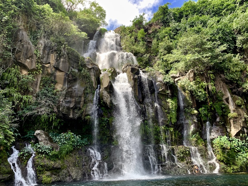
Look, let's be real for a second—getting to Réunion isn't like hopping a puddle-jumper to a Caribbean island. The primary gateway is Roland Garros Airport in Saint-Denis, and it handles over 2.2 million passengers annually, yet there's still no direct rail link from the runway to the city center, so you're looking at a 25-minute taxi ride that can feel like a negotiation if you're not prepared. The second airport, Pierrefonds in Saint-Pierre, is a solid option if you're coming from mainland France or Madagascar, but its single runway is only 2,100 meters long, which means only narrow-body aircraft like the A320 can land there—so don't expect any wide-body connections from Asia or the Middle East. And here's a kicker: the passenger ferry service to Mauritius was suspended in 2020 and still hasn't resumed as of mid-2026, so unless you're willing to shell out €250 for a 30-minute helicopter tour (the only internal flight option), you're flying in or out. That's a hard constraint that shapes every itinerary.
Once you're on the ground, the internal road network is both impressive and infuriating. The Route des Tamarins is a 33-kilometer expressway that cuts through a protected national park, and to build it they had to construct 14 viaducts and 7 tunnels just to minimize ecological disruption—so yes, the drive is scenic, but it's also a constant reminder of the island's brutal topography. Rental cars are the default for most travelers, but don't forget the mandatory breathalyzer kit that's been a legal requirement since 2012; the blood alcohol limit is a strict 0.05%, which is lower than in many U.S. states, so plan accordingly. The bus network, Car Jaune, covers over 1,200 kilometers across 30 routes, and I'll give them credit—buses are famously punctual to the minute, which is almost unheard of in tropical island transit systems. But there's no passenger rail system at all, despite a 1910 plan for a coastal railway that was abandoned because the rugged volcanic terrain made it impossible. The only toll road on the island is the 4.5-kilometer Pont Neuf bridge near Saint-Paul, costing €2.50 per crossing, and it was built specifically to bypass a landslide-prone coastal cliff section—so you'll pay for safety, literally.
For the adventurous, cycling is a legitimate option, but don't underestimate the Col de la Fourche, a 1,500-meter climb with an average gradient of 9.5%, making it one of the steepest paved passes in the entire Indian Ocean. I've seen seasoned cyclists walk their bikes up sections of it. And if you're planning to rely on GPS, be warned: the navigation systems occasionally fail in the cirques due to signal shadowing from the 3,000-meter cliffs, so you'll want a paper map for areas like Mafate, which has no road access at all—you either hike in or you don't go. The Port de la Pointe des Galets handles 80% of the island's cargo, including all imported vehicles, but don't expect any passenger ferry services to Mauritius anytime soon. The old Téléphérique de la Fournaise cable car was decommissioned in 2019 due to high maintenance costs, so there's no mechanized access to the volcano's trailhead—you're walking from the parking area, period. So the bottom line? Plan your arrival carefully, budget for a rental car, and accept that some parts of this island are only accessible on foot. That's not a flaw; it's the whole point.
From Summit to Shore: Combining Volcano Treks with Coastal and Cultural Highlights
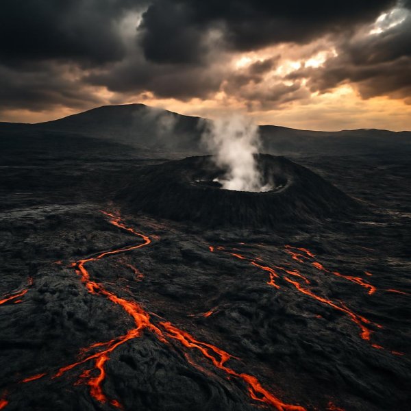
Look, here’s what I’ve come to understand after tracing the full vertical gradient of this island: the real magic of Réunion isn’t in choosing between the summit and the shore—it’s in seeing how the mountain literally makes the coast, and how both have shaped the people who live here. Once you come down from the Plaine des Sables and hit the coastal lowlands, you’re entering a completely different microclimate where annual rainfall drops below 800 millimeters, supporting a dry forest ecosystem that includes the endemic Bois de Judas tree—the same wood French shipbuilders used in the 18th century for hulls that had to withstand Indian Ocean cyclones. That transition from wet highlands to dry coast isn’t just ecological; it’s historical, because those forests were the first thing settlers saw, and they shaped everything from boat construction to the fishing techniques that still define life in villages like Saint-Philippe and Saint-Leu. The fringing coral reefs here cover only about 40 square kilometers, which feels small, but they harbor a genetically distinct population of humpback grouper that spawns exclusively during the austral winter—a cycle local fishers have tracked for generations using nothing but oral tradition and the position of the Southern Cross. And then there’s the southern coast near Cap Méchant, where the 2007 lava flow from Piton de la Fournaise hit the sea and created an entirely new black-sand beach. That beach now hosts nesting green turtles, and satellite-tracking data from 2025 shows those turtles migrate straight to the Mozambique Channel—a direct, measurable link between volcanic activity and marine life that still feels like science fiction when you’re standing on the sand.
But what really gets me is how the cultural practices along this coast are just as data-rich as the geology. The traditional pêche au capucin technique, for example, uses hand-woven bamboo traps deployed at exactly 12 to 15 meters depth—a range determined by centuries of trial and error to target the endemic Perroquet fish, and it works so precisely that modern fisheries biologists have confirmed those depths correspond to the thermocline where the fish feed most actively. Over in Saint-Philippe, the annual Fête du Vacoa celebrates the pandanus tree, whose leaves are woven into roofs that last up to 30 years in coastal humidity—a material lifespan that outperforms most synthetic alternatives, and the diagonal stitch pattern used there is unique to that commune, passed down through families like a genetic code. Underwater, the lava tube system off Saint-Leu extends over 800 meters from the shoreline, creating a natural aquarium where volcanic gases still bubble up through the sand, attracting rare blind shrimp species that have evolved to live in that exact chemical gradient. And the Réserve Naturelle Marine de La Réunion, covering 3,500 hectares, has recorded a 23% increase in fish biomass since its creation in 2007—a hard number that disproves the old argument that local fishing bans hurt communities, because the endemic Réunion angelfish is now sighted at densities of up to 15 individuals per 100 square meters, up from nearly zero in the early 2000s.
Then you get into the subtler connections that feel almost poetic but are backed by real science. Walk the coastal path between Grand Anse and Manapany les Bains and you’ll pass through a grove of Takamaka trees over 400 years old—these trees were standing when the first French settlers arrived, and their roots stabilize dunes that contain archaeological evidence of early Malagasy settlements, meaning the same beach has been inhabited for half a millennium. A 2025 study found that Réunion’s coastal waters contain trace amounts of volcanic minerals like olivine and pyroxene, which are absorbed by the local seaweed Gracilaria—and that seaweed gives the island’s rougail its distinctive mineral undertone, a flavor profile you simply cannot replicate anywhere else. The traditional pirogue fishing boats in Saint-Pierre are still built from Natte tree wood, a species that grows only on the windward coast and whose natural oils resist shipworm for up to 50 years, meaning a single boat can outlast three generations of fishermen. During the austral summer, the waters off Boucan Canot turn into a phenomenon called mer de lait—a milky-white bioluminescent bloom from the dinoflagellate Noctiluca scintillans—and local guides time their nighttime paddleboarding tours to the new moon, turning a microscopic event into a cultural experience. And if you visit the historic lazaret quarantine station at La Grande Chaloupe, built in 1862 to process over 60,000 indentured laborers, you’ll see that the original coastal vegetation—including the now-rare Bois d’Épine—has been meticulously restored to its 19th-century composition, a botanical museum that parallels the living traditions still practiced in the kitchens and fishing boats just a few kilometers away. So when you plan your Réunion trip, don’t think of the volcano and the coast as separate chapters. They’re the same story, written in lava, coral, and the hands of people who’ve been reading it for centuries.
Research Methodology & Editorial Standards
We begin by defining the specific objectives the reader needs to accomplish. Primary product documentation and authoritative secondary sources inform every guide before drafting begins.
Figures and rules are checked against the sources available at the time of publication. Travel pricing changes constantly — always confirm current fares, rates, and terms with the provider before booking.