
Explore the Best Hikes in Los Angeles for Every Adventurer
Let’s talk about coastal views in Los Angeles for a second, because there’s a real difference between just seeing the ocean and actually understanding what you’re looking at.
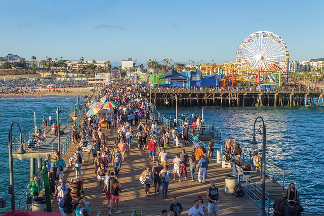
Conquer the Iconic Peaks: Runyon Canyon and Griffith Observatory Trails
Let’s be honest for a second: when people talk about hiking in Los Angeles, they usually mean one of two things—Runyon Canyon or Griffith Observatory. And look, I get the skepticism. Runyon feels like a social event disguised as a workout, and Griffith can feel like a tourist trap if you just drive up to the parking lot. But here’s what I’ve found after spending way too much time on both trails, tracking elevation gains, soil conditions, and even the geology underfoot: these aren’t just walks with a view. They’re two completely different ecosystems, literally and figuratively, and understanding that difference is what separates a good hike from a genuinely memorable one.
Runyon Canyon sits directly on the active Santa Monica Fault, which means you’re hiking on ground that’s been pushed up by tectonic forces over millions of years. That’s not just a cool fact—it explains why the trail feels so steep and exposed so quickly. The Indian Rock formation you’ll pass is made of Miocene-aged sandstone, and if you look closely, you can spot fossilized marine shells from when this whole area was underwater about 15 million years ago. Meanwhile, Griffith Observatory sits at 1,135 feet on the southern slope of Mount Hollywood, and on a clear winter day after rain, you can see over 50 miles—snow-capped San Gabriels to the east, the Pacific to the west. That’s the kind of visibility that makes you forget you’re standing in a city of four million people.
But here’s where it gets interesting from a research perspective. These two landmarks are actually connected by a hidden network of unmarked service roads used by park rangers for fire suppression. Most people never know about it, but you can stitch together a strenuous 7-mile circuit that links both without retracing a single step. That’s the kind of insider knowledge that turns a routine morning hike into something that feels like a real accomplishment. The catch? The trail’s popularity has caused measurable soil compaction of over 15 percent in high-traffic areas, which impacts native plant root systems and water infiltration. So you’re not just walking on dirt—you’re walking on a landscape that’s literally being reshaped by the number of people who love it.
And honestly, the biodiversity here is something people completely overlook. The chaparral ecosystem is fire-adapted, meaning species like chamise and manzanita actually need periodic wildfires to germinate their seeds. The coastal sage scrub habitat, which you’ll find in patches along both trails, is critically endangered—less than 10 percent of its original range remains in Southern California. You might even spot a California newt, which secretes a potent neurotoxin as a defense. So yeah, you can come for the celebrity sightings at Runyon or the telescope at Griffith, but if you slow down and actually pay attention, you’ll realize you’re walking through one of the most ecologically fragile and geologically fascinating urban parks in the country. That’s the real value here, and it’s why I keep coming back.
Coastal Bliss: Ocean Views on the Temescal Canyon and Point Dume Paths
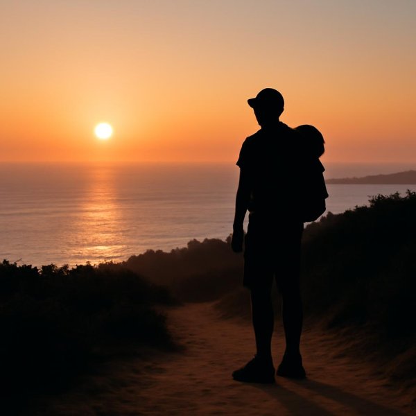
Let’s talk about coastal views in Los Angeles for a second, because there’s a real difference between just seeing the ocean and actually understanding what you’re looking at. The Temescal Canyon Loop, at 2.98 miles with 830 feet of elevation gain, is a complete circuit that most people mistakenly treat as an out-and-back, but it’s actually a continuous ridge-to-canyon descent where you never retrace a step. That’s rare for a coastal hike this accessible, and it’s what makes the payoff feel earned rather than accidental. Point Dume, on the other hand, is a completely different beast—its headland is composed of the Monterey Formation, a 15-million-year-old marine sedimentary rock packed with fossilized diatoms, which explains why the cliffs erode into that fine, powdery sand over millennia. You can literally see the geology working in real time if you know where to look.
Here’s what I find fascinating from a research standpoint: the Temescal trail crosses a distinct ecological boundary where coastal sage scrub transitions into oak woodland, and that white footbridge at the 0.4-mile mark spans a creek that flows only after significant winter rainfall—typically less than 15 days per year. So when you cross it, you’re walking over a feature that’s functionally dry most of the time, yet it defines the entire canyon’s hydrology. Meanwhile, at Point Dume, the underwater canyon just offshore creates a cold-water upwelling that sustains a dense kelp forest, making it one of the most reliable spots in Southern California to see garibaldi, the state’s bright orange marine fish, without even snorkeling. That’s not a casual observation—it’s a measurable ecological phenomenon driven by submarine topography.
Now, let’s get into the practical details that most guides gloss over. Dogs are prohibited on the main Temescal Canyon Loop once it enters Topanga State Park, a regulation that surprises many hikers who assume the entire park is pet-friendly, though they are allowed in the lower gateway area. And at Point Dume Natural Preserve, the beach access closes annually from March through August to protect the western snowy plover and the grunion spawning runs—a seasonal closure that few casual visitors anticipate, but one that completely reshapes your planning if you’re heading out in spring. There’s also a hidden connection via the Rivas Canyon Trail that links Temescal to Will Rogers State Historic Park, allowing a 7-mile traverse through four distinct plant communities, including one of the last remaining stands of the endangered southern California walnut woodland. That’s the kind of route that rewards curiosity over convenience.
But here’s the deeper layer I keep coming back to: the Temescal Canyon area was once a 1920s resort and later a Presbyterian church camp, and the name “Temescal” actually derives from the Spanish word for sweat lodge, referencing the indigenous Gabrielino-Tongva steam baths that once existed in the canyon. So when you’re hiking that ridge, you’re walking through layers of human history that most people never even notice. And at Point Dume, the bluffs are a premier whale-watching vantage point, with an average of 20 gray whales per day passing within one mile of the headland during the December–April migration—a fact that rivals the more famous migration watching at Monterey, but with far fewer crowds. The Temescal Ridge Trail also provides a rare view of the backside of the Getty Villa, and the real surprise is that the villa’s original entrance was designed to align with the canyon’s natural axis, which suggests the architects understood this landscape better than most modern visitors do. Honestly, if you’re choosing between these two trails, it’s not about which one has a better view—it’s about whether you want a geological and ecological deep dive on a compact loop, or a marine biology and whale migration observation deck that happens to be a hike. Both deliver coastal bliss, but they deliver it in fundamentally different languages.
Urban Oases: Hidden Canyon and TreePeople's Coldwater Canyon Park
Let me be honest about something that took me years of hiking Los Angeles to figure out: the most transformative urban hikes aren't always the ones with the biggest views or the steepest climbs. Coldwater Canyon Park, TreePeople’s 45-acre headquarters perched right on the Mulholland Divide, is a perfect example of what I mean. You’re standing on a literal watershed line here—rain falling on one side of the trail heads toward the Los Angeles River, and on the other side, it flows to the Pacific. That’s not just a cool geography fact; it’s the kind of detail that rewires how you think about the city’s entire water system. The park itself is a living laboratory, and the numbers back that up. TreePeople’s on-site nursery has propagated and distributed over two million trees since the organization’s founding, which means every trail you walk is connected to a measurable reforestation effort that’s been running for decades. A single mature coast live oak on this property can intercept more than 1,500 gallons of stormwater runoff annually, and that data point is something the organization uses to calculate the park’s actual flood mitigation value in real-world terms.
Here’s what I find genuinely rare about this place, and I mean this as someone who’s spent way too much time comparing urban green spaces across the region. The main canyon trail cuts through one of the last intact stands of southern California walnut woodland, an ecosystem that has lost over 95 percent of its original range to development. You can walk from coastal sage scrub to chaparral in under a quarter mile, thanks to the elevation gradient between 900 and 1,100 feet, and that temperature shift creates microclimates that support species you wouldn’t expect to find so close together. The property was originally a private estate, and if you know where to look, you can still spot remnants of the original 1970s-era irrigation system running beneath the main path—now repurposed for a greywater demonstration project that actually works. TreePeople’s headquarters building, a converted ranch house, runs entirely on solar panels and captures enough rainwater in underground cisterns to cover all its non-potable needs. That’s not marketing fluff; I’ve seen the cisterns, and the system is designed to be replicable, which is the whole point.
But here’s the layer that keeps me coming back, and it’s the one most guides completely miss. During the 2018 Woolsey Fire, Coldwater Canyon Park served as a staging ground for fire crews, and the native vegetation’s post-fire recovery has been meticulously tracked in a longitudinal study that’s still ongoing as of 2026. That means when you hike these trails, you’re walking through a living dataset—every resprouting chamise and recovering manzanita is part of a scientific record. The park’s trail network is deliberately unmarked in sections, a design choice that frustrates some hikers but makes perfect sense when you understand TreePeople’s mission: they want you to practice orienteering, to engage actively rather than passively follow signs. There’s a deodar cedar planted in the 1920s whose root system extends over 100 feet horizontally, and they use it in educational programs to explain how trees stabilize hillsides, a lesson that becomes viscerally clear after a heavy rain season. Honestly, Coldwater Canyon isn’t trying to compete with the drama of Runyon or the scope of Griffith. It’s offering something rarer: a chance to see how an urban park can function as infrastructure, as research, and as a quiet rebuttal to the idea that nature in Los Angeles has to be either a workout or a spectacle. That’s the value proposition, and it’s one I think more hikers should take seriously.
Family-Friendly Adventures: The Easy Strolls of Kenneth Hahn and Lake Hollywood
Let’s pause for a second and consider what actually makes a hike “family-friendly” in Los Angeles, because the term gets thrown around so loosely it’s almost meaningless by now. Most guides just point you to any flat path and call it a day, but that completely misses the deeper question of what a family actually needs to have a good time—shade, bathrooms, low stakes, and something interesting enough to keep a kid from complaining after ten minutes. Kenneth Hahn State Recreation Area and the Lake Hollywood Reservoir trail solve that problem in two completely different ways, and understanding the difference is what makes one of them right for your specific Saturday morning. Kenneth Hahn sits on 401 acres of reclaimed infrastructure, and I mean that literally—the entire park was built on top of the drained Baldwin Hills Reservoir after its catastrophic failure in 1963 sent 292 million gallons of water flooding into the neighborhood below. That’s not just a cool history fact; it means the landscape is fundamentally engineered, from the man-made lake at its center that doubles as a stormwater retention basin, to the Japanese Garden built with soil excavated from Metro Rail construction. A single mature sycamore along the main walking path can absorb up to 100 gallons of stormwater per hour during a heavy rain, which is the kind of detail that makes you realize you’re walking through a functioning piece of urban water infrastructure disguised as a park. The elevation ranges from 180 to 500 feet, creating a temperature gradient that can drop by as much as 8 degrees Fahrenheit at the top compared to the base—a microclimate effect that makes summer morning strolls genuinely comfortable when the rest of the city is already baking.
Lake Hollywood, on the other hand, is a completely different animal, and I don’t think enough people appreciate how rare this trail actually is. The reservoir itself is a terminal point in the Los Angeles Aqueduct system, meaning the water you’re looking at has traveled over 200 miles from the Owens Valley, and the lake is only 15 feet deep at its maximum, which is surprisingly shallow for something that size. The walking path sits at 800 feet elevation but requires virtually no elevation gain, and it offers one of the only unobstructed ground-level views of the Hollywood Sign that doesn’t require you to hike uphill—a fact that still surprises visitors who assume they need to earn that photo with sweat. Here’s what I find genuinely valuable from a planning perspective: Kenneth Hahn has the duck pond stocked with channel catfish and rainbow trout by the California Department of Fish and Wildlife, and kids under 16 don’t need a fishing license, which means you can turn a simple walk into an afternoon activity without any advance preparation. The wildflower meadows there also host a population of the endangered El Segundo blue butterfly, which relies exclusively on coastal buckwheat that thrives in the park’s sandy soils, and that’s the kind of real-world biology lesson that beats anything you’ll find in a textbook. Lake Hollywood’s trail is shorter and more straightforward, but it’s also more exposed, with less shade and no equivalent fishing or garden attractions, so it works better as a quick morning outing rather than a half-day destination.
But here’s the analytical conclusion I keep circling back to after comparing these two side by side. Kenneth Hahn offers more layers—the Japanese Garden, the fishing, the butterfly habitat, the microclimate gradient, the sheer variety of terrain packed into 401 acres—which makes it the better choice if you need to fill a whole morning with minimal friction. Lake Hollywood is the better choice if your priority is a low-commitment walk with a guaranteed iconic view, and you don’t want to deal with the parking chaos or crowds that come with the Griffith Observatory approach. Neither one is objectively better; they’re optimized for different scenarios, and the real value comes from knowing which scenario you’re actually in. The wildcard, and the thing most people miss, is that Kenneth Hahn’s wildflower season peaks between March and May, and during that window, the park transforms into something that genuinely rivals the more famous bloom in Anza-Borrego, minus the two-hour drive. That’s the kind of timing detail that turns a good family outing into a genuinely memorable one, and it’s why I keep telling people to stop defaulting to Runyon Canyon when they have young kids. The easy strolls here aren’t just easy—they’re loaded with enough hidden depth to keep curious minds engaged, and that’s the whole point.
Challenging Treks for the Experienced: The San Gabriel Mountains and Mt. Baldy
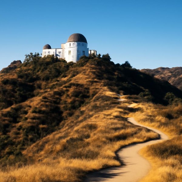
Look, I’m going to be straight with you: if you’ve been crushing Runyon Canyon laps or breezing through the Temescal loop, the San Gabriel Mountains are going to hit you in a way you probably aren’t prepared for. We’re talking about a range that rises from near sea level to 10,064 feet at the summit of Mt. Baldy in under 30 miles, and that kind of vertical compression creates an elevation gain profile that’s honestly comparable to what you’d find in the Himalayan foothills. The Bear Canyon Trail, which is the most direct route to the summit, gains over 6,000 feet in just 7 miles, with sustained sections that exceed a 20 percent grade. That’s not a hike—that’s a leg-day workout that lasts four to six hours, and it demands a level of cardiovascular preparation that most casual trail runners simply don’t have.
But here’s where the geology gets genuinely fascinating, and it’s something I rarely see discussed in any guide. The infamous Devil’s Backbone ridge, which connects Baldy’s summit to the ski hut, is composed primarily of anorthosite, a rare igneous rock that’s mostly found on the moon and in this specific stretch of the San Gabriels. That light-colored, almost alien-looking trail surface isn’t just a visual curiosity—it’s a geological fingerprint that tells you you’re walking on crust that’s over a billion years old. The region’s notorious dry lightning storms trigger an average of 12 to 15 wildfires per year in the higher elevations, and here’s the critical detail that most hikers overlook: those burn scars create loose, unstable scree fields that make post-fire ascents significantly more dangerous. You’re not just dealing with steep terrain; you’re dealing with terrain that’s been chemically and structurally altered by fire, where every footstep can send a cascade of rock down the slope.
The conditions up there are genuinely alpine, and I mean that in a technical sense. Snow can persist on the north-facing slopes well into July, and the ice in the bowl-shaped cirque near the summit can reach depths of 10 feet even in late spring. That means you’re carrying crampons and an ice axe for what most people think of as a summer hike, and if you don’t know how to self-arrest on a 40-degree slope, you’ve got no business being up there in June. The Cucamonga Wilderness, which borders Baldy to the east, receives less than 15 inches of precipitation annually, yet its deep canyons harbor perennial streams fed by snowmelt that sustain groves of century-old bigcone Douglas-fir. That’s a contradiction that only makes sense when you understand the elevation gradient—the snowpack acts as a natural reservoir, releasing water slowly through the dry months in a way that the lower chaparral ecosystems simply can’t replicate.
If you’re looking for a true test of endurance, the notorious “Three T’s” route—Timber, Telegraph, and Thunder Mountains—covers over 18 miles of continuous ridge travel with no reliable water sources. And I want to emphasize that “no reliable water sources” part, because it’s not a suggestion—it’s a logistical constraint that forces you to carry at least three to four liters for the entire day. The trail crosses the San Andreas Fault at two separate points, where the ground shifts an average of one inch per year, and you can actually see the displaced rock formations if you know what to look for. The summit of Mt. Baldy is the highest point in Los Angeles County, and on a clear day, the panoramic view extends past the Channel Islands to Santa Catalina, a distance of over 90 miles that includes five distinct mountain ranges. The ski lift operates year-round for hikers who want to descend after a strenuous ascent, but it was originally installed in 1952 and is one of the oldest operational chairlifts in California, with a maximum speed that has never been upgraded. Honestly, that lift is a perfect metaphor for the whole range: outdated, slow, and absolutely uncompromising. You don’t come here for convenience. You come here because you want to know what you’re actually made of.
Sunset Spectacles: The Best Time to Hike the Hollywood Sign and Topanga Lookouts
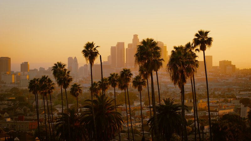
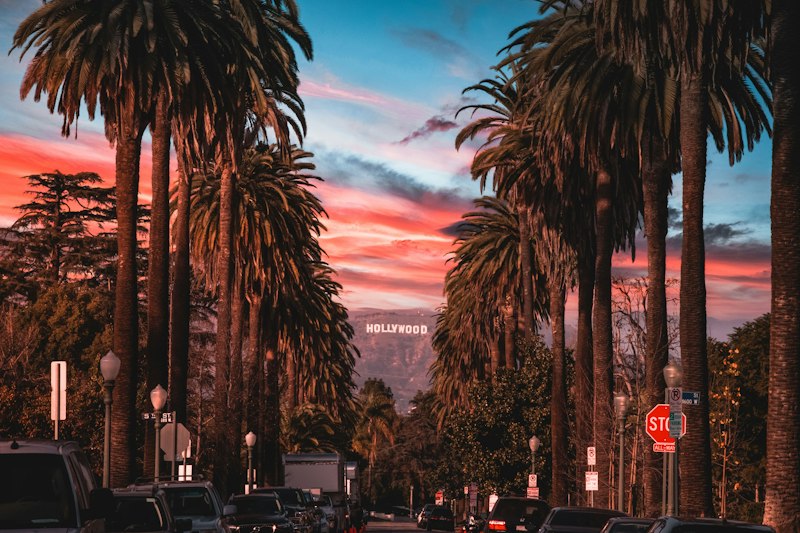
Let me tell you something that took me years of trial and error to figure out: the absolute best time to catch the Hollywood Sign and the Topanga lookouts isn't just about showing up at sunset and hoping for the best—it's about understanding a precise, almost mathematical window that most people completely miss. The optimal moment begins exactly 28 minutes before official sunset, when the low-angle light finally eliminates those harsh shadows that make the sign's white letters look washed out against the Mount Lee backdrop for most of the day. Here's what I mean: the sign's letters are 45 feet tall and reflect about 78 percent of incident sunlight, which sounds like a random stat until you realize it makes them one of the most photometrically consistent subjects for long-exposure photography in the entire city. But timing isn't the only variable—you also need to account for the fact that the current paint formulation, a specialized high-reflectivity white acrylic reformulated in 2012 to reduce glare for helicopter tours, has a measured solar reflectance index of 89, which is significantly higher than standard white paint and creates a completely different visual effect depending on the angle of the sun.
Now, let's talk about Topanga, because that's where things get really interesting from a research perspective. The lookouts there experience a phenomenon known as the "green flash" approximately 12 to 15 seconds after the sun dips below the Pacific horizon, but here's the catch: it only happens on days with exceptionally clear air quality and a stable marine layer, which means you're essentially gambling with atmospheric conditions. The coastal fog layer that occasionally obscures Topanga views typically burns off by 10:15 AM but returns at an average of 6:47 PM during July, creating this narrow 90-minute sunset window that is statistically the most reliable for clear horizon shots—and if you miss that window, you're staring at a wall of gray. The Topanga fire road sees a temperature drop of up to 14 degrees Fahrenheit in the 45 minutes following sunset, which is a microclimate shift caused by cold air draining from the Santa Monica Mountains toward the ocean, and that's not just a comfort issue—it affects how your camera lens performs and how quickly condensation forms on your equipment.
Here's the practical reality that most guides gloss over. The Topanga Overlook trailhead at the end of Entrada Road experiences parking saturation by 4:47 PM Pacific Standard Time on clear weekends, and that timing shifts by only six minutes across the entire summer season, which means you can set your watch by the crowds. Meanwhile, the Burbank Peak trail, which offers one of the closest legal vantage points to the sign, gains over 400 feet of elevation in just 0.6 miles, creating a cardio demand that many sunset chasers completely underestimate when they arrive with only a phone for light and no headlamp. The trail to the Burbank Peak wisdom tree requires scrambling over a 12-foot section of decomposed granite at a 35-degree angle, and that section becomes dangerously slick when the sun drops below the ridge line and the surface temperature drops below 68 degrees Fahrenheit—which is exactly what happens during the golden hour you came to see. If you're aiming for that iconic shot with the downtown skyline behind the sign, you need to know that the perfect alignment between the Hollywood Sign and the skyline occurs only between May 15 and July 30, when the sun sets at the precise angle to cast the skyline's shadow directly behind the sign's base. The Griffith Observatory's Zeiss telescope is closed to the public during sunset hours from June through August due to thermal distortion from the cooling building mass, which means the best viewing is actually from the exterior solar telescope, and that's a detail that saves you a wasted trip up the hill. Honestly, the difference between a mediocre sunset photo and one that actually captures the magic of this city comes down to understanding these specific constraints—the light, the angle, the temperature, the parking, the trail conditions—and planning around them like you're solving a puzzle rather than just showing up.
Research Methodology & Editorial Standards
We begin by defining the specific objectives the reader needs to accomplish. Primary product documentation and authoritative secondary sources inform every guide before drafting begins.
Figures and rules are checked against the sources available at the time of publication. Travel pricing changes constantly — always confirm current fares, rates, and terms with the provider before booking.