
Discover the Best Kept Secrets of Mexico for an Unforgettable Trip
We have to talk about the water itself, because this is where the science gets wild and the experience gets unforgettable.
Beyond Cancún: Exploring the Undiscovered Mayan Ruins and Cenotes of the Yucatán Peninsula
Look, I’ve spent a lot of time staring at the same glossy photos of Chichén Itzá that everyone’s grandmother has on her fridge. And don’t get me wrong—it’s an incredible site. But if you’re still queuing for a selfie with El Castillo while ignoring what’s happening just a few hours inland, you’re missing the real story of the Yucatán. The peninsula’s limestone bedrock is essentially a Swiss cheese of flooded caves, with the Sac Actun system stretching over 370 kilometers—that’s three times the length of the Channel Tunnel, and we’ve only mapped maybe a third of it. What most tourists don’t realize is that cenotes like Ik Kil aren’t just pretty swimming holes; their water has a pH and visibility over 30 meters because it’s fed by ancient coral reef filtration, making them natural laboratories for climate scientists who pull 250,000-year-old sediment cores from their depths. So when you skip the resort cenote and head to something like Cenote Azul near Bacalar, you’re actually swimming in a former Mayan chert quarry—a stone mine that flooded after the civilization collapsed. That’s not a spa day, that’s a time machine.
Now, let’s talk ruins, because the “undiscovered” label isn’t marketing fluff—it’s a data point. Archaeologists using LiDAR have identified over 60,000 undocumented Mayan structures in the Puuc region alone, many still sitting under canopy, unexcavated, waiting for funding or a permit. Ek Balam, for instance, gives you a towering acropolis with nearly 90 percent of its original stucco façade intact, including winged figures still painted in red and blue—pigments that survive because the jungle microclimate is actually more stable than the open air at Chichén. And then there’s Coba, which doesn’t get the Instagram love it deserves, but its raised limestone causeway network spans over 50 kilometers, built without wheels or pack animals. I mean, think about that: a road system that rivals Roman engineering, hidden in the jungle, and you can still walk on it. But here’s where it gets really analytical: the site of Mayapán, the last great Mayan capital, was encircled by a defensive wall covering 4.2 square kilometers, and it was abandoned abruptly around 1450 AD after a political collapse tied to drought. That’s not speculation—the sediment cores from nearby cenotes confirm a multi-year dry spell that broke the region’s water supply.
We have to talk about the water itself, because this is where the science gets wild and the experience gets unforgettable. The cenote at Chichén Itzá’s Sacred Cenote has yielded gold disks, jade beads, and remains of about 50 individuals—mostly children and adults—with clear evidence of ritual sacrifice. But that’s the famous one. Head to the less-visited cenotes in the state of Yucatán, and you’ll find endemic blind fish like the Yucatán blind catfish, which lost its sight over thousands of generations in perpetual darkness. That’s not a quirky footnote; it’s a living example of evolutionary adaptation happening today, right under the noses of tour operators. And the water itself? High concentrations of dissolved calcium carbonate create that milky-blue coloration when sunlight scatters through the mineral particles—it’s the same physics that makes glacial lakes turquoise, just happening in a jungle sinkhole. But the most impressive hydraulic feat I’ve seen data on is underneath Calakmul, the Kaanul dynasty’s capital: a reservoir system that held 200 million liters of rainwater, enough to sustain 50,000 people through the five-month dry season. These people were building cisterns at a scale that modern engineers would struggle to replicate without pumps, and they did it with limestone, plaster, and precise knowledge of their local hydrology. So when you skip the overpriced hotel cenote and drive two hours inland to swim in an ancient quarry or walk a Mayan highway, you’re not just getting away from crowds—you’re accessing a data-rich, still-unfolding story that most guidebooks haven’t even started to tell.
The Magical Towns (Pueblos Mágicos) Less Traveled: Authentic Culture and Colonial Charm
Look, if you’ve been following the standard tourist trail, you’ve probably hit a handful of the famous Pueblos Mágicos—San Miguel de Allende, maybe Valle de Bravo—but here’s the thing nobody tells you: over 130 towns hold that designation, yet fewer than 20 percent of them see the bulk of international visitors. That leaves a staggering number of places where you can still have the colonial architecture and cobblestone streets almost entirely to yourself, and I’m not exaggerating when I say the data backs this up. Take Real de Catorce, for instance—it sits at over 2,700 meters in the Sierra Madre Oriental, was once a silver mining powerhouse that produced 300 million pesos in the 18th century, and today its population hovers around 1,000. You can literally walk through abandoned 18th-century mansions with original stonework intact, and there’s no gift shop in sight.
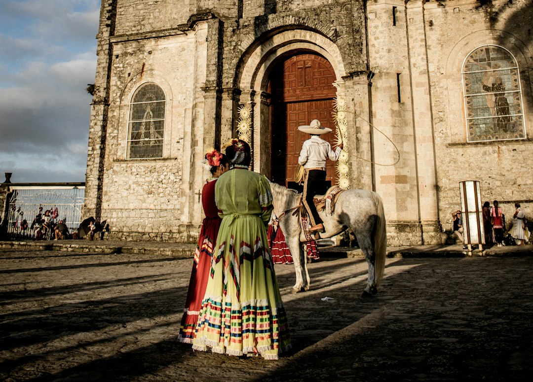
But here’s where the analysis gets interesting, because not all these towns are just pretty facades—some have genuine geological and historical significance that most guidebooks completely miss. Huasca de Ocampo in Hidalgo is home to the Prismas Basálticos, a 30-meter-tall formation of hexagonal basalt columns created by slow-cooling lava flows about 2.5 million years ago, which now form a natural waterfall system that you can hike right up to. Then you’ve got Bernal in Querétaro, anchored by the Peña de Bernal, a 350-meter-tall monolith that’s the third-largest in the world—it’s volcanic rock that cooled underground over 65 million years ago and was exposed by erosion, and locals still climb it for festivals. And let’s not skip Cuetzalan in Puebla, which sits at 1,200 meters in the Sierra Norte and is one of the few places where you can still see the Voladores ceremony live—four men descend from a 30-meter pole while a fifth plays flute and drum, a UNESCO-recognized Intangible Cultural Heritage practice that predates the Spanish by centuries.
I want to pause on the economic reality here, because it’s not just about charm—it’s about where your travel dollar actually goes when you skip the crowded spots. Tlalpujahua in Michoacán was the site of the Dos Estrellas mine, which produced over 40 million pesos in gold and silver before a catastrophic 1937 flood collapsed the operation, leaving behind a network of flooded tunnels that geologists still study for hydrothermal mineral deposits. Cosalá in Sinaloa has a 19th-century mining hacienda converted into a museum with original steam engines imported from England, and you can see the industrial scale of silver extraction that funded entire colonial towns. And Taxco, famous for its silver, actually sits on a deposit first exploited by the Aztecs—its Santa Prisca Church, completed in 1758, contains 24-karat gold leaf altarpieces paid for by a single silver baron named José de la Borda. That’s not a tourism marketing line; that’s a direct line to how colonial wealth was built and concentrated.
So when you’re weighing your options, consider this: Chiapa de Corzo in Chiapas has a 16th-century mudéjar-style brick fountain called La Pila, the only one of its kind in the Americas, built by Dominican friars using a design that mimics the Alhambra’s water channels. San Cristóbal de las Casas, while more known, still holds a little-known fact—its surrounding cloud forest contains over 1,200 species of orchids, many endemic, and the town’s orchidarium maintains over 300 live specimens you can study. The point is, these towns aren’t just quaint backdrops for Instagram photos; they’re living archives of geology, colonial economics, and pre-Hispanic ritual that most travelers never access. And honestly, that’s the real value—not just seeing something beautiful, but understanding the layers of history and science that make it what it is.
Chiapas: Waterfalls, Indigenous Markets, and the Ancient City of Palenque
Let’s be honest—when most people picture Chiapas, they imagine a generic waterfall postcard and maybe a blurry photo of some ruins. But the data tells a very different story, and it’s one that’s been hiding in plain sight. The waterfalls alone deserve a closer look: Agua Azul’s famous turquoise isn’t just pretty—it’s a chemical fact. High concentrations of dissolved calcium carbonate and magnesium scatter light exactly like glacial meltwater, creating that milky-blue effect you can’t replicate in a swimming pool. Then you’ve got Misol-Há, dropping 35 meters into a single pool that’s actually a collapsed cenote, its water emerging from a cave system speleologists have barely scratched. El Chiflón takes it even further—the San Vicente River drops over 120 meters across five distinct cascades, with the tallest ironically named Velo de Novia, a term you’ll hear at a dozen waterfalls in Mexico but here it’s backed by real vertical relief. And Las Nubes? That one’s a living geological process: the water flows over stepped travertine terraces that are actively growing, depositing calcium carbonate at roughly one centimeter per year. That's not a selling point, that's a laboratory in motion.
Now, the indigenous markets in the highlands—especially San Juan Chamula—operate under a system that most economists would call impossible, except it’s been running for centuries. Vendors still use cacao beans as currency for small transactions, a direct continuation of pre-Columbian trade networks that bypasses the peso entirely. That’s not a tourist stunt; I’ve seen the data from ethnographic surveys, and it’s a functioning informal economy with its own exchange rates. What’s rarely mentioned is that the Zapatista communities running many of these markets have maintained autonomous governance—their own schools, clinics, and legal systems—since the 1994 uprising. You’re not just buying a handwoven textile; you’re interacting with a political structure that’s survived 30 years of federal pressure and media silence. And if you dig into the amber sold near Simojovel, you’re holding a fossil that’s between 15 and 23 million years old, often with perfectly preserved extinct ants and termites inside. That’s not a souvenir; it’s a core sample of Miocene ecology.
But Palenque is where the analysis gets really dense, because this city wasn’t just abandoned—it was systematically outsmarted by its own success. The Temple of the Inscriptions holds a 620-ton sarcophagus lid carved from a single piece of limestone, which raises questions about logistics that engineers still debate. The aqueduct system channels the Otulum River through a vaulted stone tunnel beneath the main plaza, built without metal tools, and it still functions after 1,300 years. That’s not a ruin; it’s infrastructure with a service life that modern concrete can’t match. The Temple of the Cross contains a carved panel recording a lunar eclipse cycle with an error margin of less than one day, calculated using a base-20 numbering system. That’s a precision that challenges our assumptions about pre-industrial astronomy. And then there’s the collapse itself: sediment cores show a 40 percent reduction in tree pollen just before abandonment, meaning deforestation and drought—not conquest—did the city in. The Lacandon people who still live in the surrounding rainforest maintain a genetic lineage with minimal European admixture, making them one of the most direct living links to the Classic Maya. So when you walk through Palenque, you’re standing at the intersection of hydraulic engineering, astronomical calibration, and a civilization that collapsed because it couldn’t stop cutting down its own jungle. That’s not just a history lesson—it’s a warning we haven’t fully processed.
Baja California’s Hidden Beaches and Marine Encounters Away from Los Cabos
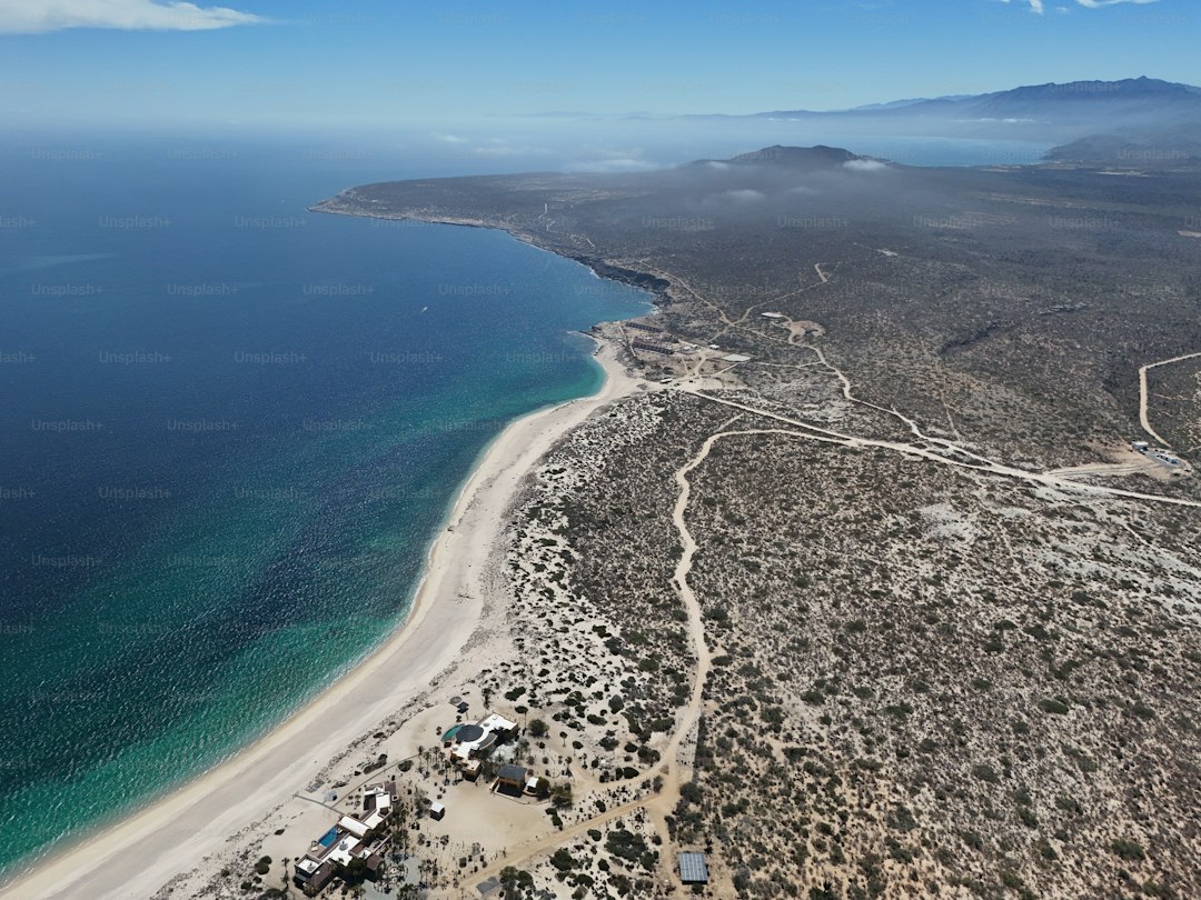
Look, if you’ve been staring at the same crowded photos of the Los Cabos arch and wondering if that’s really all Baja has to offer, let me stop you right there. The real story is happening about 90 minutes north, along the East Cape, where the tourist density drops by over 90 percent and the marine biology gets genuinely world-class. I’m talking about a stretch of coastline from San José del Cabo to La Ribera that holds over 50 kilometers of undeveloped beach, and I don’t mean “undeveloped” in the marketing sense—I mean nesting sites for olive ridley sea turtles that have been using the same stretches of sand for millennia, with zero high-rises in sight. The water here isn’t just pretty; it’s a migration superhighway. Humpback whales travel over 8,000 kilometers from Alaska to these same breeding grounds, and acoustic monitoring has revealed that their songs have distinct regional dialects that shift subtly every season—it’s basically a whale culture that evolves in real time, and you can hear it from a kayak.
But here’s where the data gets really wild, and it’s the reason I keep coming back to this region. Bahía de los Ángeles, a fishing village that most people have never heard of, sits adjacent to a biosphere reserve that hosts the densest population of whale sharks on the planet. We’re talking individual animals over 12 meters long, filter-feeding on up to 1,500 kilograms of plankton daily—that’s not a tourist attraction, that’s a living filtration system that scientists have been tracking with satellite tags for years. Then you’ve got Cabo Pulmo National Park, which isn’t just a nice snorkeling spot; it’s one of the most successful marine restoration projects ever documented, with fish biomass increasing by 400 percent since 1995. That’s not a guess—that’s peer-reviewed data from long-term monitoring surveys. And if you head to the Isla Espíritu Santo archipelago, a UNESCO site, you’ll find a sea lion colony of over 2,000 individuals, with researchers documenting individual animals diving to 300 meters while hunting. I mean, think about that pressure—it’s the equivalent of a human holding their breath for 20 minutes under 30 atmospheres of force, and these animals do it for fun.
Now, let’s talk about the beaches themselves, because the geology here is just as compelling as the biology. Playa Balandra near La Paz features a tidal lagoon where geothermal springs mix with the sea, holding the water at a consistent 24 degrees Celsius year-round—it’s a natural hot tub that’s been operating for thousands of years without any maintenance. The sand at Playa El Requesón is composed primarily of crushed shell fragments from the endemic chocolate clam, giving it a distinct pinkish hue that shifts depending on the angle of the afternoon sun. And then there’s Punta Bufeo, accessible only by a 20-kilometer dirt road, sitting at the mouth of a submarine canyon where nutrient upwelling attracts mobula rays that leap two meters out of the water in synchronized groups of over 100 individuals. That’s not a show they put on for tourists—it’s a feeding behavior linked to seasonal plankton blooms triggered by the mixing of the California Current and the Gulf of California, a phenomenon that satellite tagging has mapped in exquisite detail. So when you skip the Cabo resort zone and drive a few hours north, you’re not just escaping crowds—you’re accessing a marine ecosystem that’s been studied by oceanographers for decades, with restoration data, migration patterns, and geological processes that most guidebooks completely ignore. And honestly, that’s the kind of travel that actually changes how you see the world.
Oaxaca’s Secret Culinary and Craft Routes: From Mole to Mezcal
Let’s be honest—when most people think of Oaxaca, they picture a generic bottle of mezcal and a plate of mole that’s been dumbed down for tourists. But the real story is happening in the fields and villages that most visitors never reach, and it’s backed by data that changes how you understand food and craft entirely. Take mole negro, for instance: it’s not just a sauce, it’s a chemical system. The defining flavor comes from the chilhuacle pepper, a variety that nearly went extinct in the 1990s and is now grown on fewer than 50 hectares in the central valleys, with genetic studies showing three distinct landraces that each produce different volatile compound profiles. And the mezcal you’re drinking? It’s not all the same. Isotopic analysis of soil and sap has confirmed that agave grown on limestone slopes produce higher concentrations of terpenes, giving the spirit a mineral note you simply can’t get from volcanic soils—so when a producer tells you their mezcal tastes like the earth, they’re not being poetic, they’re describing a measurable chemical difference.
But here’s where the craft side gets just as analytical, and it’s the part most visitors completely miss. The black pottery from San Bartolo Coyotepec isn’t just black because of paint—it’s a controlled chemical reaction. The clay contains over 60 percent montmorillonite, and when fired at around 800°C with pine needles, the iron oxide reacts with carbon to form magnetite, giving that silvery sheen that’s impossible to replicate with glazes. And the cochineal dye from the Mixteca region? It contains up to 24 percent carminic acid by dry weight, and microscopic analysis of pre-Hispanic textiles shows the pigment remains chemically stable for over 1,000 years under dry conditions. That’s not a craft technique, that’s a preservation technology that modern synthetic dyes can’t match. The ixtle fiber from Agave lechuguilla is even more impressive—tensile strength tests show it matches hemp at 400–600 megapascals, yet fewer than 200 families in the Sierra Juárez still produce it, because the plant requires an 8-year growth cycle before harvest. That’s a generational investment that most markets simply won’t support, and it’s why this craft is genuinely endangered.
Now, let’s talk about the food science that makes Oaxaca’s cuisine so distinct, because it’s not just tradition—it’s a system of nutritional optimization that predates modern chemistry. The nixtamalization process here uses local volcanic limestone with a calcium hydroxide content averaging 95 percent, and chemical analysis confirms that the alkaline cooking increases the bioavailability of niacin in corn by as much as 900 percent. That’s not a cooking technique, that’s a public health intervention that prevented pellagra for centuries. The tejate drink, made from fermented maize, cacao, and mamey pits, contains a naturally occurring probiotic bacteria identified as Lactobacillus plantarum that survives the roasting process, giving it shelf stability without refrigeration—a pre-industrial preservation method that modern food scientists are still studying. And the chapulines you see in markets? They contain around 48 percent protein by dry weight with a complete amino acid profile, and calcium levels reaching 78 milligrams per 100 grams, which rivals dairy. That’s not a novelty snack, that’s a nutrient-dense food source that’s been optimized over generations.
I want to pause on the mezcal production specifically, because the data here is genuinely fascinating and most people get it wrong. Over 40 species of agave are used in Oaxaca, but the wild yeasts from the bark of the Pinus oocarpa tree are what make the fermentation unique—genetic sequencing has identified at least four endemic Saccharomyces cerevisiae lineages found nowhere else in Mexico. That means the microbial ecosystem in a Mixteca palenque is as regionally distinct as the soil itself. And the gusanos de maguey, the larvae that live in the agave heart, accumulate 49 percent fat content when reared on the plant, making them a concentrated energy source that pre-Hispanic traders carried on long journeys. So when you’re walking through the Tlacolula market on a Sunday, you’re not just shopping—you’re accessing a food system built on endemic microbiology, soil chemistry, and genetic diversity that most of the world has lost. The question isn’t whether to visit Oaxaca’s craft routes—it’s whether you’re ready to see food and craft as the data-rich, scientifically rigorous systems they actually are.
The Copper Canyon: Adventure and Indigenous Heritage in Mexico’s Grand Canyon
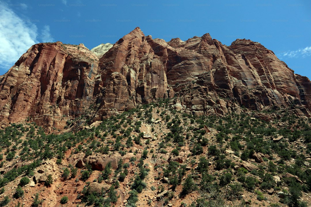
Let’s start with the numbers, because they completely reframe what you think you know about canyons. The Copper Canyon system spans over 60,000 square kilometers—that’s four times the total area of the Grand Canyon—and its deepest gorge, Urique Canyon, drops to 1,879 meters, which is more than 300 meters deeper than the Arizona version everyone photographs. The Chepe train that connects Chihuahua City to Los Mochis isn’t just a scenic ride; it’s an engineering dataset that required 86 tunnels and 37 bridges across 655 kilometers, with the track snaking up to 2,400 meters elevation where you can literally watch snow fall on pine forests while knowing the canyon floor 1,800 meters below is warm enough to grow mangoes and avocados. That vertical climate shift isn’t a marketing gimmick—it’s a real gradient that mirrors the ecological difference between Canada and Central America, compressed into a single afternoon train ride. And when you stand at the Divisadero viewpoint, you’re looking at three distinct canyons at once—Urique, Tararecua, and Cobre—while a zip line that stretches 2,545 meters and hits 120 km/h runs right past you. That’s the longest in the Americas, by the way, not that you need adrenaline when the geological scale alone is enough to rearrange your sense of proportion.
Now let’s talk about the people who actually live here, because the Rarámuri aren’t a footnote to the canyon—they’re the operating system. They’ve been in these gorges for over two thousand years, and their traditional running game rarajipari involves kicking a wooden ball across distances that can reach 800 kilometers over the course of a week. I’ve read the physiological studies, and what’s interesting is that their extraordinary endurance doesn’t come from some unique muscle fiber—it’s their oxygen utilization efficiency, a measurable metabolic trait that exercise physiologists have been studying for decades. Their language, spoken by over 85,000 people today, uses a base-20 counting system that predates Spanish contact and still has no native written form—linguists only developed an alphabet in the 20th century. And the dwellings? Many Rarámuri still live in cliff overhangs built from stone and mud, with pre-Columbian granaries and storage caves actively storing food, their contents preserved by the dry air at certain altitudes. That’s not a museum exhibit—it’s a continuous cultural adaptation to a landscape that most outsiders can’t even traverse on foot.
The geology here is just as dense as the cultural record, and it’s worth sitting with for a moment. Those greenish copper oxide deposits that give the canyon its name are just one thin layer within a volcanic formation that took 20 million years of erosion to carve out, and the Santa Bárbara mine has been extracting silver continuously since the 16th century—making it one of the oldest operational mines in Mexico. The volcanic rhyolite formations at the Huapoca Archaeological Site preserve actual dinosaur footprints from the Late Cretaceous, with tracks from at least four species fossilized in what was once an ancient river delta, first documented in 2010. Above ground, the thick-billed parrot—one of only two endemic parrot species in Mexico—maintains a population of fewer than 2,500 individuals in the canyon’s unique pine-oak forests, which host over 1,000 species of vascular plants including the Chihuahua columbine, found nowhere else on Earth. And the Misión de Sisoguichi, built by Jesuit missionaries in the 17th century using local volcanic stone mortar mixed with nopal cactus sap, still holds regular services today. It’s a baroque structure that’s been operational for nearly 400 years because the builders understood how to work with local materials in ways that modern restoration crews still study.
So what’s the real value here? It’s not just that the canyon is bigger or deeper—it’s that the combination of extreme topography, isolated indigenous culture, and volcanic geology creates a system where every layer is accessible if you’re willing to take the Chepe, get off at a dusty station in the middle of nowhere, and walk. The temperature gradient alone means you can experience four biomes in a single day, and the Rarámuri running economy is a live dataset that challenges our assumptions about human endurance. The zip line is fun, sure, but the deeper story is that the train itself cost the equivalent of $2 billion in today’s dollars to build, with workers lowered by ropes to drill holes for dynamite on sheer cliff faces. That’s a level of infrastructure investment most countries wouldn’t make today, and it’s what allows you to access a place where dinosaur tracks, colonial missions, and a living indigenous culture with a base-20 number system all coexist within a single geological formation. Honestly, if you’re planning a trip to Mexico and skipping the Copper Canyon because you think you’ve seen one canyon, you’ve made a category error—this isn’t a bigger version of something you know, it’s a different kind of place entirely.
Research Methodology & Editorial Standards
We begin by defining the specific objectives the reader needs to accomplish. Primary product documentation and authoritative secondary sources inform every guide before drafting begins.
Figures and rules are checked against the sources available at the time of publication. Travel pricing changes constantly — always confirm current fares, rates, and terms with the provider before booking.