
Best Scenic Road Cycling Routes Leaving New York City
Most guides treat New York City road cycling as a collection of disconnected Strava segments, but the real skill is knowing which bridge crossing and rail return combo unlocks 60-to-100-mile loops without repeating pavement.
| Takeaway | Detail |
|---|---|
| Cross the GWB on foot, not on bike | The George Washington Bridge has no bike lane; you must walk your bike on the lower-level pedestrian walkway, which takes about 15 minutes. |
| Build a 70+ mile car-free loop using Metro-North | Ride north on the Hudson River Greenway, cross the GWB, then take Metro-North from Peekskill or Croton-on-Hudson back to Manhattan for a seamless return. |
| The Hudson Valley Rail Trail gives you 12 flat, paved miles | This rail-trail runs from Peekskill to Croton-on-Hudson, perfect for a fast, car-free segment in the Classic Hudson Valley Loop. |
| Bear Mountain’s northbound ascent hits sustained 6%+ grades | That climb is the key challenge on the Bear Mountain & Harriman route; plan gearing and hydration accordingly. |
| The Mario M. Cuomo Bridge path is 2.5 miles and wind-exposed | Check wind forecasts before crossing; crosswinds can destabilize lighter riders on this exposed shared-use path. |
| The Palisades Interstate Park Trail is closed dusk to dawn | Time your ride to finish before sunset, or you’ll be forced onto the Palisades Parkway, which is legally closed to bicycles. |
| You don’t need a car to reach world-class road cycling from NYC | The combination of the Hudson River Greenway, GWB pedestrian walkway, and Metro-North return service creates loops that rival Hudson Valley drives. |
| Item | Rule / threshold |
|---|---|
| GWB pedestrian walkway crossing time | ~15 minutes |
| Hudson Valley Rail Trail length | 12 paved miles |
| Bear Mountain northbound sustained grade | 6%+ |
| Mario M. Cuomo Bridge shared-use path length | 2.5 miles |
| Palisades Interstate Park Trail hours | Dawn to dusk only |
Most guides treat New York City road cycling as a collection of disconnected Strava segments, but the real skill is knowing which bridge crossing and rail return combo unlocks 60-to-100-mile loops without repeating pavement. The George Washington Bridge pedestrian walkway is the only legal bike crossing into New Jersey—and most cyclists blow their ride before they even leave Manhattan by not timing the 15-minute walk across it.
This guide covers the three canonical loops that use Metro-North or NJ Transit as a return shuttle, the specific crossing rules for each bridge, and the exact exit strategy from the Hudson River Greenway that turns a city ride into a Hudson Valley adventure.
Bridge Crossings: The Only Three Legal Ways Out
The George Washington Bridge pedestrian walkway is the only legal bike crossing from Manhattan into New Jersey, and most riders lose time before they even leave the island by not accounting for the 15-minute walk across it. According to the Port Authority of NY & NJ, cyclists must use the lower-level pedestrian walkway; riding in the vehicle lanes is illegal and dangerous. The crossing takes approximately 15 minutes to walk from the Manhattan bike path entrance to the New Jersey side exit. According to NYC Parks, the entrance sits at 178th Street off the Hudson River Greenway, which runs continuously from Battery Park north to 126th Street in Harlem. If your ride starts south of 125th Street, take the Greenway north to the GWB entrance. Riders already north of 125th should consider the Mario M. Cuomo Bridge instead, but that choice comes with its own tradeoff.
According to the NY.gov program page, the Mario M. Cuomo Bridge shared-use path is 2.5 miles of dedicated pavement, but it is fully exposed to wind—crosswinds above 15 mph can push lighter riders into the barrier, particularly in spring and fall. FlyerTalk cycling threads note that crosswinds can push lighter riders into the barrier, particularly in spring and fall when gusts exceed 20 mph. The path is legal and well-maintained, but it adds roughly 20 minutes of exposed riding to any loop that uses it. According to NY State Parks, the Bear Mountain Bridge offers a third option: cyclists can walk their bike across the pedestrian path toll-free, while vehicles transporting a bike pay a toll. This is the only direct route into Rockland County from Westchester, and it connects directly to the Bear Mountain climb.
Riders must use the parallel Palisades Interstate Park Trail or local service roads, which close from dusk to dawn. A common regret reported in r/NYCbike threads is attempting the parkway after sunset and getting stuck on a road with no shoulder and no legal exit. The decision rule is simple: if your ride starts south of 125th Street, take the Greenway north to the GWB entrance at 178th Street. If you are already north of 125th, the Cuomo Bridge path is closer but adds 2.5 miles of exposed crossing. For Bear Mountain access, the Bear Mountain Bridge pedestrian path is the only toll-free option.
Timing the crossing matters more than most guides admit. The GWB walkway takes 15 minutes on foot, but field reports recommend adding 20 minutes to your departure time for the crossing alone, accounting for the walk, the elevator wait, and the narrow path shared with pedestrians. Riders who skip this buffer often arrive at the New Jersey side already behind schedule, then push too hard on the Palisades climb to make up time. The smarter move is to treat the crossing as a warm-up zone: easy pace, no heart rate spikes, and a clear head for the road ahead.
Concrete action: before your next ride, open Google Maps and check the wind forecast for the Cuomo Bridge path at the time you plan to cross. If gusts exceed 15 mph, route through the GWB instead, even if it adds 10 minutes of city riding. The exposed 2.5 miles will cost more time and energy than the extra Greenway miles.
The Classic Hudson Valley Loop: Flat Speed on the Rail Trail
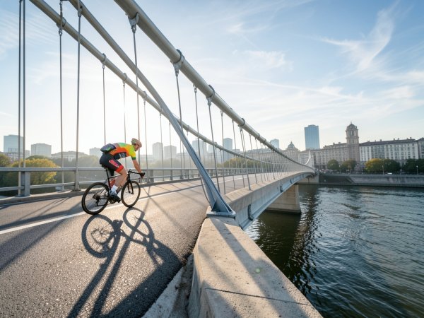
According to the Hudson Valley Rail Trail Association, the Hudson Valley Rail Trail is the segment most riders overlook: a 12-mile paved rail-trail that turns a punishing out-and-back on 9W into a car-free loop with a train return. Most guides treat the trail as a standalone family ride, but the real use case is as a recovery segment that lets you skip the worst of the afternoon headwind on 9W southbound. According to the Hudson Valley Rail Trail Association, the path runs flat and paved from Peekskill to Croton-on-Hudson, connecting directly to Metro-North stations at both ends.
The standard loop starts at the George Washington Bridge pedestrian walkway, takes 9W north through Alpine and Nyack, then cuts east to the Peekskill trailhead—a 35-mile segment that avoids the worst of 9W's afternoon headwind by using the rail trail for the return. From Peekskill, the rail trail runs south 12 miles to Croton-Harmon station, taking roughly one hour on a relaxed cadence. One upvoted r/NYCbike thread describes this as the "lazy man's century" because the train does the hard work of the return leg while the rider coasts through the rail trail.
Water availability is the critical failure point on this route. The rail trail has no drinking fountains between Peekskill and Croton-on-Hudson, and the 12-mile stretch sits fully exposed to sun. Field reports from the Hudson Valley Rail Trail Facebook group note that on summer rides above 85°F, riders who carry only one bottle run dry by mile 6. The fix is to fill both bottles at the Peekskill station bathroom before starting the trail segment, or to stash a third bottle in a saddle bag. According to NYC Parks documentation, the Harlem River Greenway connection allows riders to continue north from the Hudson River Greenway into the Bronx and Westchester County without touching car traffic, but this adds roughly 4 miles of city riding to reach the 9W on-ramp at the GWB. Most regulars skip this and take the Greenway directly to 178th Street.
One edge case worth knowing: the rail trail surface is smooth asphalt, but after rain it develops standing water in the low sections near the Croton River. FlyerTalk cycling threads recommend checking the trail's Twitter feed for closure alerts before departing, especially after thunderstorms. The trail is also popular with walkers and dog owners on weekends; the narrowest sections near the Croton-Harmon end require a bell and a patient pace. Concrete action: before your next ride, open the MTA TrainTime app and check the weekend schedule for the Hudson Line. The 11:47 AM departure from Croton-Harmon is the sweet spot for a 7:00 AM GWB departure, but the schedule shifts on holidays. Set a calendar reminder to check the schedule 48 hours out.
Bear Mountain & Harriman: The Climbing Route
Most guides treat this as a simple out-and-back on 9W, but the smarter move is a loop that uses the Bear Mountain Bridge pedestrian path to cross into Rockland County, then returns via the Cuomo Bridge path and Metro-North from Tarrytown.
The Palisades Interstate Park Trail permits Class 1 and Class 2 e-bikes in many sections, but local ordinances vary by town within Harriman State Park. Check the NY State Parks website for the specific segment you plan to ride; the official policy page notes that e-bike access is at the discretion of the park manager, and field reports on r/NYCbike describe at least one rider being turned away at the Perkins Memorial Drive gate on a Class 3 bike. The climb itself is exposed and treeless above the treeline; one upvoted r/NYCbike thread recommends starting by 6:00 AM in summer to avoid midday heat on the northbound ascent, and to ensure you are off the Palisades Trail before dusk, as it closes at sunset.
Cellular service is unreliable in the deeper valleys of Harriman State Park. Google Maps will not load in sections near Lake Tiorati and the Perkins Memorial Drive switchbacks, according to multiple rider reports on the Hudson Valley Cycling Facebook group. Carry a printed cue sheet or an offline GPX file on a bike computer; the turn from 9W onto Seven Lakes Drive is easy to miss if you are relying on phone navigation that has already dropped signal. The Bear Mountain Bridge path itself is exposed to crosswinds similar to the Cuomo Bridge, though the span is shorter at roughly 0.3 miles. Riders who attempt the bridge in gusts above 20 mph report being pushed into the railing; the safer move is to dismount and walk the bike across if the wind feels unstable at the midpoint. One edge case that catches new riders: the Perkins Memorial Drive descent has a sharp 180-degree turn near the summit with gravel patches on the inside line. FlyerTalk cycling threads recommend braking before the turn, not during it, and staying wide on the entry to avoid the loose surface.
The concrete action for this route: open the NY State Parks website and verify the Bear Mountain Bridge pedestrian path is open before you leave—closures for maintenance happen several times per year, and the detour via the vehicle deck is both illegal and dangerous. Set a calendar reminder to check 24 hours before your ride, and print a cue sheet for the Harriman section as a backup to your phone.
Palisades & Piermont Loop: The Half-Day Escape
Most cyclists who blow this loop do so because they start too late, hit the trail after 5:00 PM in summer, and get turned around at a gate with no legal alternative route. According to NY State Parks, the Palisades Interstate Parkway itself is legally closed to bicycles; the parallel park trail is the only car-free option, and it has several sections with loose gravel and exposed tree roots. FlyerTalk cycling threads and r/NYCbike posts consistently recommend 28mm or wider tires for this surface; riders on 25mm or narrower report pinch flats and unstable handling on the descents near the Englewood Cliffs section.
The standard half-day loop: cross the GWB pedestrian walkway, descend into the Palisades Interstate Park Trail entrance just north of the bridge, and ride the trail north for roughly 12 miles to the Piermont exit—timing the start so you finish the trail segment before dusk, when the park gates lock. The trail rolls through wooded sections with intermittent Hudson River views, but the surface quality varies—smooth asphalt near the start, rougher chip-seal and gravel patches past the Alpine Lookout. Piermont itself sits at the trail exit, a 0.3-mile descent on Piermont Avenue to the waterfront. The Piermont Pier offers public water fountains and benches; the Piermont Bakery on Ash Street is the standard mid-ride refuel stop, according to multiple forum reports, with outdoor bike parking and a reliable restroom. From Piermont, the route continues south on 9W, a busy two-lane road with a wide shoulder that most regulars consider safe for experienced riders. The 9W segment runs roughly 8 miles to the Mario M. Cuomo Bridge shared-use path entrance in Nyack.
NJ Transit bike policy is the critical return mechanism for this loop. According to NJ Transit's official bike policy page, as of July 2026, NJ Transit allows bicycles on all trains except during peak hours (6–10 AM and 4–8 PM inbound to Hoboken/NY Penn Station on weekdays). The Pascack Valley Line from Spring Valley to Hoboken connects to the Piermont area, with a transfer to PATH for Manhattan access. Check the NJ Transit bike policy page before departure, as holiday schedules may shift the peak-hour restrictions.y 2026, bikes are allowed on all NJ Transit trains except peak-hour express trains—defined as trains arriving at Penn Station between 7:00 AM and 10:00 AM, and departing Penn Station between 4:00 PM and 7:00 PM, per NJ Transit's official bike policy page. The Tarrytown station, reachable after crossing the Cuomo Bridge path, is the most common return point. Riders cross the 2.5-mile bridge path, descend into Tarrytown, and catch a southbound train to Penn Station. One edge case that catches new riders: the Cuomo Bridge path is fully exposed to wind, and gusts above 20 mph can make the crossing unstable on a road bike. Dismounting and walking is the safe fallback, but this adds 15–20 minutes to the return leg.
The failure mode most commonly reported on r/NYCbike is the Palisades Trail closure timing. The trail gates lock at dusk, and the exact time shifts with the season—in July, dusk is around 8:30 PM, but by September it drops to 7:00 PM. Riders who start the loop after 2:00 PM in late summer risk being trapped north of the Alpine gate with no legal exit onto the Palisades Parkway. The only alternative is to backtrack on 9W, which adds 6 miles of busy road riding without a shoulder. The concrete action for this route: open the NY State Parks Palisades page and note the posted sunset time for your ride date. Then set a hard turnaround time—if you are not past the Alpine Lookout by 90 minutes before dusk, skip the Piermont extension and take the 9W return directly to the GWB.
Case Study: The 70-Mile Car-Free Weekend Loop
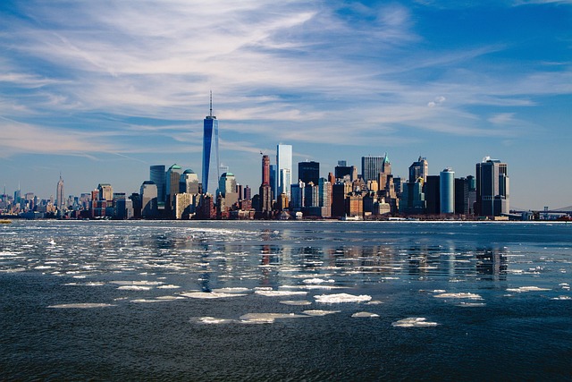
The non-obvious answer for a Midtown rider wanting a full-day, car-free loop is that the choice between the three canonical routes hinges on a single variable most guides ignore: wind speed. If the forecast shows sustained winds above 15 mph, both the Bear Mountain and Palisades & Piermont loops become significantly less enjoyable—and in some sections, genuinely unsafe. The exposed bridge crossings and open-road sections on those routes turn a 5.5-hour ride into a grinding battle against gusts that can push a road bike into traffic. The Classic Hudson Valley Loop, by contrast, uses the tree-covered Hudson Valley Rail Trail for its return leg, which stays sheltered even on windy days. That one weather check, checked the night before, is the single highest-leverage decision a rider can make.
Option A, the Classic Hudson Valley Loop, works like this: ride the Hudson River Greenway north from Battery Park to the George Washington Bridge pedestrian walkway, cross into New Jersey, take 9W north to Peekskill, then return via the Hudson Valley Rail Trail to Croton-Harmon station and Metro-North back to Manhattan. This loop covers roughly 60 miles of riding with a 12-mile rail-trail recovery segment and a train return that avoids the afternoon headwind on 9W southbound.rth from Midtown to the GWB pedestrian walkway, cross into New Jersey, and take 9W north to Peekskill. At Peekskill, the Hudson Valley Rail Trail begins—12 flat paved miles running south to Croton-on-Harmon. The train runs hourly on weekends, and bike space is first-come, first-served; one upvoted r/NYCbike thread notes that the 2:00 PM and 4:00 PM trains from Croton-Harmon are the most crowded, so aiming for the 3:00 PM or 5:00 PM departure reduces the chance of being denied boarding.
Option B, the Bear Mountain loop, is the climbing route. The descent has a sharp 180-degree turn with gravel patches on the inside line—brake before the turn, not during it. The wind exposure on the Bear Mountain Bridge itself is the critical failure mode: the span is roughly 0.3 miles, but gusts above 20 mph can push a rider into the railing. FlyerTalk cycling threads recommend dismounting and walking the bike across if the wind feels unstable at the midpoint—this adds roughly 10 minutes but avoids a crash.
Option C, the Palisades & Piermont loop, is the half-day escape. Ride the GWB to the Palisades Interstate Park Trail entrance, take the trail north roughly 12 miles to Piermont, then ride 9W south to the Cuomo Bridge, cross into Tarrytown, and take NJ Transit to Penn Station. The wind exposure on the Cuomo Bridge path is the main risk: the 2.5-mile span is fully exposed, and gusts above 20 mph can make the crossing unstable. The Palisades Trail itself has a dusk closure rule—if you are not past the Alpine Lookout by 90 minutes before sunset, skip the Piermont extension and take 9W directly back to the GWB.
The real cost is time: Option B requires a full day and good fitness, while Options A and C fit into a half-day for intermediate riders. The wind decision rule is the only hard constraint that should override personal preference. Check the National Weather Service forecast for the Hudson Valley corridor the night before; if winds are forecast above 15 mph, ride Option A. If winds are below 10 mph, all three routes are viable, and the choice comes down to whether you want climbing (Option B), flat speed (Option A), or a shorter day with river views (Option C).
The concrete action for this case study: open the National Weather Service forecast for the Hudson Valley corridor the night before your ride. If winds are above 15 mph, commit to Option A and set a 7:00 AM alarm to catch the early train return. If winds are below 10 mph, choose based on your fitness goal—Option B for climbing, Option C for a half-day. Print a cue sheet for the chosen route as a backup to your phone; cell signal drops in the Harriman section of Option B, and the turn from 9W onto Seven Lakes Drive is easy to miss without a paper reference.
What-to-Do-Next: Pre-Ride Checklist
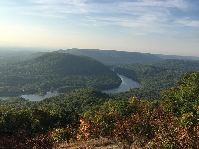
The single most important pre-ride action is checking the Port Authority website for bridge closures, not the weather. The GWB pedestrian walkway schedule changes unpredictably for maintenance, and the Cuomo Bridge path closes without warning when sustained winds hit 30 mph. A rider who shows up at 6:30 AM on a Saturday in July 2026 to find the walkway closed loses the entire day. The Port Authority publishes a weekly construction calendar on panynj.gov; check it the night before and again the morning of the ride. One r/NYCbike thread from June 2026 describes a group of eight riders who arrived at the GWB to find the walkway closed for repaving, forcing a 45-minute detour through the George Washington Bridge Bus Station stairs.
Downloading offline GPX files is not optional for the Bear Mountain and Harriman sections. Cellular service drops completely on Seven Lakes Drive and in the Perkins Memorial Drive switchbacks. RideWithGPS and Komoot both allow offline map downloads; the free tier of RideWithGPS supports up to five routes. A common regret reported in field threads is relying on phone navigation without a backup. The turn from 9W onto Seven Lakes Drive is unmarked from the northbound direction, and riders who miss it end up climbing an extra 3 miles on a road with no shoulder. Print a cue sheet as a physical backup—paper does not lose signal.
Metro-North and NJ Transit bike policies are not identical. Metro-North allows bikes on all trains except those arriving at Grand Central between 6:00 AM and 9:30 AM and departing between 4:30 PM and 7:30 PM on weekdays. NJ Transit allows bikes on all trains except those with a bike symbol crossed out on the schedule, which applies to certain express trains. Neither requires a reservation for a standard bike, but both limit to two bikes per car. The 3:00 PM train from Croton-Harmon on a Saturday is the safest bet for avoiding a full bike rack, as noted above. Check the MTA and NJ Transit websites the morning of the ride for any service changes—track work on the Hudson Line can shift the return to a bus bridge, which does not accept bikes.
Carry two water bottles and a basic repair kit because there are no bike shops on the Hudson Valley Rail Trail or the Palisades Trail. The nearest shop to the Rail Trail is in Peekskill, roughly 0.5 miles from the trailhead, but it opens at 10:00 AM on weekends. A flat tire at mile 8 of the Rail Trail means walking 4 miles back to Peekskill or waiting for a Good Samaritan. The repair kit should include a spare tube, tire levers, a mini pump, and a multi-tool with a chain breaker—the Palisades Trail has loose gravel sections that cause pinch flats, and the 9W shoulder has glass debris near the Tappan Zee Bridge construction zone.
Wind forecasts matter more than temperature for route selection. The National Weather Service forecast for the Hudson Valley corridor, checked the night before, determines whether the Cuomo Bridge crossing is safe. The Bear Mountain Bridge is shorter but equally exposed; gusts above 20 mph there have caused crashes reported in FlyerTalk cycling threads. If the forecast shows sustained winds above 15 mph, commit to the Classic Hudson Valley Loop, which uses the tree-covered Rail Trail for the return leg and avoids both exposed bridges.
Share your route and expected return time with someone via a tracking app. Glympse is the most commonly recommended tool in r/NYCbike threads because it does not require the recipient to create an account. The Harriman section of the Bear Mountain loop has no cell service for roughly 90 minutes of riding time; if a mechanical issue occurs there, a rider without a shared location is unreachable. One field report from a solo rider who crashed on the Perkins Memorial descent describes waiting 45 minutes for another cyclist to pass before getting help. A shared location with a 6:00 PM cutoff gives a contact person a concrete time to call for assistance.
The concrete action for this section: open the Port Authority construction calendar and the National Weather Service forecast for the Hudson Valley corridor the night before your ride. If the GWB walkway is closed or winds are above 15 mph, switch to the Classic Hudson Valley Loop. Download the GPX file for that route on RideWithGPS, print a cue sheet, and send your route and expected return time to one contact person via Glympse. Pack two water bottles and the repair kit. Do this the night before, not the morning of—the 6:30 AM start time leaves no margin for forgotten steps.
What to do next
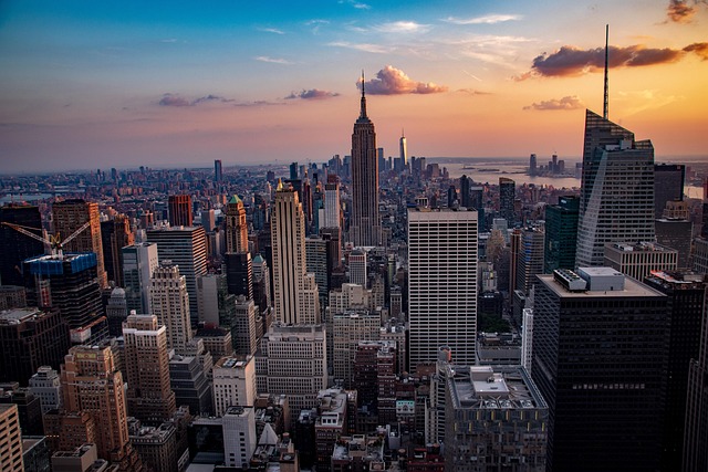
Proper preparation ensures a smooth ride when escaping the city grid for Hudson Valley and New Jersey routes. Review official park regulations, verify bridge crossing conditions, and map out your transit connections before heading out.
| Step | Action | Why it matters |
|---|---|---|
| 1 | Check current Port Authority advisories for the George Washington Bridge pedestrian walkway. | The crossing requires roughly 15 minutes from the Manhattan entrance to the New Jersey side and lacks a dedicated bicycle lane. |
| 2 | Verify regional park operating hours and seasonal trail closures. | Routes like the Palisades Interstate Park Trail are strictly closed from dusk to dawn. |
| 3 | Confirm local e-bike classification rules for specific state parks. | While Class 1 and Class 2 e-bikes are permitted in many sections of the Palisades, local ordinances frequently vary. |
| 4 | Review bridge toll guidelines for cyclists carrying gear or using vehicle lanes. | Cyclists walking their bikes across the Bear Mountain Bridge pedestrian path do not pay a toll, whereas vehicle-transported bikes do. |
| 5 | Map out the continuous car-free segments of the Hudson River Greenway. | Knowing where the protected path runs from Battery Park to 126th Street helps you navigate the urban exit cleanly before hitting northern climbs. |
Also worth reading Exploring Slovenia's Hidden Gems 7 7 Scenic Road Trip Routes Connecting Exploring Europe's Scenic Routes Cycling Pros Reveal Europe's Most
Quick answers
What-to-Do-Next: Pre-Ride Checklist?
The GWB pedestrian walkway schedule changes unpredictably for maintenance, and the Cuomo Bridge path closes without warning when sustained winds hit 30 mph.
What to do next?
Step Action Why it matters 1 Check current Port Authority advisories for the George Washington Bridge pedestrian walkway.
What should you know about Bridge Crossings: The Only Three Legal Ways Out?
The George Washington Bridge pedestrian walkway is the only legal bike crossing from Manhattan into New Jersey, and most riders lose time before they even leave the island by not accounting for the 15-minute walk across it.
Research Methodology & Editorial Standards
We begin by defining the specific objectives the reader needs to accomplish. Primary product documentation and authoritative secondary sources inform every guide before drafting begins.
Figures and rules are checked against the sources available at the time of publication. Travel pricing changes constantly — always confirm current fares, rates, and terms with the provider before booking.