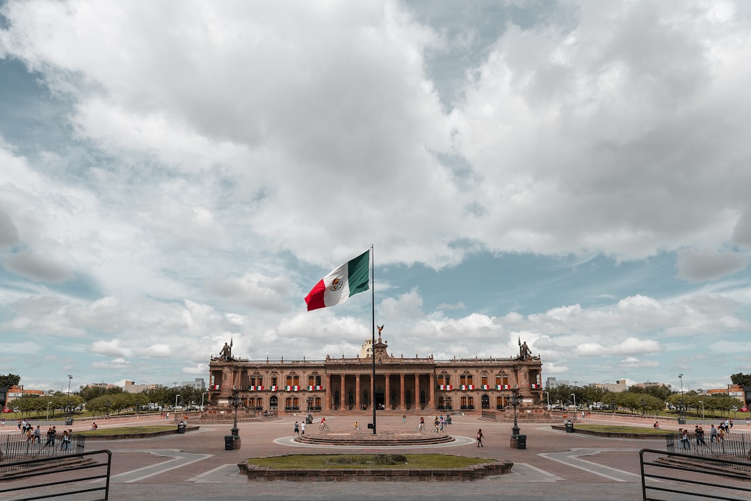
What to Know About the New State Department Travel Advisory for Mexico
If you’ve ever found yourself staring at a map of Mexico while trying to book a vacation, you know that moment of hesitation when you see those bold, color-coded travel warnings.
Understanding the State Department’s Tiered Advisory System for Mexico
If you’ve ever found yourself staring at a map of Mexico while trying to book a vacation, you know that moment of hesitation when you see those bold, color-coded travel warnings. It’s easy to feel like the entire country is being painted with the same broad brush, but the reality is actually much more surgical. The State Department doesn't issue a single blanket status for Mexico; instead, they use a state-by-state, granular system that reflects the hyper-local nature of security risks on the ground. Think of it as a dynamic heat map that changes based on specific intelligence, ranging from cartel activity in certain corridors to localized spikes in crime that don't necessarily affect the entire state.
Because these tiers are updated to account for real-time shifts—especially as we navigate major events like the 2026 World Cup—you really can’t just check the status once and call it a day. A state might have an overall high-risk designation, yet specific tourist hubs or municipalities often operate under different security realities or have distinct travel exceptions. It’s a bit of a balancing act, where the department isolates risks like kidnapping or armed robbery in transit zones while often maintaining a different outlook for the heavily patrolled resort corridors in places like the Riviera Maya or Los Cabos.
Ultimately, this four-level scale is designed to give you the data you need to make an informed choice, rather than just forcing you to cancel your plans entirely. It’s important to remember that these rankings are built on a mix of official incident reports and the restricted movement patterns of U.S. government personnel, which tells you a lot about where the actual "red lines" for safety really are. I always tell friends to look past the scary headlines and dig into the specific state-level breakdowns, because the difference between a Level 2 "exercise increased caution" and a Level 4 "do not travel" is massive. It’s about being smart with your geography and recognizing that your safety profile can change entirely just by crossing a state line.
Geographic Breakdown: Identifying High-Risk Regions vs. Safer Destinations
When we look at geographic risk, we really have to move past the headlines and get into the weeds of how these assessments actually work. I’ve found that risk isn't some uniform blanket covering an entire country; it’s more like a series of hyper-local pockets that shift based on everything from highway infrastructure to the presence of private security. Statistical analysis of road travel in Mexico, for instance, shows a massive variance between toll roads and free routes, largely because federal patrols and private security firms prioritize the former. It’s a bit of a reality check, but the State Department’s restricted movement zones for their own staff are arguably the most reliable indicators we have for where local authorities have lost the ability to maintain order.
Think about it this way: the risk of an incident isn't just about where you are, but exactly when you’re there and how you’re moving through the space. Advanced geospatial modeling consistently shows that violent activity tends to cluster around specific transit hubs or underdeveloped industrial corridors, leaving adjacent tourist areas relatively unaffected. It’s common for high-end international hotel chains to create these localized security bubbles that are almost entirely insulated from the regional risk profile, which is why your experience can feel so different depending on whether you step foot outside the property gates. I’ve seen data suggesting that staying within these established corridors and using private transport can slash your statistical exposure to crime by more than sixty percent compared to using public transit.
But you have to be careful not to mistake a quiet tourist town for a place that’s universally secure around the clock. Surveillance data and historical incident reports paint a clear picture: the danger spikes significantly the moment you hit unlit, rural, or remote mountain passes after the sun goes down. We’re also seeing more experts integrate environmental and meteorological data into these assessments, because a natural disaster can instantly strip away the law enforcement and emergency response networks that keep a destination stable. It’s all about layering these variables, from the density of security checkpoints to the time of day, to build a realistic picture of your own personal safety. If you’re planning a trip, my best advice is to stop looking for a "safe country" and start looking for the specific, low-risk transit corridors within it.
The Role of Cartel Activity and Criminal Violence in Current Advisories
When we talk about cartel activity, it’s easy to focus on the headlines, but let’s dive into what’s actually happening on the ground because the mechanics of how these groups operate are far more calculated than they appear. Cartels have started using commercial flight disruptions as a tactical lever, often timing localized violence to prevent authorities from moving high-profile detainees or to create diversions that pull federal resources away from their primary smuggling corridors. If you’re paying attention to the local signals, you might notice that disruptions in basic utility services like electricity or water often serve as a precursor to infighting, as these groups increasingly look to control municipal infrastructure as a revenue stream. It’s a sobering reality, but this isn't just random chaos; it’s a strategic effort to exert control over both the local economy and the movement of people.
Think about how these tactics directly touch your own travel plans. When you see reports of carjackings on specific highway segments, it’s rarely a random act; these are often coordinated maneuvers where vehicles are commandeered for tactical use elsewhere. I’ve noticed that intelligence analysts now monitor the presence of unofficial toll checkpoints on secondary roads, which are essentially informal tax stations used to profile commercial transport and assert territorial dominance. We also have to consider the digital side of things, where encrypted messaging platforms are used to bypass official channels and issue shelter-in-place orders, effectively stripping the state of its ability to manage public safety during a flare-up. It’s a strange and uncomfortable dynamic where the power balance in a region can shift literally overnight, turning a routine commute into an encounter with a non-state actor.
And honestly, the way this impacts tourist zones is perhaps the most nuanced part of the whole puzzle. We are seeing these groups establish recruitment centers on the periphery of popular areas, which naturally heightens the baseline risk of gang-related violence in places you might otherwise consider safe. The goal behind targeting aviation infrastructure or specific municipal commanders is often just to create enough political pressure to install leadership that won't interfere with their operations. If you’re trying to make sense of why a specific state’s advisory status changed, look at the migration patterns; when you see a sudden influx of displaced people moving from rural areas into city centers, it’s often a leading indicator that territorial disputes are about to spill over into more populated, stable zones. I know it sounds like a lot to track, but understanding these structural shifts is the only way to really gauge your own exposure rather than just reacting to the latest alert.
How to Assess Your Personal Risk Before Booking Travel
When you’re staring at a map and trying to decide if a trip is worth the gamble, it’s easy to feel like you’re just guessing. But assessing risk isn't about having a gut feeling; it’s about looking at the data points that actually shape your day-to-day safety. First, you have to look past the generic country-wide labels and start thinking about your actual itinerary. I always recommend checking if your specific route avoids known telecommunications dead zones, because the second you lose GPS or cellular data in a remote area, your vulnerability spikes. It’s also worth noting that standard insurance often fails you here; you really need to verify if you have a "Cancel For Any Reason" policy, especially since most basic plans won't touch you if a government advisory shifts or civil unrest kicks off after you’ve already paid.
Think about the timing of your transit, too, because it’s rarely as simple as just avoiding travel after dark. Analysts have found that the most dangerous windows are often during local law enforcement shift changes, when patrols are thin and visibility is at its worst. If you’re planning on driving, map out your path to stay on major toll roads, which federal authorities prioritize over the secondary, less-patrolled routes. You should also keep an eye on local economic signals before you book. A sudden, sharp spike in the price of basic goods or an increase in street-level informal currency exchange can be an early-warning sign that non-state actors are gaining a foothold in the neighborhood. It’s a bit of a detective game, but these small indicators often signal instability long before it hits the nightly news.
Finally, don't just assume your hotel has your back because it’s a big, recognizable name. You’d be surprised how many major properties use third-party security contractors with varying levels of training, so it’s worth a quick email to ask if they have a direct, vetted communication link to local law enforcement. While you're at it, look into the medical infrastructure near your destination. You need to know if the "golden hour" for trauma care is even possible in your chosen area, especially if local networks are prone to disruption. And for the love of everything, check if there's a local election coming up, as political mobilization frequently shifts the security landscape in urban centers months before the actual vote. It might feel like overkill, but these steps move you from simply hoping for the best to actually understanding the environment you’re stepping into.
Practical Safety Protocols for Americans Traveling in Mexico
When we’re talking about safety in Mexico, I think it’s easy to get overwhelmed by the sheer volume of news, but for me, it really comes down to managing your digital and physical footprint in ways you might not have considered before. Digital hygiene is honestly one of the most underrated safety tools; sophisticated groups often monitor social media check-ins to spot high-value targets, so I’ve made it a rule to only post photos after I’ve already left a location. Beyond your screen, you have to watch the clock because those predictable windows during local law enforcement shift changes are when patrols are thinnest and vulnerability is at its absolute peak. I always try to time my inter-city travel to avoid those early morning or late afternoon gaps, as it’s just not worth the gamble to be on the road when the police presence is in transition.
If you’re planning on driving, stick exclusively to federal toll roads—the cuotas—instead of the secondary routes, because those primary arteries are prioritized for federal patrols and keep you in areas with better cellular coverage. Think about it this way: the moment you hit a telecommunications dead zone, you’re essentially cut off from real-time alerts and help, so downloading offline maps and having a satellite-linked device isn't just "prepper" talk, it’s a practical necessity for remote trips. You should also be looking at the medical side of things, specifically the "golden hour" for trauma care; it's a sobering exercise, but checking the distance to the nearest Level 1 trauma center before you head into mountain or rural regions can be the difference between a minor incident and a complete emergency.
It’s also worth doing a bit of extra homework on your accommodations, especially since even the biggest hotel brands often outsource their security to third-party contractors with wildly different training levels. I’ve started sending a quick, direct email to properties asking about their specific communication links to local law enforcement, which usually tells me everything I need to know about how they handle real-world threats. Keep an eye on local economic indicators, too; a sudden, sharp spike in the price of basic staples or weird fluctuations in local street-level currency exchange can be a surprisingly accurate canary in the coal mine for neighborhood instability long before any official advisory comes out. It sounds like a lot, but these small, tactical adjustments move you from just hoping for the best to actually building a personal security plan that really works.
Navigating Trip Cancellations and Insurance Options Amid Evolving Warnings
When you're staring down a shifting travel landscape, it’s easy to feel like the ground is moving beneath your feet, especially when a simple vacation plan gets caught in the crosshairs of a regional security alert. Let’s be real: most of us assume our travel insurance acts as a safety net for any emergency, but the truth is often buried deep in the fine print where "acts of war" or "civil unrest" are frequently excluded. It’s a frustrating reality check, but standard policies rarely trigger a payout just because the State Department has raised a threat level. You really need to understand that these advisories are meant to inform your judgment, not necessarily force an insurance company’s hand, which is why relying on them as a legal trigger for a claim is a common, and often expensive, mistake.
If you’re looking for actual peace of mind, you’ve got to move beyond basic coverage and look at "Cancel For Any Reason" policies, even though they usually cap your reimbursement at 50 to 75 percent of your trip cost. It’s a trade-off, sure, but it’s the only way to get some cash back if you decide a destination has become too volatile for your comfort. And honestly, watch out for the "foreseeable event" trap; if you buy your policy after a threat has made headlines, you’re likely out of luck entirely because insurers consider that a known risk. I’ve seen enough people get blindsided by this to know that timing your insurance purchase is just as important as choosing the right coverage level in the first place.
And then there's the logistical nightmare of what happens when the flights actually stop. If commercial air travel is suspended, your airline is generally only on the hook for the unused flight segments, leaving you to fight over non-refundable hotels and land tours on your own. It’s a massive gap in protection that most people don't fully grasp until they're stuck in a hotel room trying to navigate a crisis. Plus, with insurers now using hyper-local, real-time data to adjust coverage on the fly, you could find yourself in a situation where your destination is theoretically open but functionally impossible to insure. My advice? Don't just hope for the best—map out the actual costs of a potential extraction, which can easily hit six figures, and make sure your plan explicitly covers that scenario before you ever leave the driveway.