
Plan the Ultimate West Coast Road Trip With These Essential Stops
When we talk about driving from Southern California to the Pacific Northwest, most people just focus on the gas money or hotel bookings, but I think there is something way more interesting happening beneath your tires.
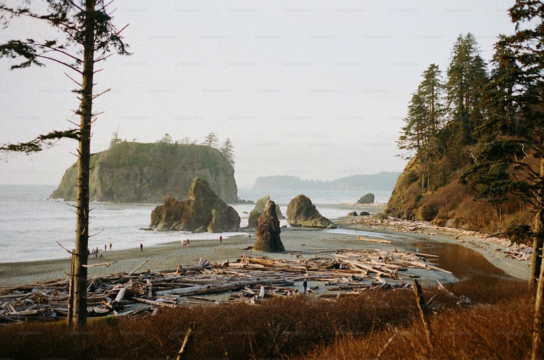
Crafting Your Route: From Sunny Southern California to the Rugged Pacific Northwest
When we talk about driving from Southern California to the Pacific Northwest, most people just focus on the gas money or hotel bookings, but I think there is something way more interesting happening beneath your tires. You’re essentially tracking the Pacific Plate as it slides northwest at about 50 to 60 millimeters every single year, which is basically why the coastline looks the way it does. You’ll notice the ocean temperature plummet as you head north, and that is all thanks to the California Current pulling cold, nutrient-rich subarctic water down the coast. That shift is also what creates those thick, moody fog banks that seem to swallow the road right as you hit the northern stretches. It is a massive transition, moving from the sun-drenched, bioluminescent-ready waters of the south into the cool, maritime climates of the north in just a few days of driving.
If you’re looking at the map, think about the sheer engineering required to keep Highway 101 moving. You are passing through the Mendocino Triple Junction in Humboldt County, which is arguably the most active seismic patch in the state, and the road infrastructure has to account for that constant movement. Then you have the erosion problem in places like Pacifica, where the coast is literally disappearing at a rate of two feet a year in some spots. It makes you realize that the route isn’t just a line on a map; it’s a living, breathing project that engineers are constantly fighting to keep open. I find it pretty wild that we are driving across terrain that includes Paleozoic-era rocks in the Klamath Mountains while keeping an eye out for gray whales making their 12,000-mile migration right offshore.
And honestly, don’t skip the chance to see where the redwoods finally hit their northern wall in the Chetco River basin. It’s the perfect marker for when the landscape shifts from those classic Mediterranean vibes into the heavy, wet air of the temperate rainforests, where you can see over 140 inches of rain a year. Those forests are doing heavy lifting for the planet, too, with kelp beds acting as carbon sinks that are way more efficient than the trees on land. When you’re planning your stops, try to look past the typical beach town tropes and appreciate the fact that you’re moving through one of the most geologically and ecologically intense zones on the planet. Just take it slow, because when you’re driving through that much history and physical change, the destination really ends up being secondary to the ride itself.
Coastal Icons: Must-Visit Landmarks Along the Pacific Coast Highway
When you’re mapping out your stops along the Pacific Coast Highway, it’s easy to get caught up in the sheer volume of "must-see" spots, but I think the real value lies in understanding the engineering and geology behind these landmarks. Take the Bixby Creek Bridge, for example; it’s not just a photo op, but a masterclass in seismic-resilient design, rising 260 feet over a canyon on a reinforced concrete arch that’s been holding strong since 1932. Similarly, when you’re standing at the base of Morro Rock, you’re looking at an extinct volcanic plug that reaches 576 feet into the sky and acts as a vital sanctuary for the endangered peregrine falcon. It’s this intersection of raw natural history and human ingenuity that makes the drive so compelling, whether you’re geeking out over the rare manganese garnet at Pfeiffer Beach or watching the elephant seals at Piedras Blancas.
We also have to talk about how these landmarks function within their specific environments, like the Point Sur Lighthouse, which sits on a volcanic formation isolated by a rare sand tombolo. It’s one of the few turn-of-the-century stations still fully intact, and it tells a much different story than the nearby Esalen Institute, where indigenous populations have utilized the site’s natural thermal hot springs for millennia. Even in the cities, you see this tension between development and the elements, like the Monterey Bay Aquarium’s sophisticated pipe system that pulls in fresh seawater to maintain its ecosystems right on top of a former sardine cannery. I’ve always found it fascinating that the Golden Gate Bridge is painted its signature International Orange not for aesthetics, but specifically to cut through the dense marine layer that would otherwise swallow it whole.
When you weigh these against more "amusement-focused" landmarks, like the 1924 Giant Dipper at the Santa Cruz Beach Boardwalk, you start to see the coast as a living timeline of California’s evolution. The coaster still runs on its original friction-brake system, which feels like a relic when you contrast it with the immense, focused wave energy of the Maverick’s surf break, created by nothing more than specific, chaotic underwater topography. It’s easy to just breeze past Natural Bridges State Beach, but try to remember that the limestone arch you’re seeing is just the last survivor of a series being slowly dismantled by wave erosion. Honestly, if you look closely, you’ll realize that none of these places are static; they’re all in a state of constant, gradual transition, and that’s what makes them worth the detour.
Beyond the Coastline: Hidden Gem Towns and Epic Stargazing Destinations
When we talk about the West Coast, it is so easy to just glue ourselves to the highway, but I really think the best parts of the trip happen when you veer off the main road and start looking up. You know that moment when the sun drops and the sky just opens up in a way you never see back home? That is exactly why I find places like Borrego Springs so fascinating, as they’ve actually engineered their town lighting to be low-pressure sodium just to keep the Milky Way visible. It is not just about a pretty view; it is about the physics of light pollution and how these small communities are essentially fighting to protect a natural resource we often forget exists. If you find yourself heading toward the Cascade-Siskiyou National Monument, you’re in a sweet spot where the lack of light domes lets you spot the Andromeda Galaxy without even needing a telescope.
And look, the science of where you stop matters just as much as the scenery itself. Take Mendocino, for instance; because of a specific temperature inversion, that pesky marine fog that ruins your beach day actually acts like a filter that clears out at night, giving you incredibly stable air for long-exposure photography. I’ve spent time comparing this to the experience at the Goldendale Observatory in Washington, where the high altitude puts you above the thickest parts of the atmosphere, which really cuts down on that annoying stellar scintillation—or flickering—that makes stars look blurry. If you’re near Port Orford, you’re hitting one of the cleanest air pockets in the entire country, which means less aerosol scattering and a much sharper view of the night sky. It is kind of wild to think that a simple change in elevation or local wind patterns can be the difference between a hazy view and seeing the deep cosmos clearly.
Honestly, the sheer variety of these dark sky pockets is what keeps me coming back to these hidden inland valleys near the Oregon border. These spots are geologically positioned to trap cold, dense air, which keeps the atmosphere calm and free from the particulates that usually make the air turbulent. You’ve also got places like Shelter Cove, where the King Range acts like a giant natural wall, blocking out the light from inland cities so you’re left with a truly black horizon. It’s a completely different vibe compared to Cape Perpetua, where the lack of industrial infrastructure is so profound you can sometimes catch the zodiacal light, which is just faint sunlight reflecting off interplanetary dust. I’d suggest doing some research on local light ordinances before you pick your campsite, because places like Cannon Beach specifically mandate downward-facing lights to keep the contrast high against the Pacific. It’s all about finding those quiet zones where the human noise—and the light—finally stops interfering with the view.
Fueling Your Journey: Finding the Best Regional Eats and Local Flavors
When we hit the road, it’s easy to settle for the nearest gas station snack or a familiar chain, but I’ve found that the real story of the West Coast is actually written on the plate. Think about it: the very same geologic and atmospheric forces that shape our driving route—like the nutrient-rich upwelling near Humboldt Bay—are what give Pacific oysters their distinct, metallic salinity. It’s not just food; it’s a direct biological link to the environment. You’re tasting the cold, turbulent Pacific in every bite of local Dungeness crab, where the meat density is dictated entirely by the water’s temperature and seasonal cycle.
I honestly think you’re missing out if you don't pay attention to these hyper-local ingredients as you head north. Take the sourdough in the Bay Area, for instance; the specific Lactobacillus strain that gives it that signature tang has evolved to metabolize local flour in a way you just can’t replicate elsewhere. Or look at the wild-caught salmon you’ll find as you push toward the Oregon border. Those fish carry a higher concentration of omega-3s as a survival adaptation to the subarctic currents, resulting in a lipid profile that’s miles ahead of what you’d find in warmer waters. It’s fascinating how these small, environmental variables ripple out to change everything from the texture of your bread to the complexity of a craft beer brewed with tectonically influenced groundwater.
And when we talk about fueling up, don't just lean on the standard fare. I’ve noticed that regional fast-food chains sticking to localized supply chains often serve up produce with significantly higher nutrient density because it hasn't spent days in a shipping container degrading. Even the way we prepare food shifts as we move; the manzanita wood used for smoking in the south adds phenolic compounds you simply won't find in standard mesquite or hickory-smoked dishes further north. It’s worth being a little intentional about where you stop, even if it’s just grabbing a coffee or a quick bite, because the difference in mineral content and freshness is usually stark. My advice is to lean into these regional quirks—it’s the easiest way to turn a simple road trip into an actual masterclass in local flavor.
Strategic Pit Stops: Where to Rest, Recharge, and Luxury Lodging Picks
When you’re planning where to lay your head after a long day of driving, I think it’s worth looking past the standard star ratings and considering how these properties actually interact with the rugged environment you’re traversing. You’ve probably noticed that the most memorable stays on this coast aren't just about plush bedding; they’re the ones that feel like they’re part of the landscape’s own engineering. For instance, some of the most impressive luxury lodges in Big Sur are built with advanced seismic dampers tucked into their foundation piers, which allow the entire structure to remain rock-steady while the ground beneath them shifts during minor tectonic tremors. It’s a pretty wild feeling to know you’re sleeping in a space designed to dance with the geology of the Pacific Plate rather than fight it.
If you head further north into the redwood groves, the approach to lodging shifts toward protecting that delicate root structure of the trees. Many of the boutique eco-lodges there are built on raised platforms, a design choice that prevents soil compaction and lets the massive root systems of the sequoias stretch out undisturbed. I’ve also been really impressed by how some properties near the California-Oregon border have started harvesting their own water directly from that thick marine fog using atmospheric generators, which gives you a mineral-rich source that’s as sustainable as it gets. It’s this kind of intentionality—using reclaimed redwood that naturally resists salt-spray decay or leveraging the thermal mass of decommissioned military bunkers to regulate room temperature—that makes a stop feel like a genuine part of the journey.
And honestly, don't overlook the tech-forward comfort built into these remote spots. You'll find high-end resorts now installing their own off-grid solar arrays to power Level 3 DC fast-charging stations, ensuring your EV is ready for the next leg without putting a strain on the local grid. If you’re a light sleeper, keep an eye out for properties using triple-paned acoustic glass that’s specifically coated to filter out the low-frequency roar of the Pacific surf, which honestly makes a massive difference when you’re trying to recover. Many of these places are even leaning into the science of the coast, like those that offer real-time data feeds on wave energy or provide professional-grade Newtonian reflectors tuned to their specific latitude for stargazing. It really changes the vibe of your trip when your hotel is actually helping you tune into the physics and biology of the coast while you recharge.
Timing Your Trip: How to Maximize Your West Coast Adventure in 2024
When we talk about the best time to hit the road, I think most people just look at the calendar and hope for the best, but the reality of a West Coast trip is much more about working with the physics of the environment. If you’re timing your trip for 2026, you’re hitting a sweet spot with Solar Cycle 25 nearing its peak, which actually increases the odds of catching the aurora borealis even as far south as the Pacific Northwest. Most travelers assume July is the warmest month, but because of the Pacific’s thermal inertia, you’ll find the best coastal temperatures don't actually arrive until late August or September. If you’re coming in the spring, try to aim for April through June, as you’ll align your drive with the northward migration of gray whale mothers and their calves. And if you’re a photographer, remember that those northern latitudes provide a significantly longer golden hour compared to what you’d get down in Southern California.
But look, there’s a trade-off for every window you pick, and you really have to be intentional about what you’re prioritizing. If you’re chasing that iconic bioluminescence in the southern waters, you’re looking for water temperatures over 60 degrees Fahrenheit and high nutrient upwelling, which usually means planning around specific biological blooms. On the flip side, if you find yourself wandering the coast in June, don’t be surprised by the persistent marine layer—the locals call it June Gloom—caused by the extreme temperature gap between the hot inland valleys and the chilly Pacific. It’s a classic case of the North Pacific High pressure cell doing its work, and while it might hide the sun, it’s also the same atmospheric engine that keeps the coast feeling so raw and alive.
If you’re the type who wants to get out and explore the tide pools, stop guessing and start looking at the lunar cycle instead. The lowest tides of the year occur during the full and new moon phases, when the combined gravitational pull of the sun and moon gives you the maximum tidal range to see those hidden ecosystems. I’d also suggest keeping an eye on the equinoxes if you’re into stargazing, as that’s when the ecliptic plane sits at a steep angle to the horizon, making the zodiacal light much easier to catch. Even the wildflowers serve as a clock; keep an eye on the central coast in April, which is usually when the coastal scrub hits its peak bloom. It’s all about realizing that the coast isn't just a static background for your photos—it’s a dynamic system that shifts its rhythm every few weeks, and the more you align with that, the better your trip is going to be.
Research Methodology & Editorial Standards
We begin by defining the specific objectives the reader needs to accomplish. Primary product documentation and authoritative secondary sources inform every guide before drafting begins.
Figures and rules are checked against the sources available at the time of publication. Travel pricing changes constantly — always confirm current fares, rates, and terms with the provider before booking.